Daintree National Park

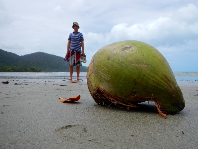
Coconut, Cape Tribulation

Daintree National Park is a special place. I could tell you lots of facts about it, and show you lots of pictures, but none of that would convey the wonder of the place and its stunning beauty.

I have no doubt why this place is sacred to the Kuku Yulanji Aboriginal People. Their traditional country stretches from Mossman in the south almost as far as Cooktown in the north and as far west as Chillagoe on the other side of the Great Dividing Range on Cape York.

The rainforest in this part of the world is over 100 million years old, making it the oldest rainforest on our planet. It survived this long because while other continents were slowly drifting around the planet from hotter to cooler climates (or vice versa), the wet tropics of North Queensland stayed reasonably close to the same latitude for most of that time, with a fairly consistent climate. This meant that species of plants and animals that died out in other parts of the world, stayed alive here. This extensive biodiversity is what sets the Daintree Rainforest apart from almost any other place on earth.
Ferry, Daintree River

It’s difficult to get to the Daintree. For starters, it’s over 1,500 km North-West of Brisbane. And you can’t easily drive there because there’s no bridge over the crocodile infested Daintree River. You have to catch a ferry. Thankfully, the ferry leaves every 10 to 15 minutes. But the roads are steep and twisty, so it’s a slow drive. You’ll have to take your time.
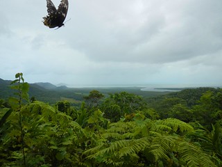
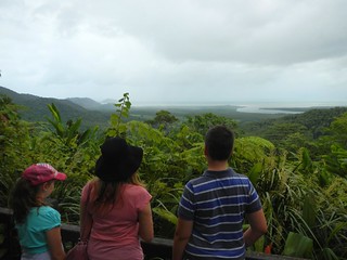
Alexandra Lookout, Daintree NPAlexandra Lookout, Daintree NP
Our first stop after climbing the range was Alexandra Lookout. This gives great views to the east over the forest allowing you to see where the Daintree River meets the sea. It’s also a good place to get photos of butterflies trying to get their face on a photo 🙂
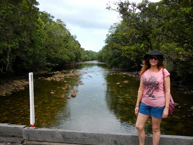
Noah Creek, Daintree NP
From there we drove north, past a tea plantation and over numerous speed bumps (to stop you hitting cassowaries) to Noah Creek. The bridge is narrow, so there’s no room for pedestrians. To get a picture of the babbling creek we had to park the car, run quickly onto the bridge, take the photo, then get back off the bridge before the next car came round the corner. I think we managed it with a few seconds to spare.

Cape Tribulation
Cape Tribulation
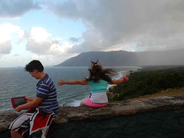
Cape Tribulation was the furthest north we could go in the hire car. After this, the bitumen stops, and the road turns into a 4wd track. At Cape Trib the rainforest reaches down from the mountains right to the edge of the beach. What a beautiful place!
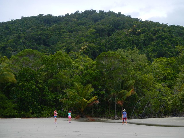
Cape Tribulation
Cape Tribulation
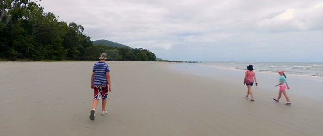
We decided to go for a wander up the beach to see what we could find. I don’t think we were looking for anything in particular. We just wanted to soak it all up.
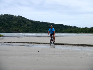
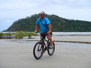
Mountainbiking at Cape Tribulation Mountainbiking at Cape Tribulation
This mountain biker had the right idea. A simple single-speed rig with no suspension, nice fat tyres and “low tech” rubber footwear. Just the trick for riding on the beach.

Dubuji Boardwalk
Dubuji is a Boardwalk through the forest that gives you an idea of the biodiversity of the area. I was amazed to look down from the walk into shallow creeks and see numerous fish over 30cm (1 foot) long, just quietly sitting the shallows.
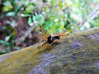
Green Ant, Daintree NPSpider, Dubuji Boardwalk
The colors and variety of the wildlife were stunning…
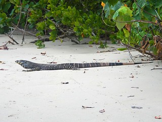
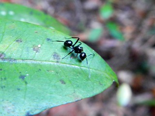
Goanna, Cape TribulationBlack Ant, Dubuji Boardwalk
It didn’t matter where we looked – the place was teeming with life…

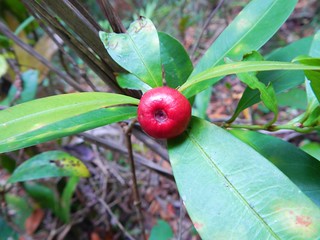
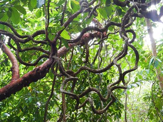
Wild Fruit, Cape TribulationRainforest Vine, Dubuji Boardwalk
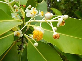
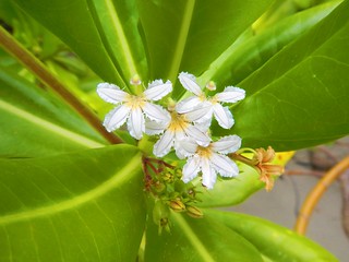
Wildflowers, Dubuji BoardwalkWildflowers, Dubuji Boardwalk

The rainforest here grows on the sand, which is extremely rare. The Kuku Yalanji people named this place “Dubuji” which means “Place of spirits”. They have stories about many specific places only several metres from the boardwalk.

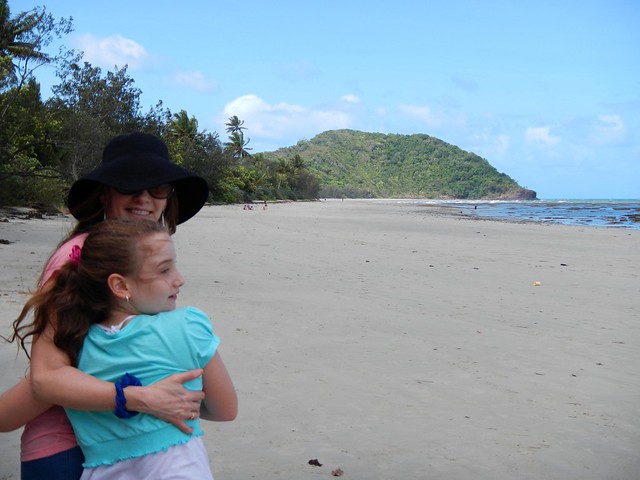
Cow Bay, Daintree NP
Cape Tribulation
As we slowly made our way back south towards our starting point we stopped at a few different places along the way to have a look around.
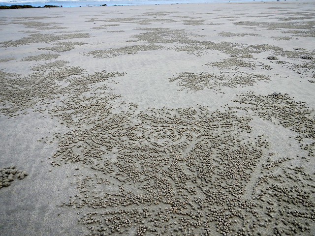
Crab "Dot Art", Cape Tribulation
It looked to me like the crabs were making Aboriginal “Dot Art”.
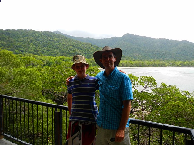
Kulki Lookout, Cape Tribulation
I’m so glad we were able to experience this stunning place. I’d love to go back sometime. Who knows? Perhaps I’ll bring a bike next time 🙂

Rex Lookout

Blue Tiers

I cycled through the Blue Tiers in North Eastern Tasmania today. The day started beautifully at the small town of Weldborough, but the weather quickly deteriorated and I ended up doing most of the 35km in cold rain.  I’ve never ridden in such cold conditions (3 – 4 C) before, and it was satisfying to know I could do a tough ride in such difficult conditions.

The route was east out of Weldborough, up the mountain, then down a dirt road to Lottah, up to the Blue Tier camping ground at Poimena, and then down the “Descent” trail back into Weldborough.

Lottah Caravan
As I rode into Lottah, it was pouring with rain and freezing, so I waited a while at this little caravan and shelter. No one was there, and the door was unlocked. I went in, and there was a guest book on the table, so I signed it.

What a welcome sight to a cold, wet traveler! I celebrated by eating Snickers bar. I was amazed at how quickly the chocolate and nuts warmed me up.
Poimena
Which way to go? I had a pretty basic map and I tried to follow all the signs. Even so, there were still a few times I thought I had gone the wrong way.


I got sick of battling to climb all the rock gardens on foot, so I stopped and did a quick video 🙂

Weldborough Hotel
This is where I started and ended my ride. I was so glad to arrive there 90 minutes late at the end of the ride.

It was built in the 1880’s and is pretty spartan inside. So I had a Ham Pot Roast and a cup of tea as I sat by the warm fireplace.

That meal was better than any I have had at a fancy restaurant. It warmed me to my core.

All up, it was a total ascent of about 1,000m. The climb up was steep and I worked hard, but it was much more difficult coming down the mountain. There were some very rocky descents, and quite a few freezing flooded creeks that I had to cross.

I couldn’t take many photos because it rained so much, so I couldn’t get the phone out to take photos because it would get wet.

I’d say this was the hardest ride I’ve done todate because I did it alone, so I had to be extra careful, and because of the unfamiliar conditions – very cold and very tricky downhills.

Because my phone conked out I don’t have a complete log, so I’m basing the profile and map on the manual route I worked out before the ride. I actually rode an extra 5km in the middle of the ride at Poimena because I made a mistake and got onto the descent trail the “long” way instead of the short way.

<a href=”http://www.flickr.com/photos/magictyger/4871487906/” title=”Lottah Caravan by Neil Ennis, on Flickr”><img src=”http://farm5.static.flickr.com/4136/4871487906_e2c5b838d3.jpg” width=”500″ height=”375″ alt=”Lottah Caravan” /></a>

Blue Tiers, Tasmania

I plan to ride a mountain bike through the Blue Tiers in Tasmania this Sunday. It’s a picturesque, remote alpine area of north-eastern Tasmania that is supposed to be well worth the effort.

The only problem is that I’ll probably be riding it alone, and I’ve never been there before.

So to be on the safe side, I’m publishing my proposed route here, with some checkpoints along the way, and I’ll update my twitter feed with a photo from those checkpoints so that (if you’re interested) you can keep an eye on where I’m up to. If I fall off the bike, or get abducted by aliens, at least you’ll know how far I got and where I plan to go.

I’ll be leaving the Weldborough Hotel at about 10.30am and aim to be back by about 3pm.

The checkpoints are:

  1. Weldborough Hotel. 0km. 10:30am
  2. Lotta Rd Turnoff. 6.4km. 11:00am
  3. Town of Lotta. 14.2km.  11:45am
  4. Poimena School Site. 17.8km. 12:30pm
  5. Emu Road. 22.4km. 1:30pm
  6. Weldborough Hotel. 30km. 2:30pm

Here’s the map

I’m really looking forward to it, and hope to share some great photos.

Exploring Launceston by Mountain Bike

I’ll be working in Launceston for the next week, so I thought I’d come down a day and a bit earlier and explore the place by mountain bike.

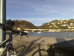
I hired a basic hardtail bike from a local shop, donned my cold weather gear, and took off into the hills on this beautiful cloudless late autumn day.

The first part of the trip was up to Trevallyn Reserve which is perched atop some of the hills to the west of town.

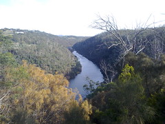
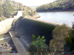
The reserve has some pretty steep and rocky trails which were hard work to negotiate, but worth the effort. The view down the river towards the dam is spectacular.

After a quick break, I then headed to the Kate Reed reserve to the south of town. This has a lot more narrow single track than Trevallyn, and it was here I suffered a pretty nasty “Gumby Stack” where I fell off my bike for no reason other than I couldn’t pull my feet out of my clip-in pedals. Luckily my shoulder survived the fall and I have no broken bones.

I’ve never ridden in such cold weather before. It takes a lot more preparation than I’m used to. And you still get hot, and cold, and wet with perspiration.

But it’s a great way to explore a city. I’ll definitely try this again!
Looking towards the GorgeEarly morning near the SummitDewy trailsReachng for the CloudsThe Hoo Hoo HutLake TrevallynTrevallyn Dam

Fun at Luna Park

Fun at Luna ParkFun at Luna Park

I had a great time in Sydney today at a client’s Christmas Party.

We had lunch at Luna Park, so I took a few minutes out to take a few photos of this fun place.

The smiley clown looking guy had a girl with him. I told her I was really Seven years old and just looked old, and would she take my picture please.

As you can see she obliged!

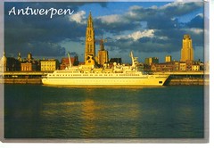
Antwerpen

A postcrossing post card from Judit in Belgium

The ship in the picture is “Carina” (you might be able to see the name КАРИНА in cyrillic on her bow).

Length: 122m, 7600GRT, 328 passengers.

She is currently known as “Rochale One” and operates as a static ship for student accommodation in Amsterdam.

She was built in Nantes, France in 1977 for the then Soviet government and named “Aywasowski”. She operated cruises out of the Black Sea and the Mediterranean.

She was renamed Carina after she was bought by German company Phoenix Reisen in 1997. She changed hands again in 2000 and was renamed “Primexpress Island”, operating out of Cyprus.

The ship was impounded in the port of Limassol (Cyprus) because of unpaid bills.

She was eventually purchased by a consortium of three Dutch housing companies acquired the vessel, towed it to Amsterdam and configured it for use as hotel accommodation for students.

Her engines are kept in working order, so she is capable of sailing as and when needed.

Thanks for the fascinating postcard, Judit!