Mount Nebo

Mount Nebo Summit
The kids were a bit restless this morning, so we decided to burn up some of their excess energy by taking them on a hike. We drove up into the D’Aguilar Ranges and hiked from the road to the Summit of Mount Nebo (620m) and back – a total of about 6.5km.

We followed a forestry fire trail for about 2.5km to the summit, and came back via a walking track on the southern side of the ridge, which meant we were able to check out a number of different ecosystems.
Liz and the KidsNeil at Mt Nebo
Lilly in a Tree StumpMount Nebo Walking Track

It’s a different world in the rainforest. Worries seem far away!
Palm Forest

Let’s do this again soon 🙂

Total distance: 6.32 km
Total climbing: 328 m
Average temperature: NAN
Total time: 01:48:10
Download file: activity_64668973.gpx
More data

Mangoes at Clear Mountain

Liz in the Mango OrchardMango OrchardMango Orchard
It was getting late in the afternoon, and neither Liz nor I had done any exercise for the day. It was too late in the afternoon for me to consider going on the roads in peak hour in the dying light, so we decided to go for a walk along one of my favourite mountain biking tracks at Clear Mountain.

It’s a state forest reserve, but it doesn’t take much looking to realize that this land had other uses. Right at the start of the walk there’s a very old orchard of Mango trees poking out of the undergrowth. The only problem is either someone got there before us, or the wind in the storms was particularly strong, because there’s no mangoes on the trees at all.

The route we took is a great one-hour workout with about half a dozen steep hills to walk up and plenty of peaceful looking scenery to check out along the way.

Where's My Stump?
Perhaps the strangest looking thing was this Eucalypt which appeared to be suspended in mid-air without any stump – an entire tree that must weight a ton. I’m guessing the stump burned away during bush fires last year, and the rest of the tree ended up nestled into one of its neighbors. It’s still a weird looking sight.

God its good to get out into the bush!

Total distance: 4.59 km
Total climbing: 239 m
Average temperature: NAN
Total time: 01:07:57
Download file: activity_64099541.gpx
More data

One Mile Creek

There are two major creeks in our area with misleading names. One Mile Creek is about Seven miles long. Four Mile Creek is about Ten miles long. Both creeks have their source in the beautiful bushland of Clear Mountain. Here’s some pictures of my ride through Clear Mountain and over the upper reaches of One Mile Creek.

Clear Mountain - Centre Road
This is the trail head of one of my favourite rides through Clear Mountain. Starting at the top of the mountain near Old School Road, Centre Road winds steeply down the hill through the eucalypts to a few crossings over One Mile Creek.

There are lots of trees, lizards and no sounds except bird calls and wind through the leaves.

It’s a great place to ride, and I’m so glad most of it is a state forest reserve.

Clear Mountain - One Mile Creek
The crossings over One Mile Creek have created some steep banks which are challenging to cycle in and out of, but are always enjoyable.

I took a slow ride by the lakes today. It’s amazing how much more you see when you slow down!
Lake Samsonvale / Mount Samson
Mount Samson and its pyramid peak overlook lake Samsonvale.

Lake Kurwongbah
Some houses overlook the shoreline on the far side of Lake Kurwongbah

Tree house
I think a goblin lives here 🙂

Grass Trees
Grass Trees at Forgan Cove

It’s a great feeling riding a mountain bike along these paths!

Total distance: 30.26 km
Total climbing: 459 m
Average temperature:
Total time: 02:52:18
Download file: activity_61504187.gpx
More data

Mount Samson Summit

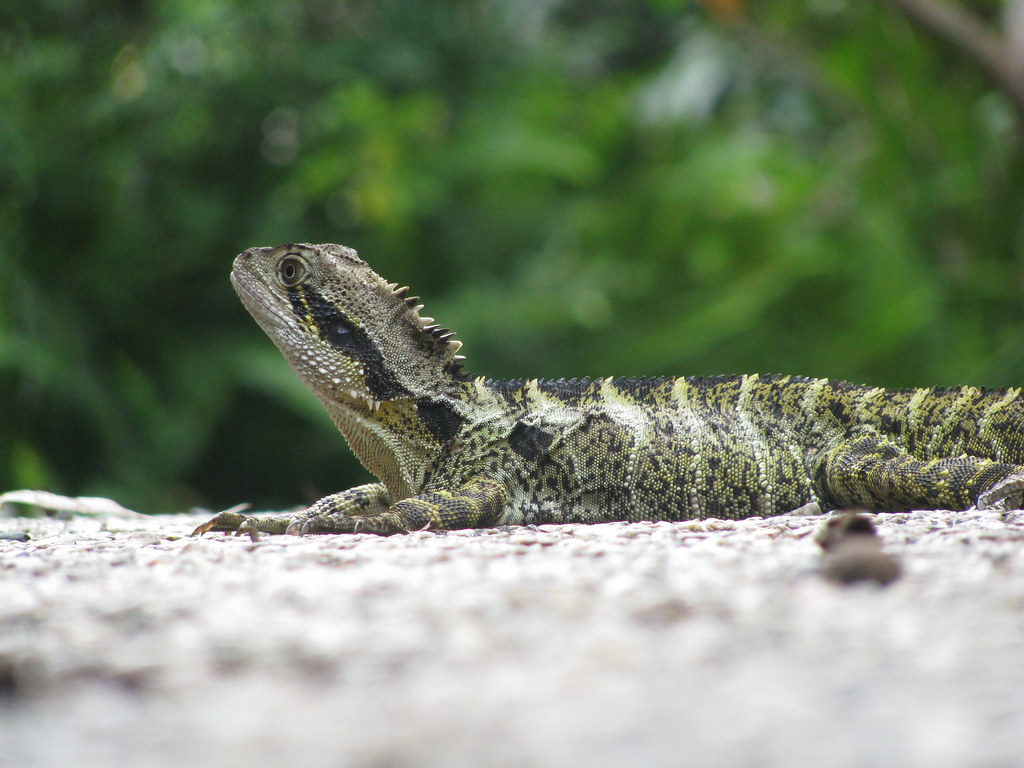
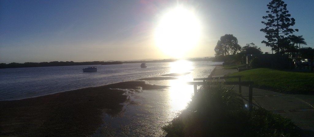
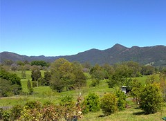
If you ever drive into the Pine Rivers district and look west, the chances are you’ll see a pyramid-shaped mountain on the horizon. You can’t miss it. The 18th century English navigators didn’t miss it – they drew it on their sketches of the area. And the chances are if you read this blog you’ve already seen it in some of my photos:
Mount Samson, D'Aguilar RangesLake Samsonvale and Mount Samson

A week or so ago I decided I’d like to climb it, but I wanted to take my bike as far as I could up the mountain. It’s a tough climb for hikers, so when I told my plans to my dear long-suffering wife, she gave me a look which gave no doubts that I should ask some friends to come as well in case anything went wrong.

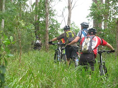
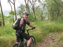
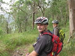
So I asked on the excellent local mountain biking website MTBDirt.com.au for some riding buddies. “You have to be crazy to do this ride”, I said. “I’ve never done it before, I don’t know if it’s rideable, it will be wet and muddy. If you’ve got any doubts, don’t come”. So seven other guys turned up this morning for the ride. I was stoked 🙂

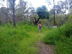
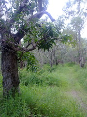
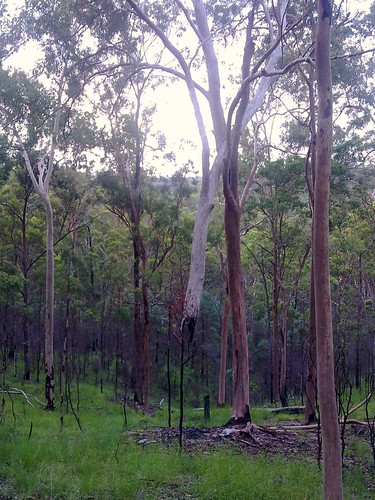
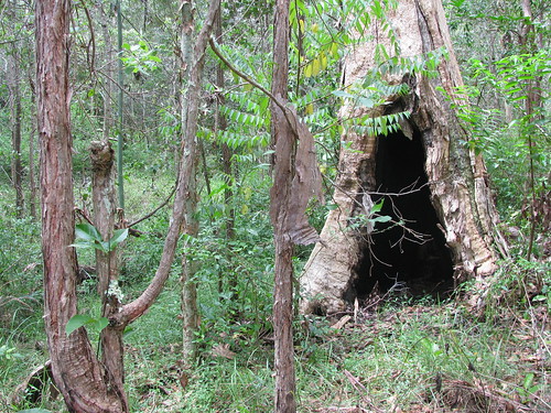
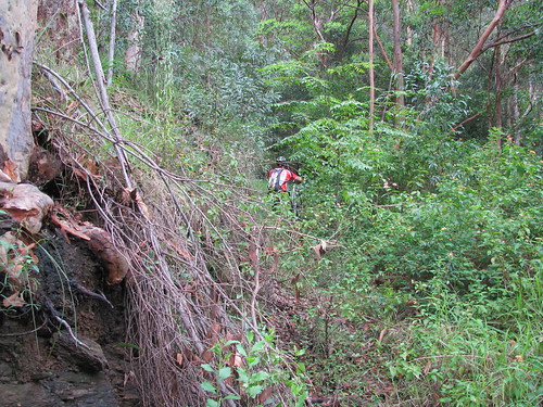
We had permission from the local land owner who let us ride through their property up to the national park. (Thanks Gab & Shirley – we love you!). But when we got there, we took a wrong turn and ended up bashing through a few hundred metres of lantana before we’d even really started:
Climbing Mt Samson on a bike

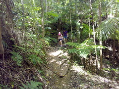
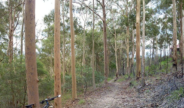
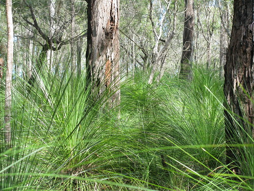
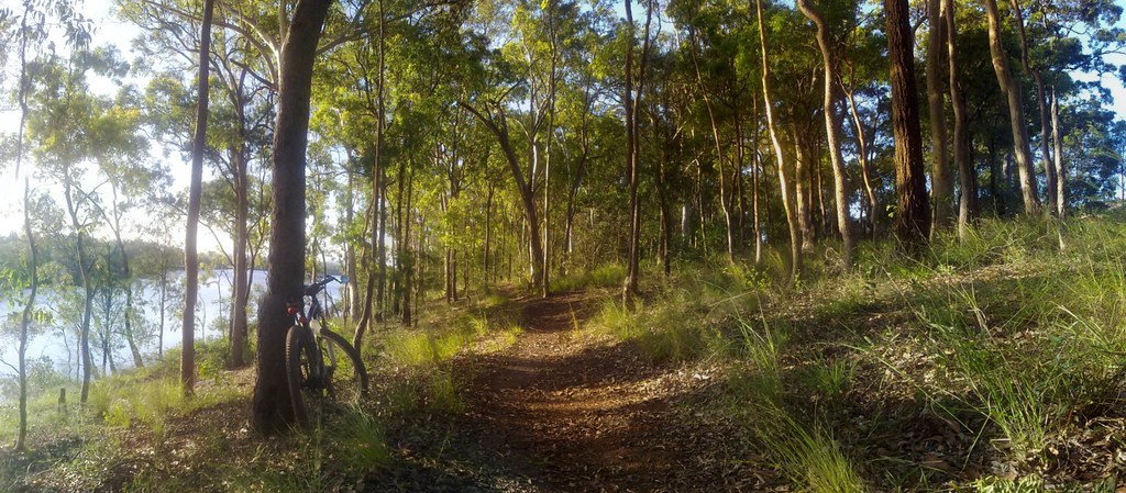
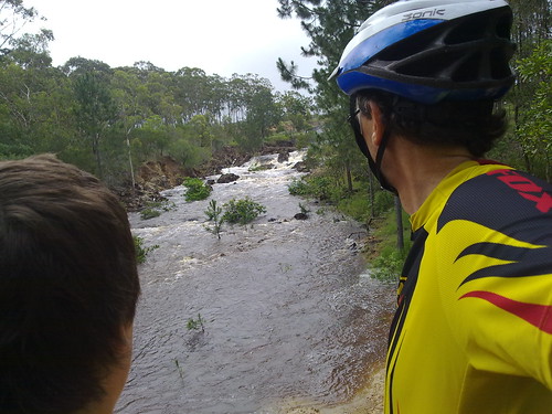
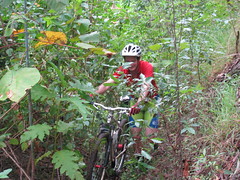
Eventually, we found the fire trail, and half-rode, half dragged our bikes up the hill:
Climbing Mt Samson on a bikeClimbing Mt Samson on a bikeClimbing Mt Samson on a bike

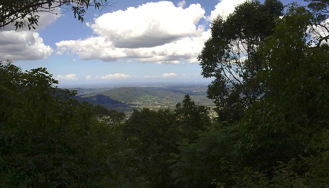
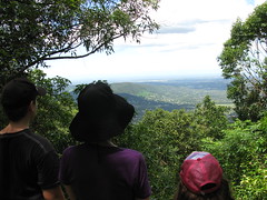
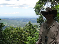
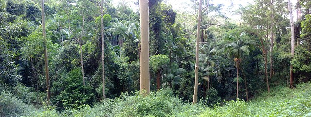
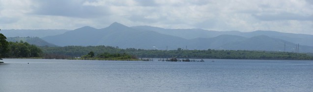
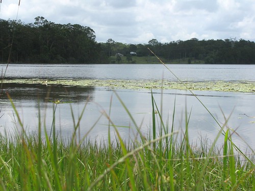
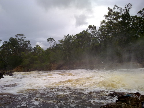
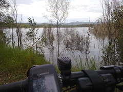
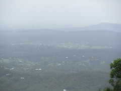
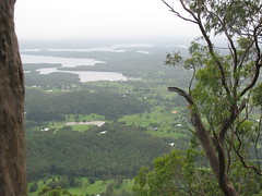
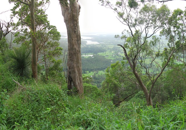
We eventually made it to the 500m line which marks a saddle between the lesser peak to the north, and the imposing pyramid of Mount Samson. It’s at this point that Hang Gliders used to jump off and glide into the valley below. The views, even at this point, were spectacular – despite all the clouds and rain in the area:
Climbing Mt Samson on a bikeClimbing Mt Samson on a bikeClimbing Mt Samson on a bike
Climbing Mt Samson on a bike
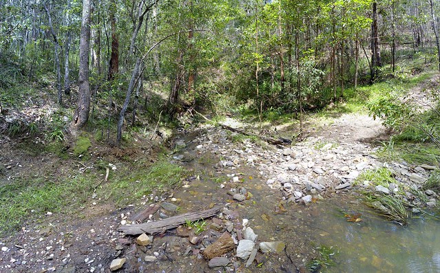
We pushed on and eventually reached a thick bunch of lantana that was impenetrable. There was no way we could drag the bikes any further, and as we tried to push through it, the horrible weed cut us and made any further progress impossible.

So we did what any fun-loving mountain bikers would do, turned the bikes around, and rolled down the hill. What a ride! About 450m of descent in 3 or 4 km. I crashed a couple of times as did others – but there was so much undergrowth that it was like landing on pillows. Also, while riding down we discovered the route we should have used coming up. It would have saved us some crazy hiking at the start and maybe saved us half an hour.

But it was a great ride with some really fun, fit, and slightly crazy guys. I’d love to try it again once I have a better idea of where to go when we reach the saddle at the top.

MtSamsonProfile

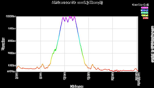
Total distance: 25.37 km
Total climbing: 832 m
Average temperature: NAN
Total time: 03:45:15
Download file: activity_60963369.gpx
More data

Bearded Dragon

This little fellow and his friends visit our place regularly. Sometimes before I can drive up the driveway, I have to get out of the car and shoo them out of the way.

This afternoon he was checking us out, so I snuck up on him with Liz’s camera and took a few shots.

Liz’s camera is much easier to take good photos with than my mobile phone!
Beared Dragon
Beared Dragon

Following the North Pine River

Several weeks ago I rode out to the source of the North Pine River in the D’Aguilar Ranges. Today I thought I’d have a look at the other end of this beautiful river, near where it meets the South Pine River, and the sea.

Part of the trip was through John Oxley Reserve, where Oxley first set foot in our region in 1823. There are some well kept trails through the reserve which lead down to the river, and then eventually further downstream to Acacia Park.

Acacia Park, Murrumba Downs
There’s a small amount of single trail in Acacia Park and great views of the river.

River Junction
The confluence of the North Pine and South Pine Rivers as seen from Acacia Park, Murrumba Downs

Dohles Rocks
Dohle’s Rocks is near the mouth of the river. It’s quiet because the only way out is the way you came in – so it’s a cul-de-sac. The area is named after the Dohle family who first settled there, and whose kids used to row across the river most mornings to get to school. As you can see it’s quite idyllic late in the afternoon.

It’s rides like this that remind me how fortunate our family is to live where we do!

Total distance: 34.47 km
Total climbing: 384 m
Average temperature: NAN
Total time: 02:13:15
Download file: activity_60250096.gpx
More data

Sideling Creek


The excessive rain around here means that there aren’t many dirt trails we can ride at the moment without getting bogged in mud.
Sideling Creek in Flood

Harrison and I had a look at some of the flooded creeks in the area, but were particularly impressed with all the flood water in Sideling Creek.
Water over the Spillway
I normally ride the bike across a few rocks over Sideling Creek below the Dam that forms lake Kurwongbah. But today, there was no chance of riding across this creek.
Sideling Creek in Flood
It was once the physical western boundary of Tom Petrie’s “Murrumba” property after he purchased if from the Griffins in 1858. It was definitely a physical boundary today!
Dam Wall - Kurwongbah

Total distance: 18.63 km
Total climbing: 298 m
Average temperature: NAN
Total time: 01:58:27
Download file: activity_59022580.gpx
More data