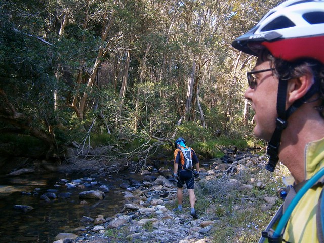
It’s taken two years and a couple of attempts but today Aaron and I finally made it to Dianas Bath.
Dianas Bath is a spectacular rock pool in the northern section of D’Aguilar National Park, fed by Byron Creek. It’s very difficult to get to – even if you have a 4WD (which I don’t), and it’s surrounded by steep hills, thick scrub and large boulders.
Todays ride started at the bottom of Wirth Road at Laceys Creek.
We slowly ground our way 6km to the top of the hill, then meandered through the forest until we reached Jacky Creek Road. This is a steep descent which switches back and forth down the mountain and devolves into some really fun steep single track towards the bottom.


Jacky Creek is a quiet pretty stream, but it flows in all weather, so it’s a bit of a challenge to cross. We managed to get to the other side and stay dry, which was quite an achievement.
From there we followed Dianas Bath Road to the end. This is a steep climb followed by a steep descent. In the past I found it so steep I had to push the bike in some parts. Today I just kept my head down and kept pushing the pedals around, and made it to the top. I was really pleased to tick this hill off the list. I must give credit to my riding buddy, Aaron, who spurred me on.

Eventually we had to leave the bikes behind and rock-hop along Byron Creek. This is tough because cycling shoes aren’t designed for walking in. Mine have carbon-fibre soles which hard hard and slippery. Walking on rocks in shoes like this is really difficult. In addition, the track was overgrown, we had to scramble over a few fallen trees, and the banks either side of the creek are steep and strewn with boulders. Oh, and did I mention the thorny “wait-a-while” vines that wrapped around our limbs?

After about half an hour of scrambling along the creek, we finally reached Dianas Bath. I was delighted. It was prettier (and bigger) than I imagined. My only regret was not bringing some swimmers. This place would be a lot of fun to swim in.

Aaron took his shoes off and waded in the water while I kept scrambling around on the edge of the pool looking for a Geo Cache.

My friend, Paul, created the Dianas Bath Geocache a few years ago. A Geocache is a small container containing trinkets and a log book. There are millions of them hidden all over the place. You can find out more here. I was delighted to finally log this cache after two years.

From there we headed back towards Mount Brisbane Road for the ride back to the cars, dodging lots of friendly goannas along the way.

Today we rode 52km in about five and half hours (including stops). We climbed about 1,750m of vertical ascent. I burned about 5,200kcal.
The ride included many slopes in excess of 25%, and some gradients in excess of 30%. This means you need to be fit enough to ride up the hills (or push your bike up), and confident enough to ride down them. Some of those slopes are slippery with dust or gravel.
I’m rating this one 9 out of 10 on the tough-o-meter. Take lots of water and plenty of snacks. Don’t do it in wet weather. Watch out for 4WD’s.
Thanks Aaron for a fun ride 🙂
Note: Dianas Bath is on private property. The owner currently allows walk-in access only. Please treat it with respect, clean up any mess you make, take all litter with you, and be courteous towards anyone else who is using the waterhole.
Total climbing: 1843 m
Average temperature:
Total time: 05:29:19
More data


