Missed it by “This Much”

Last year I tried to ride to Dianas Bath. Today I thought I’d give it another go.
Road through the Rainforest
Diana’s Bath is a beautiful rock pool on Byron Creek in the D’Aguilar Ranges. It’s secluded, hard to get to, and picturesque. You can drive there in a 2wd car from the west via Esk. You can get there via 4wd and a bit of a hike over the mountains from the East. So I thought I’d (again) try to get there from the east via Dayboro.

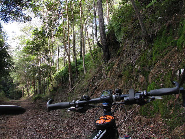
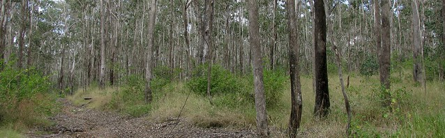
I drove to the foot of the mountains, and rode from there, rather that riding from home – saving me about 60km. The ride starts with a 200m ascent in less than 2km. It’s a tough climb but if you sit back and work hard, it’s do-able. The views at the top of the hill are worth the climb:
Looking EastGrevilieas

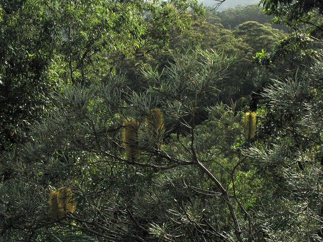
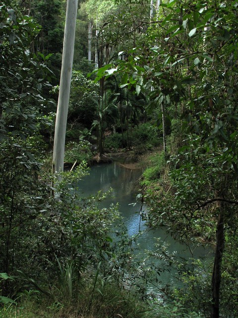
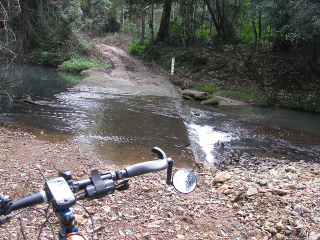
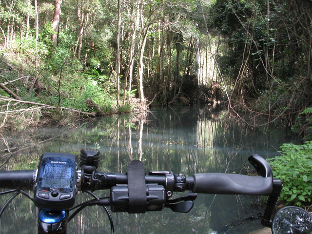
Then there’s some fun downhill, and bouncing along the creek beds. Byron Creek is really pretty. The water actually looks a light cloudy blue colour. I don’t know whether it’s sediment, or something in the water, but it’s amazing to see. The banks of the creek are fringed with palm trees and rainforest vegetation, and there’s a continuous sound of Bellbirds and Whipbirds ringing in the air.
Byron Creek

Byron CreekByron Creek

Eventually you have to do another 200m ascent, but this time it’s in about 1.5km along Diana’s Bath Road. I think they should rename this road “Heart Break Hill” because you need to be totally committed to be able to ride to the top.
Taking "A Break"
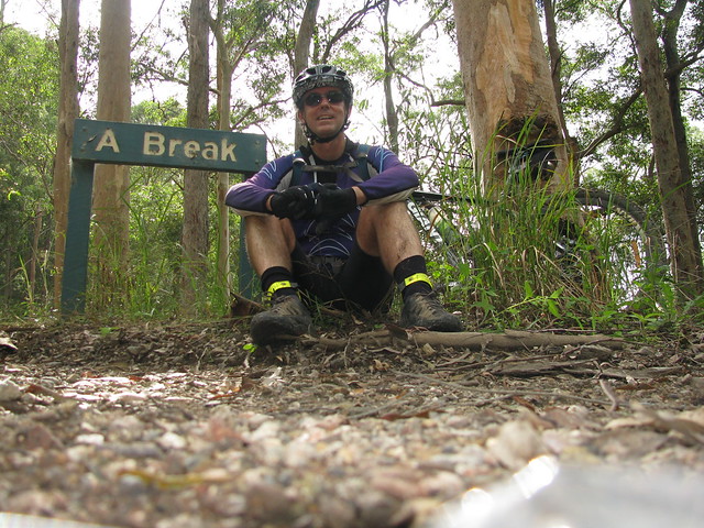
When I got to the top, I saw a sign which said “A Break” – so I thought – why not? 🙂

In the middle of nowhere

I followed the road as far as I could and eventually it disappeared into lantana and weeds. So I decided to play it safe and turn around. I wasn’t going to get to Diana’s Bath today.

It was only when I got home and checked out the track log that I realized I had gotten to within 100 metres of Diana’s Bath, but didn’t realize it at the time. So I think it’ll be a case of “Third Time Lucky”. Perhaps I’ll take a long-suffering friend with me next time for my final assault on this elusive part of the world!

All up, about 1,000m of ascent in 25km, and about 3,000cal. Very hard work. Some of the ride was flat, but when you consider that I came and went on the same track, and if you subtract a few km for the flat bits, that works out to 10km of 10% climbs, 10km of 10% downhills, and 5km of bumpy creek beds.
Eucalyptus Trees

Total distance: 25.98 km
Total climbing: 1010 m
Average temperature: NAN
Total time: 03:51:01
Download file: activity_86919315.gpx
More data

4 Replies to “Missed it by “This Much””

  1. Hi, I wonder if you could help us out a little. We have been trying and find Dianas bath for about 3 years after some one told us about.
    we gave it an other go today but missed it again. We enterd from Fernvale into Mt Byron rd and drove right up to the gate which has the hydro sign and walked past the shak. It seemd to be a cow paddock. We asked a local along the way and he told us it was about 1.5 km hike from the gate but perhaps we did not walk far enough. Came across Bobs camp and walked a little further to an other creek crossing the rd then turned back…..it is so frustrating knowing how close we are yet so out of reach.
    Any guide posts would be much appreciated

    Many thanks melitta

    1. Hi Melitta

      I know it sounds crazy but I’ve never tried getting to Diana’s Bath by road. Each time I’ve tried it, I came via fire trails over the mountain.

      Here’s a map of my most recent visit: http://g.co/maps/28jkm – Can you tell where abouts you got to on it?

      I think the easiest way to get there is to go to the point marked “Open Field / Camping Ground” and hike upstream a couple of hundred metres.

      Have you got a GPS? If so, I think it’s at S 27° 07.658 E 152° 40.713

      A friend of mine gave these instructions:

      Odometer 	Directions 	                                           Distance
      0 	Fernvale turn-off south of dam 	 
      2.9 	Turn left at crossroads in to Mt Byron Rd 	                        2.9
      7.9 	Keep left 	                                                        5.0
      11.3 	Keep right 	                                                        3.4
      12.7 	Turn left after grid 	                                                1.4
      13.0 	Concrete causeway (the next section crosses a steep hill)  	        0.3
      14.8 	Keep left 	                                                        1.8
      15.4 	Turn left 	                                                        0.6
      16.2 	Keep right - leave cars here before a creek crossing and locked gate 	0.8
      

      From the cars cross over the creek and the locked gate. After the gate, turn immediately left and walk 200m back down to the creek where a sign will be found marking the short trail to Diana’s Bath.

      Hope this helps.

      Neil

  2. Pingback: Big Wet « Musings

Leave a Reply

Your email address will not be published. Required fields are marked *

This site uses Akismet to reduce spam. Learn how your comment data is processed.