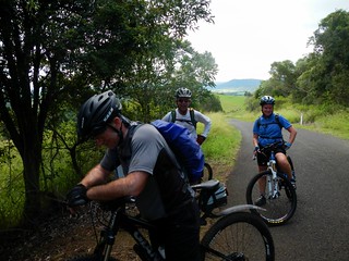
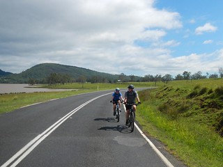
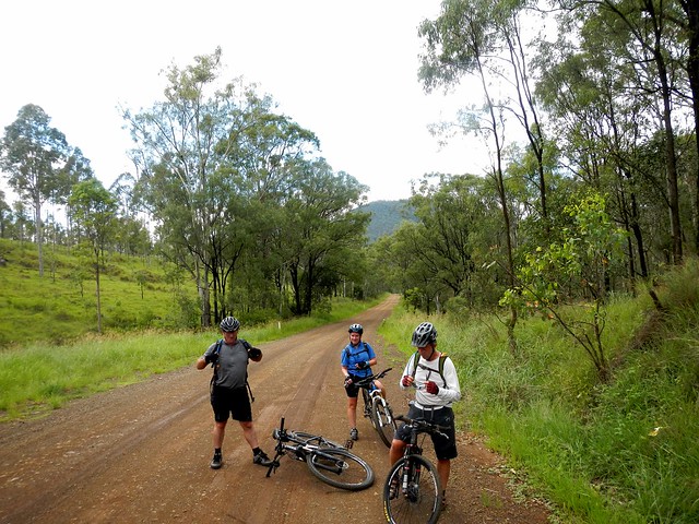
Glenrock

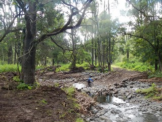
East Haldon Valley

Todays adventure was a point-to-point ride from Goomburra National Park (near Cunninghams Gap) to Mount Sylvia. I wanted to fill in another gap in my Ride Network Map, and Becca, Eric and Darb were kind enough to indulge my whim and ride with me. We’ve ridden in Goomburra before, and were familiar with the steep climb up to the top of the range, peaking at about 1,100 metres above sea level. This was going to be a long day, so we wanted to save some time at the start by driving to the top of the range and starting our ride there…

Carpark - Goomburra

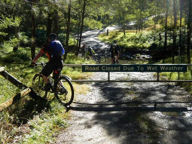
Unfortunately, the road to the top was closed to vehicles – a locked gate blocked the way. So we had to ride our bikes to the top instead.

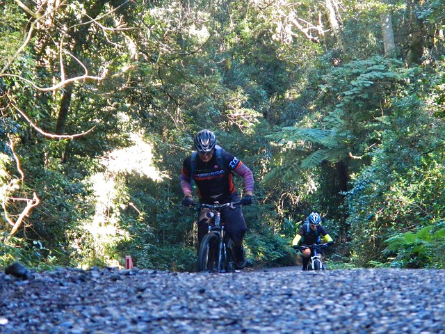
Steep Road - Goomburra

I thought this was poetic justice. I had recently written an article for The Mountain Bike Life about Hill Climbing in which I enthusiastically described how wonderful it was to ride a bike up steep hills. It seemed like the universe was forcing me to practice what I preached ๐Ÿ™‚

The climb had added an hour’s riding time to our trip, but it was still worth the effort.

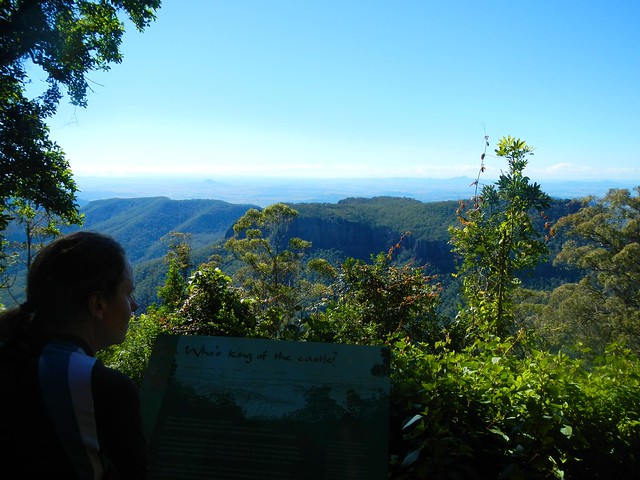
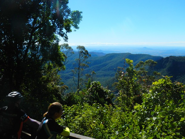
Mount Castle Lookout

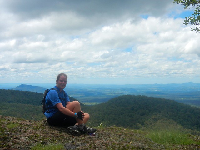
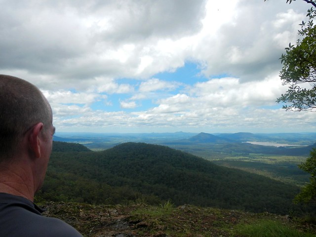
No ride “to the top” at Goomburra is complete without a side-trip to the Mount Castle Lookout, so we left Eric to mind our bikes while we hiked a few hundred metres through the rainforest to enjoy the view. Despite dismal rain the previous day, and heavy fog that morning, it had transformed into a glorious day.

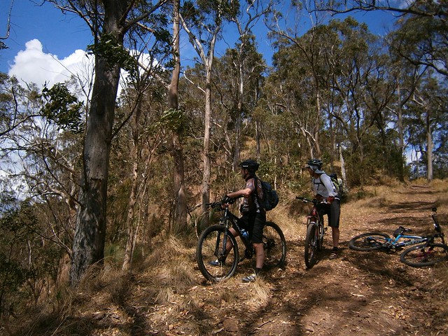
Goomburra Ridgeline Track

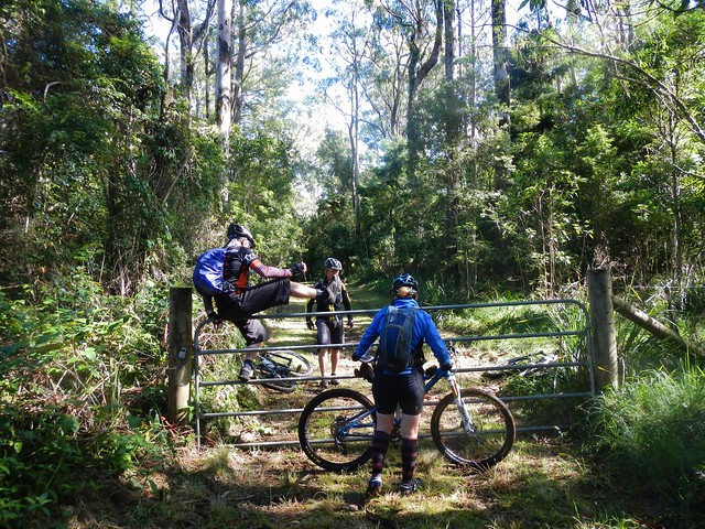
From the lookout we turned westward and followed a forestry track along a sharp high ridgeline, jumping a few locked gates as we went. Try doing that in a 4wd ๐Ÿ™‚

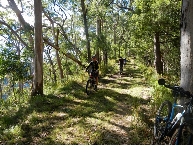
Goomburra Ridgeline Track

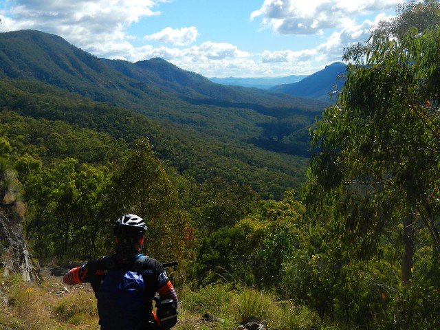
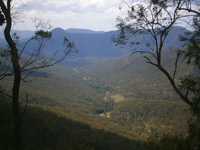
Riding this ridge line is like cycling on a knife’s edge. On either side the terrain drops off steeply. As we rode, on our left and right, we could see the valley below us through the trees.

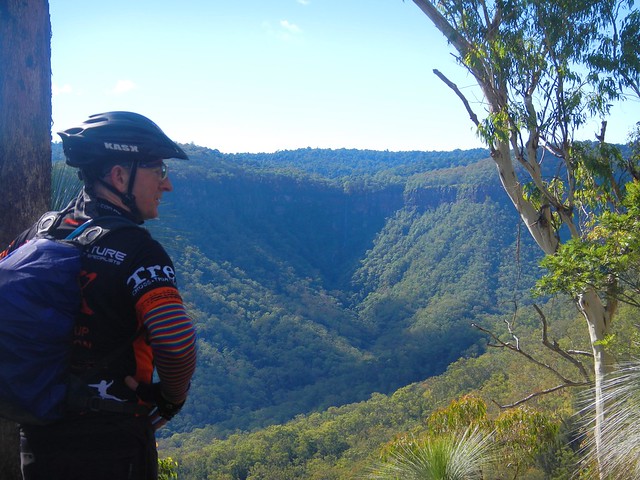
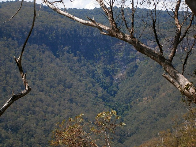
Blackfellow FallsLookout - Goomburra

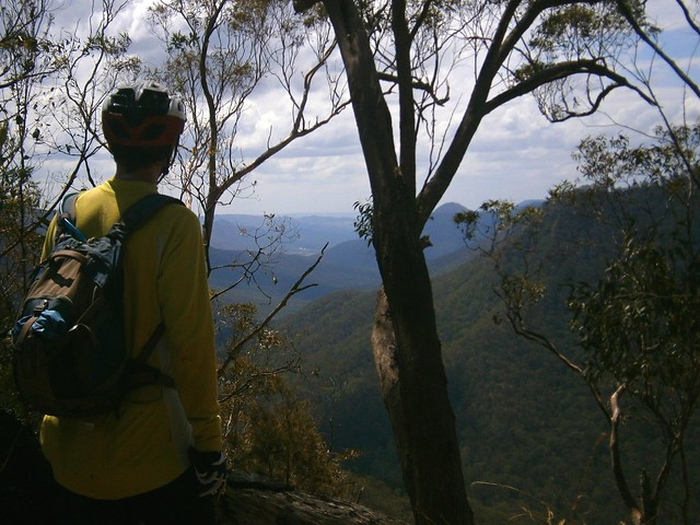
The views up the valley towards the waterfall were stunning. At times like this I’m so glad I’m able to ride a bike in the bush in this part of the world. Doesn’t it look fantastic?
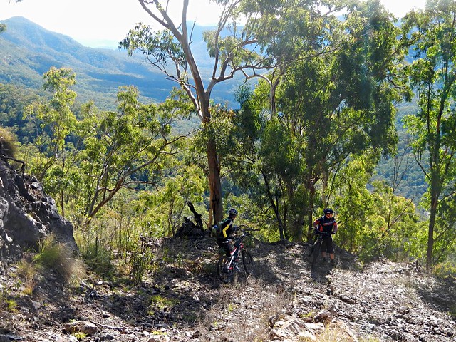
Steep Descent
Eventually we reached the end of the ridgeline. It was time to drop down into the valley. Our plan was very optimistic. We had based the route on faint track marks we could make out from aerial photos. We were aware that the descent would be steep (up to 50% gradient in parts), and that we’d have to be very careful.
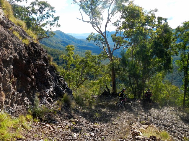
Steep Descent
Yep – it was steep alright. What impressed me was that we were actually able to ride any of it ๐Ÿ™‚

Steep Descent
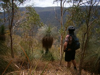
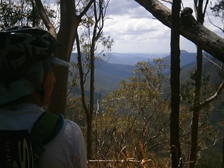
The views were amazing. We stopped every few minutes to soak up the panorama.
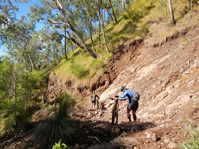
Landslip
Recent wet weather had caused land-slips which impeded our progress. Thankfully we were able to walk over the rubble.
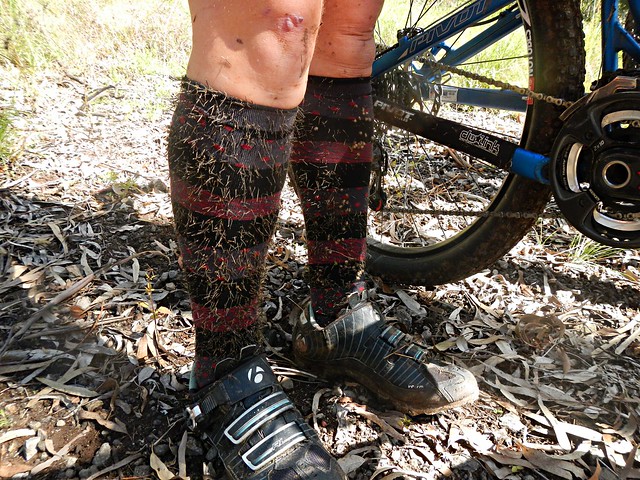
Cobblers Pegs
One thing that was unavoidable, however, were the cobblers pegs. After bashing through the undergrowth for a few minutes, it looked like our legs had sprouted wierd hairs that had poked through our socks. I think it’s going to take ages for me to pick them out of my clothes.
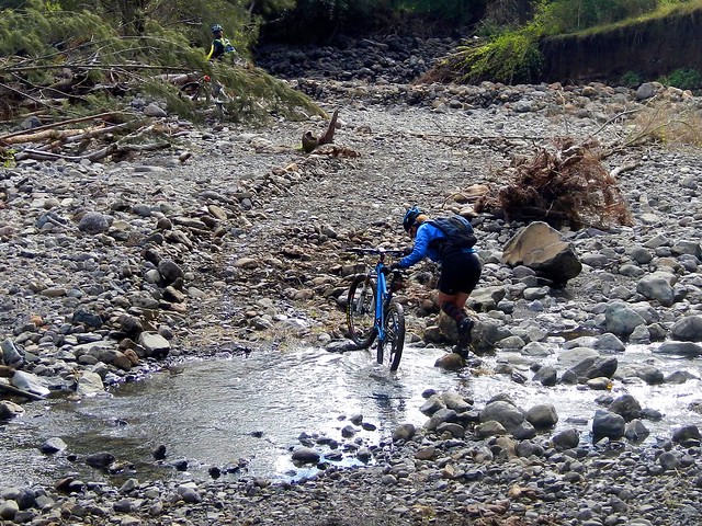
East Haldon "Road" - Blackfellow Creek
Eventually we reached East Haldon “Road” which follows the creek along the valley. I use the term “Road” lightly. It was a rough track to follow.

East Haldon "Road" - Blackfellow Creek
The track took us past a place on the map known as “Top Yards”. I’m guessing this was a place where graziers kept cattle in earlier times.

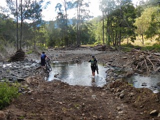
East Haldon "Road" - Blackfellow CreekEast Haldon "Road" - Blackfellow Creek

We had to cross the creek many times. Initally I tried to “rock hop” and keep my feet dry. Eventually I just hardened up, and waded through the water.
Groundhog's Cafe
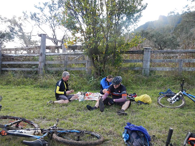
Eric surprised us. He had told me that he was carrying climbing rope in his frame bag for our precarious descent. But actually he was carrying a gas stove and picnic blanket. When we caught up to Eric at the “Bottom Yards”, he had the water boiling, picnic blanket spread out, coffee and hot chocolate rady, and even some short-bread.

We were cold and hungry. What a pleasant surprise!

Thanks for being so thoughtful, Eric.
Wild Mandarin
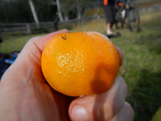
As an added bonus, we were sitting under a mandarin tree laden with fruit. We were able to pick some ripe mandarins to enjoy with our lunch. They were delicious!

Here’s Darb’s video of our lunch “surprise”:

Groundhog’s Bottom Yard Cafe from Darb Ryan on Vimeo.
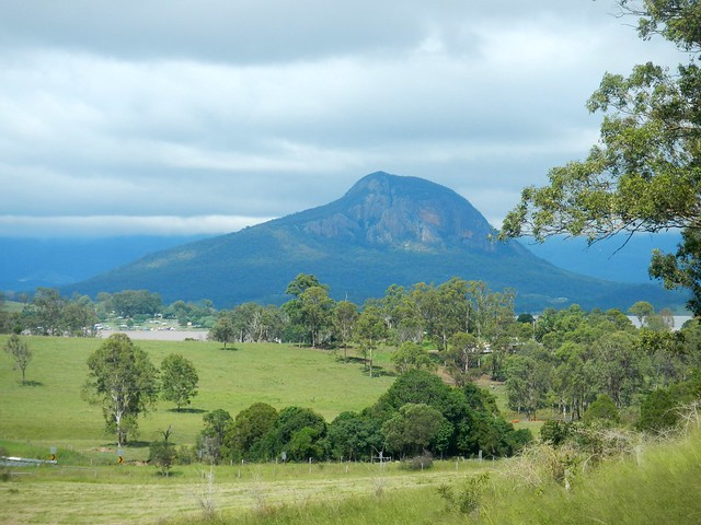
Glenrock
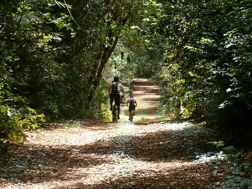
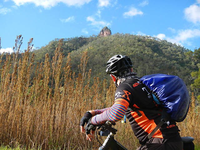
As we rode out of the valley, a prominent rocky outcrop came into view. This is “Glenrock” – it’s what the state forest is named after.

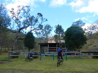
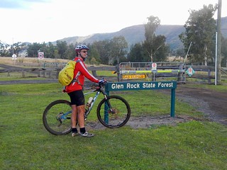
Day Use Area - GlenrockGlenrock State Forest

After countless creek crossings and what seemed like an eternity of rough tracks, we finally made it out of the state forest.

It had taken us over 4 hours, and we’d only ridden 25km. Hard work. That must have been the slowest 25km I’ve ever ridden. In fact I’ve done faster hikes than that.
East Haldon Road
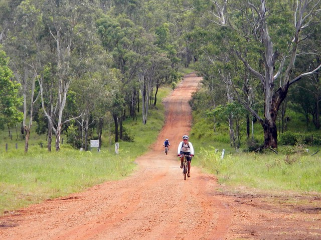
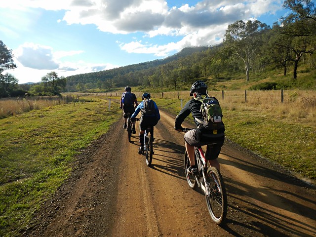
The rough tracks became smooth dirt roads. While we still had about 30km to go, the toughest part of the ride was over, and we were able to enjoy a smooth, fast, ride to Mount Sylvia.

End of the Ride

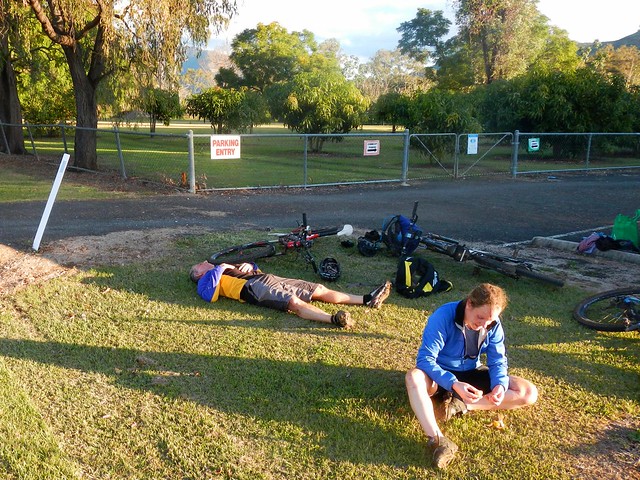
It had taken us over 6 hours to ride 50km. We were delighted to reach our destination and relax.

We climbed about 860m during this ride, and descended about 1,400m. I burned about 3,000 kcal. We took a vote at the end of the ride and decided this one rates about 8 out of 10 on the tough-o-meter.

If you’re going to try doing it, be prepared for very rough country. There are no groomed trails out here. In places the track is difficult to see. And (of course) the descent from Goomburra is dangerous, so take care.

Thanks Becca, Eric and Darb for a great day out.

Thanks also to Mike for driving us out there, and to my dad, Bruce, for helping me get the Van out to Mount Sylvia the day before.

Point-to-point rides take a bit of extra planning, but they’re worth the effort!

Total distance: 54.14 km
Total climbing: 1543 m
Average temperature: 14.3
Total time: 06:07:27
Download file: activity_331321083.gpx
More data

Egypt

Egypt Plateau
Queensland has its very own “Egypt” – a spectacular plateau to the south-east of Toowoomba with amazing views of the Lockyer Valley. Today’s adventure took us to the heights of Egypt following portions of the Bicentennial National Trail (BNT) as well as old tracks that were once used in the Flight Centre Epic mountain bike race.

Egypt Plateau
We rode from Withcott with some new friends, Tamsin and Richard, who were familiar with many of the trails in the area, and were able to point us in the right direction when planning the ride.

Silver Pinch
There’s no chance to “warm up” when riding along the BNT out of Withcott. The hills start almost immediately. One of the first major climbs is “Silver Pinch” which takes you up to Silver Ridge, near the Toowoomba Golf Club at Middle Ridge.

Upper Flagstone Creek Road
As with most climbs, we were rewarded afterwards with a wonderful twisty descent down Horsfalls Lane towards Upper Flagstone Creek. It was a cold day, and I was grateful for the warm gear I was wearing as the wind whipped past us on the way down.

BNT Climb to PrestonBNT Climb to Preston

After following the creek for a short while, we left the paved road and followed the BNT up a dirt track leading up to Preston.

BNT Climb to Preston

And this was to be the pattern of the day. Tough climbs. Short break at the top. Wonderful quick descent ๐Ÿ™‚

BNT Climb to PrestonTeamwork
Some of the hills were a bit too steep to ride in places, but it still felt great to be out in this wonderful part of the world.

Preston Village Chapel
We eventually made it up the climb to Preston – a picturesque hilltop village with its own Chapel and Vineyard. (Note to self, lets come back here in a few weeks with the family for a leisurely drive)

Preston Lookout
Preston Lookout

One of the hidden treasures of Preston is a lookout, not far from the winery. I only found out about this gem by reading Shannon Wall’s excellent blog “Biking the BNT” in which he describes his adventures riding a mountain bike along the BNT from Cooktown to Aratula (over 3,000 km). The panorama is worth the small detour from the main road. Thanks for letting us know about it, Shannon!

Kennedys Road
Richard suggested we leave the BNT at this point, and ride up to the Egypt Plateau via the small villages of Rockmount and Stockyard.

What followed was another eye-watering descent down from Preston in which we lost about 500 metres of altitude over 10 km.

Wow!

At the bottom, Paul pointed out to me that while he enjoyed the ride down, he was reluctant to give up so much altitude. Because as any intrepid mountain biker will tell you, you must pay your dues to the gravity gods. What goes down must go up. And so we met Kennedys Road.

It starts with a bit of a giggle. There are a few letter boxes at the bottom, and a rusty old fridge, that makes an effective letter box if you’re expecting large parcels.

But the climb is tough.

As usual, I was the last one up the hill.

I kept my legs turning over by reciting Banjo Patterson’s “Clancy of the Overflow” to myself. The rhythm and imagery kept my mind off the effort.

Egypt Plateau
Egypt Plateau
And so we made it up onto the Egypt Plateau, where we all collapsed on the grass opposite an old fig tree, and enjoyed our lunch. Eric (relaxing on his back) says the best sauce is hunger. I agree with him. Peanut butter sandwiches never tasted so good.

Egypt Plateau
We stopped quite often to soak up the views. The rolling hills seemed to go on forever.

"Little Egypt""Little Egypt"

For some reason an old song by Elvis Presley starting going through my head. No prizes for guessing which one.

Egypt Plateau
Each corner revealed a new vista…

Egypt Plateau
… so we stopped quite often to enjoy the view.

Incidentally, this is one of the reasons I don’t do races. How could you possibly enjoy the view? (The other reason is that I don’t ride fast enough).

Egypt Plateau
Great views with great friends. I can’t really thing of anything I’d rather be doing on a Saturday!

Road cutting
Eventually we hit the main road near Ma Ma Creek and started riding southwards. This imposing road cutting stretched high on either side of the road. There were warnings at either end alerting us to the possibility of falling rocks. Eric (ever wise) advised us all to keep riding. I couldn’t resist and had to stop and get a photo of it.

Water Stop
After about 55km riding, we stopped to fill up with water at this goregous old galvanized iron hall at Ma Ma Creek.

Razorback Road
We then left the paved road, and started our way up a dirt track ominously named “Razorback Road”. This was the third major climb of the day. Good old Clancy came to lend a hand yet again as I re-recited the poem to myself.

This track was part of the “Epic” mountain bike race a few years ago. I thought about hardened racers grinding up this road. It was hard work at my slow pace. Imagine how painful it would be riding up this hill as fast as you could go?

Razorback Road
The road passes through a couple of cattle properties on its way up to the Gap at the top.

Razorback Road
The rugged landscape was stunning.

Razorback Road
Jason kindly hung back on the climb to ride with me. He’s new to mountain biking, but his legs are accustomed to working hard on the road bike. It’s hard to keep up with him on the hills.

Rock Formation - Lagoon Creek
At the bottom of another exhillarating descent, we came across this gorge at Lagoon Creek.

It’s amazing what you find off the beaten track.

West Haldon Road
After one more climb, we eventually reached the top of West Haldon Road. In the Epic MTB Race, some riders were clocked at 110 km/h riding down this hill. It had a bit too much loose gravel for my liking, so I decended much more sedately today!

The Vision Splendid
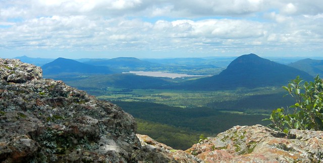
To the south we looked towards Glenrock National Park below the peaks of Goomburra. I haven’t been there. Yet ๐Ÿ™‚

What a wonderful place we live in!

Wavey Davey
We enjoyed the relaxing doanhill coast into Mount Sylvia. Our generous driver for the day, “Wavey Davey” met us here and drove us home. Point to point rides are always logistically challenging, and I’m so grateful for the time “Wavey” kindly gave to us today. Thanks mate!

Tamsin and Richard
Thanks also to Tamsin and Richard for showing us around their specatcular back yard.

We rode 85km, and climbed over 2,100m in vertical ascent, in under 7 hours, including breaks. I burned about 3,700 kcal. It was a cold day, and we worked very hard.

This ride deserves 9.5 out of 10 on the tough-o-meter.

To anyone who rode this route for the Epic race – you are tough as nails. Well done!

Oh – can anyone tell me how it this place got to be named Egypt please?

Total distance: 86.06 km
Total climbing: 3053 m
Average temperature: 12.5
Total time: 06:41:49
Download file: activity_327890106.gpx
More data

Bicentennial National Trail

Wow!
Today’s ride was a point-to-point epic starting at Mount Sylvia south of Gatton, following the Bicentennial National Trail (BNT) towards Cunningham’s Gap.

The BNT is an amazing recreational trekking route stretching 5,300 km along Australia’s Great Dividing Range from Cooktown in North Queensland to Healseville in Victoria. Following historic aboriginal trails and stock routes, the trail was opened in 1988, allowing self-supporting adventurers to traverse one of the longest off-road touring trails in the world, passing through some stunningly scenic country.

We decided to explore one small 90km section of the trail, starting at Mount Sylvia (near Gatton in the Lockyer Valley) and passing south-eastwards over a couple of mountain ranges before finally ending up at Clumber near Cunningham’s Gap.
JasonReady to Go
We planned to finish our ride at a different place to where we started. This usually involves time-consuming arrangements where we bring multiple vehicles, leave one at the destination, then all drive back to the start. To save time, my friend Jason kindly volunteered to drive us to Mount Sylvia (two hours drive from Brisbane), drop us off, then meet us again at the end of the day at Cunningham’s Gap. It’s the first time we’ve had a “chauffeur” and I appreciated the convenience that it gave us.
Left Hand Branch RoadLeft Hand Branch Road
We set off down Left-Hand Branch Road which follows a long narrow valley along Tenthill Creek up into the Liverpool Range. Blue skies, low temperatures, and a nice flat-ish road – what a perfect way to start the day!
Having a Yarn
At the end of the valley, we met a friendly farming couple who happily told us that the local council had only just fixed the road yesterday, and that if we’d come any earler we would have had to contend with land-slips and blockages. They then added:

“Oh and by the way, I hope you realize it’s all up-hill from here?”

Splash
They were right. The road slowly started getting steeper. All good mountain bikers like a decent hill climb, but the road up to Laidley Gap is not your average hill!

The Big Climb
We all gave it an honest attempt. My GPS tells me the gradient maxed-out at just under 40%. Not even Eric, with his deisel moter of a heart and iron legs could ride up it. So we pushed….

Laidley GapLaidley Gap
…and eventually reached the top. The friendly little red arrows let us know we were on the right route. Paul actually made and placed these arrows on the track a couple of years ago when it was used as part of a famous mountain biking race called “The Epic”. In those days, this 120km race ran from Toowoomba to Grandchester through some of the toughest country around. In 2010, Andrew Pioch set the record for this climb, completing it in just over 11 minutes averaging almost 10km/h. It took me 17 minutes. Andrew must be an amazing rider.

History on a Tree
Keen-eyed Eric spied a “Blaze” in the trunk of an old Ironbark Tree. If you look closely above his head you’ll see a yellow triangular BNT marker. These little markers are all along the trail and help to let you know that you’re on the right track.

Wow!
Wow!
As with all big climbs, it was worth the effort for the views and the exhillarating descent down the other side. Superlatives can’t do it justice. I was stunned by the views I saw.

And for the next short while, a huge grin was plastered across my face as I enjoyed a steep 10 km descent, wind howling in my ears, gravel crunching under my tyres, and trees rushing by in an adrenaline induced blur.

I was a kid again ๐Ÿ™‚

No Bridge!
After rolling into the small town of Thornton, it didn’t take long to discover some major damage caused by floods earlier this year. The bridge had been totally washed away. There was no way across the creek. A deep ditch lay in front of us. We briefly contemplated climbing down, and then up the other side, but common-sense overruled. We decided to make a short detour and cross the creek several kilometres further north.

Dodging Cattle
Along the way we dodged a some cattle being herded along the road by a farmer in his tractor.

It’s strange. When I usually come upon a bunch of cows on the road while riding a bike, they’re usually skittish and run away. But these animals seemed much calmer, and weren’t spooked by us. And the only difference I can come up with is that the farmer was behind them in his tractor. I imagine they felt more secure while being herded than they would be on their own.

Letterbox TractorEdwards Gap
After a brief stint on the bitumen, we followed the trail markers across another paddock towards Edwards Gap – our second big climb of the day. Paul was impressed with a letter box that someone had made to look like a tractor.

In the distance we could see the Liverpool Range and Laidley Gap where we had recently descended.

Edwards GapEdwards Gap

The climb up to Edwards Gap is another “hike-a-bike”. The track is steep and rough, but (thankfully) it’s not very long.

At the topHodge Road

It wasn’t long before we reached the grassy summit of Edwards Gap and yet another pleasant bumpy descent down the other side towards Mount Mort.

Amazing Views
Amazing Views

From here we headed south with the towering cliffs of the Great Dividing Range on our right.

The exhillarating views provided a pleasant distraction to the hard work of pedalling the bike into a stiff headwind.

Rosevale PubRosevale Pub

And so we reached the wonderful Rosevale Pub – our lunch stop. And we were early ๐Ÿ™‚

I had pre-arranged with Jason that I’d send him a message via my Spot Satellite Messenger once we reached Rosevale. If we got there late, we would take the shorter option and ride to Aratula. If we were on time we’d take the longer route over the Cunningham Highway and down to Clumber on Spicers Gap Road. I was excited to send Jason the “All ok” message that we’d be able to stick to the original plan and do the full route.

The Rosevale Pub has a fascinating story. Today it’s in the middle of nowhere by the side of the BNT.

It’s the oldest pub in Queensland, built in 1852 as a Homestead that provided liquor to travellers. Mathew Carmody was granted a victuallers license in 1887. In 1893 there was a huge flood which covered most of the surrounding plains, so the owners decided to move the pub about 1 mile to its present location.

The move required a couple of bullock teams to haul the building across the fields.

It took five days. During that time, while the building was on the wagons, it still traded. Can you imagine thirsty travellers buying grog fron a pub building that was rolling along on a dray as it was pulled through a field by a couple of teams of bullocks? Where else but Queensland? ๐Ÿ™‚

Today, the publican tells us that a few days prior some people came through leading a pack of camels heading south. A few days before that it was a bloke on horseback. In a few days time he’s expecting a young lady riding northwards from NSW.

What an amazing place.

But, after a delicious lunch, we set off on the final leg of our trip…
Amazing Views
Amazing Views

I can’t do the views justice by trying to describe them. They were awesome in the true sense.

Amazing ViewsAmazing Views
Amazing Views

Imagine waking up to views like this every day?

Cunningham Highway
We received a rude shock when we eventually reached the Cunningham Highway. The quiet rural tracks and solitude gave way to busy national highway with massive trucks whizzing by. We accidentally missed the track that passed through the bush 100m from the road, so decided to soldier on for a short way on the shoulder of the highway.

We were following the notes in the BNT guide book, but they seemed vague at this point, and we ended up crossing the highway near an old quarry. While this might have been appropriate for travellers on horseback it was too rough for bikes.

If you’re planning to ride this section of the BNT by bike, I’d suggest you follow the highway up to the Helipad 1km to the west, and cross there. You’ll save yourself a lot of hassle.

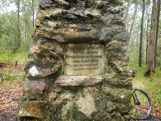
Vagabond Memorial
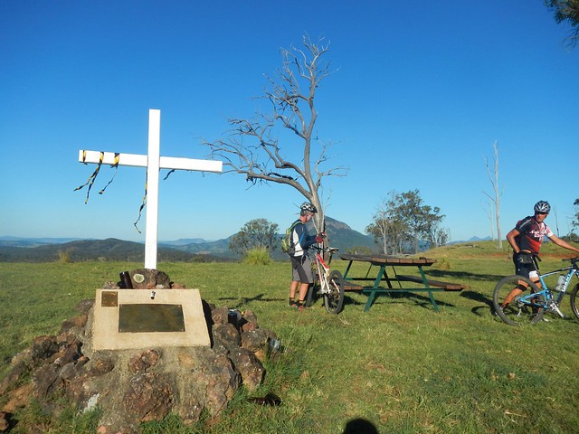
At the top of one last hill by the side of the highway we came across this memorial. Erected by the Vagabond Motorcycle Cllub I think it commemorates members who have died. There are a few empty beer bottles cemented into the monument, so I can imagine a few melancholy bikies standing in this scenic spot drinking wistful a toast to absent friends.

From this point we rolled southwards down the hill towards Pat Speedy’s farm, trying not to bother his cattle too much. Pat used to be a rodeo clown – one of the toughest jobs you can do. The man must have nerves of steel. He survived a horrible encounter with the horn of an angry bull.

I would have liked to meet him today, but unfortunately he wasn’t home.

Made it!
And off in the distance, across a paddock, we spied our cheerful van and generous driver. We’d made it. We were half an hour late, but delighted to have finished this small part of our trip.

Thank you to Eric, Paul and Becca for another amazing ride.

BIG thanks to Jason, our driver, for giving up a Saturday to drive a van full of sweatty mountain bikers around the country side. Our van travelled a total of 520 km for the day and went through one complete tank of fuel.

We ended up riding 87km in about seven and a half hours. We climbed about 1,300m and I burned about 3,500 kcal.

This is a tough ride, logistically and physically. It helps to do it with other experienced riders.

If you take the route we did, and finish at Spicers Gap Road, I’d rate it 9.5 out of 10 on the tough-o-meter.

If you take the easier option and finish at Aratula instead, I’d rate it 8.5 out of 10.

Total distance: 88.67 km
Total climbing: 2174 m
Average temperature: 25.6
Total time: 07:39:38
Download file: activity_307333212.gpx
More data

Boonah

Gorkow Rd
Have you ever made a mistake, only to discover later that it’s lucky you did because it actually saved you a lot of heart-ache?

That happened on our ride to Boonah today.

Our aim was to start at Peak Crossing, head south towards Boonah along some quiet gravel and bitumen roads, then head back to Boonah via the Western Trailhead at Mount Joyce. The added bonus of this ride is that it would link up a lot of disconnected rides on my map at the same time.

The only problem was that we took a wrong turn, and accidentally ended up doing our proposed loop in reverse (thank goodness).

Lost in the Grass
We followed the course along a quiet paved road, which turned into a quieter gravel road (“Oh this is nice” I muttered), which devolved into a disused vehicle track, which eventually degenerated into an overgrown unrideable “track” complete with soft sticky mud.
Farm field, Peak CrossingFarm field, Peak Crossing
To get away from the mud, we tried a detour along a track in an adjoining field – but the track disappeared and we had to get back into the quagmire.

Mud!Mud!
Eventually we got back to the comfort of a wide open gravel road, and were able to clean the bikes up a bit.

This wasn’t your ordinary mud. Normally, when my tyres get mud on them, I ride through the grass. This usually knocks the mud off. But in this case, the grass combined with the mud to make the raw materials for mud bricks. When we pulled at it, it came away from the tyres in a thick continuous layer like … mud cake. I’m sure if we had let it sit in the sun for a while we would have had a few bricks with which we could start building a house.

“Sorry about that, guys” I said. And then optimistically: “It should be a bit better now”.
Tough Hill Climb
Tough Hill Climb
I was wrong.

Our next track quickly devolved into a grassy jungle again, but this time we had the added joy of having to bash through it up-hill. Foolhardy soul that I was, I rode the bike up the hill, through the grass, without being able to see the ground. Miraculously I survived, and was able to photograph the others coming up the hill.

How did this mistake save us heart-ache?

Two hours had passed. We had ridden less than ten kilometres. This had been the hardest part of the ride. By accident we had gotten it out of the way during the early part of the day while our legs were still fresh. I shudder to think how we would have managed if we had to contend with this sort of challenge at the end of the day when we would have been much more tired.

Note to self: Do the tough stuff first, and save the easy stuff till last.

Limestone
At the top of the hill, the grass thinned out, and we came across a large ridge of white limestone. I had a “eureka” moment as I realized why this locality is called “Limestone Ridges”. The track we were riding actually ran between two limestone quarries. In fact the whole area near Ipswich used to be called “Limestone” in the mid 19th century because of the white rock that could be quarried there. (Come to think of it, isn’t there a place near Ipswich called “White Rock” as well?)

Enjoying the View
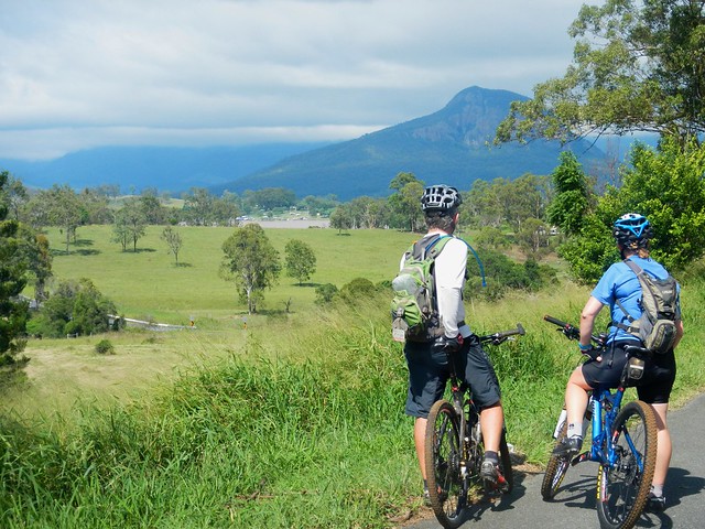
After rolling down the other side of the hill, we slowly made our way eastwards up into the Teviot Range. The long climb up Wenzell Road offered some impressive views westwards towards Cunningham’s Gap.

Mocker Rd Descent
Eventually we reached the top of the hill. After another short bash through some long grass we eventually found the trail that would take us down the hill towards the Western Trailhead at Mount Joyce Recreation Park, near Lillybrook Station.

This was a really enjoyable descent. It was steep and rocky, and required a reasonable amount of technical ability to stay on the bike. It followed some wonderful single-tracks that had been worn by intrepid cattle that grazed on the side of the hill. For me, this track was the highlight of the ride. I’d love to include it as part of some future ride to Mount Joyce.

Old Beaudesert RdOld Beaudesert Rd
And after what seemed too short a time, we were down the other side, following Old Beaudesert Road along Teviot Brook.

This track has personal significance for me. It was where I rode with my (then) eleven year old son in the middle of the night, in the middle of winter after we’d got lost riding at Mount Joyce. In the light of day it seemed much more benign than it did back then.
Rifle Range Rd
There are some beautiful dirt roads out the back of Boonah…

Gorkow Rd
We made our way into town, soaking up the great views around us.

Flavour Cafe
I ate too much good food at “Flavours Cafe” in Boonah. Impressively, they have a supply of chain lube, paper towels, visor cleaner and compressed air – all free of charge. I think it’s because of the large numbers of motorcyclists who frequent the cafe. For future rides, it’s handy to know where you can get some free chain lube!

Hoya Rd
Hoya Road runs north out of Boonah. The Great Dividing Range to the west provides a picturesque backdrop to this steep climb. After my indulgent lunch, I was glad I took this one slowly.

Hoya Rd
I don’t know what his secret was, but the tough climbs never seemed to faze Dean at all.

Roadvale
Our route back to our starting point followed the hill tops for about 12 km. Although the road was straight, it was undulating. I lost count of the number of times we’d get to the top of one hill, roll down the other side, only to have to grind up another hill. The mountain views provided a pretty distraction from the hard work.

MTB Descent
I think we were all happy when the paved roads gave way to dirt, and we were able to let our tyres crunch through the gravel.

Beckwith Road
The last ten kilometres of the ride were the easiest. Because of our earlier mistake we were now able to roll back into town, and relax as we soaked up the views. I’m so glad we didn’t spend the last couple of hours trying to battle mud and overgrowth.

DeanNeil
BeccaPaul

We rode 70 km in about 7 hours. We climbed a total of about 1,250 metres, and I burned about 2,800 kcal.

Because of the rugged start, and the numerous climbs, I rate this one 9 out of 10 on the tough-o-metre. If we did this ride again, and left out the mudfest at the start, I’d rate it 8 out of 10.

Thanks Becca, Paul and Dean for a fun ride, and for sticking with me, even when things were looking a bit tough!

Total distance: 70.83 km
Total climbing: 1944 m
Average temperature: 25.5
Total time: 06:48:20
Download file: activity_300311974.gpx
More data

Christmas Creek

Christmas Creek
The purpose of todays ride was to follow a route which connected up a previous ride Duck Creek with the small rural town Rathdowney via some picturesque country around Christmas Creek. Christmas Creek is in a rugged valley in the Macpherson Range south of Brisbane, near the state border. It’s the traditional country of the Mununjali Aboriginal People who are part of the larger Yugambeh-Bunjalung language group.
Albert RiverAlbert River
Albert River
We started from Duck Creek in Kerry and followed some quiet paved roads south along the swollen Albert River. Recent rain has increased the flow in many of the local rivers and creeks – they look spectacular.
Lost World Valley
Lost World Valley
If you keep heading south in this part of the world, you come up against the impenetrable wall of the Macpherson Range and a number of rugged valleys such as the “Lost World” valley.
Darlington Range
Our objective was is the next valley to the west, so we had to grind up and over the Darlington Range into to the Christmas Creek valley.

Christmas CreekChristmas Creek
After more that 25km of paved roads it was a delight to finally arrive at the muddy tracks that followed the upper reaches of the creek. Cliffs shrouded in clouds reared up on either side as the creek raged over the rocks below.
Christmas Creek
Much of this area is a popular hiking destination. We met up with a group of enthusiastic hikers who didn’t mind braving the intermittent rain and muddy trails. “It’s a bit wet, isn’t it?” I asked one lady. “Yes, but it sure beats sitting at home watching TV” she replied. I couldn’t have agreed more. Incidentally, I’ve never met a grumpy hiker. Or a grumpy mountain biker. So if you’re feeling a bit depressed…. ๐Ÿ˜‰
Christmas Creek
Christmas CreekChristmas Creek
After last week’s adventure through flooded creeks, Eric joked that he’d be disappointed if he didn’t get his feet wet today. We didn’t let him down.
Christmas Creek
At this point we decided it would be best to avoid the more flooded sections of the creek. Unlike last week, it wasn’t necessary for us to attempt this crossing, and there was only a short section of track on the other side, so we turned around and headed back up over the hills.
Christmas Creek
On the southern side of the track, the imposing cliffs seem un-scaleable. In fact, in this spot, almost 75 years ago to the day, they were the site of a fatal plane crash and an amazing rescue mission by Bernard O’Reilly. (To read more, click on the following newspaper clipping from the Sydney Morning Herald in March 1937).

Bernard O’Reilly was a hero. He climbed these mountains to rescue two survivors of the Stinson plane crash, and them brought them back on stretchers by following the ridgeline at the top of these hills. Everyone thought it was an impossible task – but he succeeded because of his bushcraft skills, determination, and intimate knowledge of the land.
Neglected MountainNeglected Mountain
Inspired by O’Reilley’s bravery, we thought it would be worth having a look at the final section of the “Stretcher Track”. We rode / pushed our bikes up the steep slopes of “Neglected Mountain” following the track that O’Reilley used to bring the survivors down. It was tough going.
Neglected Mountain
After battling ankle-deep mud, and impossibly steep gradients, we made it about half-way up the hill and were able to enjoy lunch and some wonderful views of the valley to the east.
Neglected MountainNeglected Mountain
I have no idea how this truck got up the hill, but it looks as though it died after the stress of the trip.
Neglected Mountain
Cattle and wet weather have recently made the track a quagmire, so we decided to turn around at this point and enjoy the slippery ride back down the hill.
Rest stopLamington National Park
After the rigours of the “Stretcher Track”, it was relaxing to ride back to Rathdowney on a few more quiet back-roads.

We rode about 77km in about 6 hours including breaks. Our total ascent was about 1,200m, and I burned about 4,000k cal. I rate this one 7.5 out of 10 on the tough-o-meter. If you plan to include the climb up the Stretcher Track in wet weather, then I’d add an extra point and make it 8.5 out of 10.

Thanks Becca, Eric and Darb for a fun ride!

NOTE: I lost my GPS after this ride, so this is Darb’s track log.

Total distance: 77.45 km
Total climbing: 1230 m
Average temperature: NAN
Total time: 05:54:35
Download file: activity_281993241.gpx
More data

The Head

Crossing Koreelah Creek

“Eighty percent of success is just showing up” – Woody Allen

In the midst of the Queensland wet-season, it would be tempting to get up at 5am, look out the window at the rain, and decide to go back to bed for another couple of hours. But instead, I recalled Woody Allen’s famous words, and decided to “turn up” and hope for the best.

The aim of todays adventure was to ride from Moogerah Dam up to the headwaters of the Condamine River at “The Head” via Koreelah National Park. I also wanted to fill in another missing link on my map. Eric and Becca kindly agreed to indulge yet another hare-brained whim, and so we set off full of hope from Lake Moogerah in the drizzle.
Croftby Road
On long cross-country rides like this, I prefer to use non-paved roads as much as possible, so we headed south towards the NSW border along Croftby Road.
Great Dividing Range
The views of the Great Dividing Range to the west were stunning, but also served as a gentle reminder that we had a lot of climbing ahead of us. The Condamine River flows westwards into the Murray-Darling basin, so to get to its headwaters, we had to get over the Great Divide. And that meant a lot of hills.
Reynolds Creek
We also wanted to check out the “Bicentennial National Trail” which runs through this region. It’s a mammoth 5,000km trail that runs from Cape York in Far North Queensland to Healsville in Victoria. It covers some of the toughest terrain in Australia, and we were lucky enough to be riding some of it today. The crossing at Reynolds Creek was flooded, but we were able to be able to avoid the flooded crossing by passing a couple of kilometres to the east.
Carney's Creek Road
A few kilometres of flattish terrain lulled us into thinking this was going to be an easy ride, until we hit Carney’s Creek Road. Instead of the 1.8km climb that the cruel sign would have you believe, the climb here is actually about 11km and ascends about 600 metres into the cloudy rainforest of Koreelah National Park.
Rabbit Proof FenceBorder Marker
After what seemed like hours of climbing, we finally reached the NSW border. A rabbit-proof fence stretches for most of the length of the 1,300km border between NSW and Qld – part of a vain attempt to keep the voracious animals out. The fence winds its way over mountain ranges, through thick rainforests, and across wide plains. It’s also a tangible sign of the work done by surveyors Roberts and Rowland in the 1860’s as they marked out the imaginary line between the two states. These and other early surveyors like Oxley, Dixon, Stapylton, Warner, Delisser and Lavelle were the true explorers of the Austrailan wilderness – blazing trails that we are still able to follow more than a century later.
Crossing Koreelah CreekCrossing Koreelah Creek
As we rode, the rain continued to increase in intensity. By the time we got to Koreelah Creek the crossing was flooded and we had to wade through. We took it carefully, making sure no-one slipped in the fast flowing water. Just to be on the safe side, Eric carefullly waded into the water first, to check that it was ok to cross.
Head Gate
After yet another long climb, we made it to the top of Head Gate Road, to the border crossing known as “Head Gate”. The old shed was a perfect spot to get out of the rain, dry off, and have a bit of lunch.

Normally, this spot would have been the most scenic of the ride, with views to the west of Condamine Gorge with craggy cliffs rising on either side, and Mount Superbus towering in the distance. Today it was rainy and foggy, and we could see nothing, so we started the long descent down Head Road…
Head Road
Head Road was closed to traffic. It was strewn with fallen trees, boulders and land-slips. Thankfully we were able to navigate around these obstacles with our bikes. It would have been impossible in a larger vehicle. As mountain bikers, we coined a new phrase for this sort of damage. It had been “Goat Tracked” – a reference to how damage to the Goat Track between Highvale and Mount Nebo had rendered it impassable to most vehicles except mountain bikes – not necessarily a bad thing ๐Ÿ™‚
Teviott Brook
At the bottom of Head Road we had to contend with the swollen Teviott Brook. It crosses the road several times, and we had to carefully make our way across several flooded causeways.

I think it’s important to point out that wherever possible I don’t cross flooded creeks. It’s dangerous. It’s not something that we set out intentionally to do. There was no other realistic option for us, and we only crossed when we were certain it was safe to do so.

All up we rode about 90km in 7.5 hours including breaks. We ascended just under 1,800m and I burned 4,200 kcal. Taking the weather into account, the obstacles, and the tough terrain, this one deserves a rating on the tough-o-meter of 10 out of 10. Not for the faint-hearted. In cooler dryer weather it would be slightly easier and would probably rate 9 out of 10.

Total distance: 89.34 km
Total climbing: 1832 m
Average temperature: NAN
Total time: 07:26:58
Download file: activity_279117272.gpx
More data

Spicers Gap

Mount Greville
The aim of today’s ride was a reasonably long cross-country ride from the Southern Queensland town of Boonah, to Spicers Gap on the top of the Great Dividing Range and back again. It was challenging but had the benefit of being enjoyable despite recent wet weather.

Tunstall RoadOn the Road
We left Boonah and made our way towards Lake Moogerah via some quiet back-roads. Most of the country around Lake Moogerah is hilly, so we had to work reasobly hard. But it’s worth the effort. The views are amazing!

Mount Greville
The Ugarapul Aboriginal people called this area “Moojirah” meaning “Place of thunderstorms”. When Reynolds Creek was dammed in 1962, the local authorities named the new dam “Moogerah” after the local aboriginal place name. When I saw the clouds brooding over Mount Greville in the distance, I agreed with the Ugarapul. It’s a perfect name ๐Ÿ™‚

Lake Moogerah Road
Our track took us around the back of the lake and up towards Spicers Gap Road. We took it easy on the undulating tarmac and gravel roads, aware of the impending long climb up the Great Dividing Range.

Spicers Gap Road
Spicers Gap RoadSpicers Gap Road
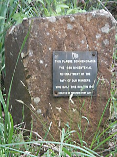
Spicers Gap road has been used for thousands of years by Aboriginal people as a (relatively easy) way of getting over the Great Dividing Range. In the 1840’s, stockman Henry Alphen discovered it was a much easier route for moving bullock drays than nearby Cunninghams Gap. So in 1847, with the help of convict labor, the government built the road along the ancient Aboriginal pathway. It’s steep – rising 600 metres in about 8km. That makes it a perfect mountain biking route ๐Ÿ™‚

Pioneers Graves
Moss's WellPioneers Graves
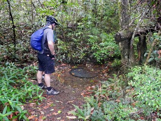
On the way up, there are some historical sites that provide a welcome break from the long climb, including a small cemetery containing the graves of several 19th century pioneers, and a curious freshwater spring, known as “Moss’s Well”.
Enjoying the view
The “highlight” for me was the wonderful view at the top of the long climb.
Enjoying the view
Enjoying the view
Enjoying the view
The views to the east are stunning. It was a perfect place to stop for a bite to eat, take in the panorama, and cool off.
Spicers Gap Road
And the up-side of any long climb on a bike is that you get to enjoy a long fast descent back down the hill. Riding down the steep, winding, muddy road with flecks of clay flying up into my face, hitting speeds of 65 km/h was a lot of fun.
Mount Alford Pub
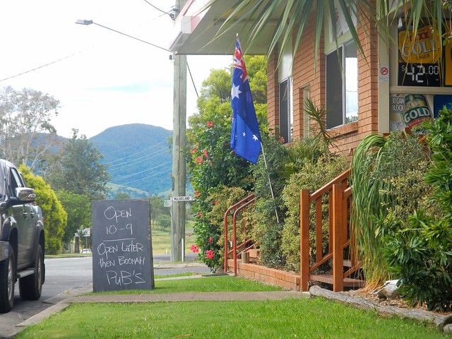
Thoroughly exhausted, we made our way back to Boonah via the small town of Mount Alford. The local pub beckoned to us with its proud boast that it has longer opening hours than neighboring Boonah. We couldn’t resist. Hard work on a bike makes a drink at a pub taste so much better.

I’m grateful to Becca, Eric and Tony for agreeing to ride with me on yet another whimsical day of adventure and exploration on the bike. And especially grateful to Eric who let me “slipstream” behind him for some of the ride when I was feeling tired. We call it “getting a tow” because sitting behind a stronger rider makes so much difference when you’re tired.

We rode almost 80km in 6.5 hours including breaks. During that time we climbed about 1,300m, and I burned about 3,700 kcal. This is a tough ride. You have to first ride 40km, and then do a long 600m ascent up a dirt track, made more difficult by the soft wet surface. I’m rating this one 9 out of 10 on the tough-o-meter. On a hot mid-summer day it would be even harder. In dry winter weather I’d probably rate it 8 to 8.5.

Total distance: 79.28 km
Total climbing: 1382 m
Average temperature: NAN
Total time: 06:26:57
Download file: activity_276466930.gpx
More data

Update

While at the State Library reading random old copies of the Moreton Bay Courier from the 1840’s I stumbled on this article about Spicers Gap Road. Click on the image for a larger more easy to read version.

Moreton Bay Courier 1 May 1847

Goomburra

"The Amphitheatre"
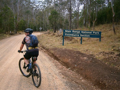
Goomburra is part of the “Main Range National Park” on the Great Dividing Range in South East Queensland. The Goomburra section of the park is located north of Cunninghams Gap either side of Dalrymple Creek. It’s named after the Gooneburra aboriginal people. In the Keinjan language, “Gooneburra” means “Fire people” from the tribe’s habit of setting fire to grasslands as a means of managing the land. Professor Maurice French, at the University of Southern Queensland, says that they numbered perhaps 1500 to 2000 people.

Dalrymple Creek is named after Ernest Dalryple, a European squatter, who arrived in the area in 1841 to take up a “selection” on what the settlers called “Goomburra Run”.
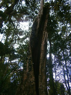
GoomburraFig Tree - Main Range National Park
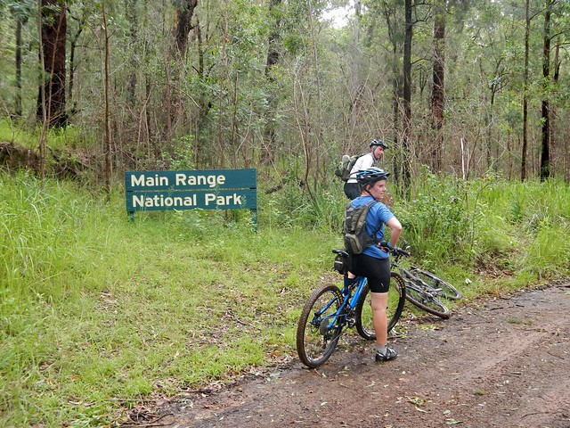
Eric, Tony and I started our ride from “Gordon Country” in the valley along Dalrymple Creek, and then slowly wound our way up the long slow climb into the rainforest. It took about an hour to reach the top, and I was glad to finally get there.
Mount Castle Lookout, Goomburra
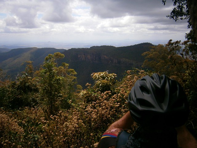
The views from Mount Castle Lookout were amazing. Mount Castle and the surrounding peaks of the Liverpool Range form a sharp ridgeline extending from the Main Range north-eastwards towards Laidley. I was impressed by the cliffs and the views off in the distant east of the Teviot Range and Lamington Plateau.
"The Winder"
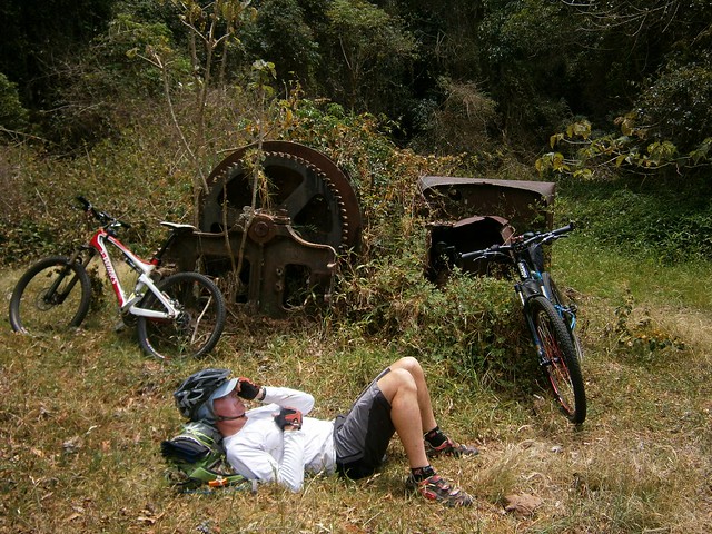
At Mount Castle Lookout, the Great Dividing Range splits in two branches. The main range heads off to the west while “The Mistake Mountains” go off to the north. They were called this because in the early days, people mistook them for the main range. We rode north over The Mistake Mountains to “The Winder”. Years ago, loggers converted an old truck into a winch to haul up the large logs from the steep slopes of these mountains. The loggers have gone, and all that is left of the “Winder” are these rusty ruins.

Eric took what he called a “Micro nap”. He’s a lot faster on the bike than I am, so I suppose he decided to make the most of the time that he spent waiting for me to catch up ๐Ÿ™‚
Tree Fern - Main Range National Park
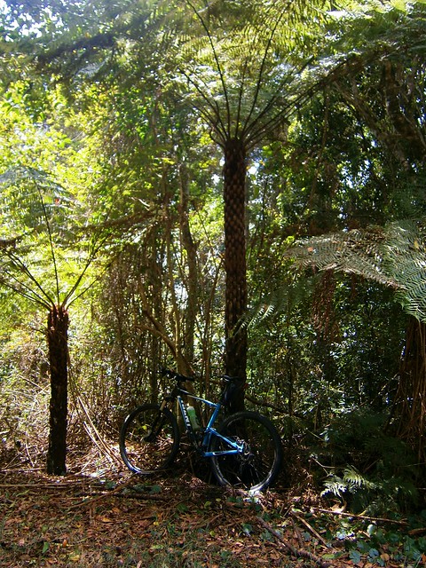
The ridge line along the Mistake Mountains is covered in rainforest. These Giant Tree Ferns (Cyathea australis) were all over the place. I’ve read somewhere that they can group up to 20 metres in height. This one made my bike look like a toy.

Fire Management Trail
Once we’d finished at the Winder, we had to climb back the way we had come regaining 250 metres in altitude, back to the junction with the Main Range. We then continued our journey westwards along the Main Range.
Glen Rock National Park
Glen Rock National ParkGlen Rock National Park
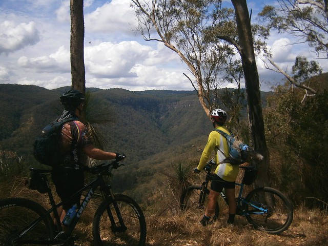
The views along the track were spectacular. Every few minutes we stopped to catch glimpses of the valley through the trees as we looked down into “Glen Rock” park below.
Enjoying the view
As we rode further along the track, the slopes on either side became progressively steeper. Eventually, it felt like we were riding on the top of a razor blade. On our left, steep slopes dropped down to Dalrymple creek to the south. On our right, sheer cliffs dropped down to Glen Rock Park to the north. The track was wide, and safe, but it meant we had some amazing views.
"The Amphitheatre"
I couldn’t belive the beauty of the landscape we were looking at.
Glen Rock National Park
As I looked down into the valley in Glen Rock National Park, I thought that perhaps we should come back to this place in the not too distant future and do a bit more exploring. There is some stunning country in South-East Queensland. With a reasonable amount of fitness, and a decent mountain bike, a whole new world opens up to explore. More than enough for one life time. In the last three yeas I’ve seen more natural beauty in thiis part of the world by riding my bike than at any other time in my life.

From our mountain-top high we rolled back down the mountain to “Gordon Country” 4wd park. There are a number of tracks down the mountain – some precariously steep, some rather gentle. By luck we managed to pick a quick but safe descent which had us back at the car in about 10 minutes.

All up we cycled 37km in about 5 hours including stops, climbing a total of 1,400m in vertical ascent. I burned about 4,000 kcal. This is probably the toughest sub 40km ride I’ve done. We had to push the bikes up a couple of hills, and had to work hard on some of the longer climbs.

I rate this one 9 out of 10 on the tough-o-meter. You won’t need more than intermediate mountain biking skills – the tracks aren’t too technical except for one or two steep descents. But you’ll need moderate to high fitness, plenty of water and snacks. Make sure you take a camera ๐Ÿ™‚

Total distance: 38.6 km
Total climbing: 1451 m
Average temperature: NAN
Total time: 05:06:54
Download file: activity_239597461.gpx
More data