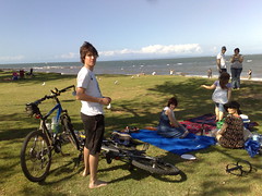
Where do you take a friend who hasn’t been on a bike for a long time?
I wanted to have a fun ride this morning, but didn’t want to do anything too hardcore because I like my friends, and don’t want to scare them off. After some poring over Google Maps (I do that a lot), I came up with a compromise that was mostly off-road, had a couple of good hills, and got us back home within two hours.
And we all survived to ride again!
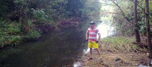
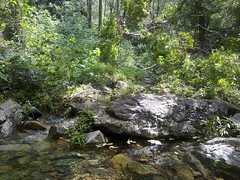
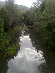
I’m amazed at Glen’s quick eyes. We’d only just got off the bikes at this river crossing and he spotted a 30cm (1 foot) catfish swimming around in the mirky water.
It had a few skin marks which Glen reckons might have been from being swept over the dam wall in recent flooding.
Well spotted!
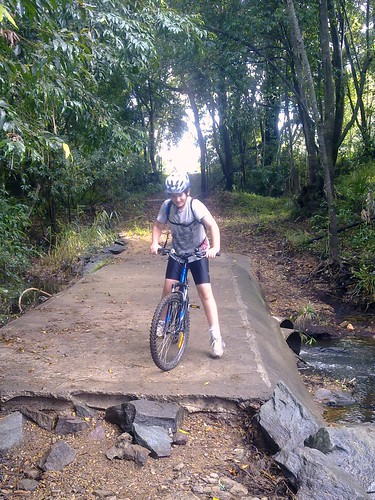
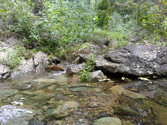
This causeway had a nasty 50cm drop at one end, which is ok for hardcore riders, but not much for everyone else.
We found a few stray rocks and put them near the drop to make it easier to traverse.
I think Harrison was a bit skeptical at my handiwork. Although you can’t see it, he did finally manage to ride over it.
All up 22km in 1 hour 45 minutes, 300m total climbing, 1500 calories.
I stopped along Bunya Road while cycling this morning so I could record some of the sounds of the birds singing in the forest.
I think they sound great, and I’m really glad I took the time to stop and listen.
The actual ride was great too – up the side of Clear Mountain along a dirt track, down Bunya Road, and through the state forest trails that run off the Jinker track.
In the last post I told you about our ride down the Lepidozamia track. Here’s the video from my helmet cam. It’s bumpy, but as you can see, it was a lot of fun.
It was a difficult ride climbing the D’Aguilar Range to its summit of almost 800m at Mount Tension Woods, and then an exhilarating ride down some very steep rocky fire trails (The Lepidozamia Track) as we followed Kobble Creek back to civilization.
The Lepidozamia Track is named after all the Cycads (Lepidozamia peroffskyana) that grow there.
All up we rode about 66km with a total ascent / descent of about 1550m. The total ride was about 10 hours because we had to keep stopping – Simon got half a dozen punctures and we went through three spare tubes and half a roll of duct tape before we fixed it.
I shudder to think what would have happened if I hadn’t taken 4 spare tubes and three rolls of duct tape. If ever I needed justification for carrying so much “Stuff” on my rides, this is it. We were in some pretty remote country, and getting out on foot would have taken a long time.
This ride covers some beautiful scenery. Normally we’d be able to do it in about 5 hours, and it’s worth the effort if you don’t mind getting your feet wet!
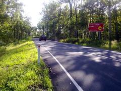
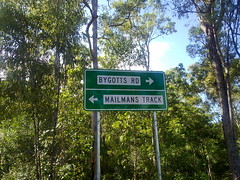
I rode out to Samford this morning via Winn Road, and came back via the Mailman’s Track and Bunya Road.
The Mailman’s Track is wonderfully hilly (just the thing for a Saturday morning bike ride), and leads into some beautiful state forest along Bunya Road.
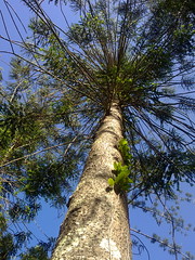
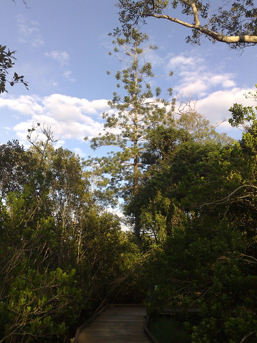
Although the area is called “Bunya” I had a hard time finding any Bunya Pines (Araucaria Bidwilli). So I was delighted to find a couple of majestic specimens by the side of the road.
The aborigines used to harvest the nuts from these trees for food. They drop their huge 5-10kg cones in abundance every three years, so you have to be careful standing under them in late summer!
This is the only remaining Hoop Pine (Araucaria Cunninghamii) at John Oxley Reserve, Murrumba Downs, on the north bank of the North Pine River about 2km west of Petrie.
John Oxley came ashore here on 1 December 1823. He was impressed with many “fine cypresses” he saw there referring to the Hoop Pines. This was the first reference to the species, which was later cataloged by English botanist and explorer, Allan Cunningham.
The first settlers loved these huge trees for their long straight trunks which were ideal for ship masts or any buildings which required large quantities of long straight timber.
Today if you drive down Gympie Road, Strathpine, you’ll see the road lined with dozens of Hoop Pines on either side – a fitting tribute to this majestic tree, native to this area.
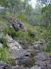
The purpose of this ride was to find a route from Kobble Creek up to Mt Glorious. There’s a road visible on Google Maps, but as we found out, it disappears into private property.
Due to recent rain, we had to cross a few flooded creeks. The bikes held up really well until the last crossing, when the current snapped my rear derailleur off.
The area around Kobble Creek is beautiful. In drier weather it would be a really pleasant ride, with some challenging hills greater than 17% gradient. When they’re not swollen, some of those creeks look like they’d be really fun to swim in too.
But to be honest, crossing flooded creeks is a pretty stupid thing to do. If you slip, it would be easy to be washed away or lose your bike. And even if you do make it across, there’s a good chance you’ll damage your bike.