Western Queensland is a stunning place. Last year’s visit wasn’t enough for me, so I convinced a few friends to return with me and explore a little further west.
Top | D1 | D2 | D3 | D4 | D5 | D6 | D7 | D8 Bottom
Once you get to Charleville, the towns get further apart. If you head back to the coast from there, it’s easy to find a town every hundred kilometres, which makes it comfortable to ride without a support vehicle because you’re never more than a day’s ride away from a shop or a pub.
Heading west, however, is more challenging. Towns are a couple of hundred kilometres apart – a two day’s ride on a bike. The terrain is dry and remote. So for this trip we brought a support vehicle. It would carry our food, water and camping gear while we pedaled through the mulga.
We each agreed to take a turn at driving the vehicle for a few hours. The driver would then park the vehicle and ride his bike back to meet the other riders, and complete the day’s ride with them.
Day 1 (Charleville to Ambathalla Creek)
Top | D1 | D2 | D3 | D4 | D5 | D6 | D7 | D8 Bottom
As we slept in the historic Corones hotel overnight, we could hear rain beating down on the tin roof. It doesn’t rain much out here, so a break from the dryness is always welcome.
In the unusually fresh cool morning air, we eagerly jumped on the bikes and started our westward journey.
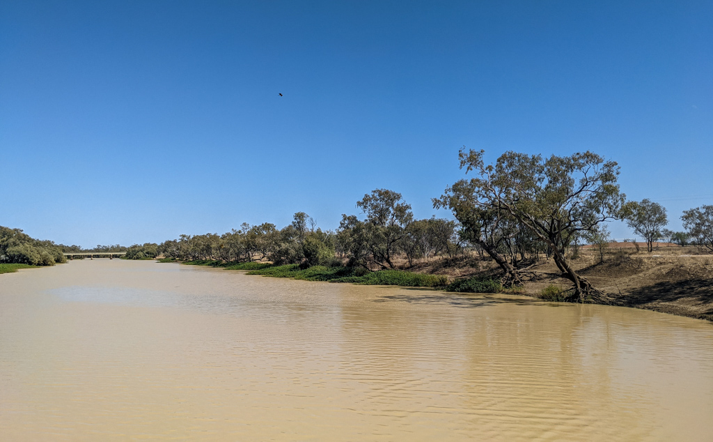
The Warrego River runs through Charleville. The water levels in the river can rise unexpectedly after heavy rain, so there’s a levee bank between the river and the town to guard against flooding.
We rolled slowly along the red soil of the levee bank, appreciating the river gums and the raucous cries of parrots in their branches.
The Warrego was at peace today. The little drop of overnight rain wasn’t enough to disturb her tranquil billabongs.
After following the river for a while, and getting bogged in some sticky black mud, we eventually found one of the many red dirt roads around town, and followed it westward.
As all signs of the town slowly evaporated, we grew more excited. We were on our way into the vast Outback.
After an hour we turned into Adavale Road.
We’d be following this long straight road towards the sunset for the next couple of days. It was paved for some of the way and dirt for the remainder.
There were no hills, no corners, and very little traffic – perfect conditions for a long lazy ride.
We stopped for a few minutes to check out an unusual memorial beside the road.
A century ago there was a air race to see who could fly from England to Australia in the quickest time. Ross and Keith Smith won the race, but had to land their aircraft here for emergency repairs in 1919.
Calum was taking his time in the car, and eventually caught up with us about forty kilometres down the road for morning tea.
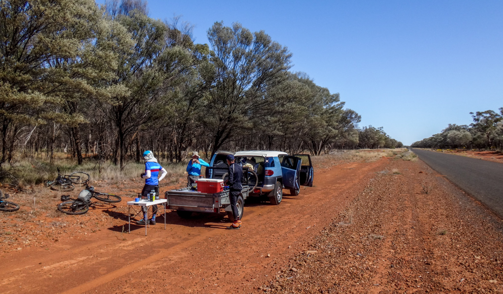
Last year, Paul and I had squatted in the shade in a ditch by the road whenever we felt like having a break. Today we reveled in luxury. With fold-out tables and chairs, we boiled some water and made hot coffee.
This was a much more comfortable way to travel.
Calum drove the car another twenty kilometres up the road to the Langlo River crossing, then rode his bike back to meet us at Mt Morris Road. He looked happy to finally be out of the car and on the bike.
The Langlo River provided a serene spot for us to have lunch.
I inhaled a beef and salad sandwich I’d purchased earlier that day, then wandered around the river bank admiring the old gum trees.
This was an idyllic spot.
I did my “car shift” at Langlo Crossing, and drove a few kilometres down the road, over the shire boundary towards our campsite for the night.
When planning this trip, I saw “Lake Dartmouth” on the map, and thought a lake might be an interesting place to camp for the night.
Alas, Lake Dartmouth was dry – just a sign poking out of some dry mud under some stunted trees.
I wonder what the people of Dartmouth in Devon would think?
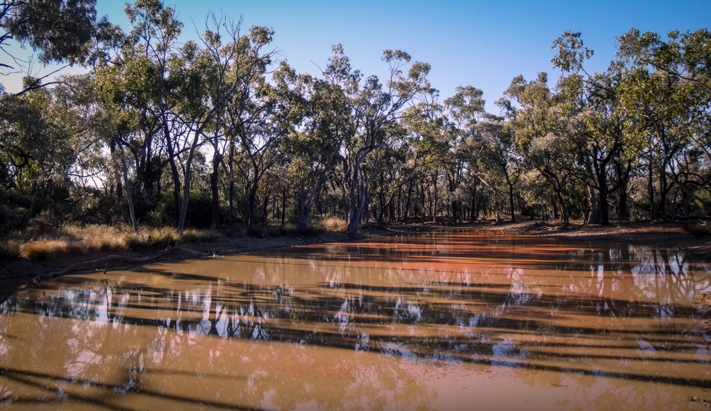
Instead of stopping at “Lake” Dartmouth, I drove a few more kilometres down the road to Ambathalla Creek. There was a large flat sheltered area beside a billabong which would be perfect for camping. We’d stay the night here – under the shade of a Coolibah Tree 🙂
I parked the car, unloaded the bike, and retraced my tracks to find my mates.
When everyone reached the camp site, Calum showed us all how easy it was to set up his tent.
Everyone approved of my choice of camp site.
We relaxed and watched the sun go down.
I grinned to myself. We were living out the first few lines of “Waltzing Matilda” – you can’t get more Aussie than that.
…And at night, the wond’rous glory of the everlasting stars.
(Banjo Patterson – “Clancy of the Overflow”)
Total climbing: 482 m
Average temperature: 17.2
Total time: 06:54:58
More info
Day 1 was easy – long, straight and flat. Temperatures were perfect all day. The toughest part was at the start of the day when we got bogged in black mud. I’ll rate this section 7 out of 10 on the tough-o-meter.
Day 2 (Ambathalla Creek to Adavale)
Top | D1 | D2 | D3 | D4 | D5 | D6 | D7 | D8 Bottom
The next morning we packed up our gear and continued our westward trek.
Paul drove the car ahead to our morning tea stop while the rest of us rode.
I’ve never ridden in a straight line for two days before.
The vastness was awe-inspiring. There was nothing monotonous about it at all.
After a couple of hours we reached the boundary of Mariala National Park and continued through it.
Situated on a small plateau, the National Park had impressive views of the horizon.
We stopped for a break and something to eat at a scenic escarpment.
My phone got reception, so I sent a quick message and picture to Liz to let her know I was OK.
Craig tells me the rocks out here are very old.
After our break we rolled down the western side of the plateau and continued towards Adavale.
Although the roads out here don’t see much traffic, we still made sure we moved out of the way when a large truck and its dust cloud approached us from the opposite direction.
The day grew warmer. Even though it was officially still “winter”, the temperature was nudging 30C.
Three kilometres to go – we were almost there.
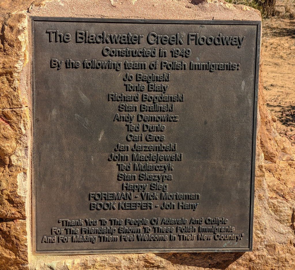
I stopped at a flood-way on the outskirts of town to read a memorial to some Polish migrant workers who built it seventy years ago after the Second World War.
I thought about how everyone benefits when we welcome new people who want to work alongside us.
I also wondered about “Happy Sleg” – it sounds like he would have been a fascinating fellow.
Kochamy Cię Polsko!
As I rolled into town, I was surprised at how small Adavale was.
The pub was the only show in town.
I got cleaned up, then introduced myself to Koss, the publican.
Koss is originally from The Netherlands, and used to be a school teacher before he moved to Adavale.
He poured me a beer and started telling me tales of the history of Adavale.
As I sipped the cool ale, and listened, I realized Koss had found his true calling in life – he was a perfect host and story teller.
He told me of the AIF light horsemen stationed out here before the First World War, who used to hone their riding skills by chasing emus through the scrub, then reaching out from atop their galloping steed to pluck a feather from the backside of the fleeing emu. If they managed it, they’d stick the emu feather in their hat as a trophy.
Or of the brutal times before the shearer’s strike of 1893 when a land-owner could dismiss a shearer without pay if they were injured or didn’t work hard enough. Without food, lodging or water in this harsh place, many an abandoned shearer would find a shady waterhole to camp at, and occasionally pilfer a stray sheep for food.
We talked, drank, and ate till the sun went down, then wandered back to our tents for the night.
At least once in their lives, every city dweller should stand on a stony and silent mulga plain and watch the sun go down.
Total climbing: 416 m
Average temperature: 17.3
Total time: 06:04:04
More info
Day two was a little more challenging that the previous day because of the hill climbs into Mariala National Park and the slightly undulating elevation prior to Adavale. I’ll rate it 7.5 out of 10 on the tough-o-meter.
Day 3 (Adavale to Listowel Downs)
Top | D1 | D2 | D3 | D4 | D5 | D6 | D7 | D8 Bottom
In the morning we pointed the bikes northward for a two-day ride towards Blackall.
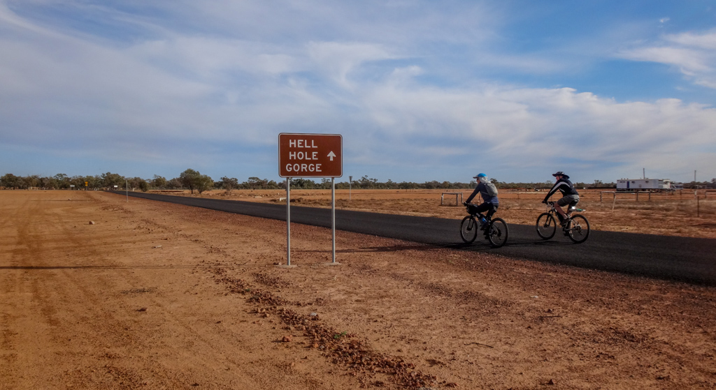
Craig’s Great-Grandfather used to work on Milo Station, west of Adavale, so he was delighted to see “Milo” on a signpost.
Milo is on the way to “Hell Hole Gorge”
I had originally thought about visiting Hell Hole Gorge as part of our trip, but couldn’t find a reliable route through to Yaraka for bikes and a support vehicle. It would have been a day’s ride out and then back again.
Maybe some other time 🙂
The red road north was beautifully remote. Hard red dirt and clay surrounded on both sides by sparse Mulga scrub as far as the eye could see. It was mesmerizing.
So it was a pleasant surprise to pass someone’s front gate…
.. with a intimidating-looking uni-testicular bull standing guard out front.
I reckon the people at Leopardwood Park have a wonderful sense of humour.
Yes – this was remote. It was reasonably warm. The road was long. But it was enjoyable because I could zone out, turn the pedals, admire the scenery and not-even break into a sweat as I rolled over the flat, firm dirt road.
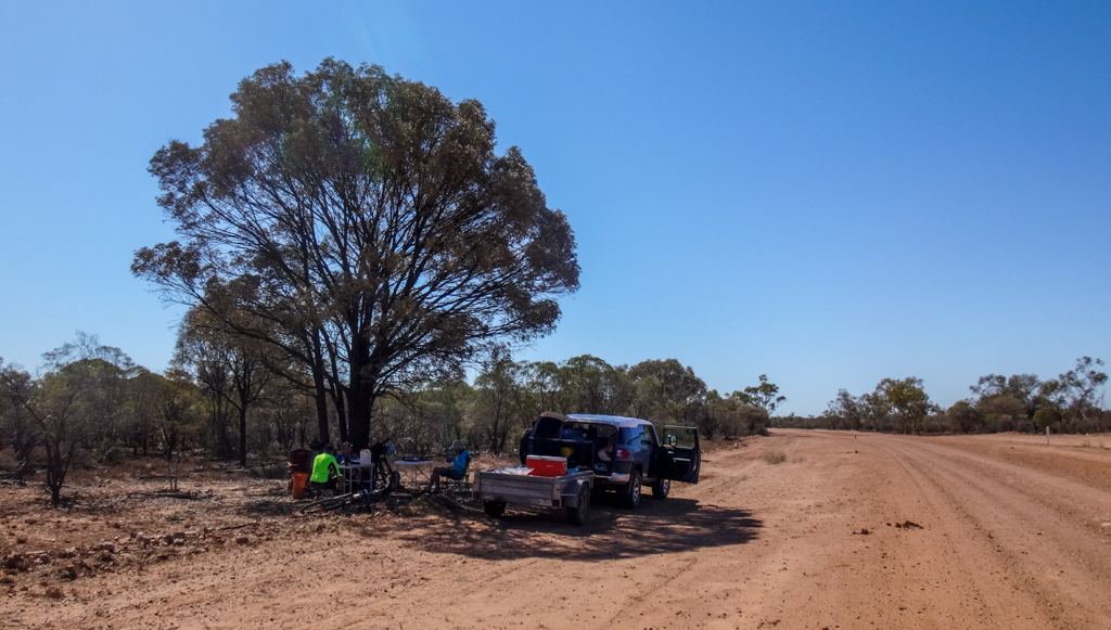
Calum had parked the car a couple of hours down the road, and set up the tables and chairs for us.
We stopped for a few minutes, made some coffee, and ate a few snacks….
…then rode off for another couple of hours.
After lunch, I took my turn at driving and set off to look for a decent place to camp for the night beside the road.
This was trickier than it seemed.
The total distance from Adavale to Blackall was 220km. We wanted to split the trip into two segments of similar length. If I stopped too soon then the next days ride would be way longer than it needed to be. If I stopped too far down the road, I’d be asking my mates to ride too far today, and they wouldn’t be too happy with me at the end of the day.
Plus, the place needed to be comfortable enough to pitch a tent and relax for the night.
Our course passed over a couple of small hills…
As I passed over the summit, I was struck by the strange-looking hills strewn over the landscape.
The landscape transformed. The Mulga gave way to larger trees and grassland.
I parked the car at a potential campsite, unloaded my bike and started riding back up the road to meet my mates.
I pedaled southward past a sign proudly declaring this as sheep country, but all I could see were a few skittish emus strutting across the road.
Eventually I heard Calum’s voice crackle over the UHF radio, and a few minutes later I spotted him riding towards me.
“Not far to go now, mate,” I said encouragingly. “The car’s only a few more kilometres up the road.”
By dint of good luck, the camp site turned out perfectly.
We pitched the tents, lit the fire, got out the chairs, cracked open a couple of cold beers and…
… watched the sun go down.
Overhead, the winter constellation of Scorpio blazed down at us, a twisted cosmic hook of stars.
Total climbing: 610 m
Average temperature: 20.4
Total time: 06:23:59
More info
Day three was long, flat and warm, with one moderate “lump” in the elevation towards the end of the ride. It rates 7.5 out of 10 on the tough-o-meter.
Day 4 (Listowel Downs to Blackall)
Top | D1 | D2 | D3 | D4 | D5 | D6 | D7 | D8 Bottom
The morning ritual of packing our gear and preparing to ride had become almost automatic by the fourth day of our adventure. 

We continued our northward push while the air was still cool and the sun was still low in the sky.
Even though the road was flat, the landscape was dotted with fascinating rocky outcrops.
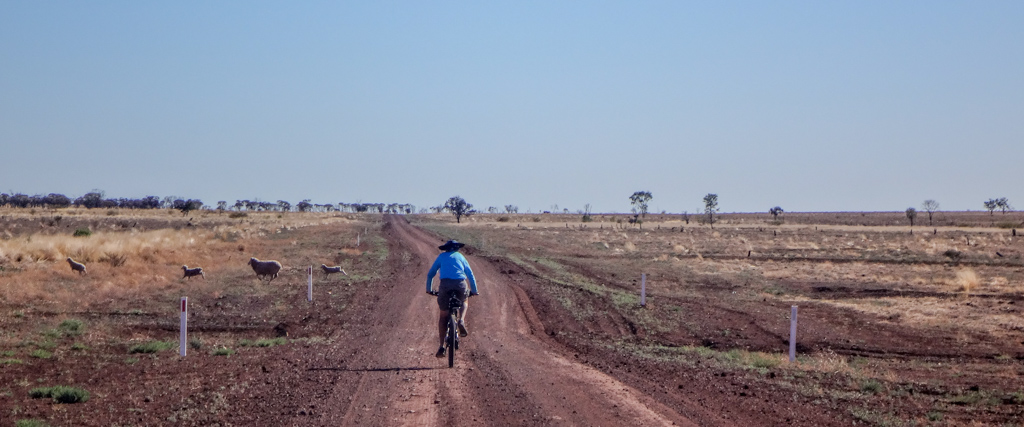
A few sheep scurried across the road as we rolled by.
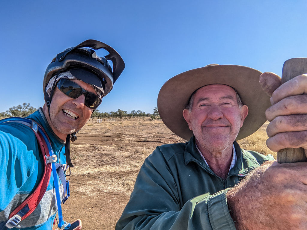
Calum and I spotted a man working by the roadside and stopped to chat.
Spencer Lipton has lived in this area all of his life, and has been working for “the Old Fella” at Cootabynia Station for the last ten years.
Spencer loves his work, and loves living around here, although I don’t think he sees many cyclists riding past his front gate very often.
A few kilometres up the road we passed Nina and Willie from Gowan Station.
They were grey nomads who had stopped to work for a few months in the Blackall area and were out checking the bores.
Water bores are vital for livestock in this dry landscape. Windmills pump artesian water into troughs for sheep and cattle. There’s an unlimited supply of water in the Great Artesian Basin, so the animals have all the water they need, provided the pumps keep working.
A few kilometres later we caught up with Craig, who had found a shady creek-side spot under a tree for us to have a coffee.
The day grew warmer.
The local wildlife relaxed in the sun.
While planning this ride, I was conscious of two constraints: Winter nights out west are very cold, and Most days out west are very hot. So the aim was to pick a “Goldilocks” time at the end of Winter which was neither too hot nor too cold.
As we rode off into a treeless landscape, fully exposed to the elements, I felt like we had timed it perfectly. We had started the day in cool temperatures of about 11C. As the sun beat down on us, it was only about 25C. No one was going to freeze or cook to death today 🙂
We stopped at a delightfully-painted bright blue fridge beside the road.
Someone at Lorne Station obviously loves books and had left a library of them outside their front gate.
Calum and I perused the titles for a while, but decided we didn’t have enough space on the bikes for any new literature.
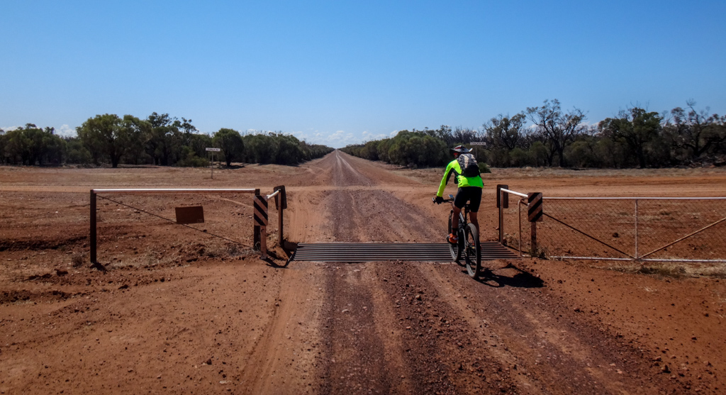
A little later we turned a slight bend, rolled over a cattle grid and stared down the length of a stretch of dirt road which seemed to continue forever as it pointed over the horizon.
This was wonderfully vast country.
Eventually we caught up with Craig and the car parked under a roadside tree.
Our regular lunchtime ritual repeated itself – comfortable respite from the hours in the saddle.
Calum indicated that he’d take over driving when we eventually reached the paved road, so Craig drove the car to that point and waited for us.
After we reached the paved road, our progress became much easier. With a smoother surface, and bunched up tightly to avoid wind resistance, we almost doubled our speed.
We were no longer trundling along in the dirt at a leisurely pace – this was more intense, but I was grateful to be ticking off the kilometres more quickly.
When we reached the intersection with the main road near Blackall, I had a look at the road sign pointing back the way we had come. There was Listowel, where we had camped the night, Cootabynia where we met Spencer, Gowan where we’d said “G’day” to Nina and Willie, and Lorne where we had discovered the cheerful blue “Library” fridge.
On a map, Blackall-Adavale Road seemed long and featureless – but after spending a couple of days on it, I learned that it was a fascinating place. I was glad we had traveled it.
As we rode towards Blackall, my legs started complaining. We were approaching 110km of riding for the day, and Paul’s strong legs were pushing over 30 km/h.
I eased off on the effort and took the final section at a slower pace.
We crossed The Barcoo River, with dozens of grey nomads camped on its banks, and made our way slowly to our comfortable lodgings for the night.
We’d been “out bush” for the last few days, and were looking forward to a comfortable bed.
Blackall was an oasis. Green grass, tall trees, and a well provisioned pub.
Perfect!
Total climbing: 580 m
Average temperature: 25.2
Total time: 09:05:11
More info
Day 4 was a hard ride – 110km with a tough on-road sprint at the end. I should have taken the last twenty kilometres at a slower pace. I’ll rate it 8.5 out of 10 on the tough-o-meter.
Day 5 (Blackall to Idalia National Park)
Top | D1 | D2 | D3 | D4 | D5 | D6 | D7 | D8 Bottom
The next section was the toughest, covering 125 kilometres from Blackall to Idalia National Park, with a long slow climb at the end.
We decided to share the driving four ways today – not because we couldn’t do the distance, but because we didn’t want to run out of daylight before reaching our campsite.
This meant each of us would only have to ride eighty kilometres for the day. We’d be able to do the distance comfortably with plenty of time remaining in the afternoon.
Calum and I parked the car about twenty-five kilometers down the road from the Adavale turnoff and set up for morning tea.
We were heading west towards Yaraka on a road which followed the remains of an old railway line.
The Yaraka branch line provided a railway service which could take people all the way to Rockhampton on the coast – a journey of about 800 kilometres which took 26 hours.
It closed in 2005, but some of the locals talk about converting it into a rail trail.
What a wonderful idea 🙂
As we continued, we could make out the Gowan Range on the horizon. That’s where the National Park was located. It still seemed a long way off.
At last we reached the turn-off to Idalia. Only 44 kilometres to the National Park boundary, and 60 kilometres to our camp site.
At lunch time we caught up with Paul, parked beside the road under a tree. 

The hills grew closer as we continued southward – a scenic relief from the sparse landscape we were passing through.
After a another hour, we crossed the National Park Boundary.
The landscape changed.
Outside the park it was sparse and and almost featureless.
But here it was diverse and flourishing. 
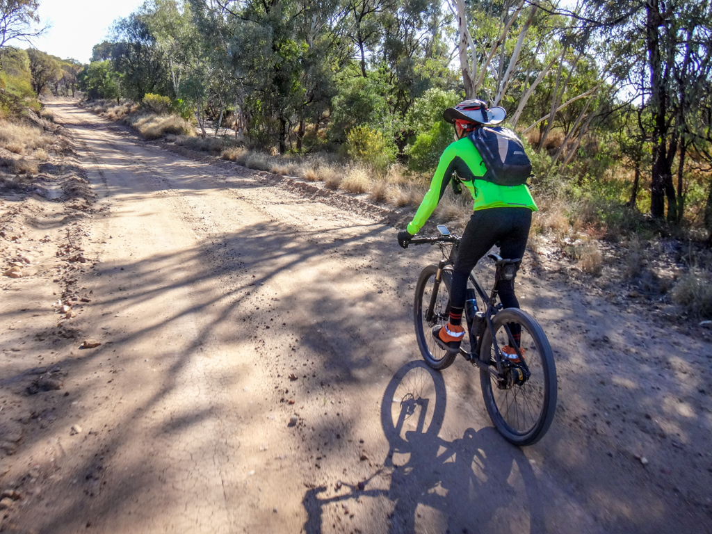
Calum grinned.
“I was feeling tired and depleted, but now that we’re here, I’m feeling much happier”. 
Healthy countryside can do that to you.
Idalia National Park used to be a sheep station.
There are still old dams (called “tanks”) on the property, including this one called “Junction Hole”.
We stopped to admire it, but didn’t stop long. The sun was getting low and we wanted to get to the camp site before dark.
We had the campground to ourselves.
I set up my tent then wandered up to Monks Tank – a large fenced off dam built a long time ago to provide water for sheep, but now an important water source for local wildlife.
Total climbing: 675 m
Average temperature: 30.2
Total time: 08:25:16
More info
Sharing driving duties to reduce riding distance made this a much easier ride than it could have been. Even so, our legs were tested by the long climb towards the end of the day. I’ll rate this section 7.5 out of 10 on the tough-o-meter.
Day 6 (Idalia National Park to Isisford)
Top | D1 | D2 | D3 | D4 | D5 | D6 | D7 | D8 Bottom
Unlike previous mornings, we awoke to a chorus of birdsong in the National Park.
After packing our gear, we headed up the track to the lookout at Emmet Pocket.
The twelve kilometre track rose gently uphill towards the escarpment.

Calum had volunteered to do drive this morning, but rode with us for the first leg of the ride. Like the rest of us, he was keen to see the lookout.
We reached the edge of a massive drop-off.
The views were amazing.
We sat ourselves down on the craggy edge and soaked up the panorama for a while.
From this point, it was a 70km drive back to the main road, then a further 70km to our next stop. Riding all that way back wasn’t a viable option, so we took a short-cut on the bikes, while Calum drove back the long way.
We followed a steep rocky track down the northern face of the escarpment.
Calum waited at the top listening on the UHF radio. Every kilometre I radioed back to him to let him know we were OK. The added elevation of his location added range to the radios.
The steep track grew less steep…
When I had planned the course, this was one section I was unsure of. The track wasn’t very visible from the aerial photos.
But by some stroke of amazing luck, my course was perfect. The track was exactly where we expected it to be, and was easy to follow.
After about ten kilometres, feeling very pleased with ourselves, we emerged on the main road to Emmet… 
…and started heading west once more.
The Gowan Range and Idalia National Park now seemed a long way off. 

A little over an hour later, we rolled into Emmet.
The train to Yaraka once rolled through here.
Although most of the infrastructure has gone, a few rails and the railway station remain.
We strolled over to the nearby house and introduced ourselves to Jocelyn and John.
They’ve run a farm here most of their lives, and told us about their vision for the place while Jocelyn served up a cup of tea and some fruit cake.
As we chatted, a few sheep straggled by under a hot sun, while persistent lambs cried out for their mothers. 
After lunch at Emmet, we changed direction and started riding north up the red dirt road towards Isisford.
Up ahead, Calum had pulled over and appeared worried.
He had run over a spike while trying to park the car in the shade, and suffered a punctured tyre.
Car tyres are much heavier than bike tyres, so we all pitched in and help him change it before moving on.
In the distance, I noticed a red dust cloud approaching. A truck was rumbling towards me.
I moved out of the way and tried not to breathe up too much dust.
The shadows lenghtened as the day wore on.
A few kilometres from Isisford, Craig and I noticed a roadside sign pointing out a “Historical Site” ahead.
We took a short detour to see what it was.
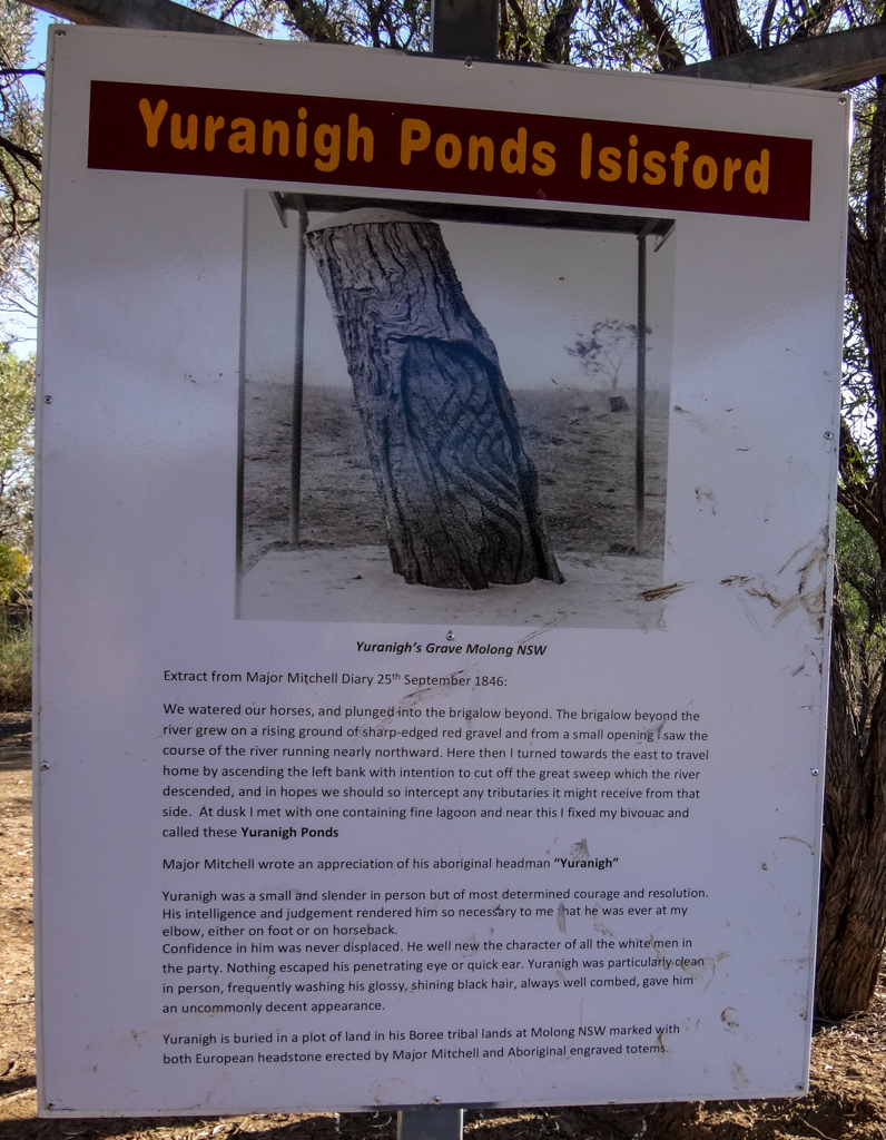
The explorer, Thomas Mitchell passed through here in 1846 and camped by the banks of the Barcoo River.
Mitchell was in unfamiliar country, and had relied on the assistance and advice of Yuranigh, an indigenous man who accompanied him on his journey, pointing out waterholes and warning of potential threats.
What a great spot. Yuranigh knew a good campsite when he saw it.
We crossed the Barcoo River a few kilometres later and rolled into Isisford…

…home of the Yellowbelly – an iconic fish which lives in the river here. 
As we booked a room in the local pub, I thought about Banjo Patterson’s poem. “A Bush Christening” which was probably inspired by a small town on the Barcoo River like Isisford or Yaraka:
On the outer Barcoo where the churches are few,
	And men of religion are scanty,
On a road never cross'd 'cept by folk that are lost,
	One Michael Magee had a shanty.
Although I couldn’t see any shanties, Banjo was right about the churches – I didn’t see any 🙂
Total climbing: 527 m
Average temperature: 29.9
Total time: 08:40:09
More info
Day six was long, flat and easy. I’ll rate it 7 out of 10 on the tough-o-meter.
Day 7 (Isisford to Longreach)
Top | D1 | D2 | D3 | D4 | D5 | D6 | D7 | D8 Bottom
The next morning was my turn to drive the car up the road a while, park it under a tree, then ride back to meet my buddies.
We no longer had a spare tyre, so I took the utmost care when parking it, then unloaded my bike and set off southwards in search of three cyclists.
Another old fridge stood by the roadside, happily advertising pies, drinks and ice-cream.
Unable to resist, I took the bait, and opened the door. It was empty.
Ah well!
The land was flat.
There were no trees. There was no shade.
In a few months, this place would be a merciless oven with nowhere to hide.
Today it was fine
As the others rode ahead, I stuck to a cruisy pace and enjoyed myself.
Signs pointed in various directions, telling of places I’d never heard of.
So many places. So little time!
A few months ago, as I surveyed this section of our trip on Google Earth, I thought it might end up being the most boring part of the trip – a long straight paved road.
But it wasn’t boring at all.
The vastness inspired awe in me. And that felt wonderful.
Hangman’s Gully…
I wondered how it got its name.
I looked suspiciously at the tree by the road.
Saltbush Creek….
OK, that one made sense.
Jawbone Gully?
Visions of bleached skeletons came to mind.
We neared Ilfracombe – our final stop before Longreach.
Stock Routes led off in all directions.
I imagine if you lived out here and owned a mountain bike (or a horse) you could have a lot of fun exploring those stock routes.
I was thirsty, and pulled into the Wellshot hotel for a drink, but beer was the last thing on my mind.
Although I got some strange looks from the bartender, she happily filled my glass with ice and poured me a cold schooner of milk.
It was wonderful.
I skulled it and ordered another.
Tracey, the publican and owner sat down with me and told me about the wonderful history of the Wellshot Hotel, and Wellshot station – a nearby property.
I looked up and saw dozens of five, ten and twenty dollar bills pinned to the ceiling.
Tracey explained that it was a fund raiser for a local charity. Basically you wrapped your paper banknote around a dollar coin with a thumb tack, then threw the bundle up to the ceiling as hard as you could. If you were lucky, the thumb tack stuck, the banknote opened, and the coin fell out. If you caught the coin you got a free beer.
I tried many times. Eventually I managed to hit the ceiling. A few tries later I managed to get the bank note to stick, but it didn’t open, and the dollar coin stayed up there in the bundle.
No free beer for me.
Before leaving, I took a few minutes to appreciate some poetry written on the side of the pub.
This well-written verse by Rob Raftery cleverly mimics the rhyme and meter of “The Geebung Polo Club” – another classic written by Banjo Patterson.
On the way out of Ilfracombe, we rode past an impressive display of old machinery. Gaily painted tractors, graders, carts and other strange contraptions lined the footpath for hundreds of meters. This was huge.
My original plan was to ride the final leg of our journey from Ilfracombe to Longreach by following the service track adjacent to the railway line – similar to what Paul and I had done last year at Charleville.
The track started out OK but gradually grew softer and more powdery. Our legs were tired so we decided that rather than grind away in soft soil for an hour, we’d get on the highway and take the easy way into town.
“This is OK,” I called out to Craig and Paul. “It’s a nice wide shoulder and there isn’t much traffic”
Just then a fifty-three metre long road train whizzed past.
I’m glad it was going in the opposite direction. 
Almost there, we rolled past an old Boeing 747 parked at the Qantas Founders Museum.
As we neared Longreach we followed a shady tree-lined bike path into town. This was much nicer than riding on the road.
I was surprised at how well we all scrubbed up after spending so long out in “the bush”.
Total climbing: 628 m
Average temperature: 31.4
Total time: 09:17:43
More info
Day 7 was long and hot. It was hard work pedaling the last twenty kilometres on the highway into Longreach. I’ll rate this section 8.5 out of 10 on the tough-o-meter.
Day 8 (Longreach)
Top | D1 | D2 | D3 | D4 | D5 | D6 | D7 | D8 Bottom
On our “rest day” in Longreach I decided to treat myself to a large cooked breakfast.
Wilma from Outback Pioneers made me feel like I had walked into a Nineteenth Century saloon as she poured me a fresh cup of hot coffee.
The constant “clip-clop clip-clop” of horses pulling stage coaches down the street added to the wonderful illusion.
Longreach is a beautiful town in late Winter or early Spring, with crisp cool morning air and clear blue skies.
Even though it was a rest day, we decided to hop on the bikes again anyway and take a short roll out to the river.
The old highway has been transformed into a bike path. We could take it easy and not worry about trucks and cars.
The Thompson River is part of a massive river system which starts on the slopes of the Great Dividing Range near Charters Towers in North Queensland and drains into the Lake Eyre Basin in South Australia.
I was surprised at how large it was.
You can even go for a Paddle-Steamer ride on it, although I didn’t see any boats on it today.
A large raptor circled overhead as we slowly pedaled back to our hotel…
…and a lazy old emu strutted alongside us.
We finished off our rest day in Longreach by doing a few “tourist” things.
This had been a wonderful trip.
We had visited some stunning places.
But I was looking forward to going home.
Total climbing: 75 m
Average temperature: 31.3
Total time: 00:47:12
More info
It’s an easy ride out to the Thompson River from the centre of Longreach – a perfect family ride on which you could bring young kids. Two out of 10 on the tough-o-meter.
We rode a total of 763km with 1,400m of elevation in seven days.
This was a memorable ride through iconic outback country.
I still can’t believe how fortunate I have been to be able to experience such things with a group of good friends.
We live in a stunning place.
Our trip was much easier than expected, and required considerably less effort than last year’s ride from Charleville to Brisbane. We made the right decision to bring a support vehicle. This allowed us to experience each day at a less intense pace than if we were carrying all our own gear and water.
My ride network map is starting to look quite large. It feels very satisfying to look at it and see our tyre tracks on such a vast part of the land.
Thanks Calum, Paul and Craig for entertaining this crazy idea, for agreeing to ride with me, and for waiting patiently with me when I was slow. You were all great company easy to live with in close proximity for a couple of weeks.
Thanks, Calum, for bringing your car and trailer. It made all the difference.
And now the big question remains. Where to next?






















Thanks Neil, that is a really great account of our adventure, brings many good memories. Yes to next year, around the same time, happy to take my car and trailer again
Thanks Calum. It sounds like a plan!
Thanks Neil, I second Calum’s comments – a great record of our trip. Your comments and pics really captured the essence of journey. See you next time!
Great read and great photos, looks like lots of fun.
It was lovely meeting up with you and the crew in Longreach and sharing stories over a meal and some beers.
It’ll be great to catch up again soon!
Matt and Yuko
Thanks Matt. We enjoyed meeting up with you and Yuko too.
Really nice post, the images make it more interesting. Thanks for sharing!
Hi Neil,
I have just a enjoyed a re-read of your email excellent blog – almost one year later. A trip to remember!
Thanks again.
Craig
A great account. I have ridden only 200km through scrub over two days in about 35c. My arse was very sore. How was yours?
Long days are tough on the backside. I find it helps to use lots of chamois cream.