Lockyer

Wallers Road
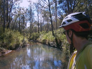
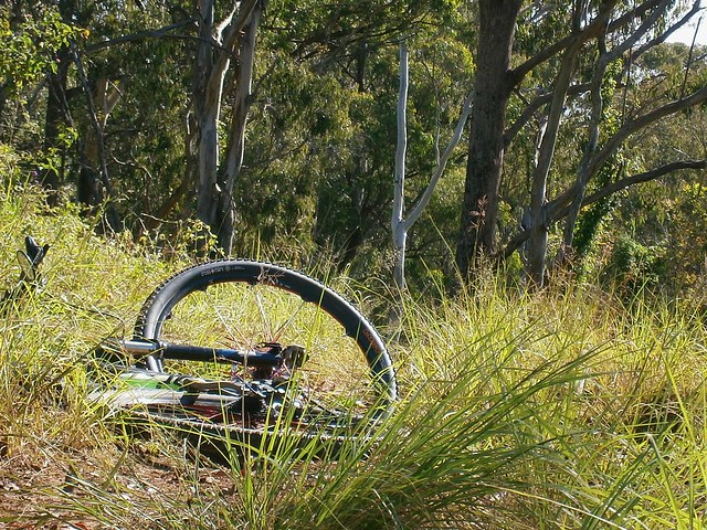
Lockyer National Park and State Forest is located in the hills north of Gatton, between Ipswich and Toowoomba. Gillian Duncan and Mark Roberts mentioned it in their excellent book “Where to Mountain Bike in South East Queensland” so I thought I’d check it out today on a solo ride.

This was a “spur of the moment” ride. I woke up on Saturday morning without a plan, so I ended up picking a ride from the book that appealed to me, and set out rather late, not arriving at the trail head till about 11.30am.
Millers Road
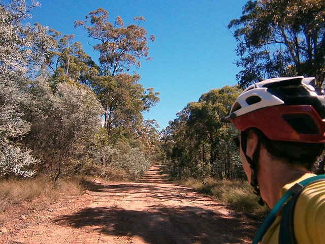
I started the ride at Millers Road on the corner of the Gatton-Esk Road. It has the distinction of passing by one of the newest prisons in Queensland. Rather than stop by this impressive looking Lockyer Valley resort, I slowly made my way up the red dusty road into the national park.
Redbank CreekRedbank Creek
Redbank Creek
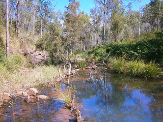
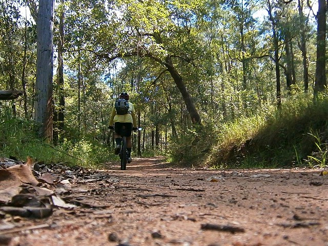
The road crosses Redbank Creek Several Times as it winds up the hill for 10km. So if you try this ride, be prepared to get your feet wet. Today was hot (30C / 86F) so I didn’t mind cooling my toes in the water as I rode through.
Logans Road
Wallers RoadWallers Road
It’s a 10km climb and takes about an hour to ride to the highest point – about 550m above sea level. There are one or two parts that are quite steep – especially towards the end of the climb. At the start of the climb, after crossing a few creeks, the road is quite dusty. This was a challenging combination as the water, sand and dust got on my chain making it crunchy and difficult to pedal. Luckily I always bring a rag and a bottle of chain lube in my backpack, and was able to give my chain a wipe down.
Wallers Road
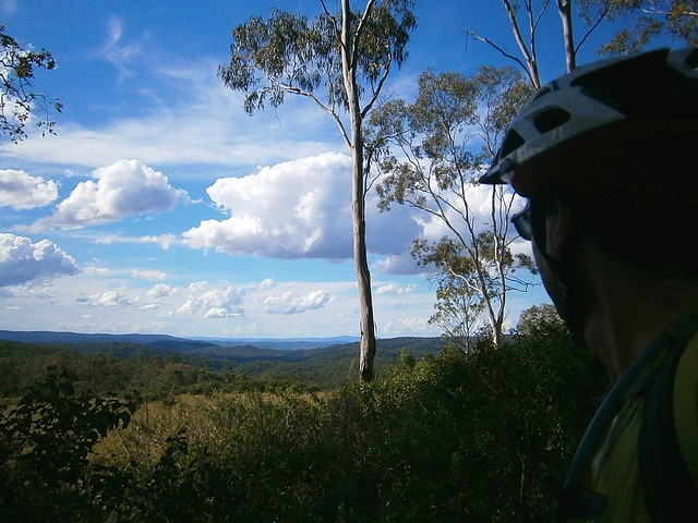
At the top of the hill, I was able to look out over some of the lush farmland towards the D’Aguilar Ranges to the north-east.
Wallers Road
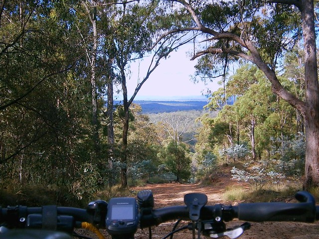
The ride down Wallers Road was a lot of fun. It starts as a gentle descent, getting steeper as you get towards the bottom. Apart from one short climb partway down, the whole descent is about 12km long. The steep bits towards the bottom are really enjoyable. They’re rocky with some loose gravel, and the gradient exceeds 30% in some places – it’s what mountain biking is all about. I had to hang my backside as far out over the back of the bike as I could and take a “controlled skid” over the rocks, trusting my wonderful suspension to smooth out most of the bumps. It was hard to stop smiling as I rode down.
Adare
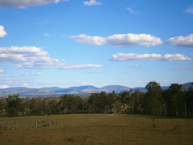
The last part of the ride was through some quiet back roads near Gatton with some spectacular views towards the Great Dividing Range to the South.

This ride was 45km with about 850m of vertical ascent. It took me 3 hours (excluding stops) and I burned 2,500kcal. I think it rates about 7.5 out of 10 on the tough-o-meter. There’s a tough climb and a technical descent, but it’s an enjoyable ride. The only downside for me was having to do the last few km on the busy Gatton-Esk Road.

I might come back here again and see if I can eliminate some of the bitumen road towards the end – I think it would make an excellent social ride.

Allow 90 minutes if driving from the Brisbane CBD – or 2 hours from the Northern Suburbs.

Total distance: 45.67 km
Total climbing: 899 m
Average temperature: NAN
Total time: 03:39:44
Download file: activity_170081966.gpx
More data

Border Ranges – Deans Pictures

Dean the Diesel
In my last post I mentioned that my friend Dean successfully completed the 90km Border Ranges Loop, and managed to match our 4wd speed-wise over the last 5 km.

This man is like a diesel engine – he just keeps going. Plus he has a strange ability to get out of bed really early to get to the start point of a ride.

Here’s some of his pictures of his ride on the same day. It overlapped ours for part of the way, but when the weather got wet – he decided to stick to the original plan šŸ™‚
panorama-1
panorama-2
panorama-3
panorama-4
panorama-5
panorama-7
panorama-8
panorama-10
panorama-13
panorama-15
panorama-16
simes-rd

panorama-6

View Larger Map

Border Ranges

Ridgeline
Like its name suggests, the Border Ranges National Park is a mountainous area of rainforest on the border of NSW and Queensland, just south of the border. It rises above 1,100 (3,600ft) in places and is covered with thick lush rainforest, towering trees and fast flowing streams.

The area is the traditional country of the Githabul Aboriginal People. It covers some of Australia’s most scenic country covering a number of natonal parks amd state forests around Kyogle, Woodenbong and Tenterfield, such as Koreelah NP, Mount Clunie NP, Richmond Range NP, Mount Northofagus NP, and Mount Lindesay State Forest.

Our plan was to start an 80km loop at the north-western edge of the park, head south towards Kyogle, then loop back northwards through Lynches Creek. This was quite ambitious considering we had to drive two and a half hours to get there in the first place, and considering the fact that that I find it very difficult to get out of bed early.
Simes Road
We arrived at the starting point, Simes Road, at 9:30am – a little later than we had anticipated and were optimistic we could make good time if we kept the pace up.
Tweed Range Road
The roads were muddy from the overnight rain. Being from the UK, Adi was used to wet tracks, and showed us how the Brits handle mud by popping a wheelstand while riding up one of the steep hills.
Border Ranges National Park
(Photo by Nick Mills)

After about half an hour climbing, farmland gave way to rainforest as we reached the entrance to the National Park.
Resting in the Mist
We didn’t realize that we’d be climbing for well over two hours before we reached the top of mountain. Physically this was ok – we were all used to long climbs. You just sit back, turn the pedals, and enjoy the view šŸ™‚ The problem was that it meant we made much slower progress that we had expected, and we didn’t get to the top of the range till about 12:30.
Brindle Creek
(Photo by Nick Mills)

It started to rain fairly heavily on the way up, so we were all quite wet by the time we got to the top. This, and the mist, meant that we couldn’t see anything from the lookout, but Brindle Creek looked spectactular. There’s something about a bubbling creek in the middle of a misty rainforest that stirs my soul.

Brindle Creek Road
At the eastern edge of the loop through the rainforest the track splits in two where Bridnle Creek Road meets Tweed Range Road. Our intended route was southwards. The other alternative was to take Tweed Range Road westward back to our starting point. This would shorten the ride by more than half. We talked about it for a while. It was getting close to 1pm, our intended route still involved 60km of muddy roads and heavy rain, and we still had a 3 hour drive home after that. So we decided to take the shortcut and head back downhill along Tweed Range Road. At least we’d end up getting home before dark.
Bottom of the Hill
(Photo by Nick Mills)
While it took us over two hours to ride UP the range, it only took us about 20 minutes to ride down. It was incredible fun. Riding downhill at close to 60km/h in a wet jersey makes you very cold, so I decided to put on a jacket to keep the wind out. One consequence of that is that the wind inflated the jacket, so by the time I reached the bottom I looked like the Michelin Tyre man šŸ™‚

Nick
Being a much tougher rider, Nick decided to give the jacket a miss. But he still ended up wearing a fine mask of mud all over his face by the time he got to the bottom of the hill.

Dean
Perhaps the biggest surprise of the day was when we got back to the car, and met our exhausted and mud covered friend Dean grinding his bike up the hill from the other direction. He had actually started the ride two and a half hours before us. Unlike us, he slogged it out the entire way finishing the 80km loop at about the same time we finished our 35km loop.

What was most impressive was that he had parked 5km down the road from us at the top of Simes Road. So he kept pedalling on while we got in the cars to leave. 5km later when we had driven to the top of Simes Road, we looked in the rear view mirror, and there was Dean right behind us on the bike. After an 85km slog through the hills, he was able to go head to head with a 4wd over 5km in about the same time. Good on ya, Dean!

Lookout
On the drive home we stopped at the Railway Loop Lookout. Just before it reaches the Qld / NSW border, the railway line has to climb several hundred metres in a short time. The engineers came up with a novel way of overcoming this obstacle by making the railway loop over itself in a big circle (see the google map below). You can see this unusual bit of railway from the lookout.

View Larger Map

All up, 35km in 3 hours with 1,100m of ascent and 4,000kcal bunred. I can’t rate our intended loop as we didn’t finish it. I’m rating our actual loop 8 out of 10 on the tough-o-meter. I would have rated it lower, but the rain made it more difficult, as well as the logistics of getting to and from the starting point. It’s a great loop for anyone who’d like to see some great views over a short distance. But make sure you do it in dry weather!

Total distance: 36.73 km
Total climbing: 1118 m
Average temperature: NAN
Total time: 04:04:44
Download file: activity_167779924.gpx
More data

Mount O’Reilly

Harland Road
Mount O’Reilly is a forest covered mountain west of Samford, east of Mount Glorious, and sandwiched between Cedar Creek to the north, and the South Pine River to the south.

Our aim today was to ride to the top along Harland Road, and then follow a steep fire trail southward under some powerlines to the main road, 500 metres below.

To get there, Simon and I took “the scenic route” from Lawnton to Bunyaville, then over the Samford Range to Ironbark, along the Lanita rail trail, through the back blocks of Samford Valley, up the Goat Track to Mount Nebo, and then up to Mount Glorious.
Harland Road
At Mount Glorious, we turned down Harland Road which meanders through some spectacular forests before devolving into a dirt track which goes over the summit of Mount O’Reilly.
Mount O'Reilly Fire Trail
Once at the summit, we turned south to follow an overgrown fire trail southwards. I found the traces of a track on Google Earth and thought it would be worth a try. The only problem is that Google Earth didn’t show you how rocky or overgrown it was.
Land Slip
But the thing that stopped us dead in our tracks was a land slide halfway down the mountain. The road follows the side of the mountain in some places, and in one spot, the side of the mountain had fallen away. There was a gulf over a hundred metres wide, which was too deep and dangerous for us to cross. There was no way around it, no way through it. So we had to turn around and head back up to the top of the mountain again.

Once at the top, the alternatives were to grind our way back up Harland Road to Mount Glorious (a tough climb), or to scramble down the northern side of Mount O’Reilly to Cedar Creek following a trail that Darb, Graham and I took a few weeks ago.

Lake Samsonvale
Simon and I decided to try our chances scrambling down to Cedar Creek. It was as thick and as overgrown as last time, and the views were just as spectacular.

Mount Lawson
We eventually made it down to Cedar Creek and slowly made our way home to Lawnton via Winn Rd.

All up the trip was just under 90km and took 7 hours. I took it slower than usual so Simon could enjoy the ride a bit better. With over 5,300kcal of energy burnred, and 1,730 meters of vertical ascent, it was still a challenging ride. I’m giving it 8.5 out of 10 on the tough-o-meter.

Total distance: 88.89 km
Total climbing: 1818 m
Average temperature: NAN
Total time: 09:25:15
Download file: activity_163151130.gpx
More data

The Long Way Round

The recent wet weather has made some of the local tracks difficult to ride, so I decided to try a route which would work well even after heavy rain. The result was this very large (> 120km) loop of the North of Brisbane.

Incidentally, if you’re a Mountain Biker new to Brisbane – this is one way to see a bit of everything: Rainforest, Bush, Mountains, City Centre, Mangroves… all in one day.

I started from Lawnton, and met up with Paul at Bunyaville, where we headed west to Ironbark and the Pony Trails in Samford Valley.
Samford Pony Trails

Some of the pony trails around Samford are rocky and steep. The recent rain has made them muddy too – which just adds to the fun.

We followed the pony trails to the bottom of “The Goat Track”.

Goat TrackGoat Track

Nature continues to reclaim the Goat Track. A trafficable road with cars and trucks going up and down it 15 months ago, it’s now overgrown with land slips and drops off the edge – a perfect mountain biking trail. It offers some great views of Moreton Bay to the east, and is still the easiest and safeest way up to Mount Nebo if you keep your wits about you.

If you ride DOWN it, I’d suggest you take it easy, especially near some of the land slips.

At Mount Nebo we topped up on snacks and drinks, and made our way to the trail head for South Boundary Road.

South Boundary Road

South Boundary Road is a dirt fire trail that runs from Mount Nebo to The Gap. The landscape varies as it undulates from one end to the other. East to West is a tough climb, but heading the opposite way down to The Gap offers some really fun fast descents.

Either way you need to be prepared to do some climbing.

This time we passed dozens of walkers training for the 100km Oxfam Trail walk. (A 100km walk? Those guys are crazier than me). If any of you walkers are reading this, thanks so much for thoughtfully moving to the side of the trail as we came hooting down it on our bikes. We really appreciate it!

At the end of South Boundary Road we skirted the northern part of Gap Creek and started the climb up the side of Mount Coot-tha.
Highwood RoadHighwood Road
While many road cyclists grimace at the thought of taking the “easy” bitumen route up Mt Coot-tha, Mountain Bikers do it the hard way – up the side of the mountain. Highwood Road starts with a short climb up a 20% bitumen gradient, followed 1,110 metres of pain up a steep dirt fire trail with a dozen water bars thrown in to make the climb even harder.

Paul and I nailed the hill yesterday – the first time for me.

Once we reached the top, we then followed the “Powerful Owl” trail behind Channel Nine, which undulates for a while before steeply descending to Silky Oak Picnic Area. A few friends had warned me to beware of the steep drop at the end which consisted of 100 metres of a controlled skid to the bottom over rocks and ruts. Thankfully, the DERM graders had been through recently. The path was smoother and safer than before, and the ride down was much easier than I had anticipated.

From here, we followed bike paths through Toowong into the centre of Brisbane, out through the Roma Street Parklands and finally joining the Kedron Brook Cycleway which we followed to Toombul, Nudgee and Deagon, before finally heading west through Bracken Ridge and Bald Hills home again.

I really should pay tribute to Paul. By the time we got to the Kedron Brook Cycleway, the climbing and distance had started to affect both of us. Paul was hurting but didn’t want to spoil the ride by finishing early. So he persevered, despite the fact that the last 40km were in the rain.

We were soaked and exhausted by the time we got back to Lawnton.

All up, 124km with almost 1,900m of vertical ascent, and over 6,500 kcal of energy.

I drank a lot of sports drinks, a few cakes, a few bottles of Orange Juice and lots of water.

I rate this one 10 out of 10 on the tough-o-meter because of:
1. The distance. We were on the road for 10 and a half hours which is a logistical issue if you need to be back home before dark.
2. The climb up Highwood Road. After toughing it out on the hills of South Boundary Road, that last little climb is NASTY.
3. The rain at the end. A little bit of rain is nice. It keeps you cool. A lot of rain is uncomfortable.

Total distance: 124.45 km
Total climbing: 2002 m
Average temperature: NAN
Total time: 10:29:16
Download file: activity_158595887.gpx
More data

Walloon Revisited

Dundas Road
I’ve ridden to Walloon a few times in the last year, and had been planning a return visit for the last couple of months. The only problem is that we’ve had heavy rain which made some of the tracks difficult to ride.

Thankfully, we’ve had a lot of sun over the last few days, so the tracks had a chance to dry out. The only fly in the ointment was that my camera got water damaged when I fell in the creek last week, so I only had my mobile phone to take photos. Darb got some video, so I’ll add that when it becomes available.

Aaron and I started from my place in Lawnton, meeting Darb at Leitches Crossing (still flooded). We then made our way to Bunyaville to meet Neil B. From there we made our way to Ironbark Gully, and on to the Lanita Road Rail Trail.

We then followed the pony trails through the back of Samford to the Goat Track. This road has slowly deteriorated since it was closed over a year ago from heavy rain. It’s very rutted, with several nasty looking holes close to a sheer drop near the edge of the road. It’s a fun road to ride up, and is still the easiest way to get up the D’Aguilar Range to Mount Nebo, but since it’s no longer being maintained by the council, and since bits of it keep falling off, it’s getting more dangerous.

Dundas Road
Once we reached Mount Nebo, we then headed down Dundas Road. This enjoyable trail starts behind the Mt Nebo Rubbish Dump and heads a couple of kilometres westward and downhill to a water tank and camping ground. I stopped to take a few photos, only to discover my camera wasn’t working, so I had to quickly get my mobile phone out to get these photos. You can’t see it in the picture, but the guys were going pretty fast down this hill, and whizzed by me with only a couple of inches to spare.

After the camping ground, the road gets considerably steeper, turning into “Whoa Boy” break. Originally I thought it was called this because when you get to the top and look down, you say to yourself “Whoa Boy”. But actually, it’s named after all the water bars on the track. A water bar is a hump of dirt that crosses a steep track. The hump stops rain water from eroding the track. It also makes the track a lot of fun to ride down – more daring riders use the humps as a jump, and launch into the air. It also makes the track a lot more diabolical to ride up – it’s hard work riding up a steep hill anyway, but then having to ride up the back of an extra steep hump makes it even more difficult.

Another name for a water bar is a “Whoa Boy” which is what the old drovers used to call them because they’d slow their horses down as the cart went over the hump, often saying to the horse “Whoa Boy”.

Mountain Bikers don’t say that. They usually just give a “Whoop” and fly over the hump.

But…. this hill is so steep, and so long, and I used my brakes so much that they over heated. And suddenly they were gone. I pulled the brake lever, and nothing happened. Worse than that, the lever just squeezed right into the handlebars. It’s a horrible feeling. I’m very fortunate that this happened near the bottom of the descent, and that I still had my front brakes. After stopping the bike for a few minutes the brakes came back, and we were able to continue the journey.

Once we got down the other side of the D’Aguilar Range we headed west along Banks Creek Road. The road crosses Banks Creek several times, and there was enough water flowing at the crossings for us to get our feet wet. But the major surprise was Savages Crossing. This is where we had to cross the Brisbane River. But the river was swollen after recent rain, and had covered the causeway by about 30cm (knee height). A couple of the guys rode across the 50 metre causeway. I’m sure it was safe, but I didn’t want to risk damaging the bike, so I waded across, carrying the bike.

From there we stopped at the Fernvale Bakery for lunch, and followed the Brisbane Valley Railtrail and soem quiet gravel roads southwards to Walloon.

One of Walloons major assets is its wonderful pub, where we stopped for a few beers, before hopping on the train and heading home.

All up we rode about 85km. I burned about 4,500kcal in just under 6 hours of riding (excluding breaks). I’ll give this one 8.5 out of 10 on the tough-o-meter. The weather was perfect – perhaps a little warm, and the major descent required a lot of concentration. I’d also recommend this as a winter ride when the weather is drier, and the creeks / rivers are lower.

Total distance: 86.3 km
Total climbing: 1674 m
Average temperature: NAN
Total time: 08:08:23
Download file: activity_156344511.gpx
More data