Walloon Revisited

Dundas Road
I’ve ridden to Walloon a few times in the last year, and had been planning a return visit for the last couple of months. The only problem is that we’ve had heavy rain which made some of the tracks difficult to ride.

Thankfully, we’ve had a lot of sun over the last few days, so the tracks had a chance to dry out. The only fly in the ointment was that my camera got water damaged when I fell in the creek last week, so I only had my mobile phone to take photos. Darb got some video, so I’ll add that when it becomes available.

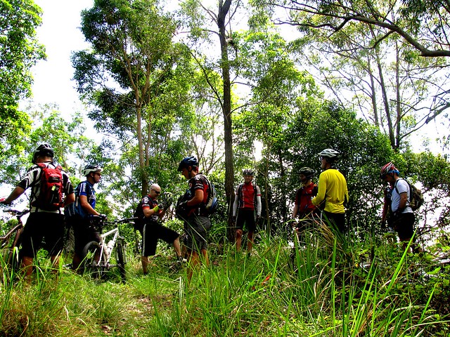
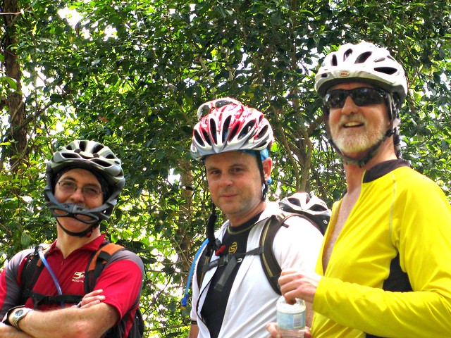
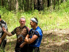
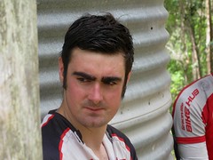
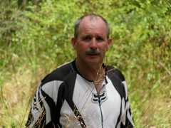
Aaron and I started from my place in Lawnton, meeting Darb at Leitches Crossing (still flooded). We then made our way to Bunyaville to meet Neil B. From there we made our way to Ironbark Gully, and on to the Lanita Road Rail Trail.

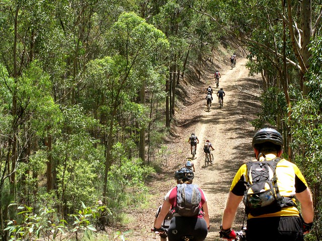
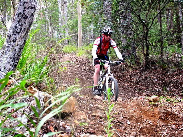
We then followed the pony trails through the back of Samford to the Goat Track. This road has slowly deteriorated since it was closed over a year ago from heavy rain. It’s very rutted, with several nasty looking holes close to a sheer drop near the edge of the road. It’s a fun road to ride up, and is still the easiest way to get up the D’Aguilar Range to Mount Nebo, but since it’s no longer being maintained by the council, and since bits of it keep falling off, it’s getting more dangerous.

Dundas Road
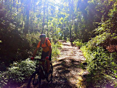
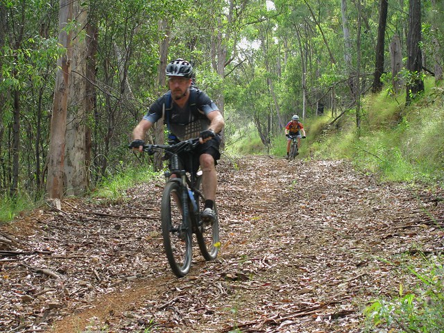
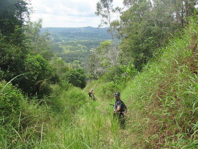
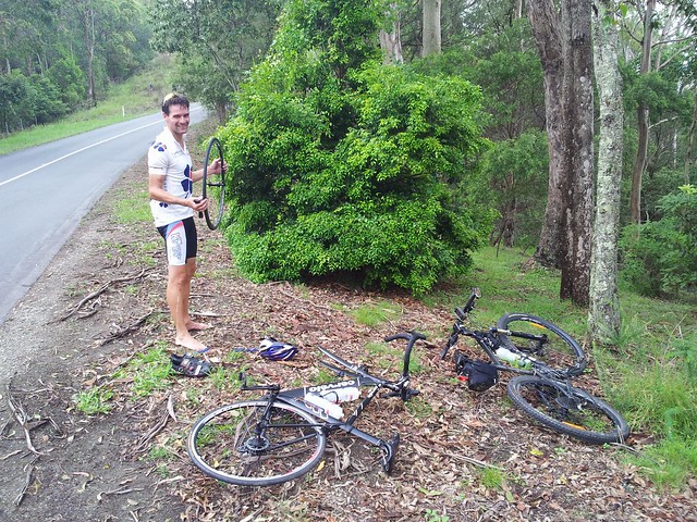
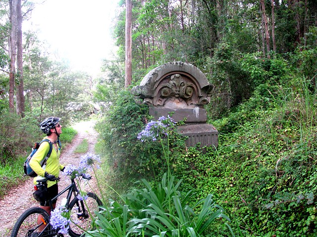
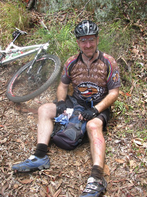
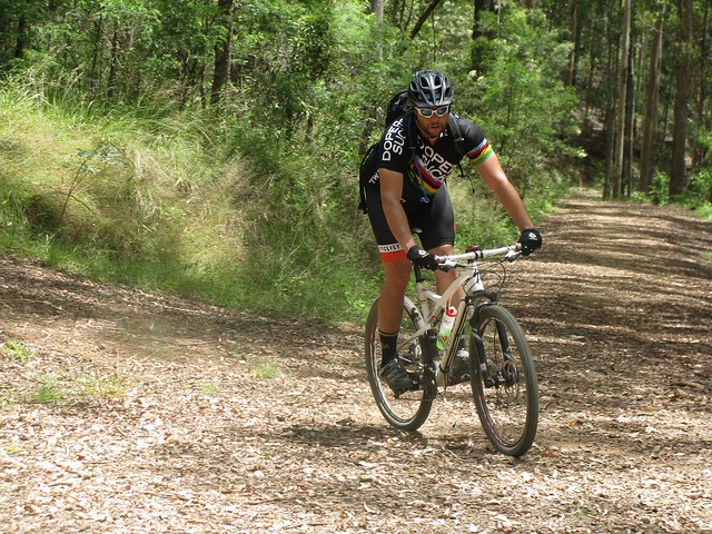
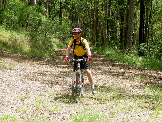
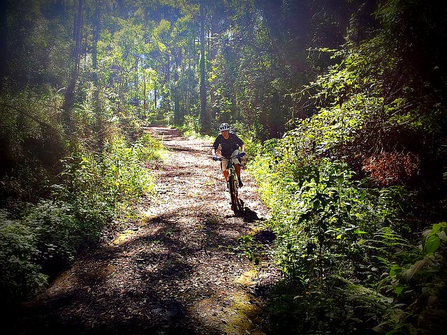
Once we reached Mount Nebo, we then headed down Dundas Road. This enjoyable trail starts behind the Mt Nebo Rubbish Dump and heads a couple of kilometres westward and downhill to a water tank and camping ground. I stopped to take a few photos, only to discover my camera wasn’t working, so I had to quickly get my mobile phone out to get these photos. You can’t see it in the picture, but the guys were going pretty fast down this hill, and whizzed by me with only a couple of inches to spare.

After the camping ground, the road gets considerably steeper, turning into “Whoa Boy” break. Originally I thought it was called this because when you get to the top and look down, you say to yourself “Whoa Boy”. But actually, it’s named after all the water bars on the track. A water bar is a hump of dirt that crosses a steep track. The hump stops rain water from eroding the track. It also makes the track a lot of fun to ride down – more daring riders use the humps as a jump, and launch into the air. It also makes the track a lot more diabolical to ride up – it’s hard work riding up a steep hill anyway, but then having to ride up the back of an extra steep hump makes it even more difficult.

Another name for a water bar is a “Whoa Boy” which is what the old drovers used to call them because they’d slow their horses down as the cart went over the hump, often saying to the horse “Whoa Boy”.

Mountain Bikers don’t say that. They usually just give a “Whoop” and fly over the hump.

But…. this hill is so steep, and so long, and I used my brakes so much that they over heated. And suddenly they were gone. I pulled the brake lever, and nothing happened. Worse than that, the lever just squeezed right into the handlebars. It’s a horrible feeling. I’m very fortunate that this happened near the bottom of the descent, and that I still had my front brakes. After stopping the bike for a few minutes the brakes came back, and we were able to continue the journey.

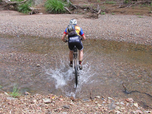
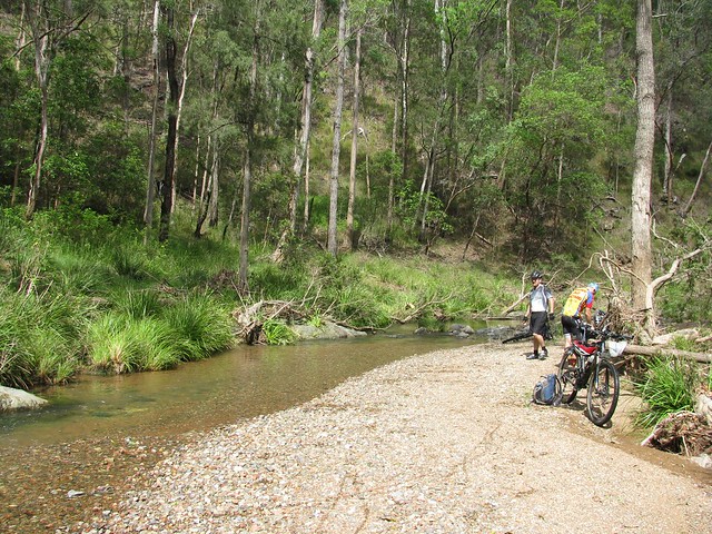
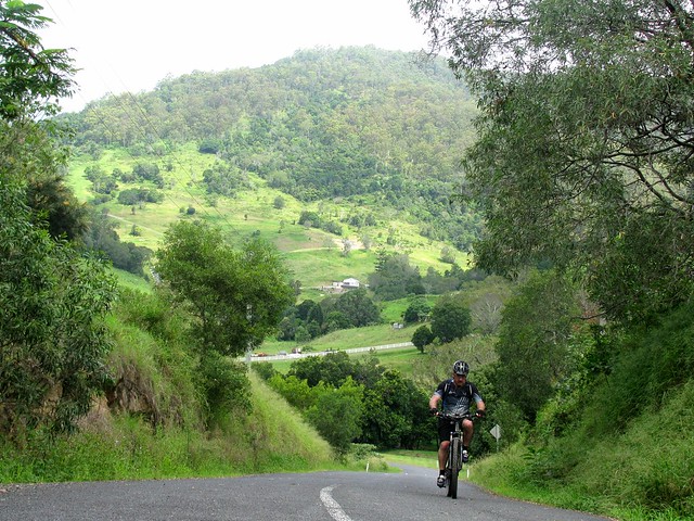
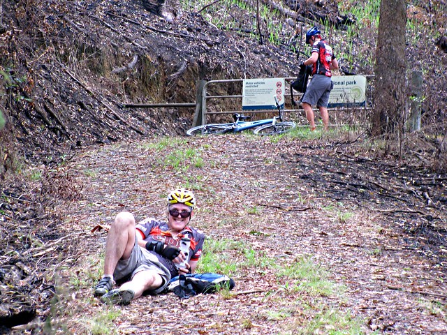
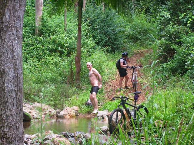
Once we got down the other side of the D’Aguilar Range we headed west along Banks Creek Road. The road crosses Banks Creek several times, and there was enough water flowing at the crossings for us to get our feet wet. But the major surprise was Savages Crossing. This is where we had to cross the Brisbane River. But the river was swollen after recent rain, and had covered the causeway by about 30cm (knee height). A couple of the guys rode across the 50 metre causeway. I’m sure it was safe, but I didn’t want to risk damaging the bike, so I waded across, carrying the bike.

From there we stopped at the Fernvale Bakery for lunch, and followed the Brisbane Valley Railtrail and soem quiet gravel roads southwards to Walloon.

One of Walloons major assets is its wonderful pub, where we stopped for a few beers, before hopping on the train and heading home.

All up we rode about 85km. I burned about 4,500kcal in just under 6 hours of riding (excluding breaks). I’ll give this one 8.5 out of 10 on the tough-o-meter. The weather was perfect – perhaps a little warm, and the major descent required a lot of concentration. I’d also recommend this as a winter ride when the weather is drier, and the creeks / rivers are lower.

Total distance: 86.3 km
Total climbing: 1674 m
Average temperature: NAN
Total time: 08:08:23
Download file: activity_156344511.gpx
More data

What If?

Two years ago I asked a few friends if they knew of any way to ride a bike from Cedar Creek (a few kilometres north of Samford) up to Mount Glorious. At the time, no one had any clear ideas about how to do it. But today we found a challenging way to go the other way, riding down to Cedar Creek from Mount Glorious.

Tony, Graham and I started the day from Samford, heading west to the D’Aguilar Range via some local Pony Trails. We made our way up the hill to the Dundas Road water tank and campsite before taking a long descent down Goodes Road.
Goodes Road
Goodes Road descends almost 500 metres in 4.5km. That’s a long way down in a fairly short distance. It’s a lot of fun to ride down, provided you keep your wits about you. It’s very hard work to ride up.
Splash!
After the long descent we eventually we reached England Creek. This beautiful clear creek meanders westward through the National Park eventually draining into the Brisbane River near Fernvale. Today it was full of beautiful fresh water. Tony and Graham rode through it effortlessly. I however, stalled midway through, fell off and got totally saturated.
England Creek
Since England Creek marks the bottom of the descent, and the start of the long climb out, we decided to take a quick break.
Repairs
Graham broke his chain while riding up Joyners Ridge Road, and didn’t have a spare link or chain breaker with him. Luckily I did, so he was able to get back on his way fairly quickly. The only problem was that leeches found us while we stopped in the damp undergrowth, so we all had to pick off a few of the horrible little creatures before setting off again.
Rainforest
The climb up Joyners Ridge Road from England Creek is about 10km in length. But during that time we had to make a total ascent a total of 835 meters. So by the time we got to the top we were quite hot. So the cool rain-forest at the top of the climb was a delight to ride through.

After a quick break at Mount Glorious, we headed east along Harland Road, past an old saw mill near the summit of Mount O’Reilly to look for a way down the mountain. Harland Road is beautiful to ride along. It slowly gets narrower and more overgrown until it eventually disappears completely.

At this point we just steered the bikes down the hill along what appeared to be a ridge-line until we could no longer ride, and had to walk the bikes, scrambling down some very steep hill sides.

My predefined route was useless at this point. It went off over the side of the hill through terrain that we would never have been able to negotiate.
Are you sure this is the right way?
Eventually Graham found a rough 4wd track. Rocky, and overgrown, it was still too rough to ride, but it slowly improved until we were able to finish riding down the hill.
Mount O'Reilly
Eventually we made it down to Morrison Road at Cedar Creek. Looking back over my shoulder, I thought “did we actually ride down that?”

Well – we probably walked about 600m of it, but we did ride the rest.

Thanks so much, Tony and Graham, for helping me to answer my “what-if” question today šŸ™‚

All up, 55km, 4,300kcal and 1,600m of vertical ascent. This one rates a definite 10 out of 10 on the tough-o-meter. Just doing the Goat Track, Dundas Rd, Goodes Rd and Joyners Ridge Rd is difficult. But adding Harland Rd into the mix, and scrambling through some thick undergrowth to get down a steep hill side made it insane (but fun).

Only try the Harland Road part of this ride if you’re willing and able to scramble down some very steep, overgrown, rocky hill sides carrying your bike. Don’t try it solo – it’s too dangerous to do alone.

Total distance: 56.36 km
Total climbing: 1662 m
Average temperature:
Total time: 06:47:26
Download file: activity_154291943.gpx
More data

Third Time Lucky

This WayAfter two recent unsuccessful recent attempts, I finally managed to ride from my place to Scrub Road / South Boundary Road via Camp Mountain.

On my third trip along this route in a month, it was starting to feel a bit repetitious, but I really wanted to prove to myself that I could do it.

It’s challenging because there are a few tough climbs involved (Camp Mountain, Scrub Road, South Boundary Road northward), plus a couple of short nasty climbs in Bunyaville and Ironbark. All up it involveds about 1,600m of climbing, so I wanted to nail all of them in one go just for the sake of it.


Goanna, Camp Mountain
DERM has recently graded the trail to the summit of Camp Mountain, but it didn’t seem to help me. I still took just over 13 minutes to climb it, and was exhausted and gasping for breath when I reached the top. This Goanna (or Lace Monitor) looked at me suspiciously, sniffing the air as I tried to catch my breath, so I grabbed a quick picture of him while I had the chance.

Then I had a quick ride up the bitumen along the hill tops to the trail head for Scrub Road.
Scrub RoadScrub Road
The last time I rode this track it was so muddy my wheels clogged up and stopped turning. Thankfully this time the sun had dried up the mud, which meant a nice smooth ride for a couple of kilometres to the causeway at the bottom.

But, as every rider and hiker in D’Aguilar National Park knows, what goes down, must go up! So I put the bike into “granny” gear and spun furiously for half an hour to get out of the valley and back up onto the ridgeline at South Boundary Road.
Cooling OffScrub Road Shelter
I really appreciate the shelters and water tanks that DERM has built in the national park. Once I reached the shelter at the corner of Scrub Road and South Boundary Road, I took a bit of a break and cooled off under the water tap. It felt wonderful!

Since I had a bit of a whinge about DERM in a previous post I wanted to put on the record the fact that I do appreciate the work they do maintaining our parks. I love having such a large and diverse park so close to home, and despite occasional muddy fire trails, the park is very well maintained.

Just on a side note, did you know that Mount Coot-tha forms part of the D’Aguilar National Park system. It’s only 5.5km from the Brisbane CBD. I can’t think of any other capital city in the world that has such a large national park so close to the city centre.

All up 81km, 1,600m of ascent, and just under 5,000 kcal burned. This one is 9 out of 10 on the tough-o-meter.

Total distance: 81.86 km
Total climbing: 1695 m
Average temperature: NAN
Total time: 06:59:44
Download file: activity_150347023.gpx
More data

Battling Bulldozers

Thank you, Lesley Hunter-Nolan (editor, Pine Rivers Press) and Nick Kuhn (photographer) for running this story in the Pine Rivers Press yesterday. I admire Nick for agreeing to come for an hour trek in the hilly forests of Clear Mountain with me so he could see some of the damage done by the DERM bulldozers.

Journalists get a lot of criticism from us at times, but I appreciate the job that the local press does – keeping us informed about what’s going on in our area.

It’s About the Journey

Enjoying the ViewLast week I tried to ride a large loop from home which took in Scrub Road and South Boundary Road… but didn’t quite make it. I tried again this week, and didn’t quite make it again. The problem last week was lack of water and time. This week the mud defeated us. The people from DERM have recently taken a bulldozer down some of the paths to clear fire breaks, and the roads have become impassable due to the thick mud caused by recent heavy rain.

Dean and I set out from my place at the ungodly time of 6am (he’s an early riser) and headed out to Bunyaville via some local bike paths.

From there we rode to Ironbark Gully in Samford Forest via Wongan Creek. The creek crossing was flooded, so I smugly let Dean know I thought we could ride across it without any problems. Halfway across the creek my wheel sunk into a hidden hole, I went over the handle bars, and and ended up sitting in water up to my neck wondering what was going on.

In the meantime, Dean did the commonsense thing and rode around the flooded bit without even taking a foot off the pedals.

I’ve really got to learn my lesson about flooded creeks I think!


Camp Mountain Picnic Area
(Picture by Dean)
From Ironbark Gully we headed up to Camp Mountain for the gruelling climb up the short track. It’s always a painful climb, but I love the sense of achievement when I reach the picnic ground at the top having beaten the hill.
Brisbane CBD from Camp Mountain
The recent rain has cleared the haze from the air, so the views from Camp Mountain south to the Brisbane CBD were beautiful.
Scrub Road Causeway
(Picture by Dean)
From there it was a quick ride up the bitumen to the gate at Scrub Road, and a fun descent for a couple of km down this steep firetrail to the creek and causeway at the bottom.

The only problem was the mud on the track up which clogged our wheels up so much they stopped turning. So the sensible thing to do (as Dean managed to convince me) was to turn around, climb back up to the bitumen, skip this section of dirt trails, and ride the road up to Mount Nebo.

I was disappointed. It’s annoying to be defeated twice in a week by the same stretch of track. But it forced me to face up to my main reason for doing all this anyway. And if I’m honest, it’s not about achieving objectives, it’s about getting to visit great places with good friends.
Samford Valley
(Picture by Dean)
The views from the Mount Nebo Road looking down into Samford Valley were pretty special anyway, so I don’t think we really missed out that badly!

Just over 82km, with 5:30 hours rolling, and a tad under 1,800m of vertical ascent, and 4,800kcal of energy. The BLT sandwich at Jones Tea Rooms, Mt Nebo, was worth the effort to get there. Once again, this ride rates 9 out of 10 on the tough-o-meter for the hot weather, tough climb up Camp Mountain, and the mud on Scrub Road. Let’s do it again some time šŸ™‚

Total distance: 82.71 km
Total climbing: 1865 m
Average temperature: NAN
Total time: 07:28:03
Download file: activity_146918033.gpx
More data

Australia Day

Camp Mountain Lookout
Australia Day this year was an ideal opportunity for me to get out of the house after all the rain rain and take a nice long ride on the bike to think about what this country means to me.

On the way, I got to enjoy some great trails at Bunyaville, Ironbark, Camp Mountain, D’Aguilar National Park, Samford Pony Trails and finally, Clear Mountain. I stuck to fire trails, so most of the ride was ok despite the recent rain.

It was great to meet up with my mate Graham who was riding with Jack along the Lanita Road Rail Trail. While I was there, I took a few minutes out to find a Geocache that was just a few metres off the track. If you like exploring, and the thrill of a treasure hunt, you might really enjoy Geocaching.
Before the Climb
The steep climb up the short side of Camp Mountain is always hard work. The wet ground was softer than usual which made it even harder. I took a quick break before starting the climb to catch my breath and appreciate the beauty of the place.
Camp Mountain Lookout
14 minutes later I was at the top gasping for breath, and feeling slightly smug that I’d nailed the hill. Even though my time was almost double the fastest time anyone has done that climb. Legend has it that someone did it in about seven minutes.

The views out to Brisbane were spectacular.
Camp Mountain Lookout
There are some great views out to Moreton Island as well.

From there, the plan was to head up to Scrub Road and spend a while down in D’Aguilar National Park before heading home via Mt Nebo.
Mike
But I met Mike instead. He had two flat tyres, and only one spare tube. My big fat spare tubes wouldn’t have been much help to him, but I did have a patch kit, so I stopped and help him patch up his tubes. Since I’m not very fast at on-the-run repairs, this chewed up a bit more time than I planned, so I abandoned my plans for Scrub Road and just followed the bitumen to Mt Nebo instead.

From there it was a quick run down the Goat Track where I met Brock, a mountain biker who is lucky enough to live in Mount Nebo. The Goat Track is looking pretty rough at the moment. The rain has worn a lot of ruts in the track and some of the precipitous edges are looking dangerously soft.
Freshwater / Keelback SnakeFreshwater / Keelback Snake
Rather than head into Samford, I followed the Pony Trails up to Gibbons Road, and came across this little Keelback (or Freshwater) snake chilling out in a puddle. They’re not venomous, but one really cool thing about them is that they eat cane toads. Unfortunately they like living around creeks and swamps, which land developers seem to enjoy clearing. Interesting to think that Land Developers and Cane Toads are on the same side šŸ™‚

So on Australia Day, I am grateful. This place is beautiful. We have some spectacular scenery and amazing animals. And the people are great. I can stop by the side of the road and say “G’day” to people I’ve never met before and become friends right away. And I won’t even start on how good our health and education systems are (even though we complain about their shortcomings).

We’re still the lucky country.

But on Australia Day I’m also uneasy. I think about what we’ve lost, and what we’re losing. I can’t imagine what it would be like to be an indigenous Australian and slowly watch my country taken away from me, with forests cleared, animals forced to the brink of extinction, huge quarries and open cut mines, and a massive increase in population.

I don’t have any easy answers, but I intend to keep on exploring it and enjoying it.

And I hope we can fully appreciate what we have, and care for it.

All up, this was a 75km ride, with about 1,450m of ascent, and about 4,300kcal of energy. I started running short of water near Mt Nebo, so next time I plan to take some water purifying tablets to make it easier to take on extra water at the emergency tanks in the forest, or in some of the cleaner creeks. Next time I hope to do a similar route, but add in Scrub Road.

This one deserves 9 out of 10 on the tough-o-meter because of the distance, and the tough slog up Camp Mountain in the soggy, strength-sapping dirt.

Total distance: 75.69 km
Total climbing: 1468 m
Average temperature: NAN
Total time: 07:23:48
Download file: activity_144674281.gpx
More data

Taylors Break

Cabbage Tree Range Road
I enjoyed last week’s solo ride down Taylors Break in D’Aguilar National Park, so I wanted to share it with a few friends. About 20 of us set off from Samford, following the Pony Trails to the bottom of Mount Nebo.
At the summitAt the summit
The ride consisted of two big 500m climbs. The first one was up the Goat Track, then along a fire trail to the Lookout at the Summit of Mount Nebo.
Andrew chills outDoes it bite?
From the summit we followed Hammermeister Road to the top of Taylors Break. But before starting that steep descent, a few riders took a detour into town to get some more water (it was a hot humid day), while the rest of us lazed around in the shade catching out breath.
I'm ok
Taylors Break is a lot of fun to ride down. The narrow track flows beautifully as it goes down the mountain. Unfortunately, towards the bottom it gets steep and slippery. Darb took a jump into the air over one of the water bars. While he was in the air, a stick went through his front spokes. As he hit the ground his front wheel slid out from under him, and he ended up on the ground. It looked painful, but Darb’s made of tough stuff, and after a few minutes he was ok and ready to keep going.
Steep Descent
Tim approaches one of the steep sections of the track. Once you go over the edge, it’s pretty much a controlled skid to the bottom. There’s no stopping – you just have to keep your front wheel straight and try to stay on the bike.
Caught with his pants down
Andrew also had a crash on the way down, and suffered a nasty bruise on his thigh (that photo is censored). He decided to strip off and wash his injuries in the creek at the bottom of the descent. Unfortunately, while he had all his gear off, Becca came round the corner. Both of them got a nasty fright, and poor Andrew had to hastily get his gear back on.

There are lots of inviting, quiet creeks like this down the bottom end of D’Aguilar National Park.
Cabbage Tree Range Road
Once we reached the bottom, there was no way to go but up. Cabbage Tree Range Road was the second major climb of the ride, also rising about 500m. It takes about an hour to climb, and by the time we got to the top we were all feeling pretty tired…
Tim
…except for Tim who (amazingly) rode the whole climb in middle ring. For those who don’t ride mountain bikes, it has three cogs on the front to make riding easier: A big ring for going fast on roads, a middle ring for moderate terrain that requires a bit of effort, and a small (“granny”) ring for steep hills and narrow winding technical sections. It takes a lot of strength to nail a long steep climb like this using the middle ring.
Brian makes it to the topRussel makes it to the top
Tim had a long wait while the rest of us mere mortals completed the climb.
Brian under the tap
Becca under the tapDarb and GeoffChilling by the water tankNeil BPaul
The best thing about the climb up Cabbage Tree Range Road is the water tower at the top. Most of us had a delightful soak under the tap to cool off.

Adam took some great photos as well which you can view here.
Andrew also took some great photos which you can view here.

The ride was 52km with about 1,500m of vertical ascent. I burned up about 3,600 kcal. Because of the heat and humidity I rate it 9.5 out of 10 on the tough-o-meter.

Thanks so much to everyone who came on the ride. It’s a lot of fun being able to do rides like this in a group. Everyone had to work really hard. Some people were totally exhausted by the end. I think everyone enjoyed themselves.

Total distance: 52.62 km
Total climbing: 1501 m
Average temperature: NAN
Total time: 06:23:15
Download file: activity_143273848.gpx
More data