Bunya Mountains

Steep Descent Ahead
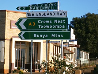
The magnificent peaks of the Bunya Mountains are a three hour drive to the northwest of Brisbane.

J.S.Fisher Lookout
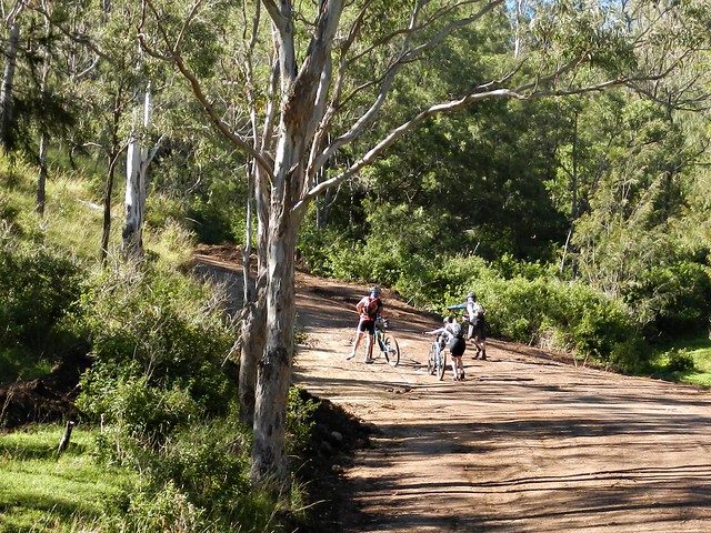
Our plan today was to ride from Burtons Well – close to Mount Kiangarow, the highest point in the Bunya Mountains at 1,135 metres above sea level. We’d then follow forestry roads eastwards towards Maidenwell where we would have lunch, before climbing back up the range to finsih at Yarraman.

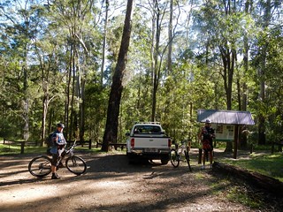
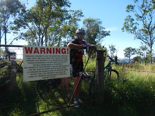
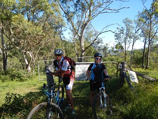
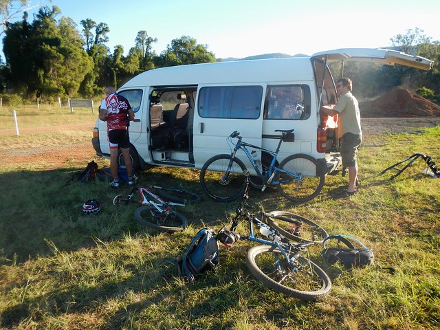
This was a point-to-point ride, which meant we’d finish at a different point to which we started. This always raises logistical challenges – bringing two vehicles, retrieving one vehilce from the starting point at the end of the ride, etc. My friend, Paul, kindly offered to be our driver for the day, dropping us off in the mountains, then driving back to Yarraman to pick us up. This saved us a lot of hassle at the end of the day.

YarramanYarraman
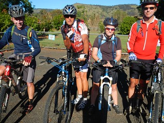
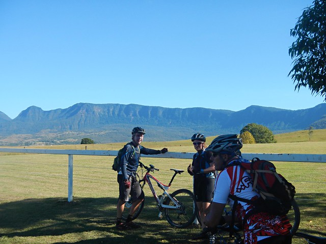
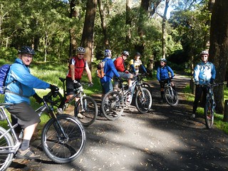
We met with some of the guys from Toowoomba Mountain Bike Club in Yarraman before making the final drive up to the top of the mountains.

J.S.Fisher Lookout
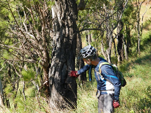
The Jarowair Aboriginal people call this place “Boobarran Ngummin” which, literally translated, means “mothers’ breast”. They believed that the creators of the land, people and animals lived here. These mountains were so important to the aborigines of southeast Queensland, that every three years they’d walk several hundred kilometres from places as far away as present-day Northen NSW, Brisbane, Moreton Bay Islands, Sunshine Coast, and Wide Bay.

The journey would take upto several months, and during that time they’d engage in trade, marriage ceremonies, spiritual discussions and gathering the nuts from the abundant Bunya Pines.

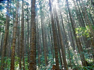
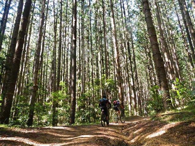
Even today, the Bunya Mountains is the site of the largest natural Bunya Pine forest in the world.

Burtons Well
Burtons WellBurtons Well
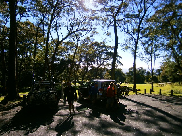
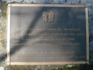
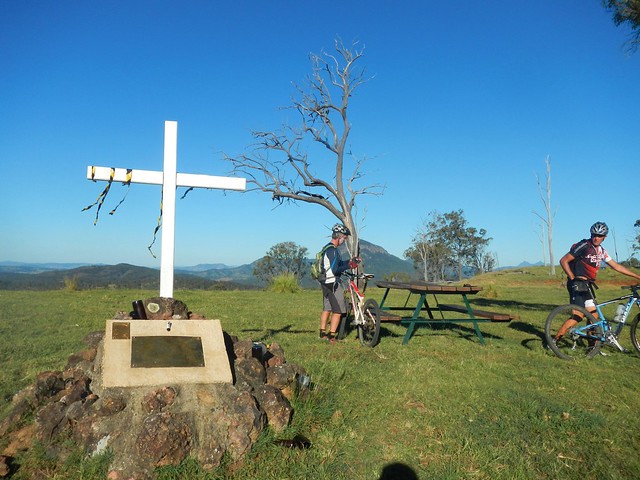
Burtons Well is named after local pioneers, Bob aand Geroge Burton, who dug the well in the drought of 1901 to provide water for their horses and bullock team.

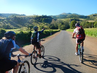
On this morning in late May, at such a high altitude, and under clear skies, it was very cold. So we all rugged up in anticipation for what would be a fast, cold descent down the mountain.

Steep Descent Ahead
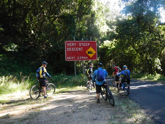
This was the fastest descent I have ever done on a bike. The winding paved road drops about 500 metres in altitude in the space of about 5 km. At one section where the road dropped steep and straight, my GPS tells me my top speed was 99.9 km/h.

Bunya Mts Yarraman 2013-05-25 from Darb Ryan on Vimeo.

Here’s a video of that descent (and the rest of the ride) by my good friend, Darb Ryan.

The road whizzed by in a blur of howling wind, chilling cold, and my shrill cries of “On your right” as I passed a few other riders.

I still haven’t confessed to Liz how fast I went.

Alice Creek
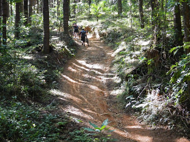
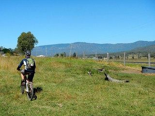
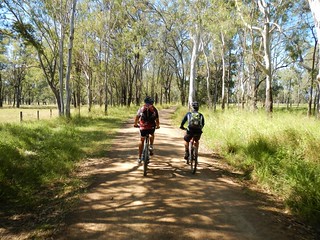
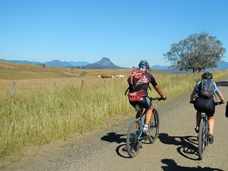
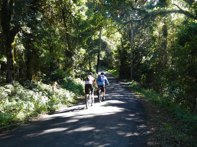
In little more than ten minutes we were out of the rainforest, down the mountain, and rolling through open farmland with frozen faces, and cold noses. A few of us took the opportunity to remove some of the cold-weather gear and prepare for the hard work ahead.

Thick MudThick Mud
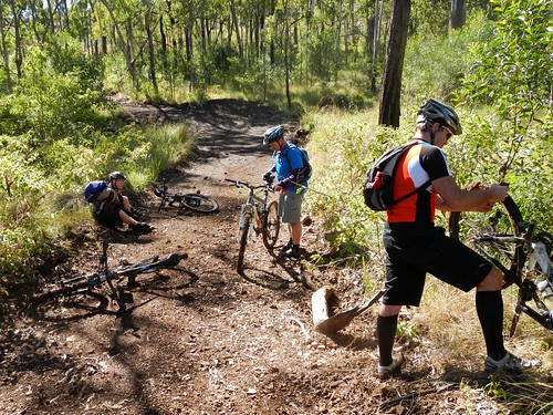
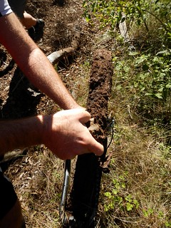
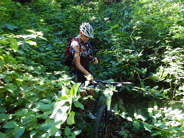
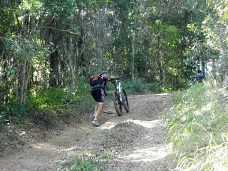
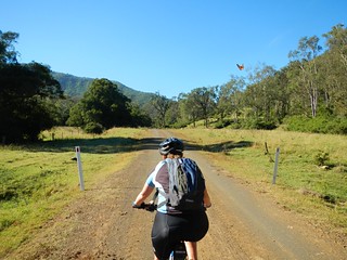
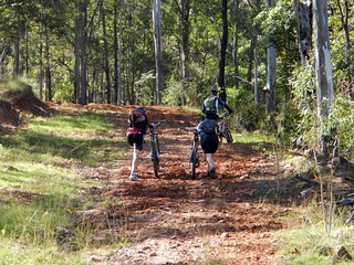
The dirt roads through Alice Creek are made of black soil. It’s nice and smooth in dry weather, but after rain it turns to sticky black goo. After a few minutes riding on it, our wheels caked up with thick mud. It was impossible to ride.

We stopped and scraped the mud from the tyres and our shoes, then pushed the bikes.

But in a cruel twist, the mud still stuck to the tyres while we pushed. So we had to carry the bikes for a couple of km.

It was hard going.
Heart Break Hill
But wait… there’s more!

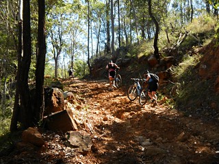
Not only was the ground akin to wet cement, some of those hills were impossibly steep.

Hoop Pine Forest
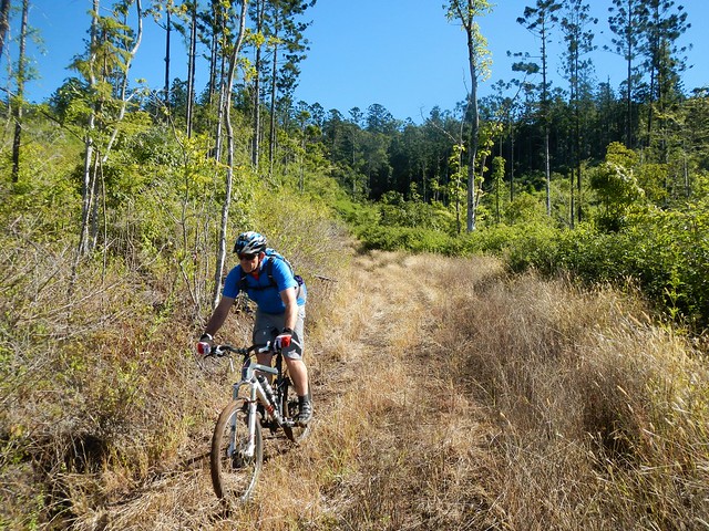
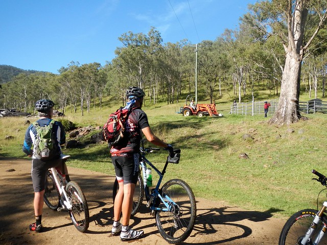
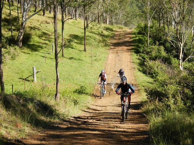
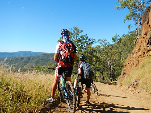
Thankfully, even the steepest of hills come to an end, and soon we were enjoying some more bumpy descents through a hoop pine plantation.

Barker Creek
Barker CreekBarker Creek

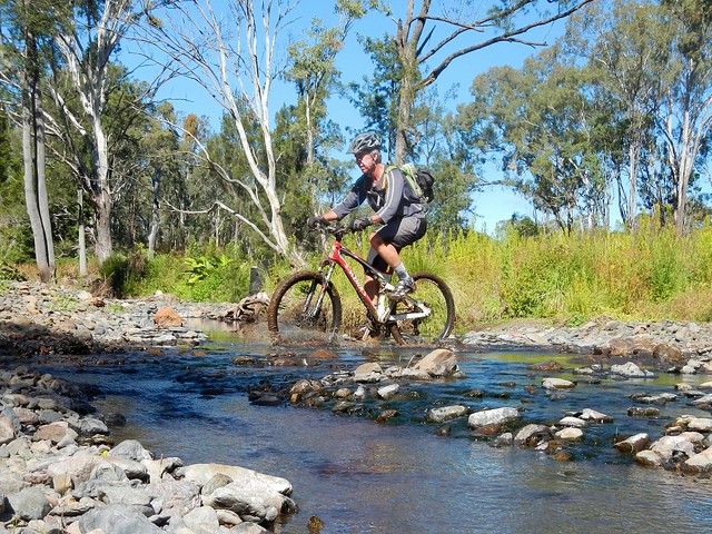
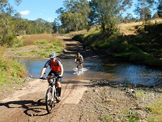
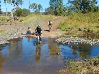
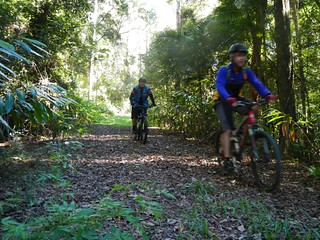
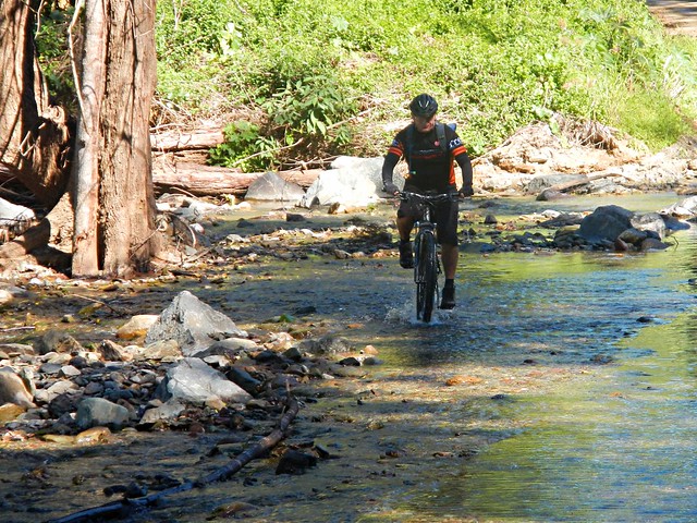
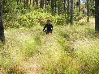
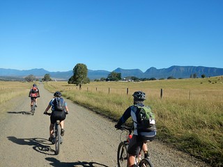
We followed the trail along Barker Creek for a few kilometres, crossing it several times.

Barker Creek
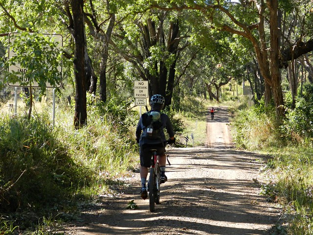
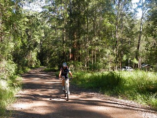
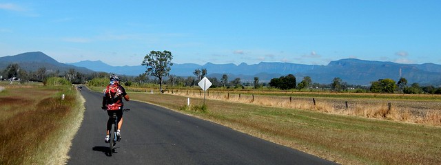
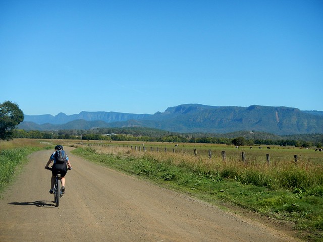
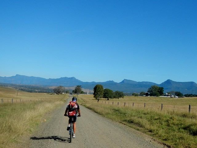
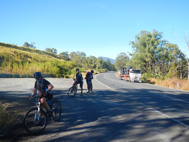
The road surface gradually improved as we got closer to Maidenwell.

"This is killing me"
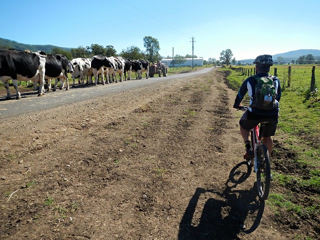
Eventually we came out on the paved road we’d driven along a few hours before. The fields of sticky black mud that we had encountered earlier had delayed us by about an hour. Although it’s difficult for a mountain biker to admit, it was actually a relief to ride on the bitumen for a short while before lunch.

Lunch at Maidenwell
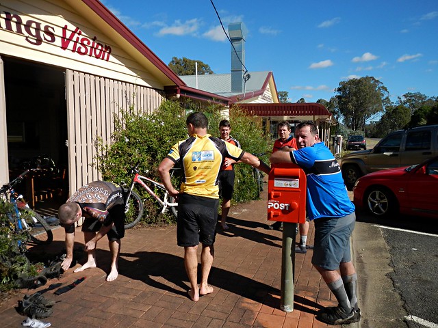
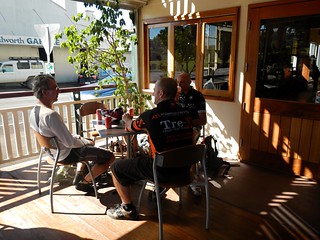
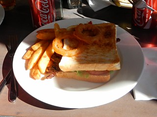
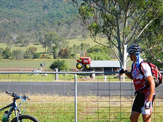
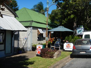
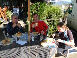
Ten hungry cyclists decended on the Maidenwell General Store and ordered mountains of food. A few of us took the opportunity to dry out wet, muddy footwear on the footpath outside. It took a while, but after about an hour, we had all eaten and were ready for the final leg of the ride.

Coomba Waterhole
Coomba Waterhole

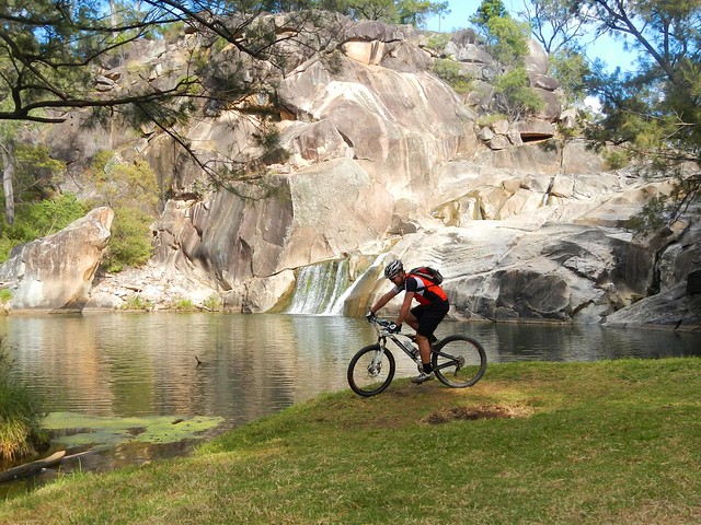
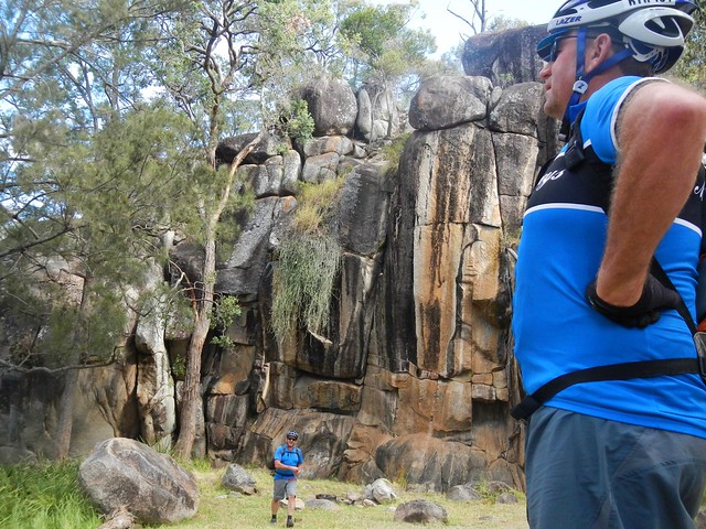
We stopped by Coomba Waterhole on the way back. This picturesque location is a great spot for a picnic, and (in warmer months) a swim. The imposing rock formations are fascinating. But in today’s chilly weather we decided to forget about having a swim.

Bunya Mountains
Resting at the Summit

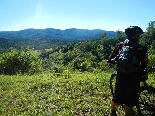
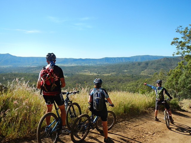
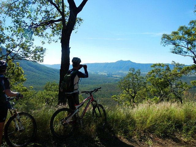
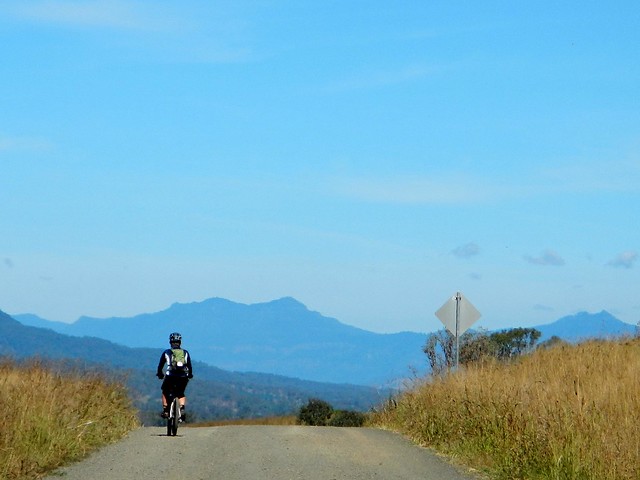
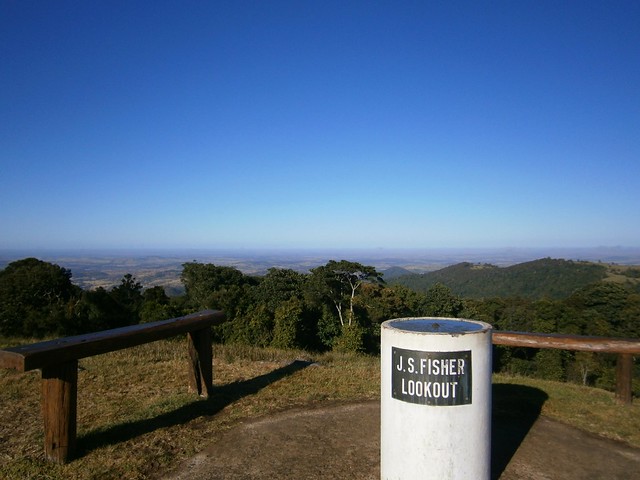
After a long climb up yet another nasty hill in Yarraman State Forest, we took a rest at the top and looked back towards the west. A long way distant, on the horizon, we could see the shadowy peaks of the Bunya Mountains. It was a great feeling to think “We’ve just ridden from there”.

We rode about 70 km in about 7 hours including breaks.

During that time we descended almost 1,800 metres, but we also had to climb about 1,200 metres, during which I burned about 3,000 kcal.

This was a tough ride, made more difficult by the sticky mud, and the logistics of starting and finishing such a long way from home.

The Bunya Mountains are stunning – well worth the effort of the visit, whether it’s on a mountain bike or in a car.

This one rates 9 out of 10 on the tough-o-meter.

Thanks everyone for great company on a spectacular ride!

Total distance: 69.55 km
Total climbing: 1899 m
Average temperature: 17.1
Total time: 06:53:47
Download file: activity_317593574.gpx
More data

Living the Dream – Tropical Trick Shots

In 1999 Liam Connor made a major decision to quit his Environmental Science degree, and study something he was passionate about – Film Making.

Since then he has shot a number of overseas films, and was a recent finalist in the prestigious Tropfest 2013 Film Festival with his short film “Time” – shot in and around the Gold Coast Hinterland.

His latest work, filmed in tropical North Queensland, is a fun two minute video of people performing amazing trick shots with footballs.

Liam and his film maker friends, Lucas Thyer and Brad Francis, got together a bunch of excited backpackers who were staying in Cairns at the time, as well as a dance crew that Lucas knew.

They used an array of GoPro Hero3 cameras, including a semi-submerged vertical array to get some spectacular footage – the result is stunning.

Liam tells me while some of the shots worked on the first go, many of them took hours.

You might look at what this son of a humble avocado farmer from the Tweed Valley is doing and think “What a lucky bloke – he’s living the dream”, but I don’t think it has anything to do with luck.

I think it comes down to Passion, Persistence and Perfection – the magic ingredients for any successful venture.

How can you create anything worthwhile unless you’re passionate about what you’re doing?

But passion isn’t enough. It takes ages to get some things just right – which requires persistence. And you’re not going to persist unless you really want excellence.

Good on you, Liam, for having the guts to decide to follow your passion – and for sticking with it. And best wishes to you, Brad and Lucas with this entry in the “1 day in Paradise” competition šŸ™‚

The Devils Staircase

The Devils Staircase
My friends and I had some “Unfinished Business” in Conondale National Park.

Last time we rode here, we took a wrong turn and ended up a long way from where we intended. Today we wanted to correct that mistake.

My personal goal today was much simpler – I wanted to fill in a missing link in my Ride Network Map between Charlie Moreland Camp Ground and Kenilworth which would make my map stretch unbroken from the Coast westward to Maidenwell in the South Burnett.

Unbeknownst to all of us, our intended route would take us through some of the toughest country we’ve ridden, including a nasty monster of a hill which Paul dubbed “The Devils Staircase”.

To add to the fun, we were following a “point to point” route which meant that I’d have to drive back up into the mountains at the end of the day to pick up the other car.

Booloumba Falls Car ParkBooloumba Road
We started the ride at the Booloumba Falls car park. This is a beautiful spot for a swim in the heat of Summer, but at almost 600 metres above sea level, it’s freezing in late autumn.

North Goods Management RoadNorth Goods Management Road
Instead of following the busy dirt road back down the mountain, we took a short cut along a quiet fire management road. It was a bit overgrown, and rougher than the road, but it was delightful to crunch over the dry leaves and brush past the ferns and native ginger while Bellbirds rang out in the trees. With the crisp cool breeze sighing in the tree tops, this was a perfect day to be on the bike.

North Goods Management Road
As with many trails in this mountain range, we knew we were up high, and we could get tantalizing glimpes of the view through the trees, but the forest was too thick to see the horizon. So we gave up on trying to get a panoramic view, and instead, enjoyed the steep descent down the mountain.

No Entry!
We followed a ridge line as we descended. Impossibly steep tracks dropped off on either side. It would have been crazy to follow them. One precarious looking track had a warning. “No Entry. Survivors Will Be Prosecuted”. I think the land owner was telling us this was a suicidal track – even if we did survive it, we’d have to contend with his lawyers afterwards.

So we stuck to the main track instead šŸ™‚

Somewhere in the Bush
As we progressed down the hill, the overgrowth became thicker….

Lantana
Eventually we were surrounded by Lantana. This horrible weed grows thickly and has prickly stems. As you brush by, it can cut your skin and tear your clothes. Crashing through it on bikes, we were asking for some punishment.

Conondale Range
Eventually the lantana thickets cleared, and we enjoyed a delightful view of the mountain tops in the distance.

Creek Crossing
After crashing through some more lantana on the steep hillside, we finally made it down to Booloumba Creek Road. I was delighted to be back on flat ground, even if it meant splashing through a few cold creek crossings. The creek crosses the road a few times, so its inevitable that we would get wet feet.

Our first objective was complete.
Hoop Pine forestHoop Pine Forest
The next leg of the ride was through some hoop pine forest to the north, towards Kenilworth. I assured the guys that even tough the terrain was very steep, I had chosen some trails that I thought would have kinder gradients and would be easier to ride.

But, alas, I was wrong…

Hoop Pine Forest
We discovered “The Devils Staircase”. It started out quite steeply…

The Devils StaircaseThe Devils Staircase

It got even steeper….

The Devils Staircase
And by the time I had dragged my bike to the top I was exhausted.

The reward for the tough climb was an exciting downhill run from the top of the range down to the town of Kenilworth…
Kenilworth PubKenilworth Pub
… where our lunch awaited us šŸ™‚

Kenilworth Bikies
This ride was only 30 kilometres, but took us four and a half hours including breaks. I burned 2,000 kcal as we climbed about 950 m, and descented about 1,300 m.

It was a tough ride through some rough country. I rate it 9 out of 10 on the tough-o-meter.

Thanks Eric, Tony and Paul for a great ride.

Total distance: 31.3 km
Total climbing: 1412 m
Average temperature: 16.9
Total time: 04:22:40
Download file: activity_314198987.gpx
More data

Monsildale

Today’s epic ride started at the small town of Jimna and followed some national park trails down the mountain before looping back again through some rugged country around Monsildale to the west.

There’s some disagreement about how the town got its name.

One theory is that when a Polish gold prospector named it “Zimme”, a polish word meaning “cold”, or “Zimna” the polish word for “winter”. In Polish, “Z” is pronounced as a soft “J”, so this theory is plausible since the prospector discovered gold in winter. And Jimna is quite cold at that time of year.

Another theory is that the name comes from the Aboriginal word “Jimna” which means “Place of many leeches”. A few of the riders from today’s voyage can vouch for the fact that there are quite a few leeches around here.

Personally, I tend to think the Aboriginal word is probably the likely origin of the name.

Mornng Mist
While driving to our starting point, we actually drove past the half way point of the ride, and were able to leave a car there to store some lunch and extra water. It also provided a bail-out option for anyone who didn’t want to continue the ride after the half-way point.

The valley to the south of Jimna was foggy, and leant an ethereal air to the morning while we parked our “Sag Wagon” at the half-way point.

Group Shot
Getting Ready

A few minutes later we were up on the mountain in Jimna, above the fog. At the start of perfect clear-skied cool day, fifteen riders were getting ready for the ride.

Rest StopOff Again
Conondale National Park is very hilly. To keep everyone together, we decided to regroup at the top of each big hill, and allow the slower riders to catch up. This provided a perfect opportunity to have a chat and catch our break. The forest echoed with the happy sounds of bellbirds ringing and mountain bikers chatting.

Splash!
At the bottom of most descents we would often pass a creek. Sometimes this meant trying to ride through mud, but (as in the case above), other times we were lucky enough to have a concrete causeway to make the creek crossings easier.

Middle RoadMiddle Road
Super Troy

All fifteen of us slowly made our way south through the forest along Middle Road. Thankfully some parts weren’t too steep and we were able to cruise down some long gentle descents. Every so often we’d take a quick break to catch our breath.

Although there were cyclists of different abilities, I was amazed that we were able to keep together as a group for most of the ride.

Ten Mile RoadTen Mile Road
Ten Mile Road
Ten Mile Road was a long fast descent with some great views of the mountains to the west. Contrary to what it’s name suggests, it’s not ten miles long. The road got it’s name from Ten Mile Creek which lies at the end of road.
Ten Mile Road
Even though it wasn’t ten miles long, this was a fansatic downhill run. Wind howling in our ears, gravel crunching under our tyres, and suspension working over-time, we rocketed down this road at great speed.

Exhillarating.

And at the bottom of the long descent…
Lunch
… was lunch!

The fog that enshrouded this place at the start of the day had lifted, and we were surrounded by green fields and clear skies.

It must have looked really strange. A bunch of 15 mountain bikes camped on a grassy verge by the side of the road in the middle of nowhere eating lunch. But it was really pleasant. I took advantage of the car and packed a few extra bits of food that wouldn’t normally fit in a back-pack.

The ice boxes in the back of the car kept the extra water cool, and we were able to take on some refreshing cold hydration for the rest of the ride.

The Pack
We started out after lunch on relaxing cruise along the flat-ish road westwards towards Monsildale.

The Pack
But the trail slowly steepened as we wound our way up into the hills again, dodging free-ranging cattle wandering around on the road.

The PackThe Pack

While this climb was steep, it didn’t last too long, and we were eventually rolling down the other side towards Monsildale Creek.

Not the Feet!
We crossed the creek a few times. My friend Rients shares my dislike of wet feet while riding. Here he demonstrates a novel way to keep your feet dry while splashing through a creek crossing at speed.

Monsildale Creek
And finally we started the long slow final climb of the ride up Mount Buggery. This steep road takes about 35 to 45 minutes to ascend, depending on your strength. The lower reaches have some great views of the valley before the track twists its way back up into the forests of Conondale National Park, and the end of the ride at Jimna.

Terry
This 72km ride took us about five and a half hours including breaks. Some of the quicker riders arrived back within about five hours.

We climbed a total of about 1,700 metres, and I burned about 3,000 kcal.

With todays pleasant weather and the luxury of a “Sag Wagon” at the half way point, I’d rate this one 8.5 out of 10 on the tough-o-meter. In warmer weather with no half-way point assistance, it would rate 9.5 out of 10.

Thanks everyone for another enjoyable ride!

Total distance: 72.71 km
Total climbing: 2130 m
Average temperature: 16.6
Total time: 05:30:02
Download file: activity_310860519.gpx
More data

Bicentennial National Trail

Wow!
Today’s ride was a point-to-point epic starting at Mount Sylvia south of Gatton, following the Bicentennial National Trail (BNT) towards Cunningham’s Gap.

The BNT is an amazing recreational trekking route stretching 5,300 km along Australia’s Great Dividing Range from Cooktown in North Queensland to Healseville in Victoria. Following historic aboriginal trails and stock routes, the trail was opened in 1988, allowing self-supporting adventurers to traverse one of the longest off-road touring trails in the world, passing through some stunningly scenic country.

We decided to explore one small 90km section of the trail, starting at Mount Sylvia (near Gatton in the Lockyer Valley) and passing south-eastwards over a couple of mountain ranges before finally ending up at Clumber near Cunningham’s Gap.
JasonReady to Go
We planned to finish our ride at a different place to where we started. This usually involves time-consuming arrangements where we bring multiple vehicles, leave one at the destination, then all drive back to the start. To save time, my friend Jason kindly volunteered to drive us to Mount Sylvia (two hours drive from Brisbane), drop us off, then meet us again at the end of the day at Cunningham’s Gap. It’s the first time we’ve had a “chauffeur” and I appreciated the convenience that it gave us.
Left Hand Branch RoadLeft Hand Branch Road
We set off down Left-Hand Branch Road which follows a long narrow valley along Tenthill Creek up into the Liverpool Range. Blue skies, low temperatures, and a nice flat-ish road – what a perfect way to start the day!
Having a Yarn
At the end of the valley, we met a friendly farming couple who happily told us that the local council had only just fixed the road yesterday, and that if we’d come any earler we would have had to contend with land-slips and blockages. They then added:

“Oh and by the way, I hope you realize it’s all up-hill from here?”

Splash
They were right. The road slowly started getting steeper. All good mountain bikers like a decent hill climb, but the road up to Laidley Gap is not your average hill!

The Big Climb
We all gave it an honest attempt. My GPS tells me the gradient maxed-out at just under 40%. Not even Eric, with his deisel moter of a heart and iron legs could ride up it. So we pushed….

Laidley GapLaidley Gap
…and eventually reached the top. The friendly little red arrows let us know we were on the right route. Paul actually made and placed these arrows on the track a couple of years ago when it was used as part of a famous mountain biking race called “The Epic”. In those days, this 120km race ran from Toowoomba to Grandchester through some of the toughest country around. In 2010, Andrew Pioch set the record for this climb, completing it in just over 11 minutes averaging almost 10km/h. It took me 17 minutes. Andrew must be an amazing rider.

History on a Tree
Keen-eyed Eric spied a “Blaze” in the trunk of an old Ironbark Tree. If you look closely above his head you’ll see a yellow triangular BNT marker. These little markers are all along the trail and help to let you know that you’re on the right track.

Wow!
Wow!
As with all big climbs, it was worth the effort for the views and the exhillarating descent down the other side. Superlatives can’t do it justice. I was stunned by the views I saw.

And for the next short while, a huge grin was plastered across my face as I enjoyed a steep 10 km descent, wind howling in my ears, gravel crunching under my tyres, and trees rushing by in an adrenaline induced blur.

I was a kid again šŸ™‚

No Bridge!
After rolling into the small town of Thornton, it didn’t take long to discover some major damage caused by floods earlier this year. The bridge had been totally washed away. There was no way across the creek. A deep ditch lay in front of us. We briefly contemplated climbing down, and then up the other side, but common-sense overruled. We decided to make a short detour and cross the creek several kilometres further north.

Dodging Cattle
Along the way we dodged a some cattle being herded along the road by a farmer in his tractor.

It’s strange. When I usually come upon a bunch of cows on the road while riding a bike, they’re usually skittish and run away. But these animals seemed much calmer, and weren’t spooked by us. And the only difference I can come up with is that the farmer was behind them in his tractor. I imagine they felt more secure while being herded than they would be on their own.

Letterbox TractorEdwards Gap
After a brief stint on the bitumen, we followed the trail markers across another paddock towards Edwards Gap – our second big climb of the day. Paul was impressed with a letter box that someone had made to look like a tractor.

In the distance we could see the Liverpool Range and Laidley Gap where we had recently descended.

Edwards GapEdwards Gap

The climb up to Edwards Gap is another “hike-a-bike”. The track is steep and rough, but (thankfully) it’s not very long.

At the topHodge Road

It wasn’t long before we reached the grassy summit of Edwards Gap and yet another pleasant bumpy descent down the other side towards Mount Mort.

Amazing Views
Amazing Views

From here we headed south with the towering cliffs of the Great Dividing Range on our right.

The exhillarating views provided a pleasant distraction to the hard work of pedalling the bike into a stiff headwind.

Rosevale PubRosevale Pub

And so we reached the wonderful Rosevale Pub – our lunch stop. And we were early šŸ™‚

I had pre-arranged with Jason that I’d send him a message via my Spot Satellite Messenger once we reached Rosevale. If we got there late, we would take the shorter option and ride to Aratula. If we were on time we’d take the longer route over the Cunningham Highway and down to Clumber on Spicers Gap Road. I was excited to send Jason the “All ok” message that we’d be able to stick to the original plan and do the full route.

The Rosevale Pub has a fascinating story. Today it’s in the middle of nowhere by the side of the BNT.

It’s the oldest pub in Queensland, built in 1852 as a Homestead that provided liquor to travellers. Mathew Carmody was granted a victuallers license in 1887. In 1893 there was a huge flood which covered most of the surrounding plains, so the owners decided to move the pub about 1 mile to its present location.

The move required a couple of bullock teams to haul the building across the fields.

It took five days. During that time, while the building was on the wagons, it still traded. Can you imagine thirsty travellers buying grog fron a pub building that was rolling along on a dray as it was pulled through a field by a couple of teams of bullocks? Where else but Queensland? šŸ™‚

Today, the publican tells us that a few days prior some people came through leading a pack of camels heading south. A few days before that it was a bloke on horseback. In a few days time he’s expecting a young lady riding northwards from NSW.

What an amazing place.

But, after a delicious lunch, we set off on the final leg of our trip…
Amazing Views
Amazing Views

I can’t do the views justice by trying to describe them. They were awesome in the true sense.

Amazing ViewsAmazing Views
Amazing Views

Imagine waking up to views like this every day?

Cunningham Highway
We received a rude shock when we eventually reached the Cunningham Highway. The quiet rural tracks and solitude gave way to busy national highway with massive trucks whizzing by. We accidentally missed the track that passed through the bush 100m from the road, so decided to soldier on for a short way on the shoulder of the highway.

We were following the notes in the BNT guide book, but they seemed vague at this point, and we ended up crossing the highway near an old quarry. While this might have been appropriate for travellers on horseback it was too rough for bikes.

If you’re planning to ride this section of the BNT by bike, I’d suggest you follow the highway up to the Helipad 1km to the west, and cross there. You’ll save yourself a lot of hassle.

Vagabond Memorial
At the top of one last hill by the side of the highway we came across this memorial. Erected by the Vagabond Motorcycle Cllub I think it commemorates members who have died. There are a few empty beer bottles cemented into the monument, so I can imagine a few melancholy bikies standing in this scenic spot drinking wistful a toast to absent friends.

From this point we rolled southwards down the hill towards Pat Speedy’s farm, trying not to bother his cattle too much. Pat used to be a rodeo clown – one of the toughest jobs you can do. The man must have nerves of steel. He survived a horrible encounter with the horn of an angry bull.

I would have liked to meet him today, but unfortunately he wasn’t home.

Made it!
And off in the distance, across a paddock, we spied our cheerful van and generous driver. We’d made it. We were half an hour late, but delighted to have finished this small part of our trip.

Thank you to Eric, Paul and Becca for another amazing ride.

BIG thanks to Jason, our driver, for giving up a Saturday to drive a van full of sweatty mountain bikers around the country side. Our van travelled a total of 520 km for the day and went through one complete tank of fuel.

We ended up riding 87km in about seven and a half hours. We climbed about 1,300m and I burned about 3,500 kcal.

This is a tough ride, logistically and physically. It helps to do it with other experienced riders.

If you take the route we did, and finish at Spicers Gap Road, I’d rate it 9.5 out of 10 on the tough-o-meter.

If you take the easier option and finish at Aratula instead, I’d rate it 8.5 out of 10.

Total distance: 88.67 km
Total climbing: 2174 m
Average temperature: 25.6
Total time: 07:39:38
Download file: activity_307333212.gpx
More data