


Tabletop is an unusual-looking mountain near Toowoomba. Today we rode and pushed our bikes up some steep hills so we could hike to the top.

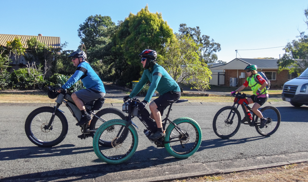
We started in Withcott, at the bottom of the range.

When you start a ride “at the bottom of the range”, there’s only one way to go.
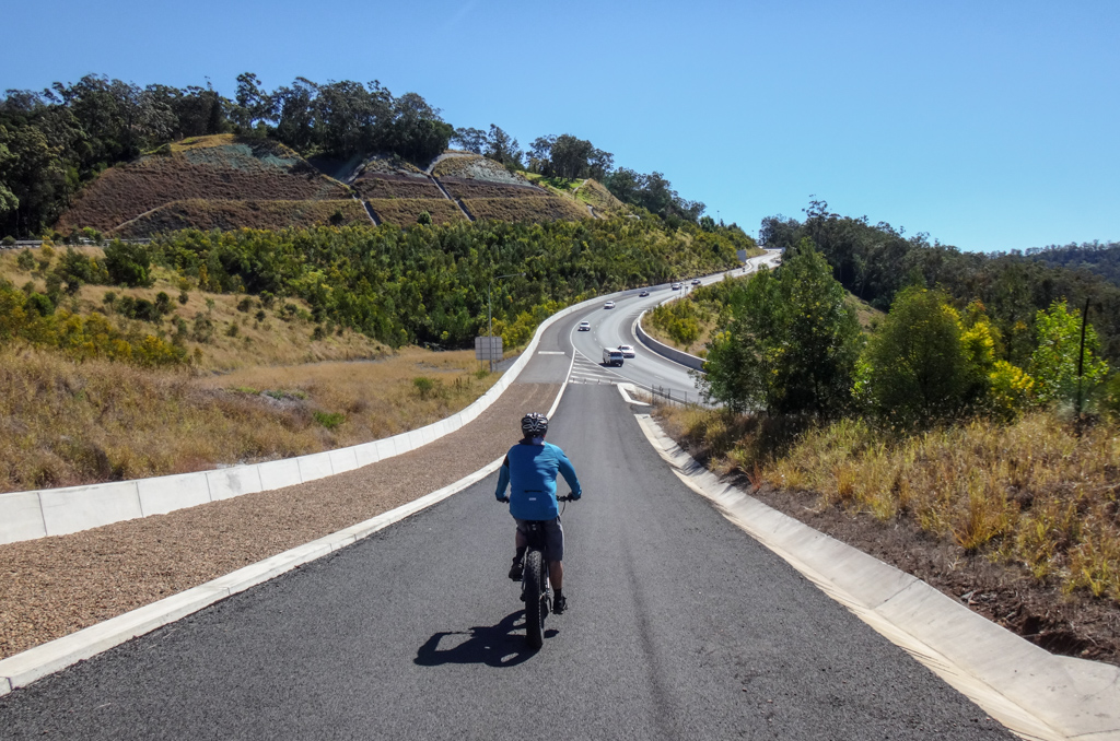
We slowly mashed the pedals as we climbed up Tabletop Drive.

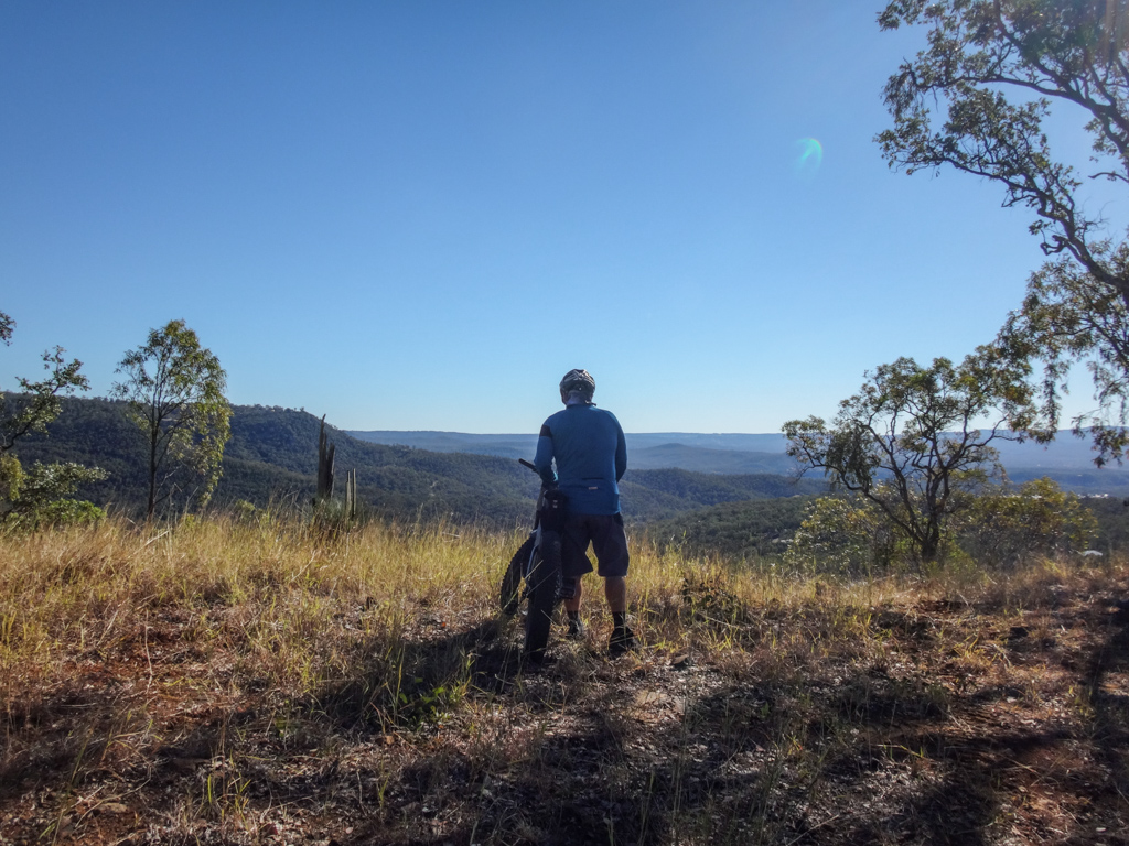
At the top of the paved road we enjoyed our first clear view of Tabletop with its flat head. I pondered how close we could get our bikes, and where the walking track was.

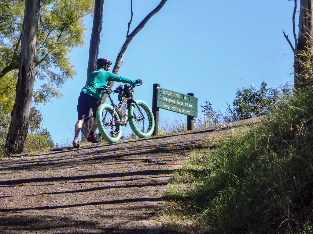
We followed a steep rough track up the hill through waist-high grass towards Toowoomba.

In some places the track was too rough to ride, so we pushed the bikes over fallen logs and through thick scrub.

In some places, the track was clear, but too steep to ride. We had to push up a few steep sections.
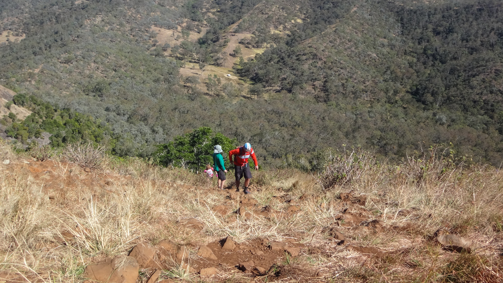
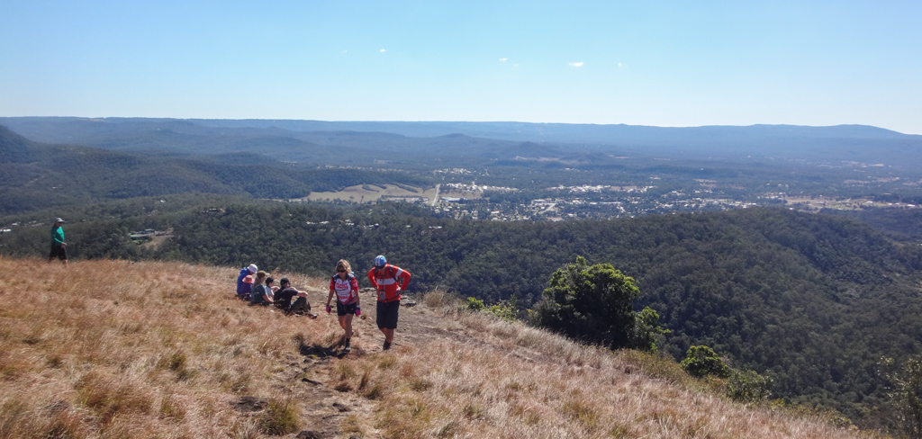
There’s a great little lookout half-way up which has some impressive views of the Lockyer Valley. It was the perfect spot to catch our breath…

…before continuing upwards.

Eventually the rough track opened up into wide paddocks, and we found ourselves beneath Picnic Point.

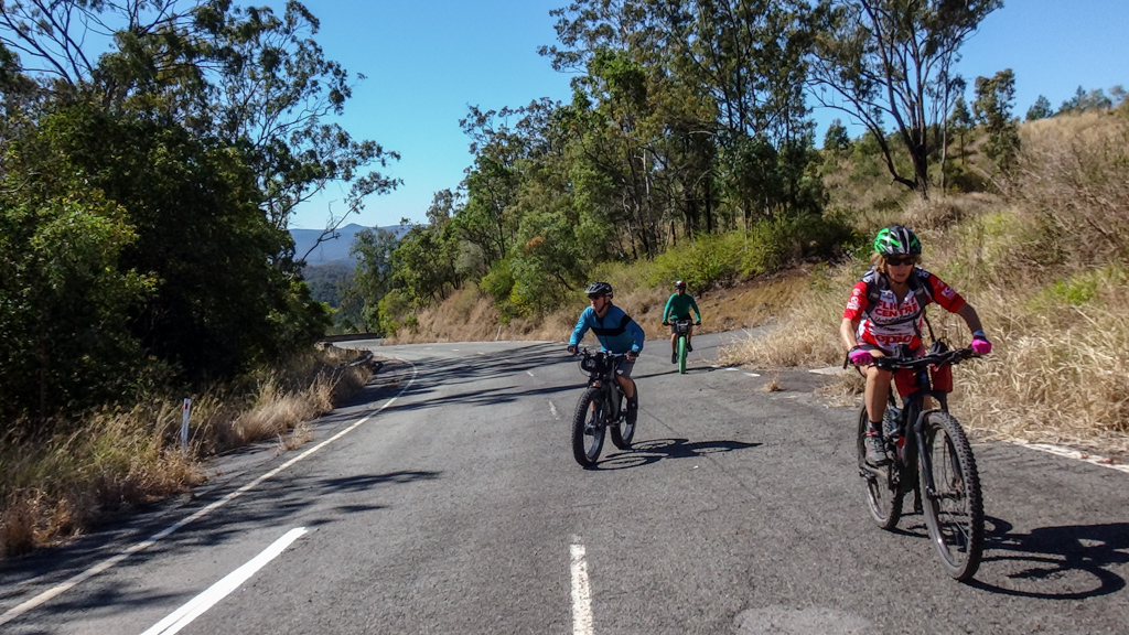
From here we hooked around to the east and followed the road to the Tabletop car park, passing a bunch of happy hikers along the way.

We parked the bikes at the Tabletop car park and continued the climb on foot.

“Do you think we could have dragged our bikes up here?”
A nervous giggle, then inevitably… “nah, probably not”.

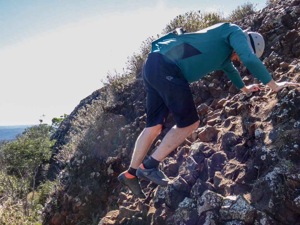
It’s a bumpy track.

We tramped over large sharp rocks as we continued upwards.
The track was steepest just before the top.
Thankfully the rocks were all stable as we scrambled the last few metres to the top.

We enjoyed a 360 degree panorama at the top…

We could see to the horizon in every direction we turned.
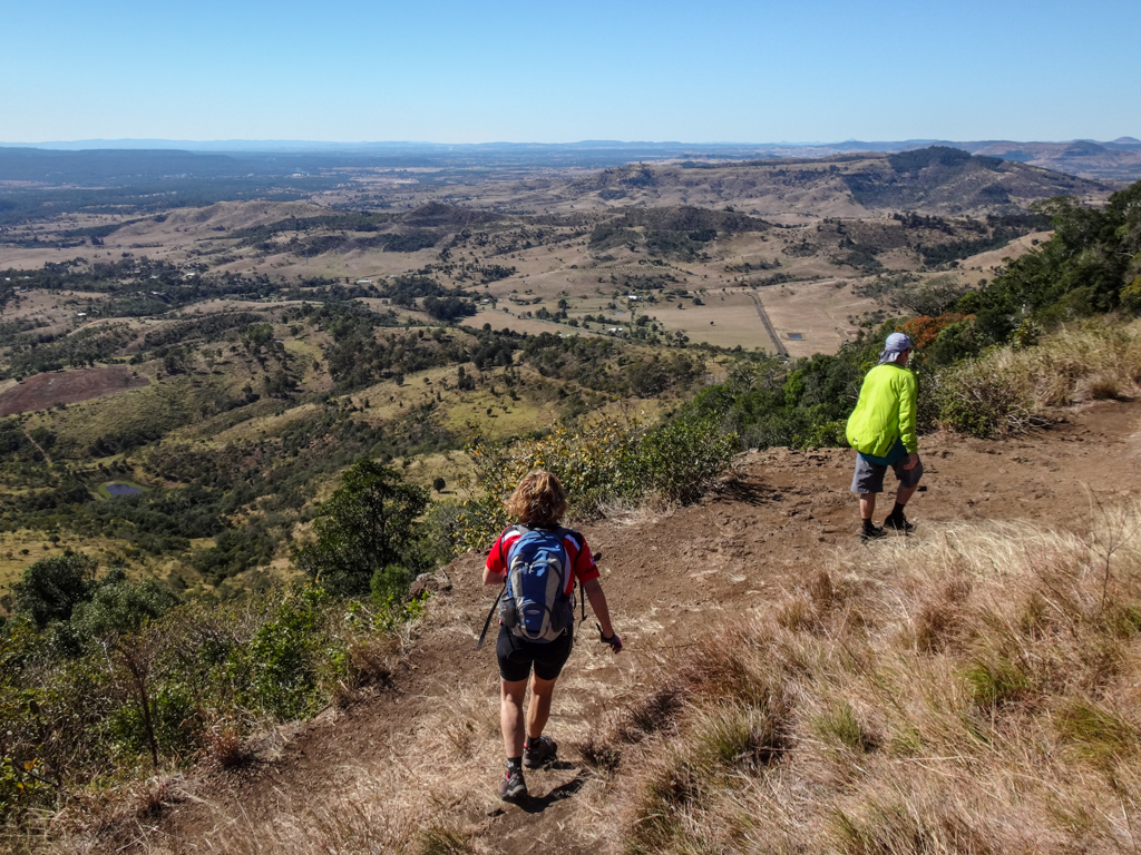
There’s a track which follows the outside of the flat “top” of the mountain all the way round. We followed this track.
This mountain was called “One Tree Hill” by early European settlers in the Lockyer Valley. Multuggerah, a Jagera warrior, lived in this area in the 1840’s, and escorted Lieutenant Owen Gorman to the top of this hill while Gorman was looking for a way up the range to the Darling Downs.
Multuggerah’s people called this hill “Gerelgerel”.
He eventually led the Jagera in a resistance against European encroachment on their land, including a famous skirmish on this mountain top known as “The Battle of One Tree Hill” where the Jagera people defended the place with boulders, rocks and spears against a group of armed soldiers.

No gunshots today.
The echoes from the sorry conflicts of centuries past have grown silent.
We enjoyed the peace as we ate a quick snack and soaked up the views.

I’m grateful we get to visit places like this.
We scrambled back down the hill.

These slopes seemed a lot easier on the way up than on the way back down. I found it easier to reverse down slowly than to descend front-first.

I was grateful there were no angry warriors above hurling boulders at me.

Back on the bikes, we followed the “Bridle Trail” from the bottom of South Street, under Picnic Point, towards the Highway.

Behind the busy highway we could just make out Tabletop, but our immediate concern was avoiding traffic coming up the range…
… then traffic coming down the range.
Once we crossed the highway we followed the old disused highway for few hundred metres up the hill.

The Bridle Trail continued northwards away from the highway, along the escarpment.


It undulated for a few kilometres with one or two steep climbs.

The final climb up to Prince Henry Drive was hard work. Some people I know have almost done it. We just got off and pushed…
…and pushed some more.

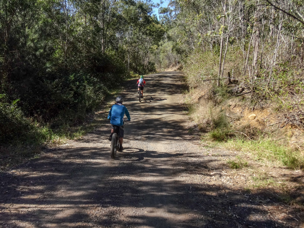
On the other side of the road we rolled into Jubilee Park and some wonderful single tracks which we were able to follow all the way down the range.

They had great names, like “Defibrillator”, “Easy Rider”, “Hyperlink”… and they just kept going.

Halfway down we met up with Brett Cotter – the man who co-ordinates all the wonderful trail maintenance on behalf of Toowoomba Mountain Bike Club.
Brett gave us some advice about which tracks to ride down the remainder of the range to the bottom.
“Preferably no black diamond stuff” I sheepishly suggested.

Before riding off back up the hill, Brett pointed us towards some more strangely named trails called “Dirty Granny”, “Turkey” and “Centrelink”.
How do you work out such funny names, Brett?

We snaked down “Dirty Granny” and “Centrelink” for what seemed like ages…


All the tracks were lovingly sign-posted. It was impossible to get lost.

But it was impossible to get good photos while bouncing down the hill frantically 🙂
At the bottom of a wonderful single track descent, we emerged onto Amos Road and started the last leg of our ride back into Withcott.

Total climbing: 1646 m
Average temperature: 19.9
Total time: 04:54:28
More data
I was surprised to discover we had barely done thirty kilometres in the five hours we’d been gone.
But during that time we had climbed over 1,250 metres in vertical ascent and I burned about 2,500 kcal.
I’m glad we did this in winter; it would be quite challenging in the warmer months. Now I know why my mountain biking mates from Toowoomba are such tough riders – the big hills harden them up.
I’ll rate this one 8.5 out of 10 on the tough-o-meter.
This is a perfect winter adventure. Climb up Tabletop early in the day, then enjoy an exhilarating snaking roll down the mountain at the end.
Thanks Darb, Kaye and Adam for a fun day out.
And thanks to Brett and the wonderful people from Toowoomba Mountain Bike Club for letting us ride your amazing trails.


Hi Niel, was wondering if we could use your description and photos of the trail up from Tabletop Road to Tabletop Mountain. You were using Surveyor Roberts’ 1859 Bypass Road to skip Black Pinch etc before rejoining Surveyor Raunsley’s 1853 Road.
G’day Peter
Thanks for the info.
Feel free to use the photos and description. If possible, please give attribution as per this article.
Regards
Neil