Mount Glorious

Hammermeister Road
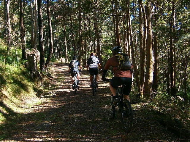
My friend David told me he and a few mates were interested in exploring D’Aguilar National Park. So I jumped at the opportunity to organize a social ride along some of my favourite tracks there today.
Goat Track
As with most expeditions in D’Aguilar NP, this one started with a short climb up the Goat Track which affords great views out to Moreton Bay, but you’ve got to work for it as you climb 400m in just over 3km.
Hammermeister Road
Rather than follow the bitumen at the top, we elected to ride up Hammermeister Road – a steep dirt road to the west of Mount Nebo. The road is named after Lou Hammermeister who started working in the timber industry at Mount Nebo during the Second World War and continued there for almost twenty years.

According to the Mt Nebo local newspaper “Mountain News“, Lou lived at Mount Nebo for over 60 years. He blazed any of the roads and fire trails in the area using his dozer. He also used his dozer to help build an Oval and Tennis Court at the Mt Nebo School. Lou started as a timber cutter, moving to Main Roads when logging at Nebo ceased in the 1960’s. As someone who regularly rides at Mount Nebo (including Hammermeister Road), I am grateful for Lou’s legacy.

Hammermeister Road
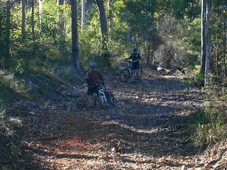
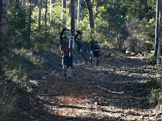
A lot of my friends enjoyed Lou’s legacy today too 🙂

Dundas RoadSixty-niner
From there it’s a short jump to Dundas Road behind the transfer station at Mount Nebo. This is where the long descent to England Creek begins. A few of the riders, including Jeff (pictured) took the opportunity to drop some of the pressure in their tyres to get a bit more grip on the dusty track surface. It was then I realized Jeff was riding a hybrid bike. It had a 29 inch front wheel and a 26 inch rear wheel. Bikes with 29 inch wheels are affectionately called “Twenty niners”. But when you’ve got “one of each” on your bike, the collogual term for the bike is a “Sixty-niner”. Jeff’s bike is even stranger. The front fork only has one staunchion on the left-hand side. So this is the only “Lefty Sixty-niner” that I’ve ever seen.
Goodes Road
From Dundas Road we rode into Goodes Road and enjoyed the quick drop down the mountain. It’s difficult to enjoy the spectacular views while riding so fast, but I think we managed. One of the “surprises” on Goodes Road is a gate across a steep section of road half-way down, which can sometimes cause riders to skid as they grab the brakes to avoid hitting the gate.
Fixing a punctureFixing a puncture
Unfortunately, Jeff got a puncture during the descent. This was when I discovered another surprise about “lefty” forks. You don’t need to remove the front wheel to change the inner tube. Since there’s only one staunchion, you can remove the tube while the wheel is attached. Amazing stuff.
England Creek
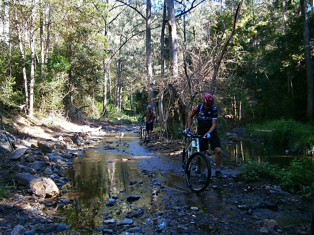
After fixing the puncture, we enjoyed the final sketchy descent down to England Creek and splashed through the creek crossing before having a break.
Joyners Ridge Road
It’s worthwhile having a break at England Creek because it takes about 90 minutes to ride from there up to the top of the hill on Joyners Ridge Road. It’s not steep (as mountain bike hills go) but it is still a long climb.
Becca - Joyners Ridge Road RainforestI've seen the light
The highlight of riding up Joyners Ridge Road is reaching the Rainforest at the top. It’s a lush, cool, green reminder that the climb is over. I think we all heaved a sigh of relief once we reached the top.
We did it!

All up, this ride was about 35km with about 1,300m of vertical ascent. It took us 5 hours including breaks and repairs (we had a long lunch at the Mt Glorious Cafe), and I burned about 3,000kcal. Wtih todays perfect cool spring weather, I rate this one 7.5 out of 10 on the tough-o-meter. Add an extra point in summer or wet weather.

Total distance: 36.03 km
Total climbing: 1338 m
Average temperature: NAN
Total time: 05:01:22
Download file: activity_220406013.gpx
More data

Adare

Adare Homestead
Adare Homestead is a specatuclar rural property which has been owned by the Pinnell family for three generations, and is several kilometres north of Gatton in Queensland’s Lockyer Valley.

The traditional owners of this area are the Kitabul Aboriginal people.

European Explorer, Allan Cunningham first encountered the Kitabul people in 1829 while on an expedition from Ipswich to survey the area. Apparently he was impressed with the strength, and intimidating physical condition of the Kitabul.

A squatter by the name of J.P.Robinson was the first European settler to move to the area, taking up a license for 150,000 acres on what was then called “Laidley’s Plain”.

Adare Homestead
The Adare Homestead was first established towards the end of the nineteenth century. The grand home was moved there from its original location near lake Clarendon. The original home included seven marble fireplaces and was situated near to the old Cobb and Co route from Ipswich to Toowoomba. In fact you can still see the circular driveway which was built to allow the horse drawn carriages to turn around outside the homestead.


These days, Adare Homestead is better known for Mountainbike Racing. John Pinnell and the folks from The Riders Club at Adare have lovingly built almost 7km of single track around the property which is a pleasure (and a challenge) to ride on.

John very kindly gave his permission for Tony and I to ride there today as part of our larger loop through Lockyer State Forest. I’ve ridden in Lockyer State Forest before, and loved it. So today I wanted to show a friend why I think it’s such a special place.

Redbank Creek
The trail through the forest up to the summit is a lot of fun with nine creek crossings (you WILL get your feet weet so bring a spare pair of socks), and a tough 5km climb which rises from about 200m above sea level to over 500m above sea level.

Lockyer National Park Summit
The blue skies and clear spring air today meant that we could enjoy some breathtaking views at the top. I think Tony and I both were a bit intimidated by the steep drop-off from this point to the valley below.

Wallers Road "Drop"
At the top of the climb, we had two choices: take the gentle 4wd trail down, or take a steep gnarly “short cut” down. We pondered over our decision for about a millisecond before deciding that “steep and gnarly” beats “gentle” every time.

Wallers Road
It’s exhillarating to ride down steep trails. Wallers Road was very rutted in parts, so it was important to chose the right line to make sure we didn’t end up at the bottom of a ditch.

Wallers Road
It’s a 9km descent down Wallers Road. The final descent starts out steep and rocky…

Darb the Daredevil
It gets steeper and rockier…

Wallers Road
…before finally turning into something resembling a fun-park joy ride. Weeeeeee……… 🙂

Good News for MTB'ers
Wallers Road
The sign at the bottom said it all for me. It may look like a warning sign, but it’s actually advertising a fun trail for daredevil mountain bikers.

Wallers Road

All up this ride was 38km long. We climbed about 900m and I burned about 2,500 kcal over two and a half hours.

With todays perfect cool weather, I’m rating this one 7 out of 10 on the tough-o-meter. Stronger riders will be able to ride it all. If you’re unsure, you should walk the steeper descents.

Just a reminder: Adare Homestead is private property. That means you can’t go there unless you first contact the owners and get their permission. John Pinnell can be contacted on 0424 057 578.

Total distance: 37.54 km
Total climbing: 997 m
Average temperature: NAN
Total time: 03:09:46
Download file: activity_217287784.gpx
More data

Woodford Adventure

"Riding" through the swamp
I was stunned when 32 people turned up for our group Mountain Biking ride from Beerburrum, through the forests of the Glasshouse Mountains, to Woodford and back. This is the largest social ride that I’ve been a part of, and I was amazed how smoothly it went, despite several crashes and a few equipment failures.

This ride was a combined effort between the online Mountain Biking community at MTBDirt.com.au and the Bushrangers Mountain Biking Club from the Sunshine Coast. Because there were so many people on the ride, I took a lot of photos, and have included a lot of thumbnails in this post to make it easier for anyone who was on the ride to take copies of any photos they want.

Adrian
Off We GoOff We GoDerekOff We Go

We started from Matthew Flinders Rest Area at Beerburrum. This is the site where, in 1799, the English explorer Matthew Flinders camped for the night before climbing Mount Beerburrum. He had originally planned to climb the taller (and steeper) Mount Tibrogargan, but found the sheer cliffs on the eastern face too intimidating, so opted for the easier scramble up Mount Beerburrum instead. Every year in July the local school celebrates the event with a commemorative climb up the hill to re-enact Flinders’ efforts.

Hill Climbing Madness
Hill Climbing MadnessHill Climbing MadnessHill Climbing Madness"I Think I Can"
But we engaged in a dfifferent sort of “Mountain Climbing” on our ride. The track behind the Glasshouse Mountains lookout is particularly steep. Everyone attempted to ride up it, but everyone (except one) couldn’t quite make it over one nasty little hump. Matthew Flinders would have been proud 🙂

Glasshouse Mountains Lookout
Glasshouse Mountains LookoutGlasshouse Mountains LookoutGlasshouse Mountains Lookout
After a final steep grind, we eventually made it to the lookout where we enjoyed the panorama and a quick rest.

Hennessey Hil
Hennessey HilHennessey HilHennessey HilHennessey Hil
One of the best things about going UP a hill is the being able to go DOWN it afterwards. We had a ball riding the Hennessey Hill downhill track. It’s a purpose-built track for riding downhill really quickly. There are enough jumps, banked corners and rock gardens to keep even the gnarliest downhiller happy. More importantly, each challenging section has a “B-Line” to allow less skilled riders to go around the features that they don’t want to ride.

Follow Me!
Follow Me!Follow Me!Follow Me!Follow Me!
Follow Me!Follow Me!
There’s a maze-like network of tracks in this part of the forest. We decided to try out some single-tracks instead of following the dirt roads. This meant everyone had to ride single-file, which caused a bit of a traffic-jam whenever we encountered obstacle like fallen trees.

Another Hill
"Mind the Gap"
"Mind the Gap""Mind the Gap""Mind the Gap""Mind the Gap"

After the fun of Hennessey Hill, we thought we’d do it all over again with another hill… A little bit of hard work to get to the top, then another exhillarating flight down a steep and bumpy track while trying to avoid the deep ruts.

Trail Through the Forest
Trail Through the ForestTrail Through the ForestTrail Through the ForestTrail Through the Forest
Trail Through the ForestTrail Through the Forest

When given a choice between dirt roads and single-tracks, most mountain bikers will chose single-tracks. The quiet trails make it easier to enjoy the surroundings without having to worry about Four-Wheel-Drives and motor bikes whizzing past. So where possible, our route kept to the quieter tracks through the forest.

Eric The Invincible
Refuelling
Simon"This is serious"
We were all glad to arrive at Woodford for a rest and a bite to eat. Because there were so many of us, we split up and ate at different cafes to keep the queues short. Eric gave us a demonstration of hard-core relaxation 🙂

"Riding" through the swamp
"Riding" through the swamp"Riding" through the swamp"Riding" through the swamp"Riding" through the swamp
"Riding" through the swamp"Riding" through the swamp
What cross-country adventure would be complete without a swamp?

The north-east track out of Woodford took us through some beautiful secluded woodland. Unfortunately, parts of the track were quite muddy, and we had to tip-toe around the edges to avoid getting wet.

"I could have bunny-hopped that log"
Eric Directs Traffic"I could have bunny-hopped that log""I could have bunny-hopped that log"Eric Directs Traffic
Eric Directs TrafficEric Directs TrafficEric Directs Traffic

At one point, we had to cart the bikes over a huge fallen log followed by a barbed wire fence. I’m really grafetul to Eric who helped keep people moving in the right direction. One of the things I love about mountain biking in a group is how everyone works together and helps each other out.

Crash Bangers 1/4
At the top of “Trig Hill” we encountered another white-knuckle descent which I like to call “The Giant Drop”. It’s steep, sandy, dusty and bumpy.

As I wached Neil (“Bangers”) ride down it, I was reminded of Banjo Patterson’s description of another rider on another hill in “The Man From Snowy River”:

But the man from Snowy River let the pony have his head,
And he swung his stockwhip round and gave a cheer,
And he raced him down the mountain like a torrent down its bed,
While the others stood and watched in very fear.

Crash Bangers 2/4Crash Bangers 3/4
Crash Bangers 4/4
Unfortunately, Neil was more “Bangers” than “Man from Snowy River” and had a bit of a crash on the way down. Nevertheless, “It was grand to see that mountain horseman ride.” 🙂

"I Think I'll Walk"Dartedevil Darb
Linda: "Will I, won't I?"The Giant DropDown We GoDerek
Thankfully, everyone made it down the hill in one piece – some walked, some rode (amazingly well).

Downhill MayhemPaul
"I Survived The Giant Drop"Tony

I’m definitely going back to Trig Hill and “The Giant Drop” again 🙂

Suzanne
Three AmigosThe Flying PiemanEric

Mount Beerwah
SuzannePaul
From there we made our way to the picnic area below the northern face of Mount Beerwah. The largest of the Glasshouse Mountains loomed over us for most of this part of the trip.

LindaAaronJason
PaulSimonPaul
"We Like to Ride"
Everyone got to the end of the ride safely – tired but happy.

Terry
One or two people had a crash. I tried my first aid skills on Terry. Unfortunately I couldn’t unroll the “Micropore” tape so resorted to taping him up with duct tape. Ah the myriad uses of duct tape – one of the reasons I always carry a roll in my pack.

Fixing a Hanger
Geoff broke the hanger on his bike. That’s the thing that connects the gear-changing mechanism to the frame of the bike. When it breaks, the chain can no longer go round, and you can’t change gears. Normally the solution is to break the chain, shorten it, remove the hanger, and complete the ride with no gears (not much fun). David showed us an ingenious bit of kit he brings on his rides – a temporary hanger you can screw into the skewer on your back wheel. The end result is gears that still work, and an enjoyable ride home.
GeoffTony
Yet Another Hill
Thanks to everyone who came on the ride today. I loved being able to share this adventure with so many great people.

63km, 3,500kcal, 1,200m of ascent, six and a half hours of riding including breaks. 32 people started this ride, 32 people finished. If you’re looking for a fun adventure, grab a few friends and give this one a try!

Total distance: 64.02 km
Total climbing: 1202 m
Average temperature: NAN
Total time: 06:25:24
Download file: activity_214551656.gpx
More data

What Goes Up…

Riding to the Top
Next week about a dozen of us are taking part in a group ride through the Glasshouse Mountains between Beerburrum and Woodford. I’ve been exploring this area recently, so Eric, Tony and I spent today checking the tracks in advance out to make sure everything goes as planned.

Nailing HillsNailing Hills
Not far from our starting point at Beerburrum we encountered our first little climb of the day up a rough and rutted track on the steep hills behind the lookout. It’s a challenging ride, but Eric and Tony made it look easy. None of us made it all the way to the top without pushing, but I hope at least one person next week can show us how it’s done 🙂

Hennessey Hill
It’s not far from the Lookout to the Hennessey Hill downhill mountainbiking track. This purpose-built black-diamond track has everything for white-knuckle downhill riding – jumps, berms, rock gardens. True to form – I took it pretty slowly. I’m not really a downhill daredevil, but I do occasionally ride with some daredevils, so I’ll include a few action shots in next week’s update. Stay tuned!

The ride out to Woodford took us just over a couple of hours. After refuelling at one of the excellent cafe’s there, we made our way back into the western part of the state forest.
Enjoying the View
It’s not really an official “Lookout” but from this high vantage point west of Mount Beerwah, you can see for miles.

Are we going down that?
It’s also a long way down. In this photo, Tony is standing at the top of what felt like a sheer drop back down into the forest. We decided we’d give it a try, and survived.

Splash
The track eventually spat us out at the bottom of the hill, with smiles on our faces. When everything goes well, gravity is a wonderful thing.

Organ Pipes
We rode back under the northern face of Mount Beerwah, and stopped for a few minutes to admire “The Organ Pipes” – a spectacular rock formation near the summit of the mountain.

What goes up...What goes up...
The final descent for the day was down the Collies Road track. It’s a bit like a roller-coaster with plenty of water bars to launch from.

We rode 63km in five and a half hours including breaks. We climbed 1,100m of vertical ascent. I burned about 3,500 kcal. With the perfect weather we had today, this ride rates 7 out of 10 on the tough-o-meter. You’ll have to walk one or two bits if you’re mortal, but you’ll come home happy!

Total distance: 63.55 km
Total climbing: 1262 m
Average temperature: NAN
Total time: 05:39:19
Download file: activity_211792899.gpx
More data

Beerburrum to Woodford

Bora Ring
Today’s plan was to ride from Beerburrum in the Glasshouse Mountains to Woodford and back, a round trip of about 70km along mostly dirt tracks and gravel roads.
Bora Ring
My first stop was an old Bora Ring on Johnston Road. Boras (or “durns”) were important places used by Aborigines for business, dancing and ceremonies. They consisted of a large circular ring of earth connected to another smaller ring situated between 100 and 400 metres away. Only one ring remains of the Beerburrum Bora Grounds. It’s on the edge of a pineapple field, so presumably the second ring was demolished when the farm was built.
"Silent Now"Bora Ring
I’ve been lucky enough to see a few Bora rings, and am always overwhelmed by strong emotions when I imagine what it must have been like to witness such a colorful and powerrful event so long ago. Perhaps somewhere the echos of those songs and dances are still ringing.
TibrogarganBeerwah, Coonowrin, Ngungun
And with the imposing rocky visages of the mystical Glasshouse Mountains staring at me from across farm paddocks or from between gum trees, I made my way up to the lookout so I could enjoy the view.
Tibrogargan and Tiberoowuccum
I wasn’t disappointed. The air was so clear today I could see all the way past brooding Tibrogargan to the sand dunes on Moreton Island.

I’ve ridden to the lookout many times, and would normally head north at this point towards Beerwah. But today I kept going west through state forest and pine plantations towards Woodford.

"Woodfordia"
Woodford is famous for its annual folk festival at “Woodfordia”. It’s a colorful celebration of song, dance and culture that’s normally held in the Christmas – New Year period.
Archer Memorial
The first European settlers in the area were David, Thomas and John Archer (the Archer Brothers) who built Durundur Station in 1841 near the upper reaches of the Stanley River. As a mountain biker, I am grateful to them because they established the “Old North Road” between their farm at Durundur and Brisbane. I have a lot of fun riding my bike along some of the remnants of that road at Dunlop Lane and Smiths Road in Kurwongbah where it’s still a dirt track.
Woodford
Today the bustling town of Woodford was an ideal spot to stop for a bite to eat as the half-way point of my journey.
Bridge, Stanley RiverStanley River
As I rode north out of Woodford, I thought I’d stop and take a quick look at the Stanley River. It starts near Maleny up in the Blackall Range, and flows through Woodford before eventually joining the Brisbane River. Before the Archers built the Old North Road, the only way to Woodford from Brisbane was in a circuitous route west following the Brisbane River and then following the Stanley River north east.
Lace Monitor
This two metre long Goanna scurried across the track in front of me while I was riding. “Aren’t you gorgeous!!!” I yelled out as I stopped the bike and got the camera out. Unfortunately I think I must have scared him because as I tried to get closer to take the photo, he just climbed higher up the tree.
Orchard
The road I was following, Dunning Lane, came to an abrupt end near an orchard. My GPS told me to go straight ahead (into a thick clump of trees). I decided to disobey it, and decided to ride through the orchard instead. This took me a couple of km off course, but I was able to correct it by making my way towards a powerline easement on the other side of the orchard. Hopefully someone will be able to point out where I went wrong.
Mount Beerwah
The last part of the trip was around the back of Mount Beerwah under what locals call “The Organ Pipes”. The mountain looks impressive up close.

I got lost a second time in Luttons State Forest – the small forest between Mount Beerwah and Old Gympie Road. There are a number of really steep descents there, and I was unsure of which one to take. The track I eventually rode down was so steep and had such large drop-offs that I had to walk the bike down the hill in some spots. For the rest, I just hung my backside out as far over the rear wheel as I could and hoped for the best. It’s amazing how stable the bike feels when you do that 🙂

Coonowrin
On the way back to the car I stopped for one last look at Coonowrin. For the first time he looked almost life-like – a rocky giant looking down at me over his right shoulder. It made me wonder whether the dreamtime legends aren’t just legends and perhaps these mystical mountains are titans made of stone.

I rode 71km in four and a half hours (excluding breaks) with just over 1,000m of ascent, and burned about 3,500kcal.

This one rates 7 out of 10 on the tough-o-meter. There are a few steep-ish hills, but nothing that would prove too difficulte for the average rider. Just take it easy going downhill in Luttons forest!

Total distance: 72.69 km
Total climbing: 1133 m
Average temperature: NAN
Total time: 06:00:49
Download file: activity_206315214.gpx
More data

Mount Glorious

Mt Glorious Cafe
On a glorious winters day like today, the destination picked itself: Mount Glorious. It’s days like today that I understand why it has that name.

Paul, Wayne and I started the ride from the bottom of the Goat Track and rode up to the trail head on Dundas Road. From there we enjoyed the long steep knuckle whitening descent to England Creek before beginning the long climb up Joyners Ridge Road.
Joyners Ridge Road
I’ve often wondered how the road came to be named “Joyners Ridge Road”. I asked my friend, local historian Leith Barter, who told me that in the 1870’s Henry Plantaginet Somerset (what a name!) made a three day journey on horseback from Cressbrook Station in the Brisbane Valley via Kilcoy and Caboolture to get to the property of William Charles Joyner at Samsonvale. Somerset wanted to arrange the purchase cattle from Joyner. Somerset didn’t want to go back via such a circuitous route and William Joyner showed him a ridge that might be a useful starting point for an ascent of the D’Aguilar Range.

Somerset became the first European to cross the range on horseback, but had to travel further north than he planned (probably near Mount Glorious) before he was able to find his way through a thick belt of rainforest.

It’s possible that “Joyners Ridge” is named after this historic route although historians point out that Joyner himself had not climbed the range, so he wouldn’t have known about the terrain on the western side.

The ironic thing is what took Somerset 3 days can now be done on a mountain bike in about 4 or 5 hours. Isn’t that amazing?
Joyners Ridge RoadJoyners Ridge Road

Our climb up Joyners Ridge Road took us about 70 minutes. It’s hard work, but the gradient is moderate enough so that most reasonably fit mountain bikers can do the climb if you keep a reasonable pace and don’t push yourself too hard.
Mt Glorious Cafe
Mt Glorious CafeMt Glorious Cafe
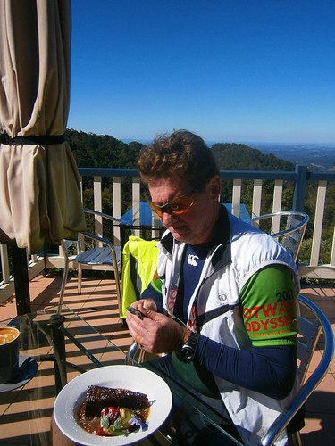
By the time we got to the top we were pretty hungry, so we stopped in at the Mt Glorious Cafe for a bite to eat and a chance to enjoy the view.

From there it was a very fast roll down the mountain back to our cars at the bottom of the Goat Track.

Overall this ride was 35km, with 1390m of ascent and 3200 kcal. With todays cool weather and the social pace, this one rates 7.5 out of 10 on the tough-o-meter.

Total distance: 36.2 km
Total climbing: 1421 m
Average temperature: NAN
Total time: 04:09:56
Download file: activity_205649390.gpx
More data

Taylors Break

Branch Creek
I’ve ridden Taylors Break in D’Aguilar National Park a couple of times. My friend Rob kindly organized another ride here, so I jumped at the chance to check it out again.

PaulAaronRob
I met with Paul, Aaron and Rob at the bottom of the Goat Track, and we rode up to the start of this fun descent near the corner Hammermeister Road and Forestry Road at Mount Nebo.
Taylors Break
The track starts with a gentle gradient near Mount Nebo. A bulldozer has cleared it recently, so the ride near the top of the hill is quite pleasant.

The steepness increases as you get further down the mountain…
Taylors BreakTaylors Break
Towards the bottom, the gradient is very intense, and there are lots of loose rocks, so it’s advisable to walk it if you’re not 100% confident. Rob showed us how you can “get air” even when you’re walking the bike 🙂

Taylors Break
You can ride the descent if you keep your wits about you, and get your weight as far back on the bike as possible.

Branch Creek
Branch Creek
The prettiest part of the ride is Branch Creek at the bottom of the descent. The shaded pools would make a great swimming spot in summer – but today we were content to enjoy the view and take pictures.


We also decided to have a bit of a break because this point was the start of the long climb up Cabbage Tree Range Road – a one hour uphill ride which rises about 500 metres in 7km.

This ride was 27km long, and we completed it in about three and a half hours. We did about 1,200m of vertical ascent and I burned about 2,500 kcal. Despite the relatively short distance, it’s still a challenging and enjoyable ride. I’m rating 7.5 out of 10 on the tough-o-meter. We enjoyed it more because it was a cool day, we kept an easy pace, and stopped lots.

If you do this ride, take it easy at the bottom of Taylors Break. It’s very steep and loose. If you’re unsure of a section, play it safe and walk it.

Total distance: 27.33 km
Total climbing: 1192 m
Average temperature: NAN
Total time: 03:26:58
Download file: activity_203746489.gpx
More data

From the Mountains to the Sea

Camp Mountain Lookout
Brisbane is a wonderful city. I got to see a lot of it today in a nice big loop which covered the mountainous D’Aguilar National Park & Brisbabe Forest Park in the West, the CBD, and the Wetlands in the East. I took my time, which was enjoyable until the sun went down, and I realized I’d have to finish the last bit of my journey with lights.
"Mini Van"Chilling
I started by exploring a few trails at Bunyaville that I don’t ride too much – “Zigzag”, “Minivan” and “Darkside”. They’ve got wierd names. Someone tells me there’s the rusting wreck of a Mini Van somewhere in there, but I didn’t see it. All I saw was lots of winding flowing tracks.

After that I took a few back streets to Samford Forest where I stopped for a quick snack.
"Estate Break" Samford Forest"Estate Break" Samford Forest
While I was relaxing, a couple of new faces showed up so I took their photos while they sped off down “Estate Break” – one of the steeper, more challenging fire trails in Samford Forest.
Three-Ways. Samford Forest
The “Three Ways” is a fun little intersection in the middle of Samford Forest with trails going off everywhere. The fun thing about it is this nice little dirt hill in the middle that you can ride over. You can’t do that at a bitumen three-ways 🙂

Camp Mountain Lookout
From there I rode over to Camp Mountain and did the tough short-climb to the summit. The climb is exhausting, which makes it easy to stop for a while at the top and enjoy the view.

Flinders Peak & Teviot Range
It took me about an hour to ride from there down (and up) Centre Road to South Boundary Road. It was fun to look to the mountains of the Teviot Range, including Flinders Peak and recall that I’d ridden there only a few weeks ago. At that time I managed to get a photo of Brisbane as I looked north. This time I grabbed a shot of Flinders Peak as I looked south.

Happy MTB'ers
While I was admiring the view, a few more happy Mountain Bikers road by. It must be something about riding a mountain bike in the bush. It just makes you smile! It happened several times in the forest today – unlike in the city and on the bike paths. It must be something in the air 🙂

Highwood Road
This time, when I got to the end of South Boundary Road, I followed “Goanna Trail” to the bottom, then climbed up Highwood Road. I have a love / hate relationship with this hill. I’ve climbed it several times, always after having ridden 50km through the national park, with tired legs. It’s a tough climb, especially with tired legs. But I’m always delighted when I make it to the top.

Bicentennial Bikeway, BrisbaneSouthbank, Brisbane
I then made the short ride from the top of Mount Coot-tha down “Powerful Owl” trail into the CBD and South Bank via the riverside Bicentennial Bikeway.

Brisbane City Cat.
I think I prefer riding along the southern bank of the river. There always seems to be a lot going on, and I enjoy the view of the city across the river. When I’ve ridden on the northern bank, I think I was too close to the city to enjoy the view.

Rock ClimbingRock Climbing
There was lots of activity by the river, including these rock climbers at the Kangaroo Point cliffs.

Pacific Dawn
On the way out of Brisbane along Kingsford Smith drive I was lucky enough to get a great view of P&O “Pacific Dawn” leaving port for a week in the Pacific. She blew her horn while I was watching, which sounded loud – even from over a kilometre away. In the past I’ve always felt envious watching a ship leaving port, wishing I was on board. This time I felt much happier riding my bike. If they’d stopped the ship and asked if I’d have liked to hop on for a cruise, I would have graciously declined.

I’m content to ride my bike in the bush.

Today’s ride was 110km and took me almost 8 hours excluding breaks. I climbed almost 2,000 metres of vertical ascent and burned 6,000 kcal (about 11 Big Macs). This one rates 8 out of 10 on the tough-o-meter.

Total distance: 110.3 km
Total climbing: 2088 m
Average temperature: NAN
Total time: 09:30:28
Download file: activity_201366034.gpx
More data