Conquering Mount Samson

A couple of months ago we tried to climb to the top of Mount Samson. Today we thought we’d try again!

Mount Samson was called “Buran” by the local Aborigines. In the Turrbal language it means “wind”. Unfortunately there was no wind up there today.

The aim was to ride our mountain bikes up to a flattish point at about 500m elevation, then hike the rest of the way to the 680m summit. Easier said than done. The road had been washed out in several places, covered in fallen rocks and logs. We climbed 430m in the first kilometre. With my head spinning and sweat dripping from me I was exhausted. Thankfully Derek gave me a bit of a push-along when I needed it, and we all managed to get the bikes up to the planned point.
Farm houses
View from Mount Samson
From this vantage point, the views over Lake Samsonvale out to Moreton Bay are spectacular.

At this point we met up with some hiking friends, and started the long slog through the lantana and up the mountain. Lantana is a horrible weed with stems that can grow thicker than your thumb. The leaves and stems cut at your skin and several times blocked out way entirely. We had to smash through it with our feet (we didn’t take a Machete).
Are we there yet?
Eventually we beat the lantana and took a breather before the final push up through the rocks and the rainforest to the top.

Grass Trees
Prayer Flags
Prayer Flags
Strangely the view from the summit isn’t panoramic. It’s covered with trees. But it’s still beautiful. Someone has erected some Tibetan Prayer Flags at the top. It took me a while to make the connection. Prayer Flags are usually flown high up in the Himalayas. But I suppose this is as high as you’re going to get around Brisbane, so it make sense to me.
Little House
We made it!
We made it!
You could see a few good views by peaking out through the trees, but for me the best bit about the summit was taking a well-earned rest with some really fun people. This started off, for me, as a harebrained scheme when I asked a few friends “Do you think we could ride bikes up Mount Samson”. The fantastic thing is that those friends were willing to try something difficult and silly with me – even the ones that weren’t able to ride. I’m really grateful to have friends like that.

What’s next???

If you’d like a sadistic look at the climbing-profile for this trip, here it is:

Total distance: 22.56 km
Total climbing: 1002 m
Average temperature: NAN
Total time: 06:08:37
Download file: activity_67763058.gpx
More data

Lacey’s Creek

Lacey's CreekLacey's Creek
I had a great ride along Lacey’s Creek this afternoon from Dayboro up into the hills towards the D’Aguilar National park.

Lots of undulating farmland, creek crossings, Hoop Pines, etc.

A really pleasant way to spend a couple of hours šŸ™‚

Total distance: 29.88 km
Total climbing: 454 m
Average temperature: NAN
Total time: 01:46:58
Download file: activity_66828316.gpx
More data

Lake Manchester

This was a huge ride, starting with a tough 5km climb at the start and a gruelling 7km climb towards the end. It was worth it for the tranquillity of being out in the bush exploring new places.
Cabbage Tree Creek
After climbing “The Goat Track” I took Lightline Road down to Lake Manchester. It’s descends steeply for about 8km, which is fun. The only problem is that what goes down must eventually come up! This is Cabbage Tree Creek which flows down from the D’Aguilar Range into Lake Manchester.
Prickly Pear
I rode back up to Mt Nebo via Cabbage Tree Range Road. I love hill climbs, but this one was hard work and just kept going for about 7km. About half way up I conked out and had a large Mars Bar to try and get going again. That’s when I spied this Prickly Pear clinging tenaciously to a rock.
Scarred Tree
Rainforest Eucalypt
Once back at the top of the range, I saw familiar looking markings on a huge Eucalyptus. I think they’re aboriginal scar marks – similar to what I saw at the Wights Mountain Bora Ring. This area is part of the traditional country of the Turrbal people and perhaps they made these marks sometime in the mid 19th century.

It was a great feeling to be back on top of the range again. The air was cooler, I knew the ride was mostly downhill from there, and the sound of the Bellbirds was magical. They really do sound like bells!

Total distance: 34.35 km
Total climbing: 1229 m
Average temperature: NAN
Total time: 04:38:23
Download file: activity_66637125.gpx
More data

One Mile Creek

There are two major creeks in our area with misleading names. One Mile Creek is about Seven miles long. Four Mile Creek is about Ten miles long. Both creeks have their source in the beautiful bushland of Clear Mountain. Here’s some pictures of my ride through Clear Mountain and over the upper reaches of One Mile Creek.

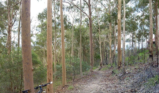
Clear Mountain - Centre Road
This is the trail head of one of my favourite rides through Clear Mountain. Starting at the top of the mountain near Old School Road, Centre Road winds steeply down the hill through the eucalypts to a few crossings over One Mile Creek.

There are lots of trees, lizards and no sounds except bird calls and wind through the leaves.

It’s a great place to ride, and I’m so glad most of it is a state forest reserve.

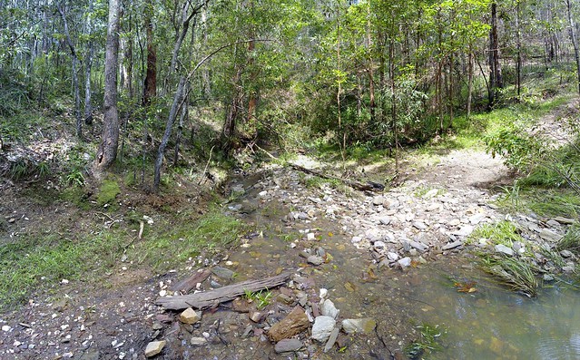
Clear Mountain - One Mile Creek
The crossings over One Mile Creek have created some steep banks which are challenging to cycle in and out of, but are always enjoyable.


View Larger Map