Beerburrum to Woodford

Bora Ring
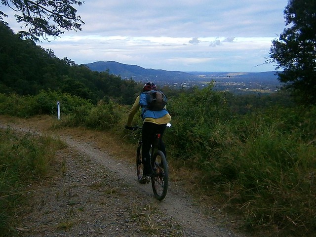
Today’s plan was to ride from Beerburrum in the Glasshouse Mountains to Woodford and back, a round trip of about 70km along mostly dirt tracks and gravel roads.
Bora Ring
My first stop was an old Bora Ring on Johnston Road. Boras (or “durns”) were important places used by Aborigines for business, dancing and ceremonies. They consisted of a large circular ring of earth connected to another smaller ring situated between 100 and 400 metres away. Only one ring remains of the Beerburrum Bora Grounds. It’s on the edge of a pineapple field, so presumably the second ring was demolished when the farm was built.
"Silent Now"Bora Ring
I’ve been lucky enough to see a few Bora rings, and am always overwhelmed by strong emotions when I imagine what it must have been like to witness such a colorful and powerrful event so long ago. Perhaps somewhere the echos of those songs and dances are still ringing.
TibrogarganBeerwah, Coonowrin, Ngungun
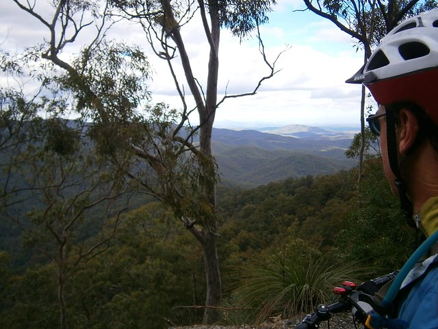
And with the imposing rocky visages of the mystical Glasshouse Mountains staring at me from across farm paddocks or from between gum trees, I made my way up to the lookout so I could enjoy the view.
Tibrogargan and Tiberoowuccum
I wasn’t disappointed. The air was so clear today I could see all the way past brooding Tibrogargan to the sand dunes on Moreton Island.

I’ve ridden to the lookout many times, and would normally head north at this point towards Beerwah. But today I kept going west through state forest and pine plantations towards Woodford.

"Woodfordia"
Woodford is famous for its annual folk festival at “Woodfordia”. It’s a colorful celebration of song, dance and culture that’s normally held in the Christmas – New Year period.
Archer Memorial
The first European settlers in the area were David, Thomas and John Archer (the Archer Brothers) who built Durundur Station in 1841 near the upper reaches of the Stanley River. As a mountain biker, I am grateful to them because they established the “Old North Road” between their farm at Durundur and Brisbane. I have a lot of fun riding my bike along some of the remnants of that road at Dunlop Lane and Smiths Road in Kurwongbah where it’s still a dirt track.
Woodford
Today the bustling town of Woodford was an ideal spot to stop for a bite to eat as the half-way point of my journey.
Bridge, Stanley RiverStanley River
As I rode north out of Woodford, I thought I’d stop and take a quick look at the Stanley River. It starts near Maleny up in the Blackall Range, and flows through Woodford before eventually joining the Brisbane River. Before the Archers built the Old North Road, the only way to Woodford from Brisbane was in a circuitous route west following the Brisbane River and then following the Stanley River north east.
Lace Monitor
This two metre long Goanna scurried across the track in front of me while I was riding. “Aren’t you gorgeous!!!” I yelled out as I stopped the bike and got the camera out. Unfortunately I think I must have scared him because as I tried to get closer to take the photo, he just climbed higher up the tree.
Orchard
The road I was following, Dunning Lane, came to an abrupt end near an orchard. My GPS told me to go straight ahead (into a thick clump of trees). I decided to disobey it, and decided to ride through the orchard instead. This took me a couple of km off course, but I was able to correct it by making my way towards a powerline easement on the other side of the orchard. Hopefully someone will be able to point out where I went wrong.
Mount Beerwah
The last part of the trip was around the back of Mount Beerwah under what locals call “The Organ Pipes”. The mountain looks impressive up close.

I got lost a second time in Luttons State Forest – the small forest between Mount Beerwah and Old Gympie Road. There are a number of really steep descents there, and I was unsure of which one to take. The track I eventually rode down was so steep and had such large drop-offs that I had to walk the bike down the hill in some spots. For the rest, I just hung my backside out as far over the rear wheel as I could and hoped for the best. It’s amazing how stable the bike feels when you do that 🙂

Coonowrin
On the way back to the car I stopped for one last look at Coonowrin. For the first time he looked almost life-like – a rocky giant looking down at me over his right shoulder. It made me wonder whether the dreamtime legends aren’t just legends and perhaps these mystical mountains are titans made of stone.

I rode 71km in four and a half hours (excluding breaks) with just over 1,000m of ascent, and burned about 3,500kcal.

This one rates 7 out of 10 on the tough-o-meter. There are a few steep-ish hills, but nothing that would prove too difficulte for the average rider. Just take it easy going downhill in Luttons forest!

Total distance: 72.69 km
Total climbing: 1133 m
Average temperature: NAN
Total time: 06:00:49
Download file: activity_206315214.gpx
More data
Mount Glorious

Mt Glorious Cafe
On a glorious winters day like today, the destination picked itself: Mount Glorious. It’s days like today that I understand why it has that name.

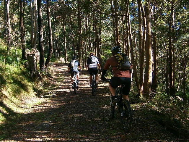
Paul, Wayne and I started the ride from the bottom of the Goat Track and rode up to the trail head on Dundas Road. From there we enjoyed the long steep knuckle whitening descent to England Creek before beginning the long climb up Joyners Ridge Road.
Joyners Ridge Road
I’ve often wondered how the road came to be named “Joyners Ridge Road”. I asked my friend, local historian Leith Barter, who told me that in the 1870’s Henry Plantaginet Somerset (what a name!) made a three day journey on horseback from Cressbrook Station in the Brisbane Valley via Kilcoy and Caboolture to get to the property of William Charles Joyner at Samsonvale. Somerset wanted to arrange the purchase cattle from Joyner. Somerset didn’t want to go back via such a circuitous route and William Joyner showed him a ridge that might be a useful starting point for an ascent of the D’Aguilar Range.

Somerset became the first European to cross the range on horseback, but had to travel further north than he planned (probably near Mount Glorious) before he was able to find his way through a thick belt of rainforest.

It’s possible that “Joyners Ridge” is named after this historic route although historians point out that Joyner himself had not climbed the range, so he wouldn’t have known about the terrain on the western side.

The ironic thing is what took Somerset 3 days can now be done on a mountain bike in about 4 or 5 hours. Isn’t that amazing?
Joyners Ridge RoadJoyners Ridge Road

Our climb up Joyners Ridge Road took us about 70 minutes. It’s hard work, but the gradient is moderate enough so that most reasonably fit mountain bikers can do the climb if you keep a reasonable pace and don’t push yourself too hard.
Mt Glorious Cafe
Mt Glorious CafeMt Glorious Cafe
By the time we got to the top we were pretty hungry, so we stopped in at the Mt Glorious Cafe for a bite to eat and a chance to enjoy the view.

From there it was a very fast roll down the mountain back to our cars at the bottom of the Goat Track.

Overall this ride was 35km, with 1390m of ascent and 3200 kcal. With todays cool weather and the social pace, this one rates 7.5 out of 10 on the tough-o-meter.

Total distance: 36.2 km
Total climbing: 1421 m
Average temperature: NAN
Total time: 04:09:56
Download file: activity_205649390.gpx
More data
Somerset Track

Somerset Lookout, Mount Mee
Here’s some photos of a recent hike along the Somerset Track, Mount Mee, that I did with my friend and business partner, Mark.
KookaburraWildflower, Somerset Track
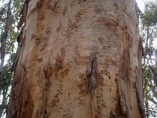
Somerset TrackScribbly Gum
The 5km walk to the lookout covers a variety of terrain including rainforests, hoop pine plantations and open eucalyptus forests.
Somerset Lookout
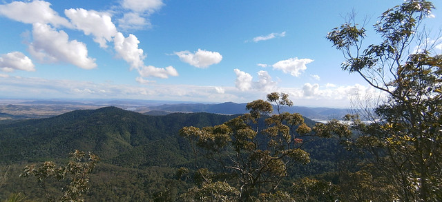
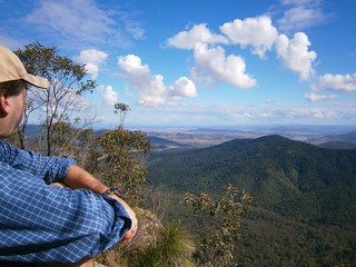
Somerset Lookout, Mount MeeSomerset Lookout, Mount Mee
The views west from the lookout are spectacular, and well worth the hike out.
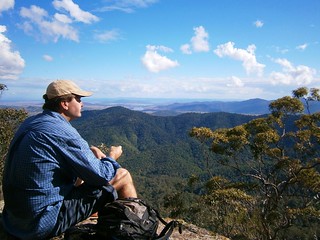
Somerset Lookout, Mount Mee
It’s an ideal spot to sit on the rock and have a bite to eat before walking back.
Somerset Track
We crossed a few creeks on the return leg. Some of them were crystal clear.

Sellin Road, Mount Mee
Brisbane CBDSellin Road, Mount Mee

On the drive home, we had a quick stop on Sellin Road to enjoy some amazing views of the Brisbane CBD off in the distance to the south-east.

13.1km in about 3 hours – this is a moderately difficult walk. Young teens would be able to handle it, but I would take younger kids.

Total distance: 13.69 km
Total climbing: 761 m
Average temperature: NAN
Total time: 03:16:04
Download file: activity_203194119.gpx
More data
Taylors Break

Branch Creek
I’ve ridden Taylors Break in D’Aguilar National Park a couple of times. My friend Rob kindly organized another ride here, so I jumped at the chance to check it out again.

PaulAaronRob
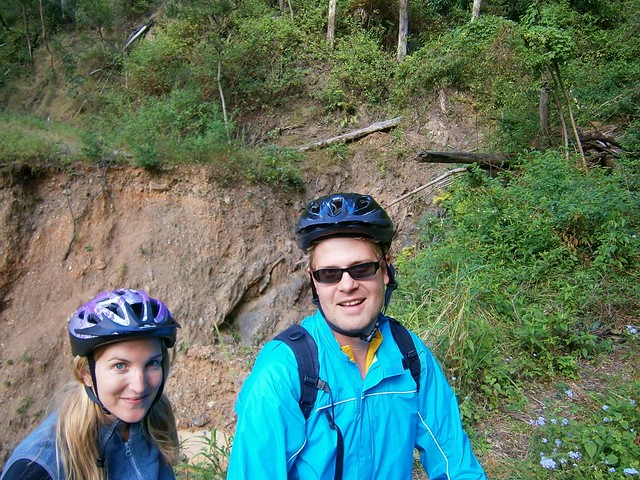
I met with Paul, Aaron and Rob at the bottom of the Goat Track, and we rode up to the start of this fun descent near the corner Hammermeister Road and Forestry Road at Mount Nebo.
Taylors Break
The track starts with a gentle gradient near Mount Nebo. A bulldozer has cleared it recently, so the ride near the top of the hill is quite pleasant.

The steepness increases as you get further down the mountain…
Taylors BreakTaylors Break
Towards the bottom, the gradient is very intense, and there are lots of loose rocks, so it’s advisable to walk it if you’re not 100% confident. Rob showed us how you can “get air” even when you’re walking the bike 🙂

Taylors Break
You can ride the descent if you keep your wits about you, and get your weight as far back on the bike as possible.

Branch Creek
Branch Creek
The prettiest part of the ride is Branch Creek at the bottom of the descent. The shaded pools would make a great swimming spot in summer – but today we were content to enjoy the view and take pictures.


We also decided to have a bit of a break because this point was the start of the long climb up Cabbage Tree Range Road – a one hour uphill ride which rises about 500 metres in 7km.

This ride was 27km long, and we completed it in about three and a half hours. We did about 1,200m of vertical ascent and I burned about 2,500 kcal. Despite the relatively short distance, it’s still a challenging and enjoyable ride. I’m rating 7.5 out of 10 on the tough-o-meter. We enjoyed it more because it was a cool day, we kept an easy pace, and stopped lots.

If you do this ride, take it easy at the bottom of Taylors Break. It’s very steep and loose. If you’re unsure of a section, play it safe and walk it.

Total distance: 27.33 km
Total climbing: 1192 m
Average temperature: NAN
Total time: 03:26:58
Download file: activity_203746489.gpx
More data

From the Mountains to the Sea

Camp Mountain Lookout
Brisbane is a wonderful city. I got to see a lot of it today in a nice big loop which covered the mountainous D’Aguilar National Park & Brisbabe Forest Park in the West, the CBD, and the Wetlands in the East. I took my time, which was enjoyable until the sun went down, and I realized I’d have to finish the last bit of my journey with lights.
"Mini Van"Chilling
I started by exploring a few trails at Bunyaville that I don’t ride too much – “Zigzag”, “Minivan” and “Darkside”. They’ve got wierd names. Someone tells me there’s the rusting wreck of a Mini Van somewhere in there, but I didn’t see it. All I saw was lots of winding flowing tracks.

After that I took a few back streets to Samford Forest where I stopped for a quick snack.
"Estate Break" Samford Forest"Estate Break" Samford Forest
While I was relaxing, a couple of new faces showed up so I took their photos while they sped off down “Estate Break” – one of the steeper, more challenging fire trails in Samford Forest.
Three-Ways. Samford Forest
The “Three Ways” is a fun little intersection in the middle of Samford Forest with trails going off everywhere. The fun thing about it is this nice little dirt hill in the middle that you can ride over. You can’t do that at a bitumen three-ways 🙂

Camp Mountain Lookout
From there I rode over to Camp Mountain and did the tough short-climb to the summit. The climb is exhausting, which makes it easy to stop for a while at the top and enjoy the view.

Flinders Peak & Teviot Range
It took me about an hour to ride from there down (and up) Centre Road to South Boundary Road. It was fun to look to the mountains of the Teviot Range, including Flinders Peak and recall that I’d ridden there only a few weeks ago. At that time I managed to get a photo of Brisbane as I looked north. This time I grabbed a shot of Flinders Peak as I looked south.

Happy MTB'ers
While I was admiring the view, a few more happy Mountain Bikers road by. It must be something about riding a mountain bike in the bush. It just makes you smile! It happened several times in the forest today – unlike in the city and on the bike paths. It must be something in the air 🙂

Highwood Road
This time, when I got to the end of South Boundary Road, I followed “Goanna Trail” to the bottom, then climbed up Highwood Road. I have a love / hate relationship with this hill. I’ve climbed it several times, always after having ridden 50km through the national park, with tired legs. It’s a tough climb, especially with tired legs. But I’m always delighted when I make it to the top.

Bicentennial Bikeway, BrisbaneSouthbank, Brisbane
I then made the short ride from the top of Mount Coot-tha down “Powerful Owl” trail into the CBD and South Bank via the riverside Bicentennial Bikeway.

Brisbane City Cat.
I think I prefer riding along the southern bank of the river. There always seems to be a lot going on, and I enjoy the view of the city across the river. When I’ve ridden on the northern bank, I think I was too close to the city to enjoy the view.

Rock ClimbingRock Climbing
There was lots of activity by the river, including these rock climbers at the Kangaroo Point cliffs.

Pacific Dawn
On the way out of Brisbane along Kingsford Smith drive I was lucky enough to get a great view of P&O “Pacific Dawn” leaving port for a week in the Pacific. She blew her horn while I was watching, which sounded loud – even from over a kilometre away. In the past I’ve always felt envious watching a ship leaving port, wishing I was on board. This time I felt much happier riding my bike. If they’d stopped the ship and asked if I’d have liked to hop on for a cruise, I would have graciously declined.

I’m content to ride my bike in the bush.

Today’s ride was 110km and took me almost 8 hours excluding breaks. I climbed almost 2,000 metres of vertical ascent and burned 6,000 kcal (about 11 Big Macs). This one rates 8 out of 10 on the tough-o-meter.

Total distance: 110.3 km
Total climbing: 2088 m
Average temperature: NAN
Total time: 09:30:28
Download file: activity_201366034.gpx
More data

The “Super W”

My friends have named a tough ride in D’Aguilar National Park the “Super-V” because of the tough elevation profile you get when you ride it: A loooooong way down, then an equally long way up. I walked the “Super-V” just over a year ago with my son, Lachlan.

Today I thought I’d mix it up a bit and add an extra climb to make it a “Super-W” 🙂

Giant Fig
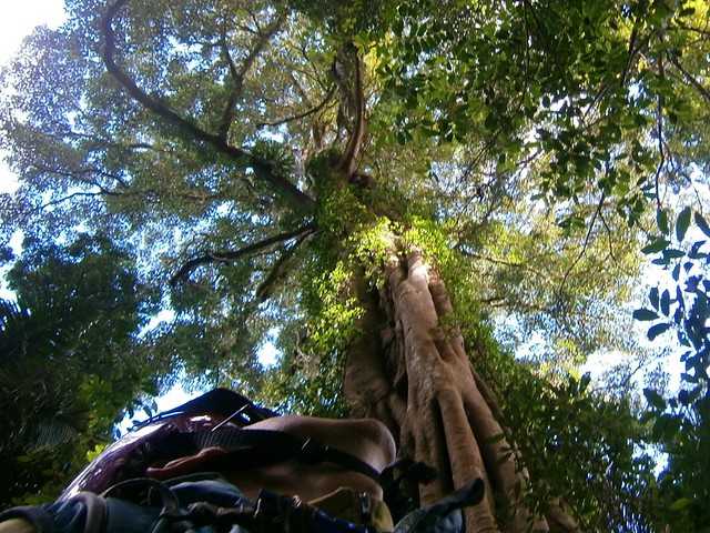
I started from the Goat Track and made my way up the bitumen to Mount Glorious, then set off down Lawton Road. This is a special place in the rainforest with Piccabean Palms and wonderful Giant Figs. I just had to stop and get a few pictures.

Dave and KellyNeil
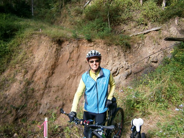
I enjoyed the roll down Lawton Road which is a fun steep descent near the top… until I met up with Kelly and Dave. They were riding their bikes back up the track because they were unable to get past one of the landslides: A huge gulf has opened on the road with nowhere to go above it, and nowhere below. All that remains is a 10cm wide precipice which is hard work to carry a bike over. I suggested that between the three of us we might be able to help each other get the bikes across and continue with the ride.

DaveKelly
We rode together up the steep climb to Northbrook Mountain and then parted ways. They were headed down Kipper Creek Road towards Wivenhoe Dam. I was headed back towards England Creek. I love meeting new people on the trail 🙂

England Creek Road
The ride down England Creek from Northbrook is amazing. It just descends for what feels like ages. I lost 500m of altitude in about 7km, and I’m glad I rode down it, instead of UP it like my friend Flyboy (Dave).
England CreekEngland Creek
Eventually I reached the bottom, and the delightful bush camp at the England Creek Crossing. I wasn’t staying the night this time, so I just devoured a banana and took a few pics of the beautiful creek.

From there it was a bit of a climb up to the intersection at the bottom of Joyners Ridge Road. Normally if you were doing the “Super-V” you’d turn left into Joyners Ridge Road and make your way back up the hill to Mount Glorious. But today I was going a bit further, so I kept going straight ahead down again towards another crossing on England Creek.
England CreekEngland Creek
England Creek is spectacular. The water is crystal clear. There’s no sound at all except bellbirds, wind in the Eucalypts, and water babbling over the pebbles. I don’t know what cosmic lottery I won to be able to enjoy these simple pleasures, but I’m continually grateful.

From this point, the hard work begain in earnest. I had to make the slow steep climb up Goodes Road. This is a cruel climb, rising almost 500m in 5km. It’s very steep, and after the long ride I’d done it was really difficult to turn the pedals and get up the hill.

I repeatedly yelled to myself in U.S. Army Marching style:

IF. IT. IS to BE
IT. IS. UP to ME!

If anyone would have caught me yelling out like a madman, I’m sure I would have been sectioned and locked up.

By some minor miracle, I made it to the top without passing out. I didn’t walk – I’m really proud that I was able to ride the whole way.

From there, I followed Dundas Road back to Mount Nebo and civilization, and enjoyed the fast roll down the bitumen back to the Goat Track.
Goat Track
After a tough ride, I love the quick drop back down the Goat Track. It was cold, and I had my plastic vest on, but it was enjoyable.


Can you see the “W” in there?

This ride was just under 45km, and took me almost 4 and a half hours. I burned about 4,500 kcal (about 8 big macs) and climbed about 1,700m. This one rates 8.5 out of 10 on the tough-o-meter. If you do it in summer, I’d rate it 9 out of 10.

Total distance: 44.55 km
Total climbing: 1753 m
Average temperature: NAN
Total time: 05:34:22
Download file: activity_196470568.gpx
More data

Flinders Peak

Flinders Peak
We rode through the Teviot Range today on a big loop through Hardings Paddock, Flinders Plum, Flinders Peak and Undullah.

The traditional owners of this area are the Ugarapul Aboriginal people. Mount Flinders is sacred to them because they believe that the powerful spirit, “Yurrangpul”, lives there, and guards their traditions and sacred places. His name is similar to the local word for green tree frog: “Yurrang”. The green tree frog is the totem of the Ugarapul people.
Hardings Paddock
Hardings Paddock is about an hours drive south-west of Brisbane. Not wanting to start our ride too early on a winters morning, we arrived there about 8.30am.
Goolman LookoutGoolman Lookout
Our first stop was Goolman Lookout which has great views to the south-west as well as back into Brisbane. Mount Goolman was originally called “Murdoch Peak” by John Oxley in 1824, but it was later renamed “Goolman” after a local indigenous word meaning “Stone Axe”.

The last hundred metres up to the lookout is steep, and we had to push the bikes most of the way – something we’d get used to for most of the day 🙂

Goolman Lookout
The air was quite clear, and the view to the city in the north-east were amazing.
Goolman Lookout
From there we were able to get a good look at Ivorys Rock – a round hill to the south of the lookout.
Flinders Plum Descent
The track from Goolman Lookout to Flinders PLum picnic ground is well maintained and clearly marked. The only problem is that in parts it’s very steep. On several occasions we had to get off the bikes and push them up the steep hills. The up-side of this is that we we enjoyed riding down the other side. There were warning signs saying “Extreme Caution” before some of the descents, which in mountain biking parlance means it’s going to be a particularly fun ride.
Puncture
Troy’s bike has been lovingly set up for long-distance touring. I am amazed at the distances this man can cover in one day. So I thought it was quite ironic that he was the only one who suffered a puncture. The white ball-shaped object on the ground near Troy’s feet is actually an inner tube wrapped in an old sock. Troy says a sock is a much better way of stowing a tube compared to a plastic bag because it offers more protection. The last thing you want when changing a tube is to discover your new tube has a hole in it because you didn’t protect it well enough!
Mount Elliott Road
After a tough 5km climb across the southern face of Mount Flinders, we eventually made it to the top of Mount Elliott Road, with more amazing views.
Mount Elliott RoadMount Elliott Road
From here you can see all the way to Mount Barney and the Border Ranges. From here it’s also a long descent down to Undullah – so we enjoyed a long white-knuckle descent down the steep gravel road.
Man and Bike - TroyMan and Bike - Pete
Man and Bike - EricMan and Bike - Tony
The bottom of the hill was a great place to chill out, take a break and a bite to eat. It’s also where we parted company with Troy who continued his epic ride to Kerry, south of Beaudesert.
Broken ChainBroken Chain
Perhaps the funniest mechanical incident of the day happened when Pete got to the bottom of a steep hill, went to apply some power, and discovered he no longer had a chain. After a quick bit of back tracking, we managed to find the chain, and put it back on with a spare link. (Hint: Don’t leave home without a spare link for your chain!)
The Road to Flinders Peak
We rode northwards into Ripley before finally turning back towards our starting point. Wards Road offered some more great views of Flinders Peak.

We rode about 50km in about 6 hours including breaks (moving time 4 hours). It included almost 1,700m of ascent. I burned just over 3,200 kcal. This would be a tough ride in summer or in wet weather. The dry cool weather of Winter is the best time to do this ride. On the tough-o-meter I rate it 8.5 out of 10.

Total distance: 49.7 km
Total climbing: 1729 m
Average temperature: NAN
Total time: 05:57:33
Download file: activity_191714959.gpx
More data

Paradise Lost

Brisbane Courier. 22 March 1930. Page 10

I had the pleasure today to read an old newspaper article from “The Brisbane Courier” which describes what the South Brisbane and West End areas of Brisbane were like in the 1820’s. The story was published in 1930 by someone who, fifty years earlier had made “the acquaintance of an old man – a time- expired convict – who was one of the first contingent of prisoners in 1825 to quit Redcliffe and ascend the Brisbane River in a cutter”. It’s a valuable recollection in that it describes the Paradise that was Brisbane prior to European Settlement.

If, like me, you’ve ever stood in your backyard and wondered what it would have been like three or four hundred years ago, or even earlier, then this article might give you a fleeting glimpse.

When I read this I get a better idea of the grief and anger many indigenous Australians feel about the loss of their land.

If you want, you can click on the image of the newspaper clipping to the left and read it. To make it easier, I’ve included a transcript of the article as well.


Source: The Brisbane Courier. 22 March 1930. Page 10.

THE BRISBANE RIVER.

100 YEARS AGO.

By AN OLD BRISBANEITE.

ITS SHALLOW WATERS.

RECENT issues of “The Brisbane Courier” have referred with a certain amount of pride to the fact that the P. and O. Coy. have decided to extend the service of their fine steamers to Brisbane. When one considers that less than a century ago men frequently waded across the Brisbane River at various spots between the present site of the Victoria Bridge and Queensport it can be realised that the work of improving the river has been one of great magnitude. Many years ago I was told by a gentleman then engaged in the pilot service at Brisbane that on one occasion at low tide he waded across the river from Queensport to Pinkenba. I had it from an ex-convict that during the years of the convict settlement in Brisbane, that is, after the year 1825, the soldiers when off duty were in the habit – at low tide – of wading about in the shallow pools of water where the Victoria Bridge now stands, and catching large quantities of fish. They caught the fish with their hands, and put them into bags or baskets slung over their backs.

Blue Moon Convolvulaceae by Kate's Photo Diary
Sacred Kingfisher
Sacred Kingfisher By Tatters:)


SCENIC BEAUTIES.

It was my experience, more than half a century ago, to make the acquaintance of an old man – a time- expired convict – who was one of the first contingent of prisoners in 1825 to quit Redcliffe and ascend the Brisbane River in a cutter. This man was well educated, as was evidenced by the fragments of old manuscripts which he had written and placed at my disposal for perusal. He exacted from me a promise that I would not divulge the contents of his notes so far as they related to the convict system, but their perusal conveyed particulars of some dreadful incidents in the administration of the penal affairs of the settlement. The writer of those notes was an ardent lover of Nature, and the beauties of the scenery along the banks of the river probably appealed to him in a manner that was lost upon his fellow prisoners. He drew vivid pictures of the scenes of enchanting beauty which unfolded themselves as each successive reach of the river came into view. To use his own words: “It looked as though some race of men had been here before us, and planted this veritable garden of Eden.” The convicts were being conveyed to a prison from which possibly the majority would be released only by death, and yet the gateway to that prison lay between river banks lined with foliage whose beauty it were almost impossible to describe. Skirting the water’s edge for miles on each side of the river was dense vine-clad jungle, festooned with the blue and the purple convolvulus, while on the tidal brink grew the beautiful salt-water lily – its flower white as alabaster, its glorious perfume filling the air with fragrance. Kingfishers – some scarlet breasted, others white, all with backs of azure blue – darted hither and thither, while anon the solitude was disturbed by the raucous laughter of the kookaburra.

Moreton Bay Fig Tree
Moreton Bay Fig Tree By ~Prescott
Hoop Pine
Hoop Pine by Neil Ennis


MAN VERSUS NATURE.

But the conditions of an earthly paradise were not to continue indefinitely, for in the course of time – particularly after the abolition of the convict system, and with the advent of free colonists in the Brisbane area – there came the inevitable day when

“The sound of the axe was heard in the land” –

when the war of devastation – man versus Nature – called by most people the march of progress – began, and the beautiful jungles were swept away. A few giant Moreton Bay fig trees were spared for some years longer. One of these stood in William-street, where now is the residence of Mr. Tom Mulcahy, of the Home Secretary’s Department. Another grew on the present site of the Treasury Buildings. Prior to the erection of these buildings that grand old tree stood sentinel over the Chief Secretary’s office – a small one-storied building, where some of the most important laws in force in Queensland first saw the hand of the Parliamentary draftsman. It was under the shadow of that old tree that Sir Thomas M’Ilwraith – then Premier – signed the historical telegram to Mr. H. M. Chester, police magistrate of Cooktown, instructing him to proceed post haste to New Guinea to hoist the Union Jack on the shores of Port Moresby, and to proclaim the annexation of New Guinea in the name of Great Britain. Incidentally it may be stated that M’Ilwraith’s action was repudiated by the Imperial Government, of which Gladstone was the head.

Maiala Rainforest
Maiala Rainforest by Neil Ennis
Mount Wilson. Cathedral of Ferns. NSW
Cathedral of Ferns by By Amanda Slater
Australia, Fraser Island
Fraser Island by Halans


NATURE’S FAIRY BOWER.

One of the most enchanting spots within the Brisbane area was an immense jungle in the western portion of South Brisbane. It began at about the spot where the Victoria Bridge now stands, and it followed the course of the river right away to Hill End, along the whole length of what is now the Montague-road. This jungle was a tangled mass of trees, vines, flowering creepers, staghorns, elkhorns, towering scrub palms, giant ferns, and hundreds of other varieties of the fern family, beautiful and rare orchids, and the wild passion flower. While along the river bank were the waterlily in thousands, and the convolvulus of gorgeous hue. What posterity lost by the destruction of this magnificent jungle in all its pristine glory only those who were privileged to see it can form any conception. Here at our very door we had a wealth, a profusion, of botanical beauty which can never be replaced by the hand of man. Too late have we recognised the desirableness of conserving these glorious works of Nature. The Lamington plateau and Mount Tamborine certainly are beauty spots, and rich from a botanic point of view, but it is not every city dweller who can get to them. A few weeks ago there appeared In the “Courier” a letter from the pen of Mr. Fred. W. Taylor, dated North Tamborine, February l8, in which these words occur: “On ascending the mountain (Tamborine) from the Tamborine station one travels through avenues of wonderful scrub, with palm trees waving their proud plumes to the whispering breeze, and there are vast reserves of virgin scrub prolific in orchids, staghorns, &c., on stately forest trees.” These words would have applied with equal truth to the magnificent stretch of primeval foliage at West End had the early residents of Brisbane exercised sufficient foresight to preserve to posterity that magnificent botanical heritage.

GRIM RELICS.

It was during the destruction of this jungle that evidence of the brutal convict system was brought to light, for, amid this primeval grandeur, there were found the skeletons of several human beings, rusted leg-irons still encircling the bones. Obviously the convicts had escaped from the settlement – either by crossing the river on logs or by wading across at low tide. They preferred to die in this veritable garden of Nature rather than continue to live amid all the horrors of the convict system. But while all lovers of Nature must deplore the destruction of these enchanted spots, there is consolation in realising that after all such destruction was the first step in the direction of a free settlement, which displaced the brutal and degrading convict system.