Condamine Gorge

Condamine Gorge
“The Head” is a spectacular spot up in the Great Dividing Range of South East Queensland, near the border. It gets that name from the fact that it forms the headwaters of the Condamine River and the Murrary Darling Basin. Starting as a trickle on the slopes of Mount Superbus, it flows through Condamine Gorge joinng up with the Balonne River, the Darling River and eventually the Murray River before draining into the Great Australian Bight near Adelaide in South Australia.

Today we were lucky enough to ride through some of this beautiful country in a loop from the small town of Legume, in Northern NSW up into Acacia Plateau, then along the Border Fence to “Head Gate” and back to our starting point via Condamine Gorge (also known as Cambanoora Gorge).

The traditional Aboriginal owners of this area are the Githubal, Kambuwal and Jocumwal people.
Acacia Plateau
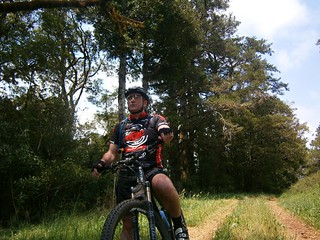
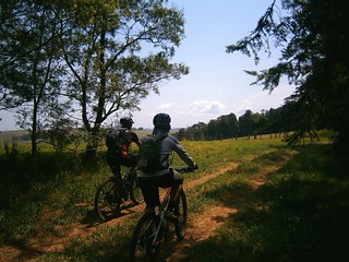
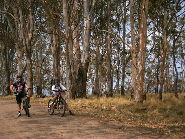
For the first hour of our journey we took a long slow climb up onto Acacia Plateau, while we battled swarms of flies. Thankfully Eric had the foresight to pack some insect repellant which kept the pesky insects away from our faces, allowing us to enjoy to majestic open blue-gum forest.
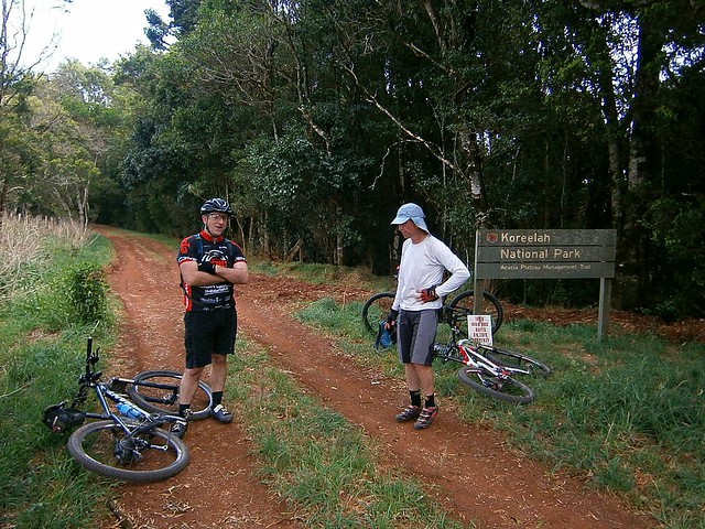
The Border Track
The Border TrackThe Border Track
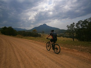
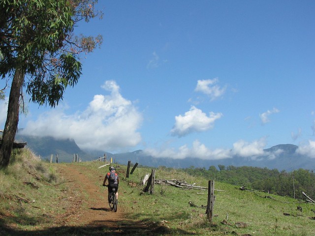
The rocky road eventually rises up to the “Border Track” following the rabbit-proof fence along the border between Queensland and New South Wales. At an altitude of over 1,000 meters, this section has thick rainforest on the NSW side of the fence and open farmland on the Qld side. I’ve seen similar scenarios at other places along the border (such as The Border Ranges) and it makes me wonder about the relative priorities of both states in their early years, and the importance of land-clearing to Queensland in the 19th and early 20th centuries.
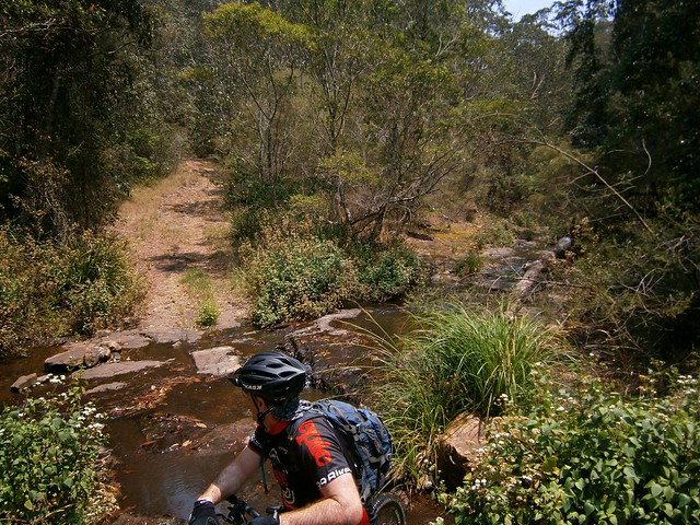
Trough Creek
From the border track we dropped about 600 metres in altitude in the space of 8km. I don’t have any pictures of it since I was clinging on to my handlebars for dear life while I bounced down a rocky track, dodging stray logs and precarious ruts. The Trough Creek descent is a mountain bikers delight, but it’s rough. You need good suspension, and a reliable wheel / tyre combination. I suspect riding this on a cheap bike would result in pinch-flats and crashes.

I got to the bottom yelling out “Wow, that was awesome!”
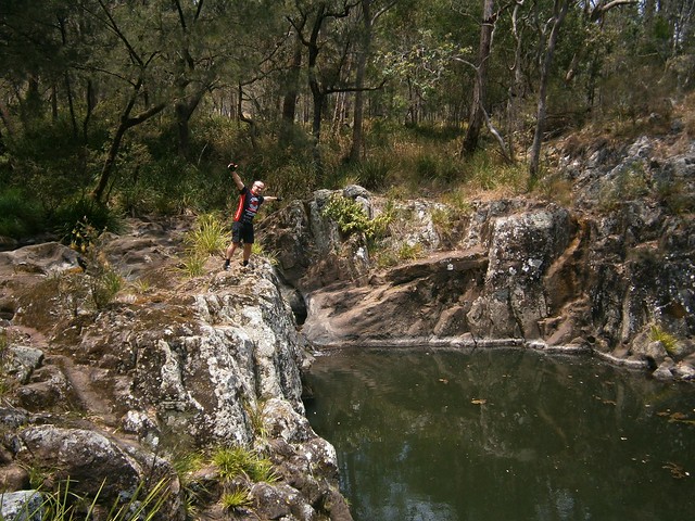
Koreelah Creek
Koreelah Creek
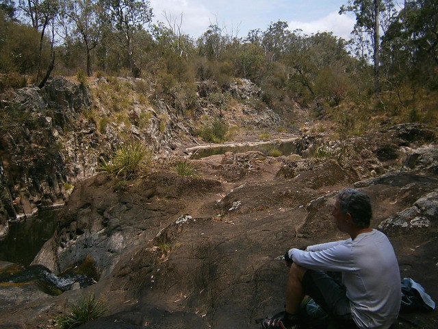
A few minutes later, after bouncing down some more rocky roads, we eventually reached the rock pools at Koreelah Creek, where we stopped for lunch.
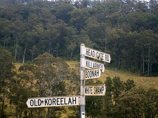
White SwampWhite Swamp
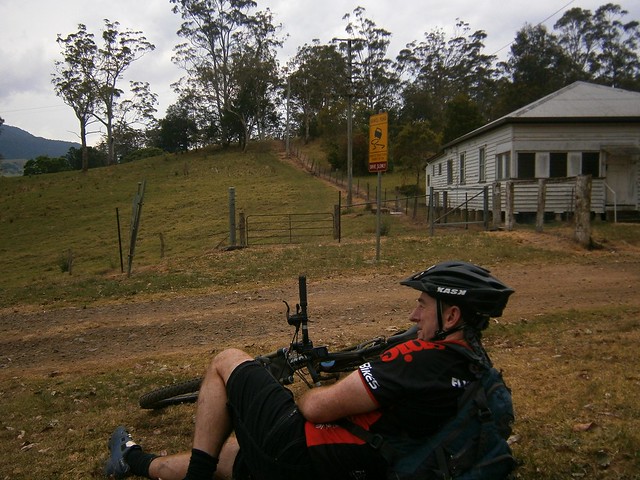
“White Swamp” marked the lowest elevation point of the ride. From here we faced another long slow climb up to “Head Gate” – the Qld / NSW border crossing.
Head Gate
Rabbit Fence
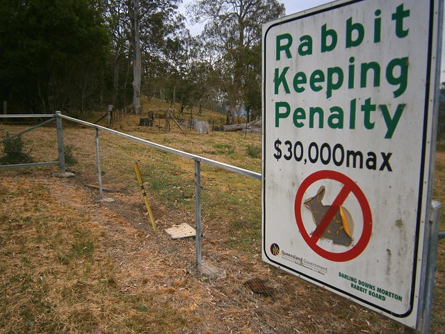
“Head Gate” is a secluded border crossing in the middle of nowhere. It boasts a dilapidaed house, and a shed. If you stand in NSW and look north to Qld, a huge sign tells you how un-welcome rabbits are. In fact, if you try to keep rabbits in Qld, you’re liable for a $30,000 fine. If you stand in Qld and look south, you’ll see a similar huge sign wich tells you you’re not allowed to take livestock into the state along that road.

For us it was a welcome place for a short break. It was also a reminder that we had stopped our long climb and could look forward to some more descending.
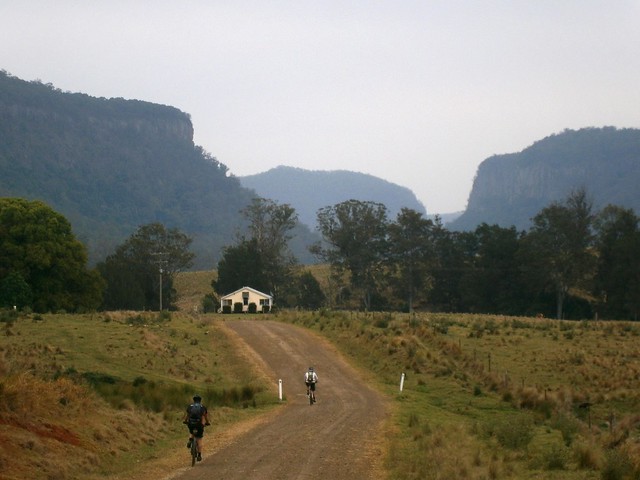
Condamine Gorge
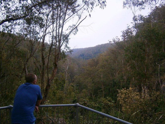
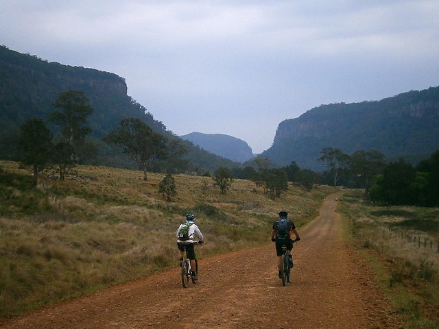
As we rode along Condamine River Road, we enjoyed some amazing views of the Gorge.
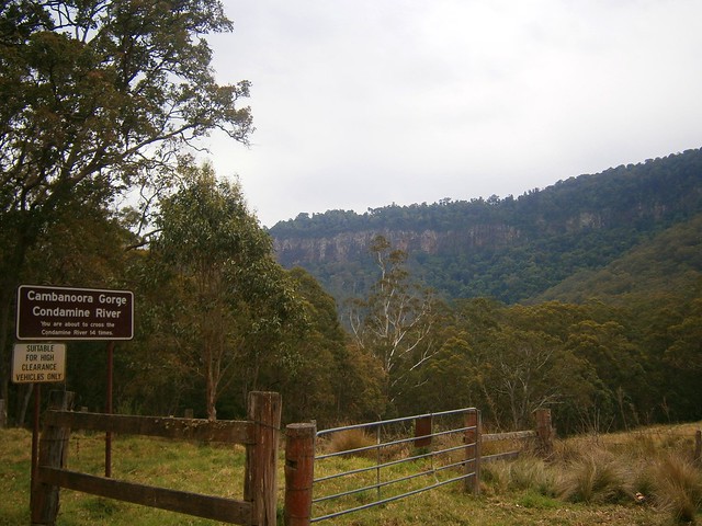
Condamine Gorge
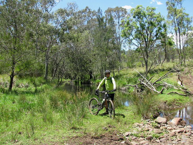
Like the sign says, if you go along Condamine River Road you need to be prepared to cross the river 14 times. And they’re not just shallow little crossings, they’re deep, and you’re definitely going to get wet.
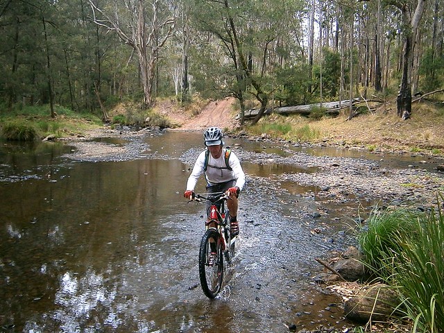
River Crossing Condamine Gorge
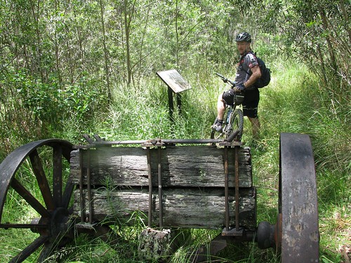
We rode through several crossings. Eric showed us how it was done. We waded through the rest of the crossings, carrying our bikes. Normally I hate getting my feet wet. On this trip, I just accepted the fact that it was going to happen, and didn’t worry about it. I actually discovered that it’s not that bad riding in wet feet – provided it happens towards the END of the journey and not the start 🙂
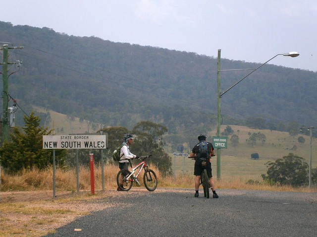
Crossing the Border
Once we got to the end of Condamine River Road, we headed south along the bitumen, across the border again, and back to our starting point at Legume.
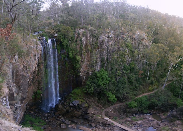
Queen Mary Falls
Queen Mary FallsQueen Mary Falls Lookout

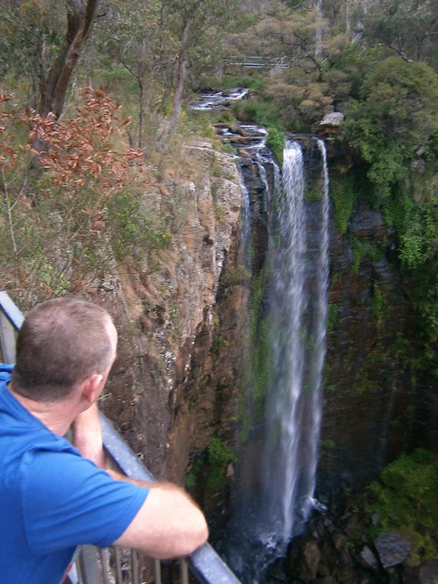
Our route took us in a big circle, in the middle of which was Queen Mary Falls. Since we didn’t actually ride to that point, we decided to drop by in the car on the way home. The falls are only a five minute walk from the car park on Spring Creek Road, so it was worth the detour.
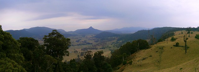
Carrs Lookout, "The Head"
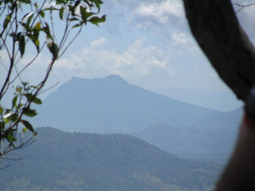
We also stopped at Carrs Lookout where we were gobsmacked by the views of Mount Superbus and Wilsons Peak.

What a stunning way to finish the day.

All up we rode about 64km in 6 hours including breaks. We ascended 1,450m and I burned 3,700 kcal. The ride has two tough climbs, one sketchy descent and numerous river crossings. It also involves a three-hour each way drive from Brisbane. I’m giving it 9 out of 10 on the tough-o-meter. You need medium to high fitness, medium skills, a good bike, and some good riding buddies. Be careful after rain as the river crossings may be impossible to ford – which means a long detour. Take lots of water in Summer – it is hot work. Take lots of snacks.

Total distance: 64.6 km
Total climbing: 1518 m
Average temperature:
Total time: 05:51:20
Download file: activity_237394912.gpx
More data

Border Ranges and Horseshoe Creek

Border Ranges

A few weeks ago some friends and I had to cut short our ride through the Border Ranges National Park because of our late start and slow progress.

Today Eric, Darb and I gave it another try.

We arrived at the starting point at about 8:30am after a two and a half hour drive from Brisbane, and immediately started the long climb up into the National Park.

Normally, this ride has some amazing views. Rising over 1,100 meters, some of the lookouts are perched atop shear drops, and let you see forever in every direction. The clouds, mist and rain made that impossible today, but it was still a wonderful experience riding through the lush rainforest.

The rain also made it impossible to take photos. My camera is out of action, so all I had was my mobile phone which doesn’t handle moisture too well. Thankfully, Darb was able to capture the high points of the ride on his Contour video camera. Here’s a link to his video of it.

The challenging thing about this route is that apart from three fast descents, we were climbing for almost 35km, which took us about three and a half hours. All the while, it was raining, and the temperature was hovering around 11C. So it was hard work.

Eric and Darb are strong hill climbers. I found it impossible to keep up with them on the long ascents, and was thankful they stopped several times to help me catch up.

The fast descents were exhillarating though. Shooting down a dirt track at about 40 km/h with fogged up mud-covered glasses, and chill breezes cutting through rain-soaked clothes really makes you feel alive – and cold 🙂 I was glad I added a couple of Snickers Bars to my normal stash of food – they helped to warm me up again.

The final descent out of the National Park is awesome. We dropped 1,000 metres of altitude in just over 10km. That’s the longest descent I’ve ever done.

Normally on a run like this my brakes would overheat, and I’d end up losing them. This time my local bike shop had installed an 8″ brake rotor on the front, and a 7″ rotor on the back. They handled the descent with ease. My brakes didn’t fade at all. Thank you, Sam from Strathpine Bicycle Centre!

Once we left the park, we took a detour through some private property. I had been in touch with a local land owner who said he didn’t mind us riding down through his property to Horseshoe Creek. This was another fun descent down a steep boggy 4wd track with a couple of dozen water bars.

Horseshoe Creek
(Picture – Dean Dwyer)

At the bottom of the boggy track, with the bikes covered in mud, we had to cross a flooded Horseshoe Creek. Eric just lifted his bike above his head and waded across in the knee-deep water. I pussy-footed around trying to hop across the rocks and keep my feet dry. In the end, Eric took pity on me, waded back into the water and grabbed my bike, while I finished crossing the creek. My efforts were to no avail – my feet were soaked despite wearing plastic feezer bags over my socks.

The creek was a good spot to wash the mud off the bikes and start the second half of the trip through the much flatter farmland in the valley below the ranges.


(© State of New South Wales through the Department of Education and Training)
In order to fit the ride into one day, we decided to leave out riding into the small town of Kyogle. This saved us about 45 minutes, but it also meant that there wasn’t any place we could stock up on water if we needed it. In the preceding week I got in touch with the teacher at Collins Creek Public School who kindly agreed to let us pop into the school grounds and fill up on water if we needed it. It was a beautiful little school surrounded by farmland, and it in just the right spot for us.

For me, the toughest part of the ride was the final two kilometers. With the end of the day seamingly in sight, and 80 tough kilometers on our legs, the road became suddenly steeper, and we had to grind our way up the hill back to the car.

We did a total of 2,000m of vertical ascent on this ride. It took us seven and a half hours to ride 81.5 km (including an hour in breaks). I burned about 8,000 kcal.

Doing this ride in cold wet weather and having to drive two and a half hours each way to get there definitely rates this one 10 out of 10 on the tough-o-meter.

Total distance: 82.71 km
Total climbing: 1999 m
Average temperature: NAN
Total time: 07:33:35
Download file: activity_184546001.gpx
More data

Border Ranges – Deans Pictures

Dean the Diesel
In my last post I mentioned that my friend Dean successfully completed the 90km Border Ranges Loop, and managed to match our 4wd speed-wise over the last 5 km.

This man is like a diesel engine – he just keeps going. Plus he has a strange ability to get out of bed really early to get to the start point of a ride.

Here’s some of his pictures of his ride on the same day. It overlapped ours for part of the way, but when the weather got wet – he decided to stick to the original plan 🙂
panorama-1
panorama-2
panorama-3
panorama-4
panorama-5
panorama-7
panorama-8
panorama-10
panorama-13
panorama-15
panorama-16
simes-rd

panorama-6

View Larger Map

Border Ranges

Ridgeline
Like its name suggests, the Border Ranges National Park is a mountainous area of rainforest on the border of NSW and Queensland, just south of the border. It rises above 1,100 (3,600ft) in places and is covered with thick lush rainforest, towering trees and fast flowing streams.

The area is the traditional country of the Githabul Aboriginal People. It covers some of Australia’s most scenic country covering a number of natonal parks amd state forests around Kyogle, Woodenbong and Tenterfield, such as Koreelah NP, Mount Clunie NP, Richmond Range NP, Mount Northofagus NP, and Mount Lindesay State Forest.

Our plan was to start an 80km loop at the north-western edge of the park, head south towards Kyogle, then loop back northwards through Lynches Creek. This was quite ambitious considering we had to drive two and a half hours to get there in the first place, and considering the fact that that I find it very difficult to get out of bed early.
Simes Road
We arrived at the starting point, Simes Road, at 9:30am – a little later than we had anticipated and were optimistic we could make good time if we kept the pace up.
Tweed Range Road
The roads were muddy from the overnight rain. Being from the UK, Adi was used to wet tracks, and showed us how the Brits handle mud by popping a wheelstand while riding up one of the steep hills.
Border Ranges National Park
(Photo by Nick Mills)

After about half an hour climbing, farmland gave way to rainforest as we reached the entrance to the National Park.
Resting in the Mist
We didn’t realize that we’d be climbing for well over two hours before we reached the top of mountain. Physically this was ok – we were all used to long climbs. You just sit back, turn the pedals, and enjoy the view 🙂 The problem was that it meant we made much slower progress that we had expected, and we didn’t get to the top of the range till about 12:30.
Brindle Creek
(Photo by Nick Mills)

It started to rain fairly heavily on the way up, so we were all quite wet by the time we got to the top. This, and the mist, meant that we couldn’t see anything from the lookout, but Brindle Creek looked spectactular. There’s something about a bubbling creek in the middle of a misty rainforest that stirs my soul.

Brindle Creek Road
At the eastern edge of the loop through the rainforest the track splits in two where Bridnle Creek Road meets Tweed Range Road. Our intended route was southwards. The other alternative was to take Tweed Range Road westward back to our starting point. This would shorten the ride by more than half. We talked about it for a while. It was getting close to 1pm, our intended route still involved 60km of muddy roads and heavy rain, and we still had a 3 hour drive home after that. So we decided to take the shortcut and head back downhill along Tweed Range Road. At least we’d end up getting home before dark.
Bottom of the Hill
(Photo by Nick Mills)
While it took us over two hours to ride UP the range, it only took us about 20 minutes to ride down. It was incredible fun. Riding downhill at close to 60km/h in a wet jersey makes you very cold, so I decided to put on a jacket to keep the wind out. One consequence of that is that the wind inflated the jacket, so by the time I reached the bottom I looked like the Michelin Tyre man 🙂

Nick
Being a much tougher rider, Nick decided to give the jacket a miss. But he still ended up wearing a fine mask of mud all over his face by the time he got to the bottom of the hill.

Dean
Perhaps the biggest surprise of the day was when we got back to the car, and met our exhausted and mud covered friend Dean grinding his bike up the hill from the other direction. He had actually started the ride two and a half hours before us. Unlike us, he slogged it out the entire way finishing the 80km loop at about the same time we finished our 35km loop.

What was most impressive was that he had parked 5km down the road from us at the top of Simes Road. So he kept pedalling on while we got in the cars to leave. 5km later when we had driven to the top of Simes Road, we looked in the rear view mirror, and there was Dean right behind us on the bike. After an 85km slog through the hills, he was able to go head to head with a 4wd over 5km in about the same time. Good on ya, Dean!

Lookout
On the drive home we stopped at the Railway Loop Lookout. Just before it reaches the Qld / NSW border, the railway line has to climb several hundred metres in a short time. The engineers came up with a novel way of overcoming this obstacle by making the railway loop over itself in a big circle (see the google map below). You can see this unusual bit of railway from the lookout.

View Larger Map

All up, 35km in 3 hours with 1,100m of ascent and 4,000kcal bunred. I can’t rate our intended loop as we didn’t finish it. I’m rating our actual loop 8 out of 10 on the tough-o-meter. I would have rated it lower, but the rain made it more difficult, as well as the logistics of getting to and from the starting point. It’s a great loop for anyone who’d like to see some great views over a short distance. But make sure you do it in dry weather!

Total distance: 36.73 km
Total climbing: 1118 m
Average temperature: NAN
Total time: 04:04:44
Download file: activity_167779924.gpx
More data

Spicers Gap

Governors Chair Lookout, Spicers Gap
Spicers Gap was used for thousands of years by indigenous Australians as a pathway over the Great Dividing Range from the inland to the coast. It was named by Alan Cunningham in 1828, but it wasn’t until 1847 that European Settlers became aware of the route, when stock-man Henry Alphen discovered it was a much easier way of moving his stock over the range than the treacherous Cunninghams Gap 7km to the north. It then became a popular route for bullock drays moving bales of wool, 6 tons at a time to the Moreton Bay settlement.
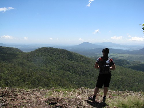
Today Darb and I decided we’d see how much “Bullock Power” we had in the tank and road our mountain bikes up and over Spicers Gap.
The Long Climb Up
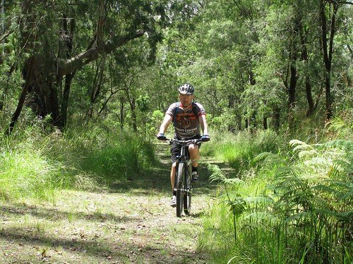
The road up is steep, and rough in places, rising about 600 metres in about 6km. Darb and I just put the bikes in “Granny Gear” and took our time riding up. Late November days in this part of the world are hot and humid, so we though the smart thing was to take a nice steady pace.
Moss's Well
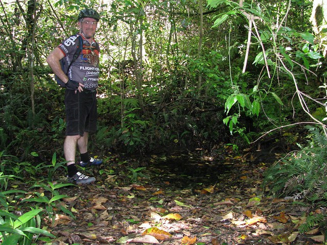
Just before we got to the lookout at the top, we stopped at Moss’s Well. From a distance it looks just like a puddle, but this freshwater mountain spring produces clean fresh water. It was named after Edward Moss, a contractor who was supposed to fix the boggy roads by laying logs across them. He never finished this “Corduroy Road”, but he was credited with finding this spring.
Governors Chair Lookout, Spicers Gap
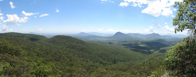
The panoramic view at the top from “Governors Chair” lookout is magnificent.
Enjoying the viewMount Maroon
It’s called “Governors Chair” because several notable people including Governors Fitzroy and Bowen came here and sat on the rock to enjoy the view. You can see for miles.
Old Logging RoadOld Jinker
The road at the top has been preserved to show some of the different methods used in nineteenth century road construction. There’s also an old Jinker up here. Darb wondered whether a man on a bike had as much power as a bullock. Needless to say the Jinker stayed put, so the Bullocks won this round 🙂
Millar Vale Creek
At the mid-point of the journey, just before we met the western section of the Cunningham Highway on the other side of the Great Dividing Range, we crossed Millar Vale Creek. It might look like a typical country creek, but if you look on a map, Millar Vale Creek eventually flows into the Condamine River, which eventually flows into the Balonne River, which…. eventually flows into the Murray River, and into the Southern Ocean over 3,000km away. So if you spit into Millar Vale Creek, it goes a heck of a long way!

All up 35km in about 4 hours with 1,250m of vertical ascent, and 3,200 kcal burned. Because of the summer humidity, boggy black soil, and flies (myriads of them) I’m giving this one 8.5 out of 10 on the Tough-o-meter. If you do it in winter when it’s cool, dry and the flies aren’t around, it would probably rate as 7.5 to 8 for toughness. So if you want an easier day, do it in Winter 🙂

Thanks for a great ride, Darb. And thanks, once again, to Gillian and Mark for giving us this idea in the first place via your wonderful book “Where to Mountain Bike in South East Queensland

Total distance: 35.43 km
Total climbing: 1303 m
Average temperature: NAN
Total time: 05:08:57
Download file: activity_131146235.gpx
More data