


The Lost World is a magical place where the Albert River has carved out a couple of lush valleys through the Border Ranges. Today we explored those valleys.

Kerry is a farming district, not far from Beaudesert. We started our ride amidst its emerald fields, and headed south.

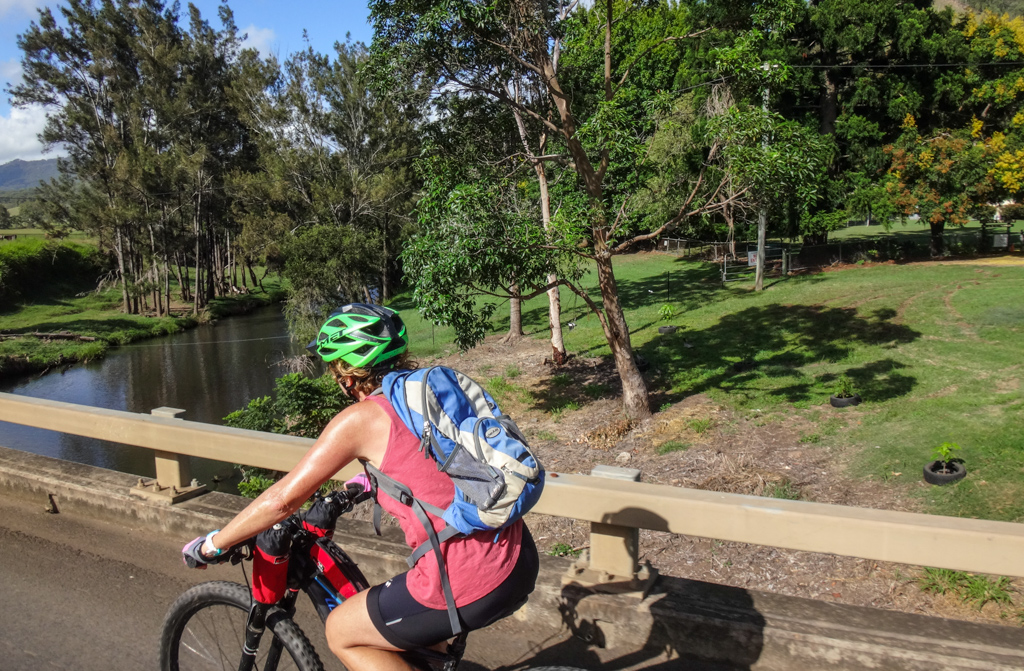
The Albert River follows the road for most of the way.
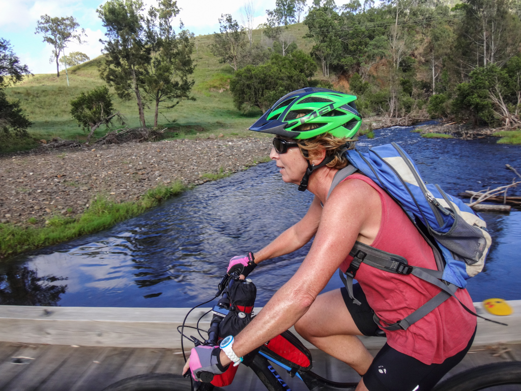
We’d be crossing this river many times today.

After a couple of crossings, the river splits into Left and Right Branches.
For the first half of today’s ride we followed the Right Branch.

The paved road eventually ended, and we crunched over the gravel.
Ahead lay “Razorback”, an imposing thousand-metre high knife-like ridge which separates the left and right branches of the river.
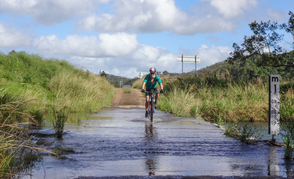
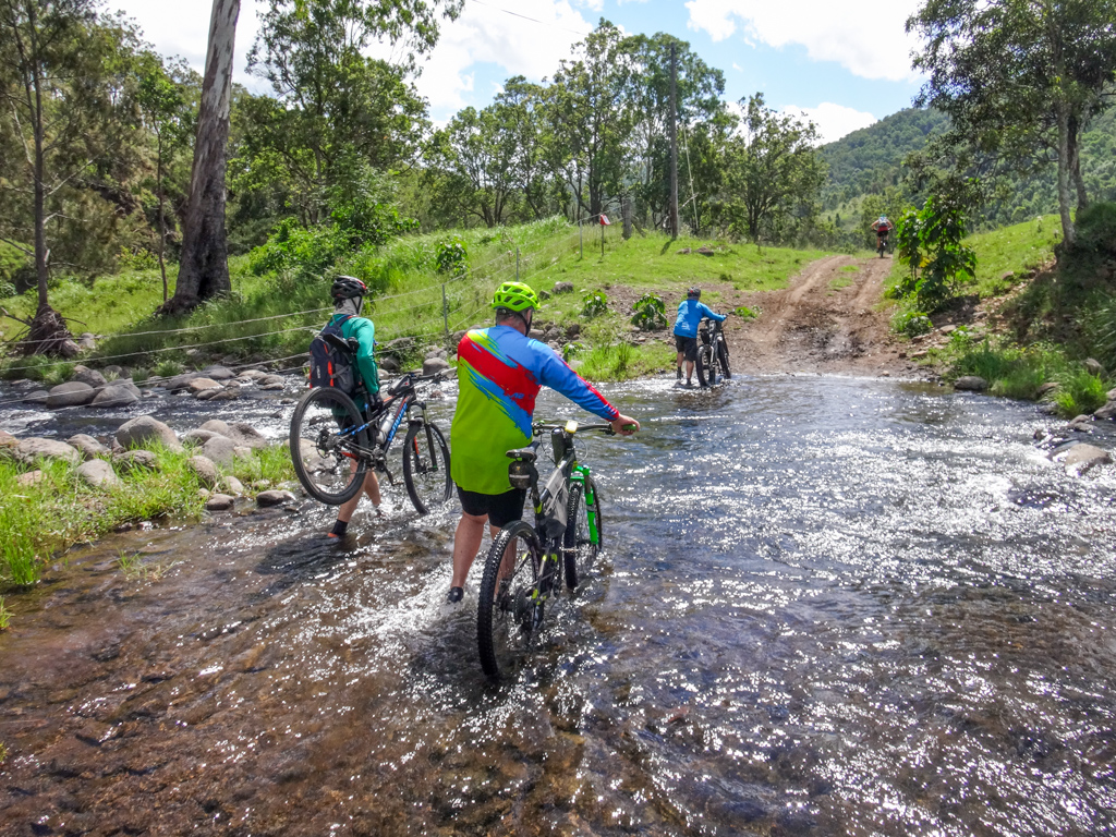
We splashed through more crossings.

We would definitely be getting wet feet today.

The cool water was freshly inviting.
“Is that a track over there?”
We waited while Adam checked out if it was rideable.

Adam decided he had more important priorities than investigating potential trails, and chilled on a boulder for a while.

We carried the bikes over the river, rode upstream a while, then hiked a bit further.

What a stunning place!
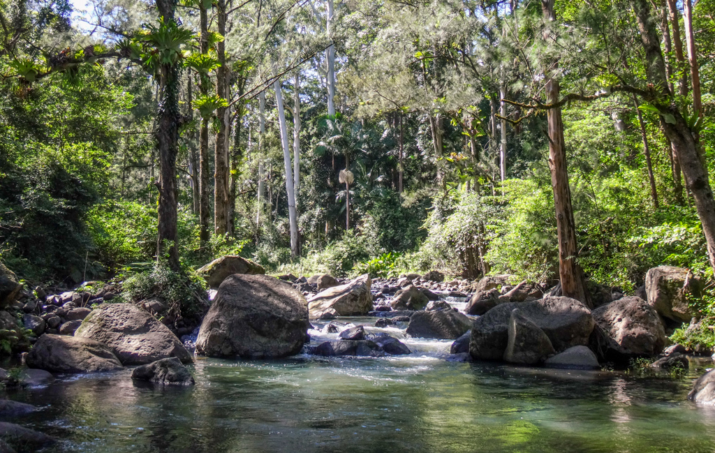

Sometimes before a ride I silently ask: “Is this going to be a fun ride?”
The answer usually comes a few kilometres later, when we’re presented with wonderful places like this.

The rocks, trees and water seemed to nod in confirmation, “Yes, you’ve come to the right place today.”

We crossed the river again and headed back down the valley…

…we still had a second valley to explore.

The landscape rewound before us as we retraced our tracks back to the confluence of the two river branches.

“Left Hand Branch Road” is a farm track which follows the river up a hidden valley.

If I hadn’t seen the line on the map, I wouldn’t have realized the road was there.
Since it looked like a farm track, I decided to call the land owner beforehand to make sure they didn’t mind us riding through their paddocks.

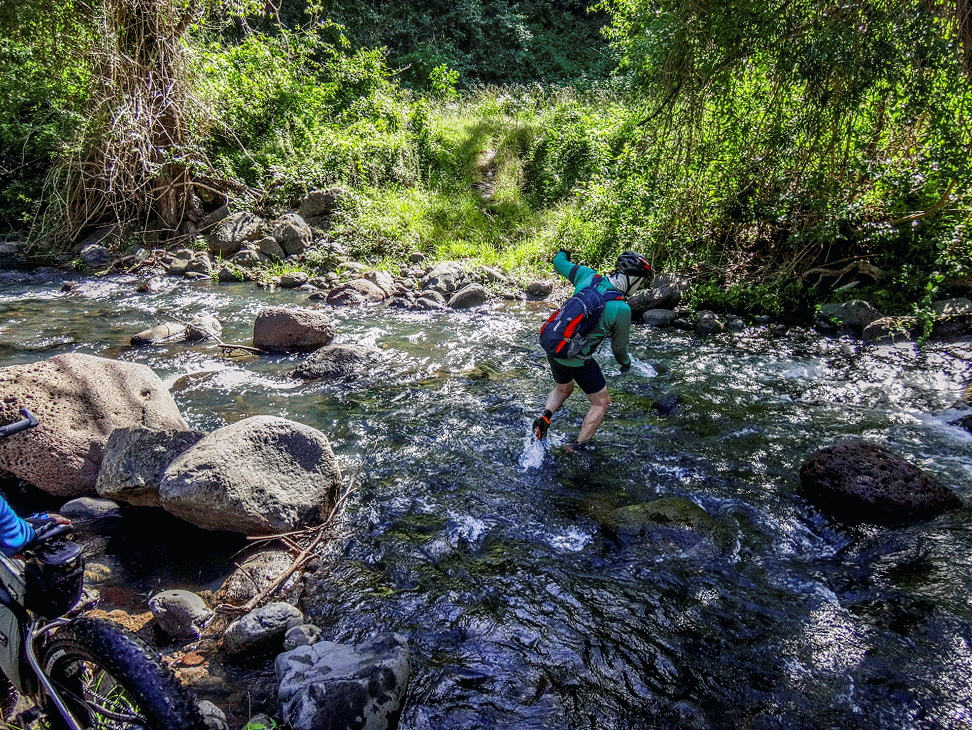
Unlike the previous valley, the crossings here were rough and rocky.
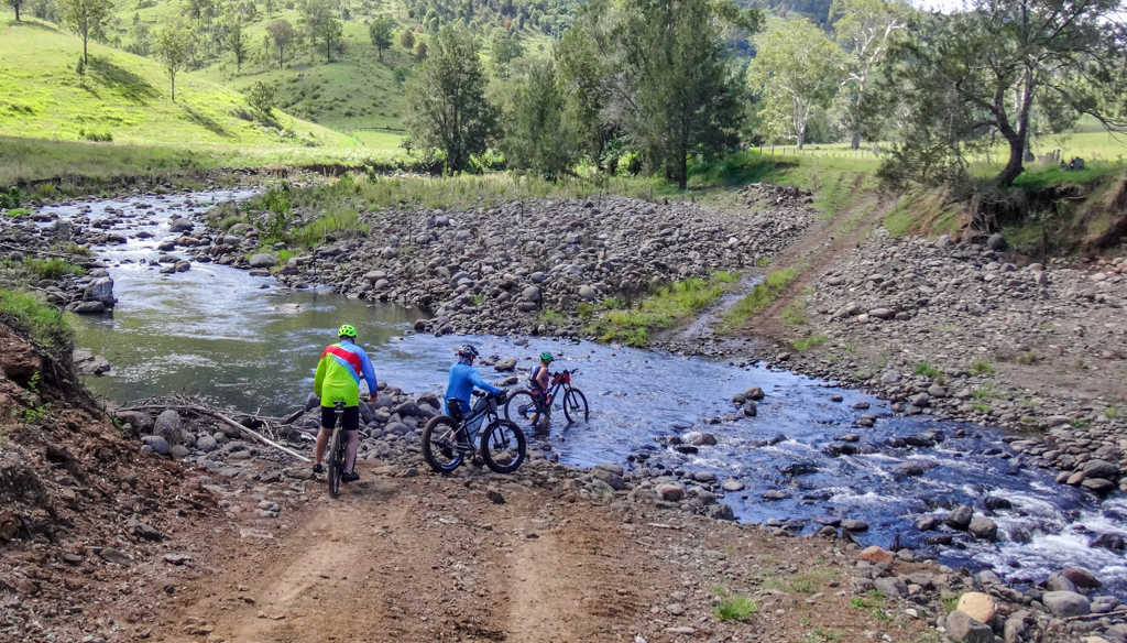
We waded through half a dozen of them as we made our way up the valley.

A few years ago I would have tiptoed over the rocks in a vain attempt to keep my feet dry.
Today I enjoyed it. Having wet feet is all part of the fun.

Adam took this “wet feet” thing to a whole new level.

As we neared the end of the valley, the road devolved into a couple of 4WD tracks.

We passed through one final gate.

At the end of the valley, we said “G’day” to Peter. His family owns the land, and he kindly pointed out a few fun-looking tracks where he thought we’d enjoy riding the bikes.
“You can ride some of those steep tracks that go up the mountain to O’Reillys if you like”
We graciously declined. The mountain tracks could wait for another day.
Peter also suggested a swimming spot we might like to try out.
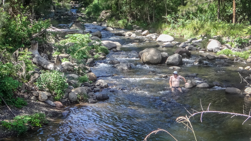
The water was cold, but we jumped in anyway.

Through the tree tops, we watched Morans Falls cascade over the cliffs.
After the swim we got back on the bikes and headed down the valley back to the cars.
Total climbing: 637 m
Average temperature: 30.9
Total time: 04:26:59
More data
We travelled fifty kilometres in about four and a half hours.
During that time we climbed about 400 metres in elevation and I burned about 1,800 kcal.
I’ll rate this one six out of ten on the tough-o-meter.
Thanks Darb, Adam, Simon and Kaye for another fun ride.


Wow, What a stunning place indeed. The first leg is on my bucket list to in conjunction with a caravan trip around the area. Thanks for sharing.
Thanks Graham 🙂 I hope you enjoy your trip.
Hi Neil,
This one looks amazing and as always, thanks for sharing. My wife Lauren and I have taken a few of your adventures now and we’re looking at doing this one next.
Can I ask; how do you approach, or even find out who to contact regarding roads like Left Hand Branch Road? We always feel wary about going through gates even if there is no private property signs. How can you tell if a road is free to access and it might just have a livestock gate, compared to an access road or leasehold that say, only property owners further down the road are supposed to be using? It gets a bit confusing and we’d love to explore some of these places but are very wary about violating anyone’s private property.
Cheers,
Karl and Lauren
Hi Karl and Lauren
Thanks for your kind words.
I get landowner’s details by following these steps:
1. Sign up for a free account with Qld Government info broker Citec-Confirm (https://www.confirm.citec.com.au/)
2. Sign up for a free account with Qld Government cadastral database Q-Globe (https://qldglobe.information.qld.gov.au/)
3. Zoom into the property in question with Q-Globe. Display the “Planning Cadastre” layer and take a note of the title volume and folio number.
4. Search Citec using the volume and folio number to get the title reference.
5. Search Citec using the title reference to get the land owner name.
6. Seach Whitepages using the land owner name to get phone number.
This process doesn’t cost anything except your time.
If the land owner is a company, you need to do a company search with Citec, which does cost money (about $20)
Thank you Neil,
That’s quite a process haha. Worth it though to get to those special places. We have been using Q-Globe more and more to try and pick out the orange local roads on our travels and stick with those…. You’ve given us more options to explore even further now though, so thank you again.
Karl and Lauren