


Kagaru is a small rural community near Beaudesert in South-East Queensland. Today we explored some rugged bushland in the area.

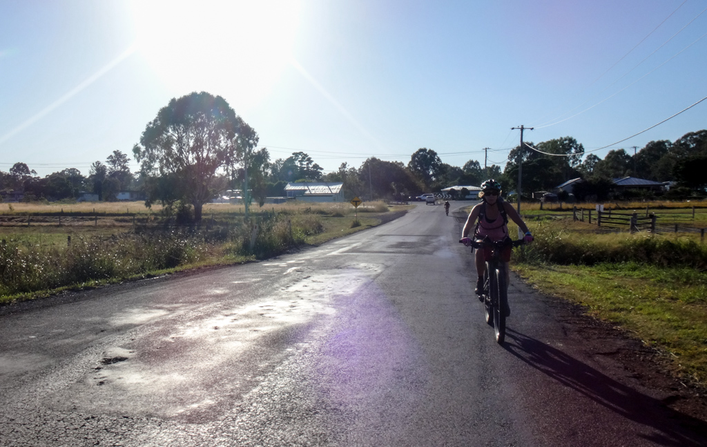
We started at Gleneagle on the highway to Beaudesert, and rode west through quiet farmland.
Our long Queensland summer has come to an end. The new season has brought with it welcome cooler temperatures and clear skies. In this part of the world, the end of summer is the perfect time for long strenuous rides.

The jagged edge of a distant summit loomed on the horizon.
“What mountain is that?” someone asked.
“Flinders Peak,” I replied. “We’ll be riding close to it later on.”
It seemed so far away for now.

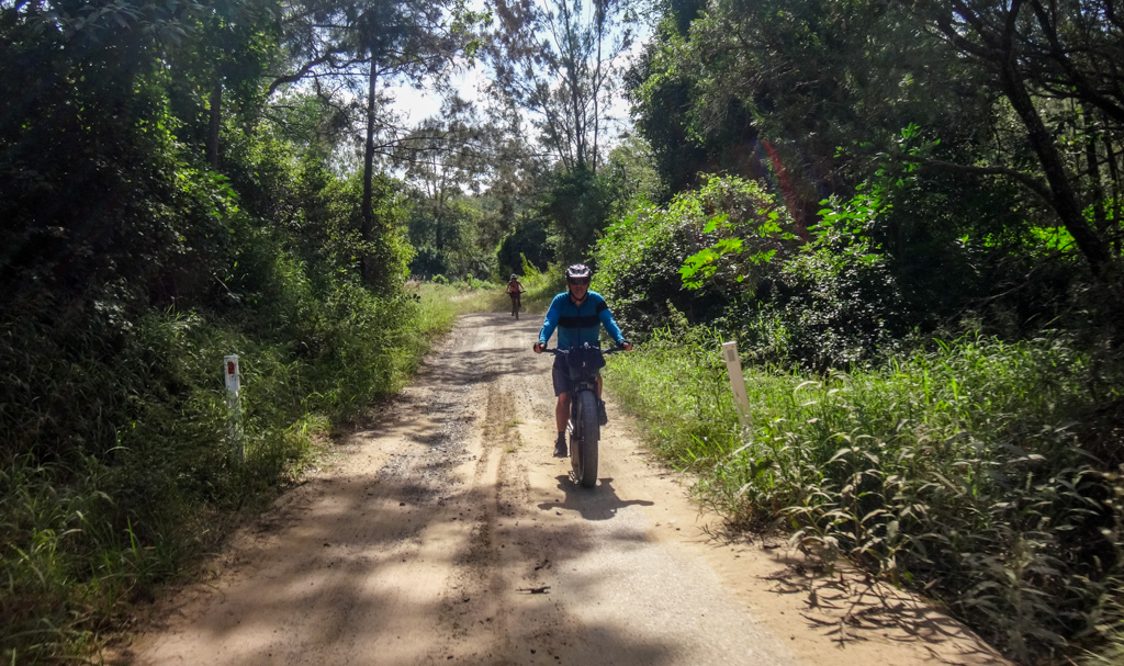
For about half an hour we coasted on long flat paved roads. Mountain bikers prefer dirt, but sometimes it’s nice to chill out on an easy quiet road, especially when there’s hard work ahead.

We clunked over an old wooden bridge, crossing the interstate railway line – a long ribbon of steel which pointed unflinchingly north towards the city.
It’s unusual because it has three rails. It’s a dual-gauge line because Queensland and NSW trains need rails of different widths.
It’s an old story that Queensland school children learn in primary school. Our teachers tell us that back in the 1860’s when the fledgling Queensland Government decided to build a railway, they didn’t have much money in the bank. When you space railway lines further apart, you need more wood for longer sleepers. NSW had a railway gauge of 4’8 1/2″ – Queensland couldn’t afford that much wood, so they decided to build a narrow gauge railway with rails only 3’6″ apart.
The result was disparate railway systems, culminating in this dual-gauge line which attempted to redress the issue.
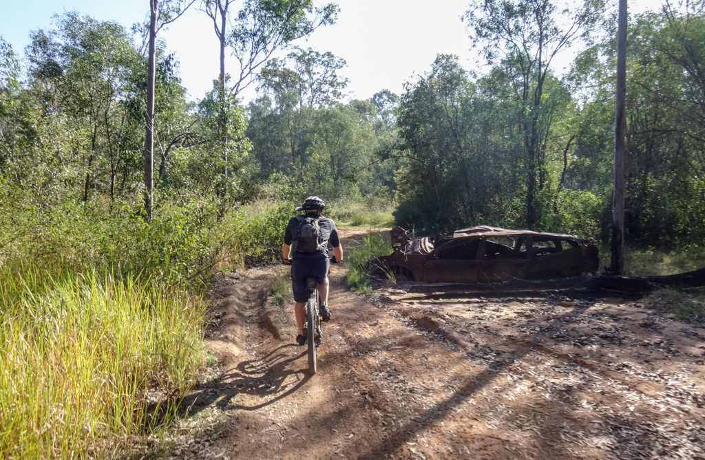
From here we left the paved road and followed a secluded bush track past rusting old car wrecks.

I had often looked at aerial photos of this parcel of bushland, wondering what it would be like.
It’s huge, stretching from Kagaru in the south all the way to Springfield near Ipswich in the north.
I thought we should explore it soon because of increasing land clearing and property development in the area. I had no idea if or when this land might be cleared.

We climbed for a while before reaching our first steep descent.
“I’ve been here before,” Kaye said. “Is this near Jimboomba?”
Kaye was right. We were actually quite close to Jimboomba. In hindsight we probably could have started our ride from there.

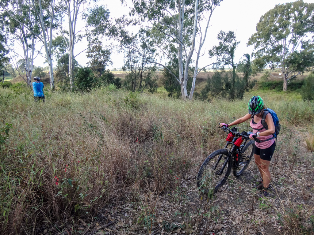
The track became rougher further down the hill.
Ruts are tricky to ride. Once your wheels roll at the bottom of a rut, it’s hard to escape. The bike is like a train on rails, and you have to either stop, or follow the rut to the end.
I stopped and walked 🙂

We took a short break at the top of a steep hill.
I took a glance at the elevation profile. An even larger slope loomed ahead.

We pushed the bikes up the steep hill, occasionally riding when the gradient allowed.

The views at the top were impressive.
We could see all the way north to Ipswich.

After admiring the panorama for a short while, we jumped back on our steeds and bounced down the hill.
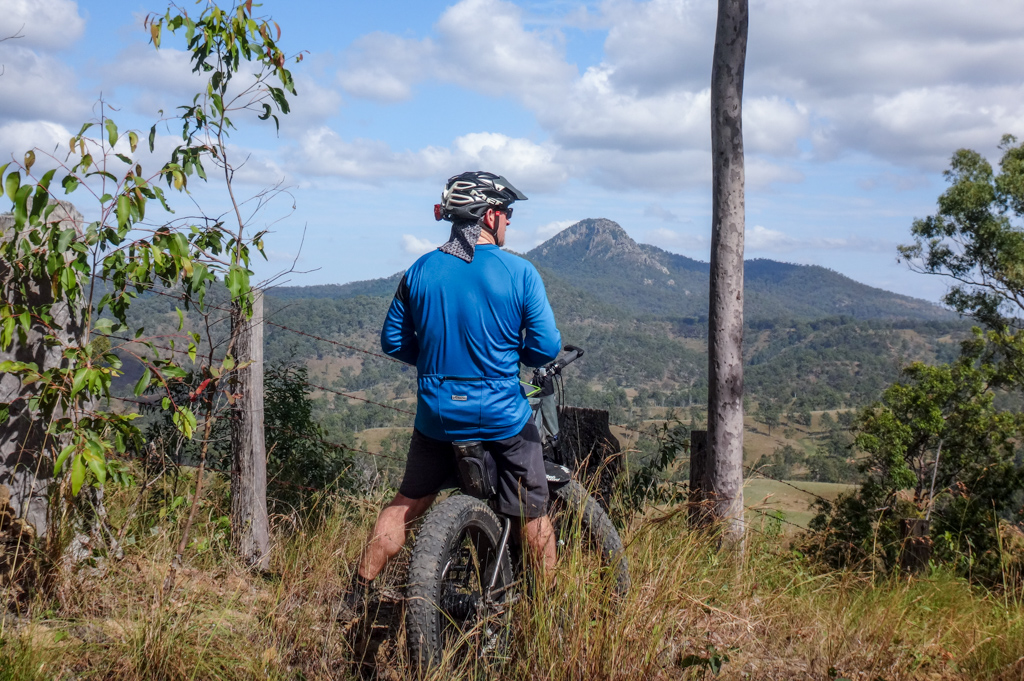

Flinders Peak grew large to our left. At the start of the day it was just a shadow on the horizon, but now it was close.
It’s amazing how far you can get on a bike in a few hours.
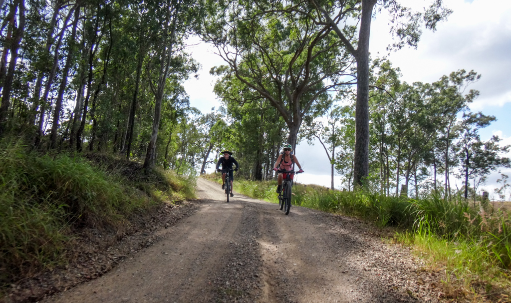
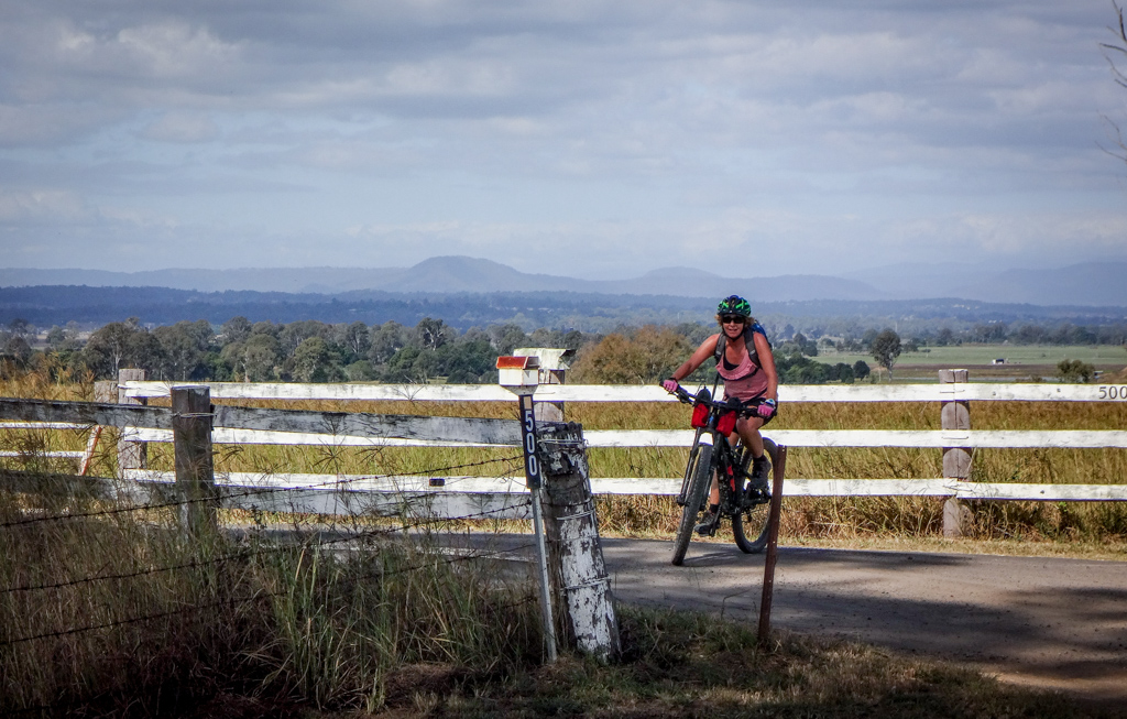
Our track eventually emerged on Undullah Road.

We’ve ridden through here on several occasions. From this point it was easy to separate the peaks of Mount Elliot on the left and Flinders Peak on the right.
In the past we’ve had a lot of fun riding down Mount Elliot Road – a long steep gravel road with a couple of hairy bends.
Today we’d be continuing south instead.

The street signs around here are great.
I wish my street had a painted rock like this instead of a sign post 🙂

The bridge over Woollaman Creek was no longer there. One of the locals told me it was destroyed by fire a few years ago.
Despite that, I thought it would be worthwhile having a look at it. Perhaps we could cross the creek on foot, if the water wasn’t too deep.

The road was overgrown due to lack of traffic.
Nope – we weren’t going to get through here. The banks were too steep and the water too deep.
We reluctantly retraced our steps and took the paved road back.

Back on the bitumen, the miles flashed by.
In the distance, more mountains, more potential rides.
Sometimes I feel like there is so much to see and so little time.
Total climbing: 1697 m
Average temperature: 25
Total time: 05:23:38
More data
We rode about sixty-three kilometres in five and a half hours. During that time we climbed about 1,700 metres and I burned about 2,800 kcal.
This was a pleasant ride in perfect weather. The only challenging bit was the long steep climb up Rice Road. I’ll rate it 8 out of 10 on the tough-o-meter.
Thanks Darb, Eric, Kaye and Jason for another fun day out!
(Technical note: I’m having problem with some of my maps. The garmin track log doesn’t seem to be working on some browsers (Firefox Quantum), and instead of a map you just see a big white square. I’m experimenting with a new mapping system. If it works I’ll gradually update older blog posts to the new maps. If you have any problems seeing the maps, please let me know).


Nice ride. Would be awesome if you can find a route from Undullah Rd through to Flinders Peak (Wild Pig Creek Rd???)
G’day Andrew
We’ve done it, but you need landowner permission.
See this ride: https://blog.neilennis.com/index.php/the-teviot-range/
And this track log: https://connect.garmin.com/modern/activity/1118221652
Hope this helps.
Neil
There’s no dual gauge down that way. Its a guard rail to stop derailed trains coming off completely. You see them on bridges.
Regards Graham.
Thanks Graham 🙂
No, you are right Neil, This is my stomping ( mtb riding ) ground. I have been riding this area for 20 years on my mtbs. The third rail on the interstate rail line is Qld 3 ft 6 inch gauge, put in a number of years ago with a federal grant I believe of somewhere in the vicinity of $50 million. It runs from Acacia Ridge out to Bromelton just west of Beaudesert. All the old wooden sleepers were gradually replaced with concrete ones when the third rail was added. . The idea was to link freight depots near Beaudesert through to Acacia Ridge and on to the Port of Brisbane. So far, a decade later, no Qld gauge train has operated on it. The much-talked- about Inland Rail system is supposed to link into it at Kagaru in the next couple of years. Rapid urban development at Flagstone and Greenbank has people asking when it will be used for urban passenger rail services, but currently there are no solid plans for this. Vague promises and talk by politicians only.
Re the missing bridge over Wollaman Creek on Undullah Road; this was initially closed to vehicular traffic, later burnt out by vandals, then demolished. We still often ride this stretch, wheeling our bikes down and up the banks and crossing at a shallow part. It is fenced, but is still a gazetted road. We often rode a quick afternoon one hour dash of 20 km loop along Old Teviot Road, Wyatt Road, Undullah Rd, and Kilmoylah Road (recently bitumened). We also roamed far and wide through the bush and tracks north of Undullah Road (future suburb of Monarch Glen), but much of this is now in the hands of developers, and legal access is becoming more doubtful. A shame, as we watch all our old tracks vanishing. Wild Pig Creek /Washpool Road and Mt Elliott Rd appear to join up on maps, but despite riding from each end, we have never pushed our luck by going past ‘Private property’ signs, which may or may not be bluff by landowners who wish to keep people out. Likewise, much of Rice Road is apparently private. Also, lots of old tracks at Ripley are now going under rapid urban development.
P.S. Recently rode Kilkivan to Wulkaraka using the two Rail trails and Link road. We camped, and towed BoB trailers with our camping and cooking gear and basic food. Tougher going than bare bikes but enjoyable nonetheless.
P.P.S. I came across your blog looking at Ten Pound Pom info with my granddaughter. My wife and family came from England under the scheme in 1966. It’s a bonus that you are a mtb tourer/ photographer/ blogger..
Cheers
G’day Brooksie
Thanks for the great info.
Nice to meet a fellow Ten Pound Pom.
It’s a shame we’re losing a lot of tracks – but thankfully there is still a lot of country out there to explore on bike.
Regards
Neil
Definitely not the purpose