Samsonvale Railway

I rode out to Mt Samson and Samsonvale again this morning to continue my search for any remnants of the old Railway line, and to check out the Samsonvale Bora Ring.

Follow that train!


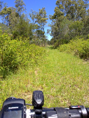
The railway line heads north from Mount Samson to Samsonvale. Unfortunately it disappears into the lake now. This is the view looking South towards Mount Samson station. The embankments are still evident.

Mount Samson, D'Aguilar Ranges
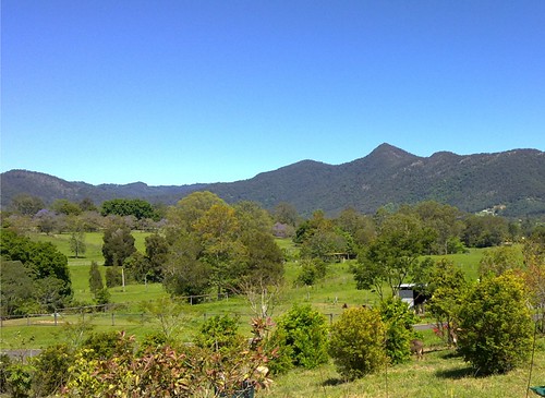
South of Mt Samson village the railway line runs under Kunde’s Road. This is the view west towards the unmistakable pyramid shape of Mount Samson in the D’Aguilar ranges.

Towards Kobble
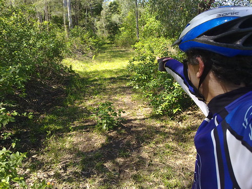
The line continues north of Samsonvale through Gold’s Scrub towards Kobble.

Ancient Sentinel
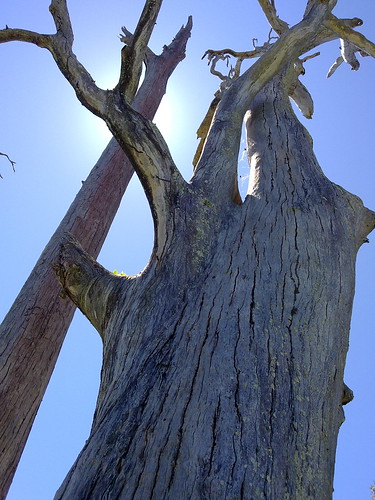
This dead tree marks the site of the Samsonvale Bora Ring.

Samsonvale Bora Ring
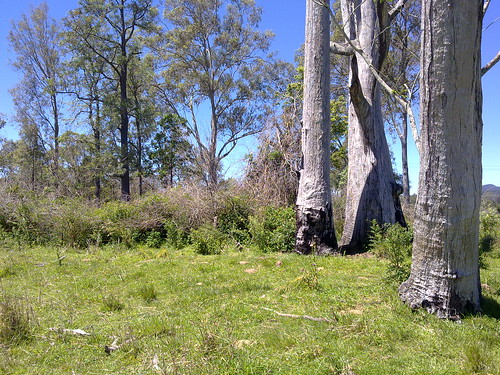
The Samsonvale Bora Ring was an ancient, sacred, ceremonial site used by the Turrbal Aborigines for corroborees and initiation ceremonies. It stands less than a hundred metres from a busy road and is easy to see, although I’m sure most of the people driving by would have no idea about the important events that have transpired here for thousands years.

View Larger Map

Note: My GPS had a glitch between Mt Samson and Samsonvale so I wasn’t able to record those tracks.

Total distance: 44.73 km
Total climbing: 696 m
Average temperature: NAN
Total time: 05:14:04
Download file: activity_53252067.gpx
More data

2 Replies to “Samsonvale Railway”

  1. Hey Neil, Me again: I was wondering if you could give me some good clear directions to the Samsonvale Bora Ring. I see you said it was marked by 2 dead trees & quite near the road. Is it the right or left going from Samford to Dayboro? About how many Kms/ mtres is it from Winn Rd/Dayboro rd intersection. You said your gps played up that day. I will also try to find the bat cave in Yugar. (Is it under Samford/ Dayboro Rd). I found the Wight mountain Ring thanks to your blog. Very impressive. There are a couple of other sites I have found: There was a boiling mud spring on 63 Graham Rd, & Hawbridge Cnr., one of apparently only in Aus. It was covered in by the council. Theres a little park there you can visit.
    Also, on your trip to Beerwah, have you visited the Bora ring or Durm on Johnstone rd. Just past the Matthew Flinders rest area, going north is “Moffat Rd” on right, about 2 kms along, it becomes Johnstone rd in among Pine forests. About 600 mtrs past the Crittendon Rd/ Johnstone intersection is a small side dirt rd on left, There is a sign ‘BORA RING”. This road is between a pine forest paddock on right & Pineapples on the left. RIDE 700 Mtrs & round the corner to right skirting the pine paddock. The ring is about 200 mtres around the corner on left. It is apparently a womens ring. Thanks for sharing your adventures & your very thorough writings.

    1. I don’t believe the picture depicts the actual site – which is accessed via Basin Road and surrounded by barbed wire fencing, accessible via a rural gate. It can be seen from the road, especially after recently mowed, with a tree growing out of the centre of what used to be the bora ring – unfortunately, local word-of-mouth is that the ring was degraded by rural plowing and tree-lopping many generations ago.

Leave a Reply

Your email address will not be published. Required fields are marked *

This site uses Akismet to reduce spam. Learn how your comment data is processed.