Minjerribah

Brown Lake

North Stradbroke Island is a stunning sand island which frames the eastern border of Moreton Bay, near Brisbane. It’s the second largest sand island in the world, after Fraser Island – a couple of hundred kilometres further north.

I spent a day roaming over this special place with my son, Jonathan.

Until about a century ago, it was one island. During a fierce storm, a ship laden explosives was wrecked on the Jumpinpin Bar. Local authorities detonated the explosives rather than risk a catastrophe while trying to retrieve the cargo. This weakened the sand bar, which allowed rough seas from the storm to break through, cleaving the island in two, forming a new passage between North and South Stradbroke Islands.

“Minjerribah” is the aboriginal name for Stradbroke Island. “Moorgumpin” is their name for Moreton Island. These islands, together with all of Moreton Bay are known as “Quandamooka” country. The Quandamooka Aboriginal people comprise three groups: The Goenpul and Noonukul from Minjerribah, and the Ngugi from Moorgumpin.
Moreton Bay Sunrise
The only way to get to “Straddie” is by boat. Our ferry left Cleveland at 5:15am, so I had to get up at 3am in order to pick up Jonathan and get to the ferry on time.

Moreton Bay Sunrise

Bleary eyed, and dosed up to the eyeballs with strong coffee, we stood out on the deck of the ferry, “Big Red Cat”, and marvelled at the amazing dawn.

Brown Lake

As we drove off the ferry, our first destination was Brown Lake – an elevated fresh water lake in the middle of the island.

Brown LakeBrown Lake

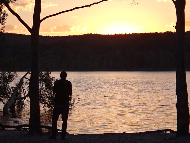
The sun was just rising over the hills as we arrived, so in true tourist fashion we gaped at the beauty while clicking off dozens of photos. It’s not every day you get to see a sunrise over a pristine freshwater lake.

Eighteen Mile Swamp

A little further towards the east we arrived at the “Eighteen Mile Swamp” a coastal freshwater swamp stretching for almost 30 kilometres behind the coastal dunes. This amazing lake is the largest of its kind in the world and is home to a large number of rare and endangered species.

Naree Budjong Dara

The swamp, surrounding forests, and dunes form part of the Naree Budjong Dara National Park. “Naree Budjong Dara” means “My Mother Earth” in the language of the Quandamooka people.

Main Beach - North Stradbroke Island

The beach here stretches as far as the eye can see in either direction. It was a wonderful feeling to be one of only a handful of people on the entire beach. Lots of space is good for the soul.

Sand Bog

It’s important to remember that the beach is an official road, and that vehicles could pass by at any time. These drivers were bogged in sand and were desperately trying to free their car by scooping sand out from under the tyres.

Tortoise Lagoon

As we made our way back from the beach, we stopped for a short walk around Toroise Lagoon – another fresh water lake that forms part of the “Blue Lake” system.

Blue Lake Walk

Because of my knee, I didn’t feel able to complete the full 6km walk around Blue Lake, but I felt pretty good about doing the shorter 3.5km loop around Tortoise Lagoon instead.

Shell Midden
Shell Midden

Back on the bay-side of the island near Dunwich, we checked out one of the few remaining Shell Middens on the island. Over centuries, Aborigines would sit around here, enjoying shellfish, oysters, crabs, etc. The left-over shells were discarded in a large pile. Over time this heap grew to several metres in width and a couple of metres high. I explained it to Jonathan as the remnants of a two-thousand year long indigenous seafood party.

Dunwich Shoreline

“Imagine being able to go out on the rocks and pick up a handful of Sydney Rock Oysters, or Moreton Bay Bugs whenever you wanted”, I said to Jonathan.

Before European colonisation, this place was paradise. Life here must have been full of contentment.

Amity Point
Amity Point

We then made our way northwards towards Amity Point, at the north-western tip of the island.

This is a fascinating point for a number of reasons:

It’s not far from here across the treacherous South Passage to Moreton Island. This is a dangerous passage because of shifting sand bars, strong currents, and unpredictable conditions.

At this point in 1823, the local Aboriginal people had their first face to face contact with Europeans. Last week I wrote about three shipwrecked ticket of leave convicts who were rescued by John Oxley on Bribie Island. Finnegan, Parsons and Pamphlett were washed ashore on Moreton Island. The Ngugi people on Moreton kindly fed these poor begraggled strangers for two weeks, and then rowed them across the South Passage to Amity Point. The Noonukul cared for them for another five weeks before eventually sending them on their way across the bay to the mainland via Peel Island, coming ashore near Ormiston.

Sovreign Memorial, AmitySovreign Memorial, Amity

A couple of decades later, Europeans were colonising Moreton Bay, including the Island. Amity Point was chosen as a Pilot station because of its proximity to the South Passage. The Cargo Ship, Sovreign, was moored off Amity for over a week in heavy weather. She attempted to clear South Passage, but was wrecked in the process, going down about two kilometres off shore.

A group of Aboriginal men, some from Minjerribah, some from Moorgumpin swam to the wreck, at great risk to their own lives. They were able to save the lives of ten passengers. Unfortunately, 44 people drowned.

It was a tragedy, but the aboriginal men were heroes, and were honored by the NSW government for their bravery.

Today, two of these brave men, Toompany and Nuggin, have streets in Amity named after them.

Hope Memorial, Point LookoutCylinder Beach

As we drove along the northern tip of the island, towards Point Lookout, Jonathan and I discovered more historical gems at Cylinder Beach.

In 1803, the colonial ships, “Cato” and “Porpoise”, were wrecked on reefs east of Gladstone. Matthew Flinders took the ship’s cutter, and decided to sail the small open boat back to Sydney with thirteen other men. After sailing 600 km south, they were running dangerously low on water, and anchored off Cyclinder Beach to find water. Some aborigines on the cliffs saw them, and signalled to them where they could find fresh water from a small creek nearby. After refilling their casks, the crew were able to complete the perilous 1,000 km voyage to Sydney.

Cylinder Beach
When we looked along Cylinder Beach today, speckled with holiday makers, it seemed a long way from the remote water stop for thirsty sailors over two centuries ago.

Cylinder Beach
Cylinder Beach

The warm turquiose ocean is stunning to look at here. As I soaked in the beauty it occurred to me that the original inhabitants of this place were fortunate to live happy, healthy lives in one of the most bountiful places on the planet. They enjoyed a standard of living higher than most of the Europeans who were trying to colonize them. In most early contacts, they responded with kind-hearted generosity.

Thomas Pamphlett came from the north of England during the industrial revolution. It would have been cold, dirty and crowded. His poverty would have made it difficult to find food to eat each day. I wonder how he would have remembered his seven weeks in the sun with the Quandamooka people?

North Gorge - Point Lookout

At Point Lookout, on the north-eastern tip of the island, we walked around North Gorge. This is a spectacular inlet where the waves rush up the narrowing gorge.

North Gorge - Point Lookout

It’s also a great spot to gaze out at the Pacific Ocean and watch for migrating Humpback whales.

Surfers at Main Beach - North Stradbroke Island

You wouldn’t believe it was the last day of “winter” – the warm water was full of surfers.

Main Beach - North Stradbroke Island

From the headland we were able to look southwards down Main Beach as far as our eyes could see.

What an amazing place. I’m definitely coming back here on a bike when I am able šŸ™‚

All up we travelled about 220km. It was 55km each way to the ferry at Cleveland, 10km each way across the bay and back on the ferry, and about 100km of driving on the island. To take a car on the ferry costs about $140, although during the winter months if you catch the early ferry it only costs $80. For a car with 4 or 5 passengers all contributing to the fare, it works out pretty cheaply.

We spent 9 hours on the island and didn’t feel rushed looking at all the things we wanted to see.

Total distance: 129.46 km
Total climbing: 3267 m
Average temperature: 29
Total time: 10:53:50
Download file: activity_367850565.gpx
More data
Total distance: 3.91 km
Total climbing: 323 m
Average temperature: 20.6
Total time: 01:08:33
Download file: activity_367861585.gpx
More data
Bribie

Bribie Passage, Bongaree
Bribie Island is a sea-side paradise, less than an hours drive from the northern Suburbs of Brisbane.

The aboriginal name for the island is “Yarun”, meaning “Crab”. According to traditional legends, Yarun (or Yirrin) was a greedy man who ate too much honey. The bees smelled the honey, and covered him with wax. He ran out into the water, but the tides and the bees weighed him down. He got stuck in the mud, the wax hardened and before long he had turned into a crab. He and his people have been crabs ever since.

The name “Bribie” comes from the Aboriginal word “Boorabee” which means “Koala”. In the early days of the Moreton Bay convict settlement, several convicts escaped and made their way to Bribie Island. Eventually, the word “Bribie” became synonymous with disappearing from every day life: when a man from Brisbane had left town without leaving an address, people would say he had “Gone to Bribie”.

Harrison and I spent a lazy day exploring the history of this wonderful place. Perhaps we should have let people know we’d “Gone to Bribie” šŸ™‚

Kal-Ma-Kuta Memorial
One of the stories of Bribie Island that has intrigued me for ages is the story of Kal-Ma-Kuta, a Joondaburri aboriginal woman. I’ve often driven past an unusual memorial about her, built in the middle of the busy four-lane road as you approach the Bribie bridge on the road from Caboolture, near Turners Camp Road.

The memorial, erected in 1962, said that Kal-Ma-Kuta was the “Last of the Joondaburri Tribe”.

Turners Camp
Today we decided to stop and have a look, and try to answer a few questions about her.

We parked the car near the beach on Turners Camp Road, planning to walk back to the memorial and check it out, but discovered a newer memorial near the water…

Kal-Ma-Kuta Memorial
According to the plaque, this place was where Kal-Ma-Kuta (who was also known by the anglicized name “Alma”) and her husband, Fred Turner, built a house shortly after they married in 1872. They had eight children together, and lived together at this spot until Kal-Ma-Kuta’s death in 1897. The place became known as “Turners Camp” because of them.

This raised another question for me: If Kal-Ma-Kuta had eight children, why did the memorial say she was the last woman of her tribe?

I eventually found an old (2004) copy of Indigenous journal, “The Koori Mail”, which recounted a story that in the 1870’s oyster fisherman, Fred Turner, had a boating accident. He was rescued by a young aboriginal woman and eventually married her. Fred and Kal-Ma-Kuta had an oyster lease, and also were responsible for lighting the beacons on Toorbul Point (known today as Sandstone Point). The article also said that the Turner’s great grand-daughter, Daphne Kalmakuta Dux, had successfully lobbied local politicians to erect the newer memorial by the water.

Now 85 years old, Aunty Daphne, is an artist who paints stunning works depicting her aboriginal heritage.

Here’s a short video of her, filmed by students at Lismore TAFE in 2009…

I was able to speak with Aunty Daphne on the phone. I asked her about the “Last of her tribe” comment on the 1962 memorial. She told me, “I’m one one of Kal-Ma-Kuta’s descendants. I’m Joondaburri. So we can’t all have disappeared!” I’m glad she sorted that out.

'Day Dreaming' by Daphne May Kalmakuta Dux
You can see some of her amazing work at Serpentine Arts.

Fish Trap, Sandstone Point
The “Koori Mail” article said the Turners had a contract to maintain navigation beacons in the Pumicestone Passage at Toorbul Point. My friend Jason had told me the day before that if we had a look around Toorbul Point we might find the remains of an old Aboriginal fish trap. So Harrison and I decided to pop down the road and have a look around…

Fish Trap, Sandstone PointFish Trap, Sandstone Point

I asked a fisherman at the point if he knew about the Aboriginal fish trap, and he pointed to a spot a few metres away and said “Yes. It’s right there. But you won’t see much at the moment because it’s high tide”.

The whole idea with fish traps was to build a wall of rocks that would be submerged by the rising tide. Fish would swim into the enclosure, and be trapped as the tide fell. The successful fishermen would then help themselves to fresh seafood.

Before Eurpoean settlement, this place was a seafood lovers delight. What we know today as expensive Sydney Rock Oysters could be picked fresh from the rocks. Crabs, fish, dugong, turtles…. there was an abundance of good food for the local inhabitants.

Memorial, Sandstone Point
Memorial, Sandstone PointMemorial, Sandstone PointMemorial, Sandstone PointMemorial, Sandstone Point

This quartet of simple markers tells the story of three english ticket-of-leave convicts who, in 1823, were shipwrecked on nearby Moreton Island. Suffering a fierce storm off the coast of Newcastle, south of Sydney, they had drifted for several weeks before being washed ashore almost 1,000 km to the north. After being cared for by the Aboriginies on Moreton and Stradbroke Islands, they made a canoe, crossed Moreton Bay and came ashore at near present day Cleveland, south of Brisbane.

Finnegan, Parsons and Pamphlett thought they had been washed ashore south of Sydney, so started walking northwards in the hope of going home. But instead they crossed several rivers and eventually ended up living with the Joondaburri on Bribie Island.

The diet these three ex-convicts enjoyed on the islands of Moreton Bay was probably the most healthy and sumptious they had ever experienced in their short, unfortunate lives.

Toorbul Point Fish Trap
Harrison and I visited the Museum on Bribie Island, and found this photo, by Jon Rhodes, of the same Toorbul Point Fish Trap that we had been looking for earlier in the day. It might be an idea to go back to this point at low tide and see if the fish trap is easier to see.

Bribie Passage, Bongaree
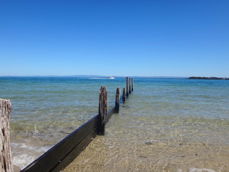
Taking a break from history, we grabbed some morning tea and sat by the water to enjoy the views of the mountains in the distance.

Buckleys Hole
Bird HideBirdlife, Buckelsy Hole

We planned to head to the southern tip of the island to check out a bit more local history. But before doing that, we wanted to have a look at “Buckley’s Hole”. This is an artificial lagoon which was created in the 1980’s when the council built a sand wall across the mouth of a slow-running creek to deter mosquitoes from breeding. The lagoon is an important habitat for a large number of different bird species. To allow visitors to observe the birds, there’s a small “hide” overlooking the lagoon.

Swallow Nest
We spent a while quietly watching the wildlife from the hide. A few swallows kept flying in and out of the windows. Keen-eyed Harrison realized there were several nests inside the hide on the wall immediately behind us. We were delighted to find some beautiful speckled eggs inside.

Buckley’s Hole is also important culturally. There are a couple of shell middens nearby, formed over centuries as Aborigines gathered to enjoy shell-fish and then discard the shells.

Norfolk in the Pumicestone River 1799
It’s also close to the first documented encounter between Europeans and Aborigines at “Skirmish Point” – as depicted in this painting by Don Brabden that we saw in the Bribie Museum. It shows Matthew Flinders rowing ashore from his sloop, The Norfolk.

Funnily enough, this is also the same point where our three ship wrecked ex-convicts: Finnegan, Parsons and Pamphlet, were found almost 24 years later by an astonished John Oxley in 1823.

Looking at Moreton Island
Harrison and I made our way down to Skirmish Point. There were no old wooden sloops there today – just a flotilla of modern pleasure craft, and a small cruise ship in the distance.

Red Beach
What a beautiful part of the world!

WW2 Bunker, Bribie Island

Eventually we made our way across to the eastern side of the island, or “surf side” as the locals call it.

It didn’t take us long to find our final historical landmark – the old World War II bunkers in the sand dunes behind the beach. These bunkers had a couple of 155mm guns mounted on them and were capable of hitting a target 30km away. The shipping channel at this point comes in closely to the coastline, so it was an ideal point for the fortifications. The bunkers were also used to monitor the channel for submarines, and were capable of detonating submerged mines if intruders were detected.

Woorim
From this spot on Bribie, Moreton Island looks quite close.

Seaside Drink
History lesson over, we decided to stop at a cafe in Woorim for a late lunch before heading home.

Today’s trip was only 116km in the car, with about 3 hours exploring on foot, and 2.5 hours driving.

Thanks Harrison for a fun day of exploration!

Historical notes:
1. People more qualified than I suggest that the Joondaburri tribe are part of the Gubbi Gubbi (or Kabi) Aboriginal people.
2. In referring to Kal-Ma-Kuta as the “Last of the Joondaburri Tribe”, the authors of the 1962 monument were probably alluding to the sad fact that most of the tribe had desserted Bribie Island by about 1880. Habitat destruction by European settlers had rendered the island unable to provide enough food for the indigenous population.
3. Aboriginal freedom fighter, Dundalli, was adopted by the Joondaburri tribe, and was involved in some gruesome conflicts with European settlers which eventually resulted in his execution in 1852.

Borumba

Yabba Creek
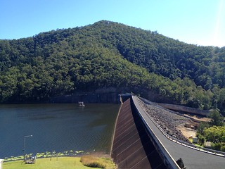
Nestled in the eastern foothills of the Conondale Range, Borumba Dam is an artificial lake which was formed when Yabba Creek was dammed in 1964.

The traditional owners of the area are the Kabi / Gubbi Gubbi aboriginal people. In their language, “Borumba” means “Place of minnows”.

In 1910, John Matthew wrote a book entitled “Two Representative Tribes of Queensland” in which he studied the ways of the Kabi / Gubbi Gubbi people. He spent six years living with and learning from these amazing people.

He told of an ancient song which the Kabi women would sing while boys went through the initiation ceremony which transformed them into men. The song mentioned the minnow (Galaxias) – a fish with a gleaming mouth:

Kung bondyin’-diman
Ngan’-daigaru’ dom’-an doman’ buthan’
Bur’-un burun‘, tang’-gara kak’-kalim’,
Windan’ windan’ buthan’,
Tang’-gara kak’-kalim’.
Water shake
The mullet-with little little close to.
A fish, a fish, the mouth gleaming,
The bank, the bank close to,
The mouth gleaming.

Unloading the Bikes
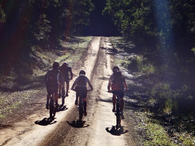
Today’s ride started at Jimna, high in the Conondale Range. The aim was to ride down the range to Borumba Dam, then ride back up a different way, making a big loop finishing back at Jimna.

No riding for Neil

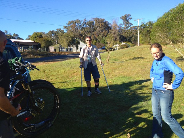
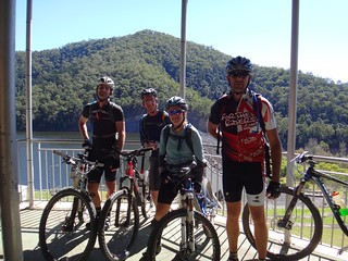
I met Becca, Eric, Paul and Jason there, but today was a new experience for me: While I had planned the route for the ride, I would be driving and they would be cycling. Some of the tracks they’d be riding were far too rough for a car, so I had to drive around the long way, meeting them at various points along the way. I was keen to make sure the route I’d sent them on was good! Eric and Jason agreed to take pictures as I wouldbn’t be there to photograph most of the ride.

Borgan Road
Borgan Road

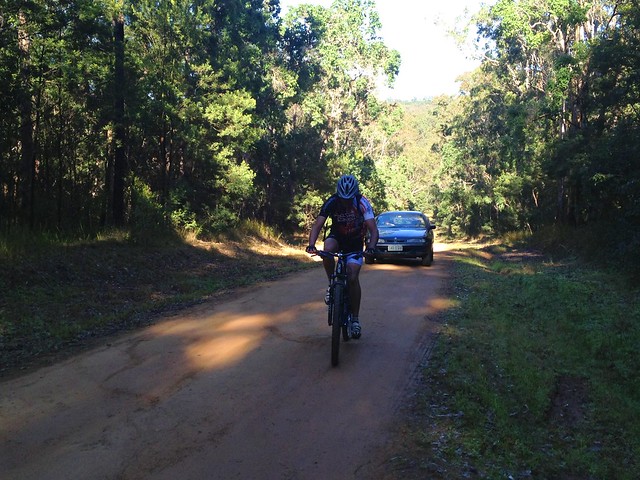
My riding buddies left on their journey to Borumba Dam, I followed for a short way in the car, but eventually I had to let them go, while I made my way back to Jimna to have a look around the visitors centre.

Aboriginal Stone AxeAboriginal Stone Axe
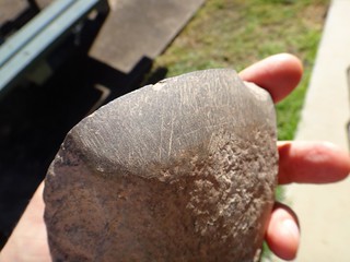
The Conondale Range around Jimna has a rich aboriginal heritage, and I was lucky enough to actually handle an ancient stone axe – sides worn smooth with use. As I touched it I tried to imagine what life would have been like here, ages ago.

Wrong Way
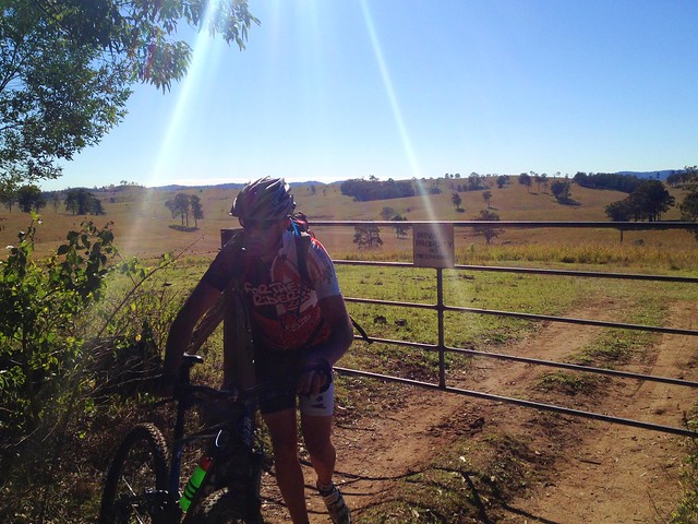
Meanwhile, our riders were having an interesting time. Instead of following the planned route, they accidentally took a righthand turn down a steep hill. Sadly it ended in a locked gate with a “No Tresspassing” sign, so they had to turn around and grind back up the hill.

Horse on Borgan Road
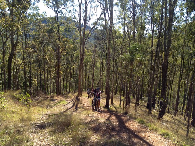
Once back up the hill, the route followed a ridge northwards through beautiful open Eucalyptus Forests. The endless days of sunny weather are finally here. With the cloudless sky a stunning blue above, it was perfect weather for exploring the bush – even the wild horses thought so!

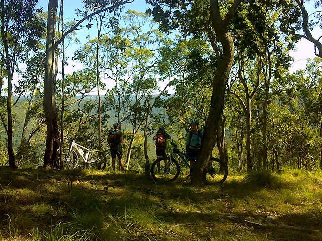
Enjoying the View
From this point the track started to descend sharply, with great views of the Yabba Creek Valley to the north-west. This is spectacular country.

"Kingham Station"Wrattens National Park
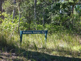
In the car, I was taking my time, slowly driving from Jimna to Borumba via Kingham Homestead and Wrattens National Park. Bordering the national park, Kingham has a deer farm. If you ever drive through here, take it easy as there are large deer running around all over the place. I’m sure it would be easy to collide with one of them if you were driving too quickly.

I took my time. I didn’t want any unpleasant surprises this far from home.

Yabba Creek
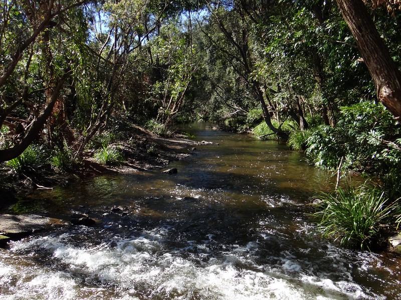
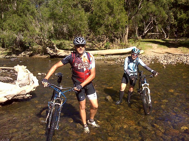
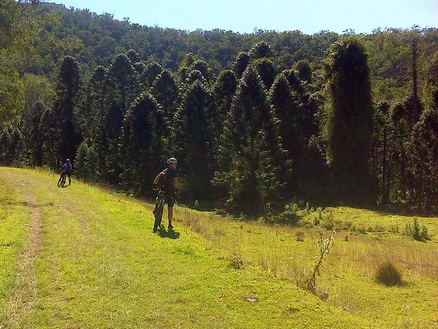
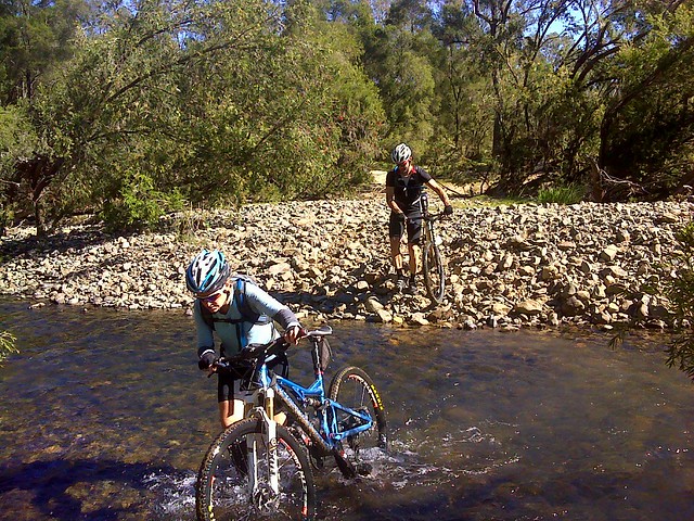
At the bottom of the steep descent, the mountain bikers crossed Yabba Creek. It’s in water like this that you can find “Burun” – the Minnow or Eel Gudgeon. The water is cool and crystal clear, but this crossing was a bit too deep to ride through.

Bunyas at Yabba Creek
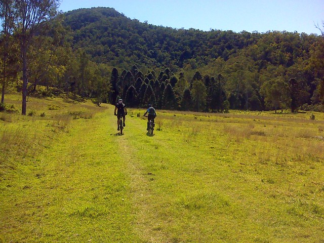
The ride along Yabba Creek has a few clues about what this land would have been like before European Settlement. While much of the forest was cleared in the 19th century for pasture, this stand of Bunya Pines gives hints about of the sort of vegetation that would have been common in the Yabba Creek valley before then.

Borgan Road
Rendezvous - Borgan Road
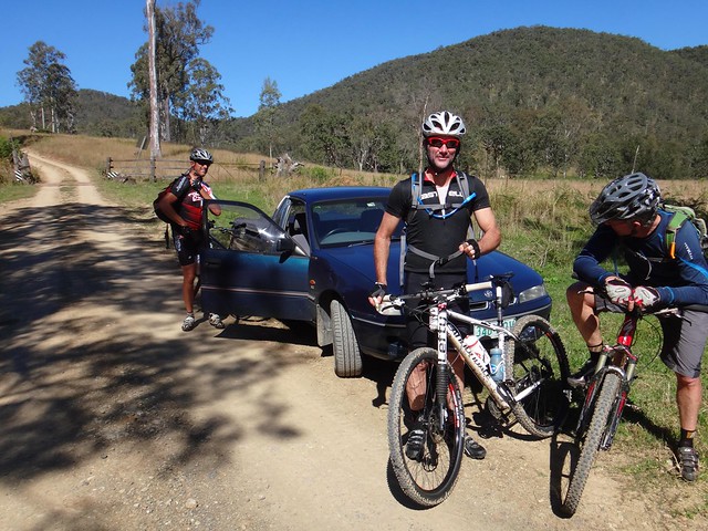
As I slowly made my way down the mountain, I saw a red flash out of the corner of my eye. It was Paul on his bike.

I was amazed. I had a quick cup of tea in Jimna, driven slowly through the forest, and these guys had beaten me to the meeting point on their bikes – even after taking a wrong turn. In hindsight I’m glad they made that wrong turn – otherwise I would have missed them.

Admittedly, I had to travel 35km, and they only had to travel 20km, but it still shows that a mountain bike is a pretty efficient way to get through rough country.

Everyone had wide grins on their faces.

“That was the most amazing descent I’ve ridden”, Paul said.

Jason described it as “The hell crazy descent with it’s drop-off to the left”. Like all true photographers who ride mountain bikes, Jason was torn between enjoying the long rocky descent, and looking for the next place to get a good photo.

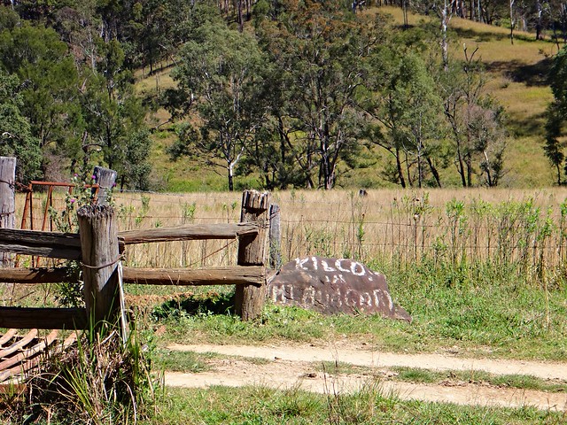
"Kilcoy via Mount Buggery"
I couldn’t resist taking this photo at our meeting point. The sign painted on the rock says “Kilcoy via Mt Buggery”. Aparently I had driven down “Mount Buggery”, which is a “shortcut” to Kilcoy if you’re driving from Imbil. The mind boggles at how they come up with these names.

Bella Creek Road
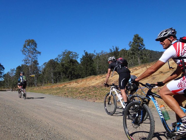
From here it was about 15km along a gravel road to the dam. I passed the riders on the road a couple of times, and had to ford a few ankle-deep creek crossings as our route wound eastward through open hilly farmland.

Borumba DamBorumba Dam

We eventually met up at a shelter overlooking the lake for lunch. I brought some spare water for everyone to fill up with. On an 80km ride it’s important to top up with extra water, as a standard 3 litre camelbak won’t last the entire day.

Yabba Creek
From this point, the riders were on their own. I didn’t think it was sensible for me to try and drive back up the hill to Jimna. We said our goodbyes and they rode back to the foot of the range 15km to the west.

Tough Climb
One saying we’ve all become familiar with is that you always have to repay your debt to the Gravity Gods. This was particularly true today. Earlier in the day, the riders had descended about 500 metres as they dropped off the edge of the range. Now they had to grind back up – this time it was a different hill, but it was just as steep, and involved one or two kilometres of walking up very steep hills.

Enjoying the View
Borumba Dam
As always – the views on the way back up were just as good as the views on the way down. One of the (few) advantages on the way up is that you have more time to enjoy those views. The panorama of the dam below was spectacular.

Ants Nest
Unfortunately, this was where part of the route I had planned had a few flaws. I had plotted the route using the aerial photos in Google Earth. There were no tracks on the map, so I had to find some way to get through some rough eucalyptus forest for about a kilometre. My track led off into some undergrowth and was impossible to follow, so everyone decided to follow a fenceline eastwards instead. This worked out perfectly and after a short struggle they were soon back on track on Yeilo Road.

Eric the Hobbit
Jason was lucky enough to spot the rare Dousi Hobbit nestled in an old dead tree trunk. It’s unusual to find one of these timid animals in the day time.

Yeilo Road
The sun was starting to get low in the sky. It was late in the day, around 5pm, before they eventually re-entered the Jimna Forest for the final leg of the trip. A couple of riders were getting low on water, and starting to feel really low on energy.

Just after 5.30pm, they rolled back into Jimna after riding a total 85km in about 8 and a half hours. During that time they climbed a total of 2,100 metres.

Sorry for the joke, but this is the toughest ride I’ve never done šŸ™‚

After talking with Becca, Eric, Paul and Jason afterwards I think it rates at least 10 out of 10 on the tough-o-meter. They don’t get much tougher than this. Becca says that I broke the metre with this route. Eric called it a “tough mother of a ride”, which (coming from him) means it was quite difficult.

One easier option for this ride is one-way frm Jimna to Borumba Dam or Imbil which would take you 3 to 4 hours and would be mostly downhill.

Don’t attempt the full loop unless you’re very fit, are in a group of very fit riders, and have plenty of food and water. It’ll take you all day.

Thanks Becca, Eric, Paul and Jason for allowing me to plot the course for you, and for letting me tag along.

Thanks Eric and Jason for the great photos!

Total distance: 84.54 km
Total climbing: 1876 m
Average temperature: NAN
Total time: 08:35:46
Download file: activity_352517048.gpx
More data

Murphys Creek

Tough Country - Murphys Creek
There’s an unusual creek which flows down from the Great Dividing Range below Toowomba.

Aborigines used to hunt for fish in this creek, which could at times run dry, and at other times transform into a raging torent during the wet season. Once a grass fire swept through the area and burned the fishing nets of the local tribe. So from that day they called the place “Tamamareen” which means “Place where the fishing nets got burned by a grass fire”.

In the 1860’s, a shepherd named Murphy built a hut in the rough foothills near this creek.

Several years later in 1867, a water tank and railway station were built at the bottom of the range to service steam engines grinding their way up the range to the Darling Downs. They decided to name the station after the local creek, which by then was known as Murphys Creek after the shepherd.

In a short while, a small town had sprung up around the railway station.

According to historical writer, Van Derek, Chinese market gardeners camped by the creek in the 1860’s and 1870-‘s. They grew vegetables which they then sold to the men working on the railway line.

Disaster struck when a torrential downpour caused a flash flood of the creek, drowning the Chinese who were camped on its banks. Local rumour has it that there is a mass grave in the Murphy’s Creek Cemetery containing the bodies of the victims of that flood.

And as most Queenslanders will tell you, this fickle creek had the final word in 2011, when it broke its banks again, and destroyed an entire town.
DSCN4510_copy
A dozen of us rode off from Helidon to explore this fascinating part of the world.

Dirt Road - Lockyer
Since Helidon was pretty much the lowest part of the ride, we started with some gentle climbs near Lockyer before having to work our legs harder as we neared Murphys Creek.

Cemetery Road, Murphys Creek
Heading down cemetery road, past the legendary mass chinese grave, we could see some of the challenging foothills that lay ahead. These hills comprised the “small climb”. We’d grind up to about the 600 metre level, and then enjoy a quick downhill run before taking on the “big climb” up Fifteen Mile Road to Hampton at almost 800 metres altitude.

Tough Country - Murphys Creek
It might have been the “small climb” but the hills around Murphys Creek are tough to ride. At times we had to push the bikes.

Crazy Hill Climb
Crazy Hill Climb

Some of the hills were so tough, we couldn’t even push the bikes up them. We let Steeve get halfway up this hill (so we could photograph him) before we decided to turn around and try an easier route. I don’t think Steeve minded too much šŸ™‚

Thank, Jeff, for showing us an easier way through the bush. I think we’d still be in there fighting our way out if it wasn’t for you.

Tough Country - Murphys Creek
Eventually the monster hills gave way to undulating terrain, and we enjoyed the relatively flat tracks as we gave our legs time to recover. We had crested the “small climb”.

Forest Trails at Fifteen Mile

These trails were wonderful. For about six kilometres we wound our way down steep tracks on narrow trails, tyres sliding on the gravel, jumping over waterbars, and hardly having to pedal at all.

I loved it!

Happy Riders
The trail spat us out, as steep trails often do, in the middle of some grassy fields at the bottom of a place descriptively named “Fifteen Mile”. We had a bit of a snack here, which was a good thing, because the “big climb” lay ahead.

Tough Climb
Fifteen Mile Road is a nine kilometre ascent which rises about 450 metres. I was the slowest up the hill, so all I managed to photograph was Steeve ahead of me, snaking up the hill, trying to make the climb a bit easier while slowly wending through the blanket of green eucalypts either side of the smooth clay road.

Tough Climb
But all hills eventually come to an end, and soon we were coasting over the rolling plateau at the top, near Hampton.

Mountain Bike Fuel
The cafe at Hampton serves delicious mountain bike fuel. The Lamb-burger, short black and Chocolate Milkshake hardly touched the sides.

“Now where’s a hammock so I can have a short nap?” I pondered.
Hampton
Hampton

With lunch over, and satiated riders back on bikes, we rocketed down the bitumen along Esk-Hampton Road towards the lookout. This is a busy road, mostly downhill, so we enjoyed the free roll down to Perseverance.

Perseverance Hall

The sign says: “Small Cheer and Great Welcome Makes a Merry Feast” – William Shakespeare.

I couldn’t agree more šŸ™‚

National Park Road
National Park Road
The hills out the back of Perseverance were hard work – especially after such a relaxing lunch. But the surrounding countryside was picturesque.

Mud!
A couple of us ended up falling in the mud after coming across this muddy bog at the bottom of a hill. I thought I’d try and get a picture of Eric doing the same, but he gave us all a lesson in negotiating slippery terrain, and eased through without faltering. You da man, Eric.

Gus Beutels Lookout
Gus Beutels Lookout
Our tribe of bedraggled muddy riders emerged from the forest to Gus Beutels Lookout. Even though it was cloudy, the view didn’t disappoint. Even the rain clouds rolling in from the south didn’t obscure the panorama.

Rain clouds?

“Do you think we’ll get back before the rain hits us?” somebody asked.

Maybe šŸ™‚

Seventeen Mile Road
And so began the “big descent” down Seventeen Mile Road – a long (mostly) dirt road, stretching 30 kilometres back to Helidon, with only one or two uphill sections.

There were one or two near misses on the screaming descent. Dom took a corner a bit too widely and ended up colliding with some rocks. “You were a bit lucky there, Dom”, I said. It could have been a lot worse, but he only suffered a few scratches and bruises.

I took a slight detour so that this route would connect with the rest of my map. Half the group kept rolling down the hill while I did this, and few waited. Unfortunately this meant we copped the rain during the final part of the ride, while the others arrived back nice and dry.

But a little bit of rain at the end of a tough ride is almost pleasant.

This ride was 83km and took 7 hours including breaks. We climbed a total of 1,833m. I burned about 3,500 kcal.

I’d rate this one 9 out of 10 on the tough-o-meter. This was in cool rider-friendly weather. I wouldn’t attempt it in summer.

Thanks everyone for a fantastic ride. Geeze I have some great friends.

JohnJohnQuentinDomJohnSteeveBeccaJeffPaulEricNeil

Total distance: 84.87 km
Total climbing: 2597 m
Average temperature: 14.8
Total time: 07:05:13
Download file: activity_324428990.gpx
More data

Bunya Mountains

Steep Descent Ahead
The magnificent peaks of the Bunya Mountains are a three hour drive to the northwest of Brisbane.

J.S.Fisher Lookout
Our plan today was to ride from Burtons Well – close to Mount Kiangarow, the highest point in the Bunya Mountains at 1,135 metres above sea level. We’d then follow forestry roads eastwards towards Maidenwell where we would have lunch, before climbing back up the range to finsih at Yarraman.

This was a point-to-point ride, which meant we’d finish at a different point to which we started. This always raises logistical challenges – bringing two vehicles, retrieving one vehilce from the starting point at the end of the ride, etc. My friend, Paul, kindly offered to be our driver for the day, dropping us off in the mountains, then driving back to Yarraman to pick us up. This saved us a lot of hassle at the end of the day.

YarramanYarraman
We met with some of the guys from Toowoomba Mountain Bike Club in Yarraman before making the final drive up to the top of the mountains.

J.S.Fisher Lookout
The Jarowair Aboriginal people call this place “Boobarran Ngummin” which, literally translated, means “mothers’ breast”. They believed that the creators of the land, people and animals lived here. These mountains were so important to the aborigines of southeast Queensland, that every three years they’d walk several hundred kilometres from places as far away as present-day Northen NSW, Brisbane, Moreton Bay Islands, Sunshine Coast, and Wide Bay.

The journey would take upto several months, and during that time they’d engage in trade, marriage ceremonies, spiritual discussions and gathering the nuts from the abundant Bunya Pines.

Even today, the Bunya Mountains is the site of the largest natural Bunya Pine forest in the world.

Burtons Well
Burtons WellBurtons Well
Burtons Well is named after local pioneers, Bob aand Geroge Burton, who dug the well in the drought of 1901 to provide water for their horses and bullock team.

On this morning in late May, at such a high altitude, and under clear skies, it was very cold. So we all rugged up in anticipation for what would be a fast, cold descent down the mountain.

Steep Descent Ahead
This was the fastest descent I have ever done on a bike. The winding paved road drops about 500 metres in altitude in the space of about 5 km. At one section where the road dropped steep and straight, my GPS tells me my top speed was 99.9 km/h.

Bunya Mts Yarraman 2013-05-25 from Darb Ryan on Vimeo.

Here’s a video of that descent (and the rest of the ride) by my good friend, Darb Ryan.

The road whizzed by in a blur of howling wind, chilling cold, and my shrill cries of “On your right” as I passed a few other riders.

I still haven’t confessed to Liz how fast I went.

Alice Creek
In little more than ten minutes we were out of the rainforest, down the mountain, and rolling through open farmland with frozen faces, and cold noses. A few of us took the opportunity to remove some of the cold-weather gear and prepare for the hard work ahead.

Thick MudThick Mud
The dirt roads through Alice Creek are made of black soil. It’s nice and smooth in dry weather, but after rain it turns to sticky black goo. After a few minutes riding on it, our wheels caked up with thick mud. It was impossible to ride.

We stopped and scraped the mud from the tyres and our shoes, then pushed the bikes.

But in a cruel twist, the mud still stuck to the tyres while we pushed. So we had to carry the bikes for a couple of km.

It was hard going.
Heart Break Hill
But wait… there’s more!

Not only was the ground akin to wet cement, some of those hills were impossibly steep.

Hoop Pine Forest
Thankfully, even the steepest of hills come to an end, and soon we were enjoying some more bumpy descents through a hoop pine plantation.

Barker Creek
Barker CreekBarker Creek

We followed the trail along Barker Creek for a few kilometres, crossing it several times.

Barker Creek
The road surface gradually improved as we got closer to Maidenwell.

"This is killing me"
Eventually we came out on the paved road we’d driven along a few hours before. The fields of sticky black mud that we had encountered earlier had delayed us by about an hour. Although it’s difficult for a mountain biker to admit, it was actually a relief to ride on the bitumen for a short while before lunch.

Lunch at Maidenwell
Ten hungry cyclists decended on the Maidenwell General Store and ordered mountains of food. A few of us took the opportunity to dry out wet, muddy footwear on the footpath outside. It took a while, but after about an hour, we had all eaten and were ready for the final leg of the ride.

Coomba Waterhole
Coomba Waterhole

We stopped by Coomba Waterhole on the way back. This picturesque location is a great spot for a picnic, and (in warmer months) a swim. The imposing rock formations are fascinating. But in today’s chilly weather we decided to forget about having a swim.

Bunya Mountains
Resting at the Summit

After a long climb up yet another nasty hill in Yarraman State Forest, we took a rest at the top and looked back towards the west. A long way distant, on the horizon, we could see the shadowy peaks of the Bunya Mountains. It was a great feeling to think “We’ve just ridden from there”.

We rode about 70 km in about 7 hours including breaks.

During that time we descended almost 1,800 metres, but we also had to climb about 1,200 metres, during which I burned about 3,000 kcal.

This was a tough ride, made more difficult by the sticky mud, and the logistics of starting and finishing such a long way from home.

The Bunya Mountains are stunning – well worth the effort of the visit, whether it’s on a mountain bike or in a car.

This one rates 9 out of 10 on the tough-o-meter.

Thanks everyone for great company on a spectacular ride!

Total distance: 69.55 km
Total climbing: 1899 m
Average temperature: 17.1
Total time: 06:53:47
Download file: activity_317593574.gpx
More data

Deongwar

Gus Beutels Lookout
It’s supposed to be all down-hill if you start a ride from its highest point. But contrary to what I told everyone before today’s epic, this ended up being one of the more difficult treks we’ve done.

Gus Beutels Lookout
This was a point-to-point ride starting at the panoramic Gus Beutel’s Lookout, almost 760 metres above sea leval, near Ravensbourne on the Great Dividing Range. We intended to ride down the hill to Esk via some of the tracks that pass through Deongwar State Forest.

It’s logistically a bit more complicated when you starting and finishing a ride at different points. It means you need more cars. We met at Esk, parked some of the cars there, and bundled everyone and their gear into two of the vehicles which took us up the hill to the lookout.

The lookout is named after a German pioneer, Gustav Beutel, who settled in the area after emmigrating from Brandenburg in the nineteenth century. In 1924 he was granted a special lease to clear a one hectare section for a picnic ground and lookout for the many visitors who came to the Ravensbourne district to enjoy the rainforests and amazing views.

Shearer RoadHorrex Road
Horrex Road
From the lookout we followed some quiet dirt roads around the back of Ravensbourne on our way to the State Forest.

This whole area was covered in thick rainforest prior to European settlement. It was the traditional home of the Jarowair and Jagera people, but contained important pathways for other indigenous groups travelling northwards for ceremonial gatherings in the Bunya mountains.

In the late nineteenth century, most of the forest was cleared for its valuable Cedar, Blackbean and Rosewood timber, and to provide land for potatoes, maize and dairy.

Since the 1920’s successive governments have tried to redress the damage caused by land-clearing, and today about 700 hectares of forest is protected in Ravensbourne National Park, with almost 5,000 hecatres set aside in Deongwar State forest.

LantanaBush Bashing
Before entering Deongwar, we had to deal with a major obstruction. On the GPS we were supposed to be on a road, but (as often happens) the reality was that we had to pass through a dense thicket of Lantana. This prickly scourge sprouts thick branches which are difficult to push through, and rip your skin and clothes as you push through.

I took the easy option and let the other guys push through the overgrowth, and I followed meekly behind šŸ™‚

Single Tracks
The discomfort was worth it. Not long after we were hurtling down some wonderful twisty single-tracks as we descended through Deongwar forest. The tracks conttinued for ages, mostly downhill with one or two sharp pinch-climbs to contend with, and a few water-bars to jump over. It was a lot of fun.

Brennan Road
Eventually we found our way to Brennan Road. Its gentle downhill slope let us zip through the trees towards the more challenging ridgelines that dropped towards Cressbrook dam.

Down Through the Grass
We chose a ridgeline which dropped us about 200 metres in the space of 2 kilometres. In places the downward gradient was over 20%. The track was covered in thick grass in many places, but it was surprisingly smooth to ride. Thankfully there were no hidden rocks or pot-holes!

Cressbrook Dam
Halfway down, we took a few minutes to enjoy the view of Cressbrook Dam and the picturesque lake behind it. It was built in the 1980’s to provide water for the nearby city of Toowoomba. All I could think of while looking at that spillway was how much fun it would be to ride down it on a boogie board before meeting your demise on the sharp rocks below. (What was I thinking?)

A track?A track?
The aerial maps of this area show a track called “Sugarloaf Road”. From the air it looked like a nice track. Once got there, however, I quickly realized I was actually looking at a rock-strewn dry creek bed. It was almost impossible to ride over this natural rock garden, so we decided to push the bikes until we reached smoother terrain.

Creek Crossing
We had to cross Cressbrook Creek quite a few times.

Creek Crossing
I hate getting my feet wet, but today the water felt great!

Lunch Beside Cressbrook Creek
This was the slowest part of the trip. A lot of the track was un-rideable. I lost count of the number of times we had to cross the creek. Eventually we took a bit of a break and enjoyed our lunch on the banks of Cressbrook Creek.

Hoop Pine Scrub
Although it was slow-going along the creek, the views were stunning. This steep slope was covered in forests of Hoop Pines strewn with vines. This was no tame plantation but a wild scrub that had obviously been too steep to harvest in logging days.

A Road!
And after a couple of hours of slogging along a barely visible creekside track, we reached a lovely gravel road. It might have been hilly, but it was a joy to ride on compared to the rough terrain we’d had to cover so far.

Cressbrook Creek Road
We eventually passed a few farms, and chased well-fed cattle along the road (can you see them in the picture?), while at the same time trying to avoid fresh cow-pats. If you get the stuff on your front tyre, it can often flick up into your face, which changes the whole “flavour” of the day šŸ™‚

Kipper Creek Road
Our speed greatly improved as we progressed along the road. Eventually we joined Kipper Creek Road which is part of the Bicentennial National Trail – a 5,300km track stretching from Cooktown in North Queensland to Healesville in Victoria. For today, unfortunately, we only travelled on it a short way.

Where To?
From there we made our way along the paved road towards Esk on the Brisbane Valley Highway.

Rail Trail at Esk
The last leg of our trip was along the Brisbane Valley Rail Trail. This recreational track follows the course of a disused railway line, and is a much more enjoyable way to get into town on a bike than trying to battle cars on the highway.

Post-Ride Snack
We eventually made it back to Esk and enjoyed a well-earned drink and snack at the local bakery before driving back up the hill to retrieve the other vehicles.

Magpie
Sunset at Gus Beutel’s Lookout is spectacular.

We rode a total of about 65km in six and a half hours. Our track descended about 1,730 metres, but we had to climb over 1,100 metres in the process – so this was no easy downhill roll. I burned just under 3,000 kcal.

This is a tough ride through some really rough country.

It deserves a rating of 9 out of 10 on the tough-o-meter.

Don’t do this ride alone. Cressbrook Creek would be dangerous and impassable after rain, so the ride is best done in the cooler drier months.

Total distance: 65.22 km
Total climbing: 1756 m
Average temperature: 23
Total time: 06:37:35
Download file: activity_303790153.gpx
More data

Flinders Peak

Enjoying the View
We didn’t intend to climb a mountain – it just “happened”.

The plan today was for a scenic downhill ride from the Great Dividing Range near Toowoomba down to Esk in the Brisbane Valley. That all changed because of heavy overnight rain. At 5.00 am I messaged Eric and Becca saying “You don’t REALLY want to go out in this weather do you?” to which they both agreed. And I promptly went back to sleep for another few hours.

Later that morning, with the rain still pouring down, Eric phoned asking if I had an idea for a wet-weather ride. I muttered something about Peak’s Crossing near Boonah, and within the hour we were on our way.
Preparation
But a funny thing happened…. The closer we got to our destination, the lighter the rain fell. I repeated my Woody Allen epithet to Eric “99% of success is just turning up”. By the time we got out of the car at Peaks Crossing, there was hardly any rain, so we set off optimistically in our rain jackets, with me proudly wearing a shower cap on my helmet to keep any future precipitation out.
Allens Road
The plan was to head east up into the Teviott Range near Flinders Peak. I wanted to join up with a previous ride on my Ride Network Map, and possibly finish by looping down through Boonah.

So we started by riding out of town on some quiet back roads.
Ivorys RockAllens Road
Ivory’s Rock and Flinders Peak loomed larger as we headed up the Teviott Range towards the Flinders Peak Picnic Ground. The gravel road became narrower, twistier and steeper as we got closer.
Going Up
When we arrived, I intended to turn around and complete the ride by doing a large loop down to Boonah and back. Eric had other plans.

“Why don’t we walk up to the lookout” he suggested.

So we started riding at first, then walking up the lookout track. I had no idea where we were going, or how long it would take. Neither did Eric. But on two feet, as on two wheels, Eric led the way, and I (breathing heavily) struggled to keep up.
Wait for me!Enjoying the View
As the track got steeper and rockier, and the views more spectacular, I resigned myself to the idea that this wasn’t going to be a leisurely ten minute detour.
Enjoying the View
Enjoying the View
As we walked, I checked my GPS and was surprised to discover we were actually walking up the side of Flinders Peak. This was no lookout we were going to, but the highest point in the Teviott Range – 679 metres above sea level.

In fact, Flinders Peak is so high it was spotted from sea by Matthew Flinders in 1799 as he sailed up the Queensland Coast.

No, he didn’t name it after himself. He actually called it “High Peak”. 25 years later, when John Oxley passed by the same point in his ship, he saw it as well. Probably using charts drawn by Flinders, he renamed it “Flinders Peak” in honor of Matthew Flinders.

Long before Flinders and Oxley passed by in their ships, the Ugarapul Aboriginal people spent some of their time living in the Teviott Range. What we call “Flinders Peak” was a sacred site to them. They called it “Yurrangpul” after their totem – the green tree frog named Yurang.

In the late 1820’s, a penal colony was established in nearby Moreton Bay. It was run by a cruel despot named Patrick Logan. As well as punishing errant convicts in cruel new ways, Logan also enjoyed exploration, venturing far inland south-west of the prison settlement. He was the first European to cross the Teviott Range in 1827, near where Eric and I were climbing. The Logan River, which has one of its sources in this area is named in his honor.
Caterpillar
As Eric and I climbed, the landscape slowly changed. I didn’t see any Green Tree Frogs that were so special to the Ugarapul people, but I did spot this brightly colored caterpillar fattening itself up, and getting ready to pupate during the colder months.
Enjoying the View
Enjoying the View
And as we got higher, a funny thing happened. The clouds parted, we could see blue sky, and the sun broke through. We’d climbed up to about the 500 metre level and were able to enjoy some amazing views out to the west across the farming plains of the Fassifern Valley.

We both agred 500 metres was about as far as we were prepared to climb this day. We both had cycling shoes on. They have hard stiff soles. It’s dangerous to walk on slippery rocks with them. Perhaps I should have thought of that before climbing this mountain šŸ™‚
City Views
City Views
On the way down we enjoyed some great views of Brisbane off in the distance to the north-east.
Flinders Peak
And we took a few minutes to enjoy the view of the “Peak” we’d almost conquered in our cycling shoes.
Creek Crossing
As we made our way back to Peaks Crossing, we decided a short 20 km ride, and a two hour climb up a mountain was enough for one day. Our loop into Boonah can wait for another rainy day.

We rode / hiked almost 23km in about three and a half hours, climbing a total of about 570 metres. I burned about 1,400 kcal.

This is an enjoable ride and offers stunning views for such a short distance. I’d rate the ride 6 out of 10 on the tough-o-meter.

The climb is a bit more difficult. We didn’t have the right gear and didn’t get to the summit. If you plan to do the climb, it would be wise to bring some good climbing shoes. I’d rate that part of the adventure 8.5 out of 10.

Thanks, Eric, for another surprising adventure!

Total distance: 25.46 km
Total climbing: 1103 m
Average temperature: 20.8
Total time: 03:17:59
Download file: activity_297038115.gpx
More data

Christmas Creek

Christmas Creek
The purpose of todays ride was to follow a route which connected up a previous ride Duck Creek with the small rural town Rathdowney via some picturesque country around Christmas Creek. Christmas Creek is in a rugged valley in the Macpherson Range south of Brisbane, near the state border. It’s the traditional country of the Mununjali Aboriginal People who are part of the larger Yugambeh-Bunjalung language group.
Albert RiverAlbert River
Albert River
We started from Duck Creek in Kerry and followed some quiet paved roads south along the swollen Albert River. Recent rain has increased the flow in many of the local rivers and creeks – they look spectacular.
Lost World Valley
Lost World Valley
If you keep heading south in this part of the world, you come up against the impenetrable wall of the Macpherson Range and a number of rugged valleys such as the “Lost World” valley.
Darlington Range
Our objective was is the next valley to the west, so we had to grind up and over the Darlington Range into to the Christmas Creek valley.

Christmas CreekChristmas Creek
After more that 25km of paved roads it was a delight to finally arrive at the muddy tracks that followed the upper reaches of the creek. Cliffs shrouded in clouds reared up on either side as the creek raged over the rocks below.
Christmas Creek
Much of this area is a popular hiking destination. We met up with a group of enthusiastic hikers who didn’t mind braving the intermittent rain and muddy trails. “It’s a bit wet, isn’t it?” I asked one lady. “Yes, but it sure beats sitting at home watching TV” she replied. I couldn’t have agreed more. Incidentally, I’ve never met a grumpy hiker. Or a grumpy mountain biker. So if you’re feeling a bit depressed…. šŸ˜‰
Christmas Creek
Christmas CreekChristmas Creek
After last week’s adventure through flooded creeks, Eric joked that he’d be disappointed if he didn’t get his feet wet today. We didn’t let him down.
Christmas Creek
At this point we decided it would be best to avoid the more flooded sections of the creek. Unlike last week, it wasn’t necessary for us to attempt this crossing, and there was only a short section of track on the other side, so we turned around and headed back up over the hills.
Christmas Creek
On the southern side of the track, the imposing cliffs seem un-scaleable. In fact, in this spot, almost 75 years ago to the day, they were the site of a fatal plane crash and an amazing rescue mission by Bernard O’Reilly. (To read more, click on the following newspaper clipping from the Sydney Morning Herald in March 1937).

Bernard O’Reilly was a hero. He climbed these mountains to rescue two survivors of the Stinson plane crash, and them brought them back on stretchers by following the ridgeline at the top of these hills. Everyone thought it was an impossible task – but he succeeded because of his bushcraft skills, determination, and intimate knowledge of the land.
Neglected MountainNeglected Mountain
Inspired by O’Reilley’s bravery, we thought it would be worth having a look at the final section of the “Stretcher Track”. We rode / pushed our bikes up the steep slopes of “Neglected Mountain” following the track that O’Reilley used to bring the survivors down. It was tough going.
Neglected Mountain
After battling ankle-deep mud, and impossibly steep gradients, we made it about half-way up the hill and were able to enjoy lunch and some wonderful views of the valley to the east.
Neglected MountainNeglected Mountain
I have no idea how this truck got up the hill, but it looks as though it died after the stress of the trip.
Neglected Mountain
Cattle and wet weather have recently made the track a quagmire, so we decided to turn around at this point and enjoy the slippery ride back down the hill.
Rest stopLamington National Park
After the rigours of the “Stretcher Track”, it was relaxing to ride back to Rathdowney on a few more quiet back-roads.

We rode about 77km in about 6 hours including breaks. Our total ascent was about 1,200m, and I burned about 4,000k cal. I rate this one 7.5 out of 10 on the tough-o-meter. If you plan to include the climb up the Stretcher Track in wet weather, then I’d add an extra point and make it 8.5 out of 10.

Thanks Becca, Eric and Darb for a fun ride!

NOTE: I lost my GPS after this ride, so this is Darb’s track log.

Total distance: 77.45 km
Total climbing: 1230 m
Average temperature: NAN
Total time: 05:54:35
Download file: activity_281993241.gpx
More data