Mount Samson Railway

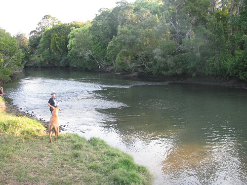
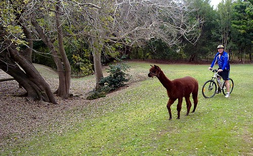
As part of my project to explore the railway line west of lake Samsonvale, Harrison and I rode out to the small village of Mount Samson this morning.

There was a small railway station in the town until 1955 which provided transport to the city and allowed local farmers to get their produce to market.


No train in sight
(A photo of the old Railway Station from the Samford Historical museum)

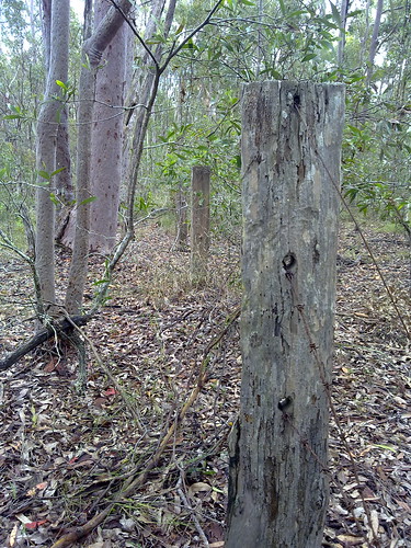
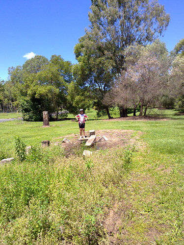
Harrison stands on the ruins of Mt Samson railway station. The railway line would have passed by on the right of the picture.

Mount Samson Railway
The railway line passed under Kunde’s Road. The cut-away is visible as the line approaches the roadway.

Riding to Mount Samson
Harrison takes a break on the ride out to Mount Samson.

Total distance: 17.74 km
Total climbing: 387 m
Average temperature: NAN
Total time: 02:01:14
Download file: activity_53125348.gpx
More data

Harrisons Pocket

It was raining heavily this morning, so I decided to postpone my trip out to the old Ferny Grove to Dayboro railway, and instead visit another “place that is no more”.

Harrisons Pocket once was a thriving little farming community almost 10km directly west of Petrie. In this area, the North Pine River twisted around almost three quarters of a circle forming a “pocket”, and Harrisons pocket nestled along the banks of the river at this point.

It had a school, formerly known as Harrisons Pocket Provisional School, then State School, and a Post and Telegraph Office.

You didn’t really drive through, because it was located in a natural cul-de-sac in the river. The way out was over a shallow part of the river about 3km south east, called “Gordon’s Crossing”. This was one of the earliest crossings of the North Pine River, predating Youngs Crossing by at least twenty years. Incidentally, if you’ve ever been on Gordons Crossing Road, now you know what it’s named after.

Sadly, these places are now inundated by the North Pine dam. You can get pretty close by riding through some scrubby bushland along some fire roads, which is what Harrison and I did today in the pouring rain. (I think he was curious about a place that shared the same name as him).

He found the ride very difficult, especially on some of the muddy tracks. To his credit, he persevered and we made it back home safely.

In the map below you can see the original course (in blue) of the North Pine River before it was dammed. The red track is the path that Harrison and I took. You can click on some of the markers on the map to see the location of the post office, the school and Gordon’s Crossing.

Grass Tree

The Grass Tree (Xanthorrhoea latifolia) is a very slow growing plant that grows widely throughout eastern Australia.

It can take more than twenty years for a trunk to appear, and then they normally grow at a rate of 1 to 2 cm per year.

The two larger specimens here had 2m trunks taller than me, so I’m guessing they would probably predate European settlement in the area. I.e. they’re probably at least 200 years old.

Aborigines used grass trees to make fishing spears. They also used resin from the plant as an adhesive and to mend leaking water containers.

The trees provide a habitat for native insects and lizards.

Some of the lakeside shores around here have forests of grass trees. When you think of how old some of these trees are, it’s an overwhelming sensation to stand among them.

The Road to Nowhere

There’s a large dam in our area (The North Pine Dam) which was built in the 1970’s. It has created a lake (Lake Samsonvale) which has flooded a lot of old historical places, including roads, bridges, homesteads, farms and townships.

About a year ago Steve and I visited this area on foot.

My ride today covered a lot of the shoreline of the lake, and I was pleasantly surprised by some of the remnants I found.

One interesting road is Samsonvale Road. As you can see from this map large parts of it are now under several metres of water, but portions of it rise out of the water like a sleepy sea-serpent.

Those above-water portions are hidden away in bushland – unused and overgrown.

These photos are of a road cut-away – where engineers have dug away a hill to smooth the course of the road to reduce its gradient. The only problem these days, apart from the overgrowth, is that if you walk along the road for a hundred metres in either direction you end up in the water.

In a way it’s eerie. Old fence posts and pieces of barbed wire mark old boundaries that are meaningless today.

Strange looking exotic / domestic plants such as umbrella trees spring up in unexpected places – a quaint reminder that this once was a garden, not overgrown bushland.

Who knows? Perhaps one day a few hundred years in the future someone will cut through the overgrowth on our street and find old fence posts, gardens and tracks that once meant something to us.
Road to nowhereRoad to nowhereRoad to nowhere

Total distance: 46.38 km
Total climbing: 852 m
Average temperature: NAN
Total time: 03:59:40
Download file: activity_51299340.gpx
More data

North Pine River. Then and Now.

North Pine River. Then and Now.

Local historian and friend Leith Barter recently sent me a copy of a photo taken near the bottom of my street around 1930.

The footbridge was built to allow local children to get to North Pine (Petrie) State School school on the other side of the river, without having to go all the way down to Gympie Road and back again.

Harrison and I went out exploring today to see if we could find where the photo was taken so we could get a “then” and “now” photo.

North Pine River. Then and Now.North Pine River. Then and Now.North Pine River. Then and Now.

The Tortoise and the Hare

While I was rocketing down a trail by the dam this afternoon I almost ran over this little guy ambling along by the side of the track.

He very kindly let me take his photo while he stood next to my bike, then as quick as I came, I went.

Reminds me of an old fable – except this time I got home first šŸ™‚


Total distance: 25.45 km
Total climbing: 370 m
Average temperature: NAN
Total time: 01:19:29
Download file: activity_50154188.gpx
More data

Tom Petrie Memorial

The unveiling of the refurbished Tom Petrie memorial was an amazing experience for many reasons.

I’ve written several articles here previously about Tom Petrie. The man was remarkable for the way he learned the ways and language of the local Turrbal Aboriginal people, and showed them a respect and honor that was more than a century ahead of his time. It was fitting to remember him on the 100th anniversary of his death.

I also had the chance to meet Maroochy Barambah, an elder, Songwoman and Law-Woman of the Turrbal Aboriginal people. This talented and dignified woman is the great grand-daughter of Kulkarawa, a young Aboriginal girl who ran off with a Sri Lankan man named Shake Brown in the 1840’s. Brown was killed in the 1840’s on the banks of what is now called Browns Creek. By some strange co-incidence I actually took some photos of this area and wrote an article about it a few months ago. So I was overwhelmed to meet someone who was actually related to Kulkarawa (Granny Kitty) and Shake Brown (Grandfather Brown).

This event was the first formal occasion that descendants of Tom Petrie and the Turrbal people had met face to face since Petrie’s death. It gives me hope that things like this happen. The mutual history of Aboriginal and non-Aboriginal Australia is something that can unite us, and strengthen our souls. It reminds us how precious is the place in which we live. It gives us continuity and reminds us that each of us is here for such a brief time, while the land is always here.
Tom Petrie Memorial - 26 August 2010Tom Petrie Memorial - 26 August 2010Tom Petrie Memorial - 26 August 2010

The Llawnton Llama of Lleis Park

We saw a couple of kangaroos while we were out cycling this morning, but this Llama wins the prize for the most unusual animal we’ve seen today.

He was just trotting around Lleis Park at Llawnton today (pardon the double LL’s but when you see Llama it affects your spelllling).

He had decided to wander off from the circus that has set up camp in the park.

No one was harmed, and he eventually went back home to the circus.