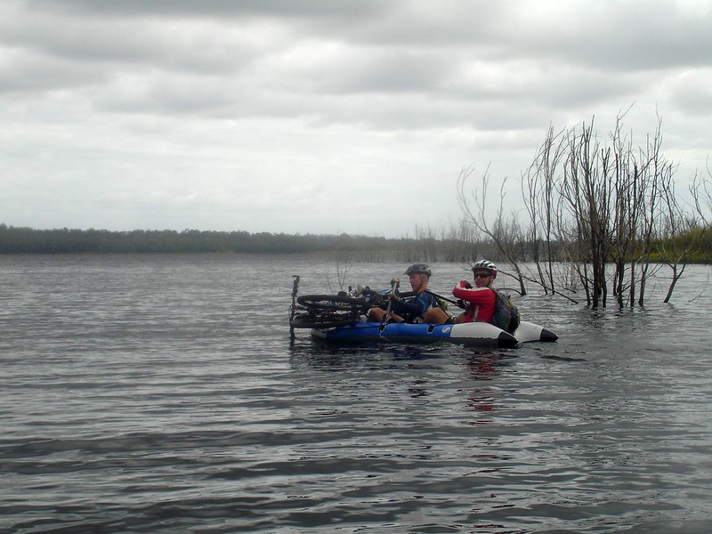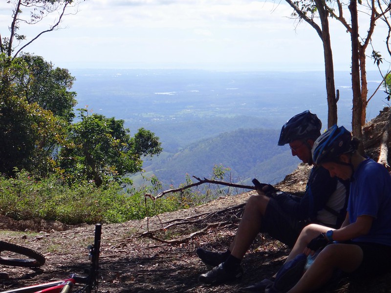
When you’re riding a mountain bike, and the trail you’re following stops at the shore of a lake, there’s really only one alternative if you want to keep going…

We had the day off on Monday (it was a public holiday) so my friend Neil Bang decided to organize a group ride with some friends from MTBDirt.com.
Our route would take us from familiar single tracks at Bunyaville out to some steep and challinging fire trails at Clear Mountain.
It was going to be hard work.
Continue Reading

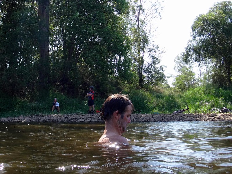
With temperatures predicted to exceed 40C (104 F) we thought the best approach for today’s ride would be something short that involved cooling off in a creek somewhere.
I also wanted to map out some of the fun trails near the western shoreline of Lake Samsonvale.
So we set off early with no route in mind, planning to follow any un-ridden trails we encountered before finishing at Kobble Creek
Continue Reading
There’s a remote mango tree by Lake Samsonvale that’s laden with fruit this time of year. Any mangoes that fall to the ground are scavenged by feral animals, so we thought we’d do the environment a favour and relieve this grand old tree of some of its fruit.
We think the tree might have been planted by the Joyner family over a century ago, but trees don’t tell tales, so we’ll never know.
Continue Reading
Many of my friends are delighted that the tracks in the northern section of D’Aguilar National Park have been opened up to Mountain Bikes. Today we planned to take a short tour along some of those tracks to let people enjoy some of the new trails that are now available.
Continue Reading

“Lets see what happens” – that was pretty much our plan today.
The idea was to ride up from Lacey’s Creek (near Dayboro) to Kluvers Lookout, and then back to our starting point in a loop. I’ve done it many times before with different friends, and we’ve all loved it. But the difference was that this time we’d go off our route at some stage to see where we ended up.
Continue Reading

Riding around Lake Samsonvale via Dayboro is a popular ride for road-cyclists with great views. It has an awful lot of paved road for a mountain biker, so we decided to do an off-road version taking in as many trails and tracks near the lake as we could while still enjoying all of the views.

We began by following some quiet meandering tracks around Forgan Cove. I often ride through here during the week on one of my “chill-out” sessions. It was fun to be able to share some of my home trails with friends.

The quiet flat trails were soon distant memories as we pointed our bikes up Old School Road. This is a reasonably tough dirt climb up Clear Mountain, with a nasty little pinch climb at the end.

The final climb on Old School Road is a bit of a bellweather test for me. Until my recent knee injury I prided myself on being able to climb it. This was my first attempt since then, and also the first time I’d tried it using flat pedals instead of clip-ins. It was really difficult, but I made it, puffing heavily, unable to talk. Sue has wanted to nail this hill for a while. She made it,, and put in such an intense effort that she heaved up what was left of her breakfast at the top. Well done, Sue 🙂

But the top of Old School Road only marks the half-way point of the climb. After a bit more huffing and puffing we finally made it to the summit of Clear Mountain near the resort.
From there we rode the downhill jump-track to the bottom of the hill.

Some people rode the twisty single-track all the way to the bottom. I decided to play it safe and avoid further injury by following the “Pineapple Break” fire trail to the bottom.
After a couple of kilometres along Winn Road we followed a few more trails along the south-western shoreline of the lake. The shoreline hass many “fingers” of land protrudiung into the lake at this point, so if you wanted it would be possible to meander around countless peninsulars all day.

Mount Samson looms large in this part of the world.

We eventually met up with the remnants of an old railway line that used to pass through this area fifty years ago. Much of the railway is under water, but it’s still a viable track in some parts.

The day grew hotter, and we had been working hard, so we stopped at the Mount Samson Community Hall to fill up with water and rest in the shade.
The remnants of the railway line emerge from the lake near the small locality of Samsonvale. This once used to be a thriving little town. Now all that remains is the cemetery. We followed the railway line along the shore, past the site of the old Samsonvale Railway Station.

Leaving the flat shoreline of the lake, we headed west into the hills behind Kobble Creek. Although the roads were paved, this was a hot and challenging section because of some of the steeper gradients. A few people were starting to feel hungry. We had toyed with the idea of having a quick swim at this pleasant section of the North Pine River at Leis Crossing, but I think most people could smell the cafes of Dayboro so we decided to keep riding.

Dayboro was a welcome lunch stop. Because there were about a dozen of us, we split up around a few of the different shops around town to have lunch. A few people had a quick lie down on the picnic benches, or topped up their water supplies.

A farmer out the back of Dayboro kindly gave us permission to ride through his property along the old Strongs Road reserve.
“I thought all you bikies were in jail”, he quipped as he let us through.
Strongs Road is a quiet alternative route east out of Dayboro. Part of it runs through private property, so there are no cars. Most of it is unpaved, which makes it a pleasant ride on a mountain bike.

At the end of the road, Eric sat on an old couch and “held court” with anyone who needed his sage advice.

Once we met up with Dayboro Road again, we tried to follow some of the horse trails by the side of the road to avoid traffic. Although the track had been mown, it was still rough going. Eventually we decided to take our chances for 4 or 5km along the bitumen until we met up with our next off-road trail.


The endless trails on the northern side of the lake are a lot of fun to ride. The views were impressive, and the shady green tracks were a welcome relief from the hot tarmac.

Towards the end of the ride, as luck would have it, I was “leading from the rear” and lost about half the riders who rode ahead of me the wrong way. While they rode on ahead, a few of us followed the final few tracks along the river back up to our starting point.

This ride was 77km with about 1,500m of ascent. It took about 8 hours including breaks, and I burned 4,500 kcal.
For a fit rider I’d rate this one about 8 out of 10 on the tough-o-meter. For beginners or anyone nursing a reasonable injury I’d rate it 9 to 9.5 out of 10.
Here’s Darb’s video of the day:
Lake Samsonvale 2013-10-20 from Darb Ryan on Vimeo.
Thanks everyone for a great day. I’m so pleased to be able to enjoy long rides with friends again!

In an unusual twist this week, Eric and I opted for a Sunday Ride closer to home.
Two of my favourite spots around here are Lake Samsonvale, and Mosquito Creek, so we decided to combine the two. The first time I tried this ride almopst 4 years ago it took me almost 5 hours. Today it took about 3 and a half hours, so I felt quite smug considering I’m only using one and a half legs at the moment.
We spent the first part of our ride dodging magpies on the bike paths which follow the North Pine River between Sweeney and Mungarra Reserves. Armed with a trusty piece of hose-pipe which I twirled around my head helicopter-style, the feathered fiends left us alone.


My neightbor, Mike, is a member of Koala Tracker. When we came across him, he was grinning because he had spotted a Koala near the track. They used to be really common around here but are slowly disappearing because of indiscriminate land-clearing. Good on ya, Mike!


Before long, we reached Lake Samsonvale and enjoyed riding the bikes along the twisty tracks that follow the shoreline.
As the hills got steeper, I started to lag behind, but Eric kindly waited for me at the top. I’m pretty sure I could have nailed this hill today if I didn’t lose traction. Maybe next time 🙂

After leaving the lake we headed down towards Dunlop Lane which snakes lazily along some small irrigation dams before it becomes a faint trail as it climbs through Slickers horse riding park. We didn’t see any horses today – I think they were all working hard.

From there we followed Smiths Road northwards. Like Dunlop Lane, “Smiths Road” is a road in name only. The road reserve is based on the historic “Old North Road” that was blazed through here in the 1840’s. That was based on the traditional trail made by local aborigines over many centuries as they passed through the area.

The most enjoyable part of Smiths Road is as it descends to the crossing over Mosquito Creek. It’s possible to pick up quite a bit of speed on the bike, shoot across the causeway, then zip up the steep bank on the other side.

Eric and I felt like stretching the ride out a bit longer today, so we kept going north until we hit Raynbird Road. After a bit of huffing and puffing up the hill (mostly on my part), we took a quick break at the top to enjoy the views of the Glasshouse Mountains and Moreton Bay.

From there we headed homeward via Browns Creek Road.
Browns Creek is named after “Shake Brown”, a Sri Lankan man who married aboriginal woman Kulkurrawa in the 1840’s. He was killed in this area because Kulkurrawa’s countrymen (like many a protective brother-in-law) suspected he wasn’t caring for her properly. You can read more about the Kulkurrawa and Shake Brown here.

Browns Creek Road devolves (or evolves, depending on whether you ride a mountain bike or not) into Browns Road. It’s rougher and much more fun – especially if you ride it down-hill like we did today.

From there we continued our homeward trek along some quiet back-roads.

Today wasn’t the most epic of rides, but I enjoyed sharing it with Eric. I’m grateful to have such a scenic backyard. In fact, after two months of staying off it, I’m grateful to just be riding again. Living in paradise, and being able to explore it on a bike. How good is that?
45km, with over 800m of ascent, in about three and a half hours. I burned about 2,000 kcal, and felt pretty tired afterwards.
For the fit, this one rates about 6.5 out of 10 on the tough-o-meter. Rehabilitating limpers like me should rate it about 8 out of 10.
Thanks for a great morning on the bike, Eric!