Beerburrum East State Forest

Open Space
I made a spur-of-the moment decision to try the Beerburrum East State Forest today. I rode it about six months ago and really enjoyed the long flat dirt roads which let me zone out and just concentrate on the ride.
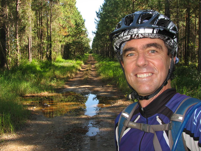
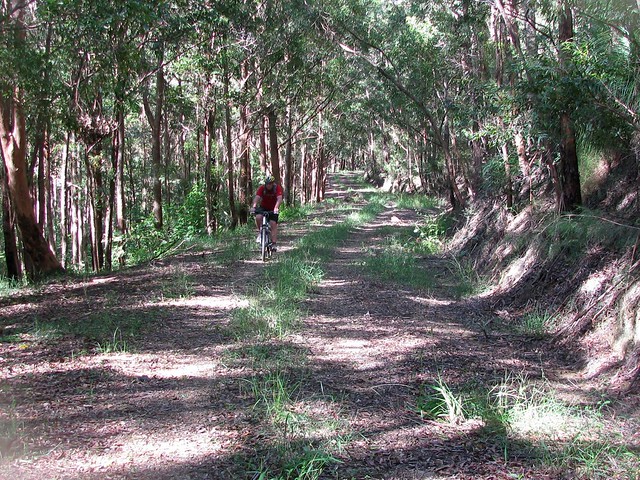
Logging Road
The forest is full of these roads, and at this time of year they’re perfect to get a few kilometres under the belt.
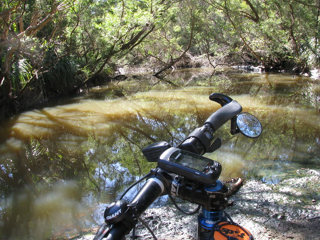
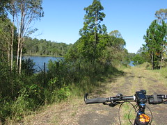
Elimbah Creek
Elimbah Creek cuts through the forest and is a nice place to stop for a quick breather. I came upon a few motor cyclists and be both were effusive about how incredible the place was, and what a beautiful day it was. Even if you’re into different things, it was great to meet someone enjoying what they were doing as much as I was enjoying what I was doing.
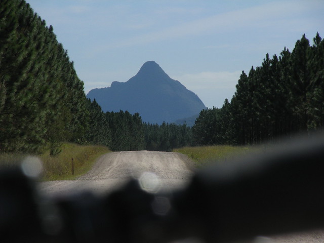
Mother Beerwah
As you get further north, the Glasshouse Moutains impose themselves on most views. Here’s Beerwah, the legendary mother of the family watching over me today. She’s still pregnant, but mountains take a long time to give birth ๐Ÿ™‚
Father Tibrogargan
…and Father Tibrogargan, still brooding, watching grumpily out to sea. He still hasn’t forgiven Coonowrin. Apparently some mountains take a long time to forgive.

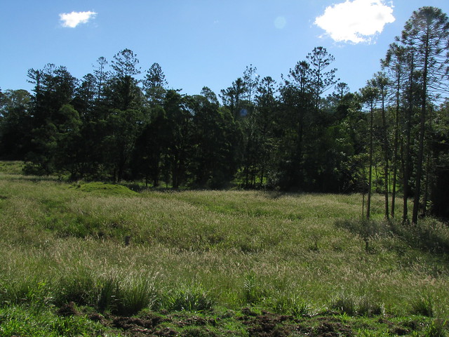
Pine Forest
All-in-all a perfect day. Next time I’d like to bring a few friends along and take it slower.

This time I was 2 mins slower than last time, but I didn’t have a major break this time, and still managed to average 21.5km/h over 60km, so I’m happy ๐Ÿ™‚

Total distance: 60.53 km
Total climbing: 412 m
Average temperature: NAN
Total time: 03:14:42
Download file: activity_85677627.gpx
More data

Laceys Creek Mega Loop

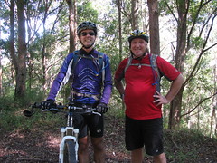
Riding Buddies
Riding Buddies
I’ve been thinking about this ride for weeks. Basically I wanted an enjoyable dirt ride which would let me get from Mount Glorious, up in the D’Aguilar Ranges down to Dayboro, and back home. A friend of mine (Russel) suggested a route, so I fed it into the GPS, talked Simon into coming with me, and set out on another hare-brained adventure.

The first part of our trip was from home to Samford, up the Goat Track, then to Mount Glorious, and Wivenhoe Outlook. That first stage was just over 50km.


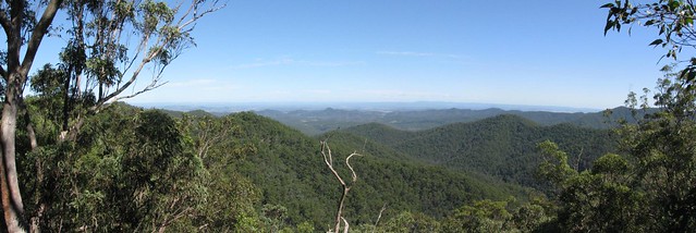
Westridge Outlook Panorama
The view from Westridge Outlook on the first part of the ride.

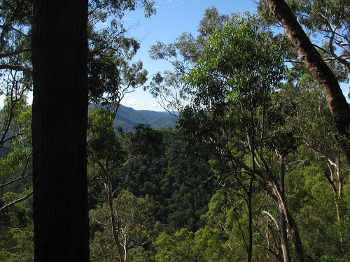
Then we hit the dirt and headed down the hill towards Lacey’s Creek and Dayboro. The track undulates for 5 or 6 km and has some amazing views..
Laceys Creek Road
Laceys Creek Road

Then the track suddenly drops 500m in elevation over 5km. That’s the exciting bit ๐Ÿ™‚ The only problem was that by the time I’d got to the bottom, my brakes were so hot they were smoking.

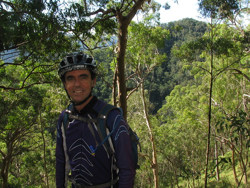
Don't Give Up!
Simon demonstrates the number one rule about climbing hills. It doesn’t matter how steep or tough they are – don’t give up!

I’d really like to do this again sometime. All up we rode 102km. Total ascent for the ride was 2,100m, and I burned 6,300kcal which is the equivalent of 13 Big Macs.

Total distance: 104.3 km
Total climbing: 2253 m
Average temperature: NAN
Total time: 09:50:56
Download file: activity_82958690.gpx
More data
Ride Profile

Rush Creek

I thought I’d explore some quiet roads out the back of Dayboro this afternoon. It was a good excuse to get a few miles on the bike before I go for a huge ride with Simon tomorrow (weather permitting).
Rush Creek and D'Aguilar Ranges
Rush Creek is one of those districts that figured large in the history of the Pine Rivers area. It was logged in the mid 19th century. William Henry Day (after whom Dayboro is named) planted one of the first sugar cane farms in South East Queensland using Kanak labour.

Today, much of what was the Rush Creek district has been flooded by the North Pine Dam…
Old Roads Never Die they just...Old Roads Never Die they just...
Rush Creek Road was closed off in the 1970’s when the North Pine Dam was built, and local farmland was flooded.

It used to be the main road between Petrie and Dayboro, and crossed Rush Creek at Whiteside / Quinns Crossing. That crossing disappeared under the man-made lake 40 years ago, and the road hasn’t been used since.

It’s funny how you can still make out the double white line down the middle, under all the grass which is slowly reclaiming the land.

One of the other unusual roads in the area is Raen Road…
Hoops and Bunyas
I followed a dirt road over a cattle grid. It eventually turned into a vehicle track, and before I knew it I was in front of an old farm house.

Will, the farmer, was really friendly and explained that the road reserve ran through his property and disappeared in the grass after a few hundred meters. He very kindly let me ride around and take some photos. I really liked these old Hoop (A.Cunninghamii) and Bunya (A. Bidwilli) pines along the banks of the upper reaches Rush Creek.

The final road I explored was Strongs Road. The sign says it’s a “No Through Road” but it actually turns into a muddy vehicle track, and eventually comes out on Mount Samson Road – a much nicer ride than battling 100km/h traffic on Dayboro Road!
Wild Bees
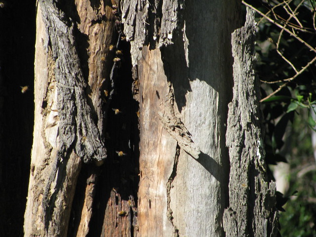
Wild bees have built a hive in the trunk of an old Eucalypt along Strong Road at Dayboro.

All up, 55km, 2,500kcal (= 6 Big Macs), and 800m of ascent.

A fantastic way to spend a Sunday afternoon!

Total distance: 55.94 km
Total climbing: 854 m
Average temperature: NAN
Total time: 03:59:43
Download file: activity_82624820.gpx
More data

Camp Mountain

Although I’ve ridden some of the trails around Camp Mountain before, this is the first time I’ve ridden to the summit.

I took the long gruelling climb to the top via the “long track”, followed by a fast bone-jarring ride back down along the “short track”. If you speak to anyone who’s ridden up Camp Mountain, and you tell them you’ve ridden up it, the first thing they’ll probably ask you is “Did you go up the long track or the short track?”. The long track is “easier”, because you take longer to reach the top, so it’s not as steep. Even so, it’s a tough climb and I had to walk a short bit that was steep and washed out from recent rain.

The short track is really steep. I had to be really careful riding down it. I think anyone who has ridden UP it must be incredibly fit. (You know who you are :))

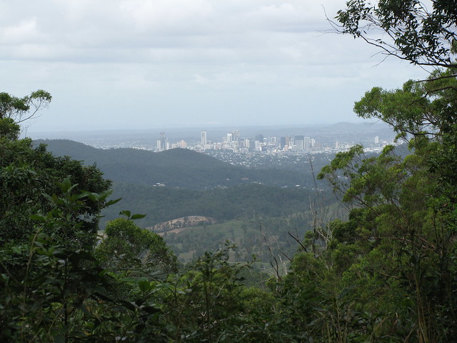
Brisbane CBD from Camp Mountain
There are some spectacular views from the lookout on Camp Mountain, including this greate view of the city.

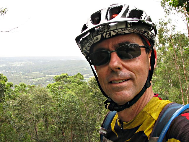
FIGJAM
I’m feeling pretty pleased with myself after completing the gruelling climb to the summit.

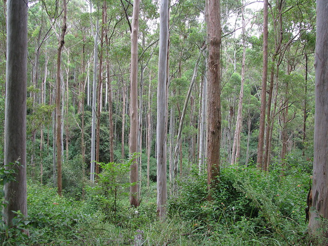
Blue Poles
These tall, straight, blue gums look like something out of a Jackson Pollock painting.

Total distance: 56.54 km
Total climbing: 1186 m
Average temperature: NAN
Total time: 04:45:57
Download file: activity_75289535.gpx
More data

Why Ride a Mountain Bike?

Why do I ride a mountain bike?

I know this sounds crazy, but deciding where to ride is a spiritual experience for me.

It forces me to think about where I’d really like to go, which means I have to listen to my “inner voice”. I often feel like I’m being “drawn” towards a particular place, and I just go there. Perhaps the spiritual part of all of this is feeling a connection to the land, and responding to that connection.

The end result is I fall in love with most of the places I visit, and come home really happy.

Dunlop Lane
Some of the beautiful open eucalyptus forest that surrounds Dunlop Lane in Kurwongbah. As I’ve written before it’s an old road – blazed over 170 years ago, but unlike most old roads, it has retained its magic.

"Slickers"
Looking over one of the gates on Dunlop Lane into the “Slickers” horse riding ranch. Lilly loves visiting here. So do I (but for different reasons!).
Lake Kurwongbah
Lake Kurwongbah as seen from one of the quiet tracks that lead off Scout Road in Kurwongbah. It’s amazing what you see when you follow a dirt track to see where it goes ๐Ÿ™‚

Total distance: 49.36 km
Total climbing: 799 m
Average temperature: NAN
Total time: 05:39:02
Download file: activity_75087933.gpx
More data

Mount Pleasant

I’m still healing from a crash last week, so I have decided to avoid riding on rough trails or single tracks at the moment to let my shoulder heal.

Today I rode to Mount Pleasant in the hills behind Dayboro. This rural area is nestled in a valley created by the North Pine River between Mount Mee and Mount Byron.
North Pine River, Mount Pleasant
What I enjoyed most was having a few hours on the bike on quiet rural roads to daydream and get in “The Zone” while covering a reasonable distance (80km). The hills were mostly gentle, although I managed to ascend a total of 1,048m during the ride.
Bunya Pines, Mount Pleasant
Andrew Petrie reported a stand of Bunya Pines in this area when he visited it in the 1830’s. I’ve got some ideas about where that stand might have been. As you ride along the road, there are some quite mature specimens poking out from behind the hills about 300 metres from the road. These two Bunyas are quite young – perhaps 60 to 70 years old.

Some time in the next year I hope to come back here again and ride through the rainforest up to Toogoolawah in the Brisbane Valley. But the management roads in the rainforest are closed at the moment due to damage from a lot of the heavy rain we’ve had lately.

I’m happy to wait ๐Ÿ™‚

Total distance: 80.65 km
Total climbing: 1131 m
Average temperature: NAN
Total time: 04:53:22
Download file: activity_72490402.gpx
More data

Trouble in the Glasshouse Family

The last time I tried a ride at the Glasshouse Mountains it had recently rained and I got stuck in miles of mud.

This time was much more enjoyable.

I found a decent looking route on Garmin Connect (thanks 1aggers) that I thought was worth a try, and set off from Matthew Flinders park.
Flinders Memorial

This place appeals to me from a historical perspective because it’s where Matthew Flinders camped in July 1799 while exploring the Moreton Bay area aboard the Norfolk, which makes it one of the earliest places in our region where European contact was first made. The story goes that Flinders sailed up the Pumicestone Passage and then up Glasshouse Creek before coming ashore and hiking to the base of Tibrogargan. It was too sheer for him to climb, so he took the easy option and climbed Mt Beerburrum instead.
The Legend of the Glasshouse Mountains
Whenever I visit the Glasshouse Mountains, I’m always mindful of the Aboriginal Legend of the area, and the timelessness of family conflict, disappointment and forgiveness (or the lack thereof). I don’t know what it is, but when you spend the day in front of these large monoliths, the legend becomes more than a quaint story. It takes on a power of its own. I could understand Tibrogargan’s rage, Beerwah’s disappointment, and even Coonowrin’s reticence.

So all of this was going through my head while I tried to complete this difficult ride today.

Trachyte Circuit
I started off on the Trachyte Track – a beautiful single track around the base of Tibrogargan. But watch out – it has stairs in some places making it a challenging ride at times.

Tiberoowuccum
The Trachyte Track winds through the forest up the northern slopes of Mt Beerburrum to Jack Ferris Lookout, which has some great views of some of the other mountains, including Tiberoowuccum and Ngungun – two of the smaller ones.

Tunbubudla (The twins)
I then bit off a bit more than I could chew when I tried riding over “The Twins”. These two pert mammarian hills seem harmless enough. But I ended up dragging the bike up the steep rutted track on one side, then carefully walking it down the steep rocky track on the other side. But I did ride some of it ๐Ÿ™‚

CoonowrinTibrogargan's Back
I then bashed north through some narrow muddy forestry roads until I reached the main lookout which has some excellent views of the mountains.

Mother Beerwah
From there I headed up to Beerwah then down some steep but picturesque tracks towards Coonowrin. All along this section, Beerwah towered over me as a rode. It was almost like she was looking over my shoulder.

Damage by 4wd's
Towards the end of this track, the wet weather and the 4WD’s have taken their toll. The track is terribly rutted, making it impossible to ride (or drive) through. My “Giant” bike was dwarfed by some of the ruts in the track.

Survey TreeFather Tibrogargan

Total distance: 40.92 km
Total climbing: 935 m
Average temperature: NAN
Total time: 05:30:20
Download file: activity_70100964.gpx
More data

Mermaid Mountain

Lance invited Craig, Graham and me around to his place for a ride in the national park near his house at Upper Brookfield. He’d told me it would probably be hilly, but I started to worry when the long driveway up to his house reached gradients of over 30%.

We planned to ride to Mermaid Mountain, climb it, and loop back through the D’Aguilar National Park.
Mermaid Mountain
Mermaid Mountain is the highest peak in the southern section of the D’Aguilar Range.

The surrounding terrain is very hilly. We ascended almost 700m in 13km on our bikes. That’s heart-breaking steepness.

But the climb to the top of the mountain is worth the wonderful view. You can see Flinders Peak off to the south (left) of the photo, and Lake Manchester off to the north-west (right).
Relaxing After the ClimbRunning Repairs
Craig’s brake pads broke. Normally this would be a serious thing out on the trail, but he had brought some replacement pads. He and Graham knew how to replace the pads.

I wouldn’t have had a clue and don’t carry spare pads. Perhaps I should add that to the long list of items I already carry in my pack?

Secretly I rejoiced because it meant we could stop for half an hour and catch our breath.

Well done guys, for fixing the brakes.

By the way, can you make out the words on Graham’s Jersey? He didn’t look that cranky to me ๐Ÿ™‚

Thanks Lance for a really enjoyable ride, and some delicious home made ginger beer at the end!

Total distance: 15.05 km
Total climbing: 722 m
Average temperature: NAN
Total time: 03:31:59
Download file: activity_69124199.gpx
More data