Bunya Dreaming

Bunya PineOne fascinating story of our local area is of a fourteen year old boy named Tom Petrie who went away with the local Turrbal people for a couple of weeks to walk up to the Blackall Ranges (not far from present day Maleny, Queensland) in 1846 to celebrate the Bunya Feast.

Although a large feast happened every three years in the Bunya Mountains (midway between Dalby and Kingaroy), a smaller annual feast was held in the Blackall Ranges at what is now Baroon Pocket.

For thousands of years the feasts were an important event for Aborigines from all over what is now south east Queensland. They gathered in their hundreds to feast, dance, sing, and generally have a good time. I often wondered what it would have been like to travel back 166 years and see what young Tom saw, hear what he heard and taste some of the food he tasted.

However, thanks to the generosity of the Kabi Kabi people of Queensland’s Sunshine Coast, we were able to find out! Sometimes I’m a bit slow on the uptake and it wasn’t until we turned up that I realized that the “Bunya Dreaming” festival at Baroon Pocket was actually the same event that Tom Petrie took part in – the annual Blackall Range Bunya Feast.

Bunya ConeHarvesting Bunya NutsBunya Nuts
The Bunya Tree produces huge cones. They can weigh anywhere from 5 to 10kg. Naturally it’s not a very wise idea to stand under a Bunya tree in summer when it’s full of cones! To harvest the nuts from a Bunya Cone, you need to first break open the cone, pull it apart, and then tease the nuts out of the green sappy flesh. One cone can have many dozen nuts in it. They’re delicious either boiled or roasted over a hot fire.

Lyndon and the Emu
The Emu on the left was just one of the many sculptures around the picnic grounds. Lyndon is talking about the history of the Gubbi Gubbi (or Kabi Kabi) people

Firelighting Demonstration
At the start of the Corroboree, one member took a spear, and spun it between the palms of his hands while pushing the end of it into a piece of wood on the ground. After a few seconds smoke appeared, and not long after that the tinder burst into flames. He made it look so easy!

Notice the painting on his chest – a Bunya Pine motif with the cones in the highest branches.

Chilling
Liz and I enjoyed being in the moment. It was great to be around so many happy, relaxed, friendly, and generous people.


The Corroboree by “Gubbi Gubbi Dance” was spectacular. The best part was that we all got to join in at the end! Look for the strange looking guy in the white shirt with the bandy legs. Thats me 🙂

In chapter 2 of her book “Tom Petrie’s Reminiscences of Early Queensland”, Constance Campbell Petrie writes:

The bon-yi tree bears huge cones, full of nuts, which the natives are very fond of. Each year the trees will bear a few cones, but it was only in every third year that the great gatherings of the natives took place, for then it was that the trees bore a heavy crop, and the blacks never failed to know the season.

These gatherings were really like huge picnics, the aborigines belonging to the district sending messengers out to invite members from other tribes to come and have a feast. Perhaps fifteen would be asked here, and thirty there, and they were mostly young people, who were able and fit to travel. Then these tribes would ia turn ask others. For instance, the Bribie blacks (Ngunda tribe) on receiving their invitation would perchance invite the Turrbal people to join them, and the latter would then ask the Logan, or Yaggapal tribe.and other island blacks, and so on from tribe to tribe all over the country, for the different tribes were generally connected by marriage, and the relatives thus invited each other. Those near at hand would all turn up, old and young, but the tribes from afar would leave the aged and the sick behind.

My father was present at one of these feasts when a boy for over a fortnight. He is the only free white man who has ever been present at a bon-yi feast. Two or three convicts in the old days, who escaped and lived afterwards with the blacks—James Davis (” Duramboi “), Bracefield (” Wandi “), and Fahey (“Gilbury”), of course, knew all about it, but they are dead now. Father met the two former after their return to civihzation, and he has often had a yarn with the old blacks who belonged to the tribes they had lived with.

In those early days the Blackall Range was spoken of as the Bon-yi Mountains, and it was there that Duramboi and Bracefield joined in the feasts, and there also that Father saw it all. He was only fourteen or fifteen years old at the time, and travelled from Brisbane with a party of about one hundred, counting the women and children. They camped the first night at Bu-yu—ba (shin of leg), the native name for the creek crossing at what is now known as Enoggera.

Arriving at the Blackall Range, the party made a halt at the first bon-yi tree they came to, and a blackfellow accompanying them, who belonged to the district, climbed up the tree by means of a vine. When a native wishes to climb a tree that has no lower branches he cuts notches or steps in the trunk as he goes up, ascending with the help of a vine held round the stem. But my father’s experience has been that the blacks would never by any chance cut a bon-yi, affirming that to do so would injure the tree, and they climbed with the vine alone, the rough surface of the tree helping them.

This tree they came first upon was a good specimen, 100 feet high before a branch, and when the native climbing could reach a cone he pulled one and opened it with a tomahawk to see if it was all right. (The others said if he did not do this the nuts would be empty and worthless, and Father noticed afterwards that the first cone was always examined before being thrown to the ground.) Then the man called out that all was well, and, throwing down the cone, he broke a branch, and with it poked and knocked off other cones. As they fell to the ground, the blacks assembled below would break them up, and, taking out the nuts, put them in their dilly-bags. Afterwards they went further on, and, camping, made fires to roast the nuts, of which they had a great feed — roasted they were very nice.

Great times those were, and what lots of fun these children of the woods had in catching paddymelons in the scrub with their nets, also in obtaining other food, of which there was plenty, such as opossums, snakes, and other animals, turkey eggs, wild yams, native figs, and a large white grub, which was found in dead trees. These latter are as thick as one’s finger and about three inches long. They were very plentiful in the scrubs, and the natives knew at a glance where to look for them. They would eat these raw with great relish, as we do an oyster, or they would roast them. Then the young tops of the cabbage tree palm, and other palms which,
grew there, served as a sort of a vegetable, and were not bad, according to my father. The bon-yi nuts were generally roasted, the blacks preferring them so, but they were also eaten raw.

It will be seen that there was no lack of food of different kinds during a bon-yi feast ; the natives did not only live on nuts as some suppose. To them it was a real pleasure getting their food ; they were so light-hearted and gay, nothing troubled them ; they had no bills to meet or wages to pay. And there were no missionaries in those days to make them think how bad they were. Whatever their faults Father could not have been treated better,and when they came into camp of an afternoon about four o’clock, from all.directions, laden with good things—opossums, carpet snakes, wild turkey eggs, and yams — he would get his share of the best — as much as he could eat. The turkey eggs were about the size of a goose egg, and the fresh ones were taken to the white boy, while addled eggs, or those (let me whisper it) with Chickens in them, were eaten and relished by the blacks, after being roasted in the hot ashes.

My father always noticed how open-handed and generous the aborigines were. Some of us would do well to learn from them in that respect. If there were unfortunates who had been unlucky in the hunt for food, it made no difference; they did not go without, but shared equally with, the others.

Dundalli

Dundalli Sketch by Sylvester Diggles, 1854

Dundalli was an Aboriginal leader and fighter from the Dalla people of the Blackall Ranges who was eventually adopted by the fearsome Djindubarri people of Bribie Island in the 1840’s.

He was convicted of the murder of Andrew Gregor and Mary Shannon in 1846. People much more qualified than I have described how the trial and conviction of Dundalli were unjust. I won’t regurgitate those arguments here, but if you’re interested, you might like to read some articles by Dr Libby Connors and Dr Dale Kerwin.

His execution was particularly gruesome. The hangman botched it while his distraught relatives looked on in horror from the hillside on what is now Wickham Terrace. The rope was too long, at the drop Dundalli actually landed on his coffin, and the hangman had to bend his legs and drag down on them to kill him.

This happened exactly 156 years ago today. So I decided to honour Dundalli by cycling into the city to the GPO and back (about 80km), stopping by “Yorks Hollow” – an important traditional camping ground for Aborigines prior to European settlement.

York's Hollow
Yorks Hollow used to cover most of what is Victoria Park Golf Course and the Exhibition Grounds. Today it’s little more than a small park beside the busy Inner City Bypass motorway. But it’s still a beautiful park – especially when you pause to think about what it was.

In her book, “Tom Petrie’s Reminiscences of Early Queensland”, Constance Campbell Petrie says of it:

Another big “tulan” or fight, Father remembers at
York’s Hollow (the Exhibition). He and his brother Walter
were standing looking on, when a fighting boomerang thrown
from the crowd circled round, and travelling in the direction
of the brothers, struck Walter Petrie on the cheek, causing
a deep flesh wound. The gins and blacks of the Brisbane
tribe commenced to cry about this, and said that the weapon
had come from the Bribie blacks’ side, and that they were
no good, but wild fellows. The brothers went home, and the
cut was sewn up. It did not take long to heal afterwards.

At that fight there must have been about eight hundred
blacks gathered from all parts, and there were about twenty
wounded. One very fine blackfellow lost his life. His
name was “Tunbur” (maggot). In the fight he got hit
on the ankle with a waddie, and next day died from lockjaw.
They carried the remains, and crossed the creek where the
Enoggera railway bridge is now, and further on made a fire
and skiimed the body and ate it. My father knew ” Tunbur”
well; he was one of the blacks who accompanied grandfather
Petrie on his trip in search of a sample of ” bon-yi ” wood.

The GPO
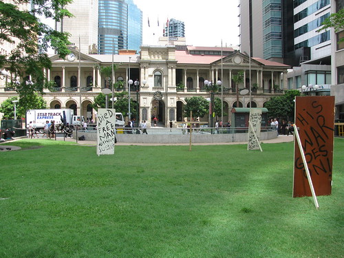
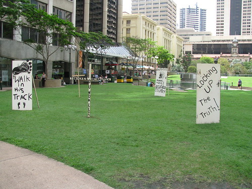
I was pleasantly surprised to find out someone else had the same idea and had erected some signs about Dundalli in Post Office Square across the road from the GPO. The GPO was actually built in 1871 on the site of the old Female Convict Factory.

The GPO
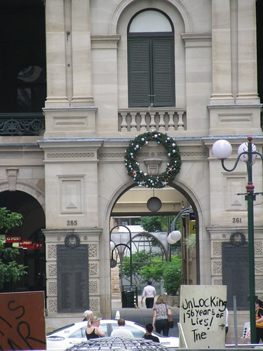
What struck me today was the irony. Here was a war memorial on the front wall of GPO comemorating soldiers who had died for their country in the First World War, yet it was the same place a black man was killed for trying to protect his country and uphold his people’s laws.

Dundalli and Glasgow
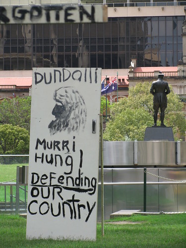
Even the grand statue of Major General Sir William Glasgow appeared to look away in shame from the GPO and the memorial posters there.

Memorials to Dundalli
The trouble is we often become emotionally immune to irony, even though it can sometimes highlight painful truths. I’m glad I did what the sign said, and walked in his tracks.

Total distance: 78.87 km
Total climbing: 682 m
Average temperature: NAN
Total time: 04:38:14
Download file: activity_62031628.gpx
More data

Sheep Station Creek

Sheep Station Creek is a 231 hectare environmental reserve about 6km south-west of Caboolture.

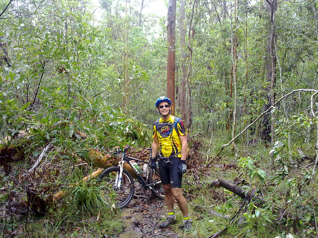
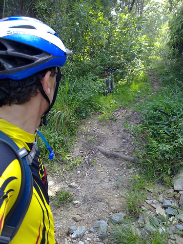
The dense eucalyptus forest is very popular with horse riders, but today I explored it on the MTB with a couple of friends.

With all the rain we’ve been experiencing, it’s very difficult to find off-road places that are rideable. The gravel trails here hold up well in the wet – but we still managed to get covered in mud.

Historically, Sheep Station Creek is important because it contains many scarred trees which may be of Aboriginal origin, and it contains the remnants of the original road between Brisbane and Gympie that Tom Petrie helped blaze in the mid 19th century.

Looking at the dense forest and muddy trails, I am stumped as to how anyone would have driven a horse and cart through there!

This is definitely a place I’d like to explore more in drier weather!

Many thanks to friends Tim and Michael for introducing me to this lovely place!


In her book “Tom Petrie’s Reminiscences of Early Queensland”, Constance Campbell Petrie says:

“When Davis (or ” Duramboi “) was asked to mark a road
to Gympie, he sought my father’s assistance for the first part
of the way, saying he would know where he was all right
when he got to the Glass House Mountains, as he had been
there before when living with the blacks. So Father took
him to the other side of Caboolture and put him and party
on his (” Tom ” Petrie’s) marked tree line to Petrie’s Creek,
on the Maroochy River. Then when the Kne to Gympie
was marked, he went with Cobb and Co. to help them pick
out stopping places for the changing of horses. . The road
was just frightful at that time ; we in these days could not
recognize it for the same.”


It’s pretty “frightful” today – but that’s the way we like it 🙂

Total distance: 8.13 km
Total climbing: 117 m
Average temperature: NAN
Total time: 00:58:23
Download file: activity_60744394.gpx
More data

Sideling Creek


The excessive rain around here means that there aren’t many dirt trails we can ride at the moment without getting bogged in mud.
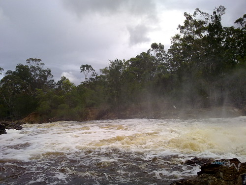
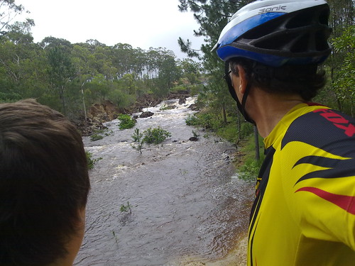
Sideling Creek in Flood

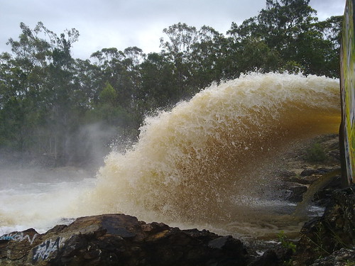
Harrison and I had a look at some of the flooded creeks in the area, but were particularly impressed with all the flood water in Sideling Creek.
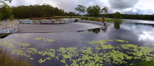
Water over the Spillway
I normally ride the bike across a few rocks over Sideling Creek below the Dam that forms lake Kurwongbah. But today, there was no chance of riding across this creek.
Sideling Creek in Flood
It was once the physical western boundary of Tom Petrie’s “Murrumba” property after he purchased if from the Griffins in 1858. It was definitely a physical boundary today!
Dam Wall - Kurwongbah

Total distance: 18.63 km
Total climbing: 298 m
Average temperature: NAN
Total time: 01:58:27
Download file: activity_59022580.gpx
More data

Alfred Delisser

Alfred Delisser was here

Alfred Delisser

Photo courtesy of John Henley

The Delisser Brothers, Edmund and Alfred were 19th century surveyors.

Edmund, the elder brother, surveyed the Nullarbor Plain in the 1860’s. Noting the distinct lack of trees, he coined the name “Nullarbor” from the latin words “Null” (lack of) and “Arbor” (tree). The Delisser Mobile Sand Dunes in Eucla National Park are named in his honour.

In the early 1880’s Alfred surveyed much of the Blackall Ranges and Glass House Mountains, proceeding via The Old North Road. On that journey he probably crossed Mosquito Creek.

You can read more about Alfred Delisser at John Henley’s excellent website about the Mapleton Tramway.

Along the Old North Road: Mosquito Creek

The crossing is still there today surrounded by peaceful bushland. I ride it quite regularly on my bike. By some strange quirk of geography, it rarely floods – even after much rain. There once was a bridge over this crossing, and I think it’s possible to see the remains if you look around hard enough.

Survey Tree, Kurwongbah

So I was delighted after finding this survey tree last week at Mosquito Creek just near the crossing to discover that it was blazed by Alfred Delisser in 1889. He had passed through this area several years earlier and was probably quite familiar with it, making him an ideal choice. No survey marks remain on the tree, apart from its original blazing. In fact the wooden “heart” of the blaze has fallen out. I thought it deserved a bit of respect so I cleaned it up and set it against the tree.

The tree itself isn’t that big. But it could easily be over 200 years old. Ironbark trees grow slowly.

Here’s part of the survey plan of the Mosquito Creek crossing created by Alftred Delisser in 1889. Many thanks to Leith Barter for obtaining this copy for me.

The survey plan is over 111 years old. But even as Delisser created it, the road he was on had been used for 45 years by Evan Mackenzie and the Archer Brothers as they made their way north to Durrundur Station.

But even that is fairly recent compared to the thousands of years that the original track had been in use by Aborigines walking from Meeanjin (Brisbane) to the Bonyi (Bunya) feasts in the Blackall Ranges.

Burke and Wills were here

The carving says “B&W 70 1860”. Burke and Wills passed this way in 1860 on their way from Melbourne to the Gulf Country. They carved their initials on this tree as a survey marker.

Amazing how slowly a tree grows. And amazing to touch something of such national significance. About 100 miles south of here is another tree, the “Dig Tree”. Google it for more info. It’s an amazing story.

This photo was taken in 1993 when I visited Birdsville with my mate, Brian.

Mosquito Creek

Mosquito Creek Crossing
One of my favourite spots on the Dunlop Lane / Smiths Road loop is the Mosquito Creek crossing. It’s in the middle of several km of quiet bushland trails. When I first rode it, I had to dismount to complete the crossing, but these days I just zip across it on the bike and always feel smug about it 🙂

Survey Tree, Kurwongbah
Another survey tree. It’s amazing how once you know what to look for, these trees just seem to pop up everywhere.

Surveyors “blazed” Iron Bark Eucalypts like this one, for use as survey markers, because the species is very slow growing. So a mark will remain relatively unchanged for decades. This one is probably almost 100 years old. I’ll update when I find out more info from our wonderful local history librarian.

Moo?
A camel thinks she’s part of the herd. I stopped the bike and asked the camel if I could take her picture. The only reply I got was a very low grumble. Camels have attitude!

Total distance: 36.51 km
Total climbing: 628 m
Average temperature: NAN
Total time: 02:36:13
Download file: activity_56281808.gpx
More data

The Bat Cave

The Bat Cave


The Bat Cave
The Bat Cave
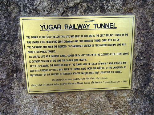
North of Samford, the railway line passes through Yugar. This is the only place on the line where a tunnel was necessary to pass under the roadway.

After the railway line was closed, this gully was used as a rubbish dump, but in 1983 the University of Queensland acquired the site to study the bats that now live in the tunnel.

Today my only other companion was a large hungry Brown Snake who was obviously looking for some bat-flavored fast food take-away!

Total distance: 78.19 km
Total climbing: 1340 m
Average temperature: NAN
Total time: 05:38:40
Download file: activity_54798328.gpx
More data