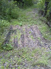
Whiteside

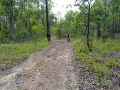
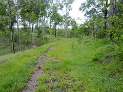
Today I made a quick visit to the approximate location of the former Whiteside homestead – one of the earliest European settlements in the Pine Rivers district. Francis Griffin founded Whiteside Station in 1843. He was joined by his brother William in 1844, and his parents George and Jane in 1845.

Francis was a formerly the captain of a steamer called “James Watt” which had carried the Petrie family to Moreton Bay in 1837.

Unfortunately he had a disagreement with his brother, William, which resulted in Francis leaving the station in 1848, and in fact being sent back to Sydney.

William’s time at Whiteside didn’t last long either. The next year, his father, George, expelled him from the station “for bad conduct”.

George died in 1851, and his youngest son, John took over the property. He married the widow, Isabella Joyner in 1852. She owned the “Samsonvale Run” on the other side of the North Pine river. This meant that collectively, the Griffin and Joyner families owned large tracts of land north and south of the river.

Some of the Whiteside Run (east of Sideling Creek) was eventually sold to Tom Petrie in 1858 to establish “Murrumba”.

Total distance: 29.62 km
Total climbing: 590 m
Average temperature: NAN
Total time: 02:09:45
Download file: activity_51183525.gpx
More data
North Pine River. Then and Now.

North Pine River. Then and Now.

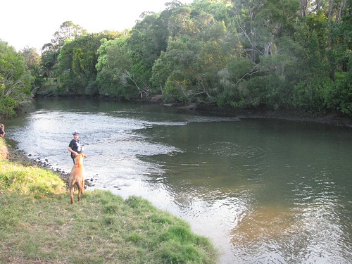
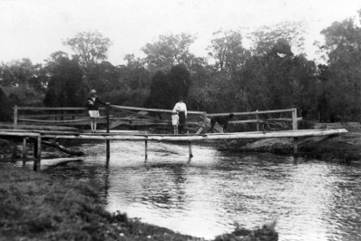
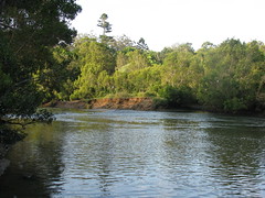
Local historian and friend Leith Barter recently sent me a copy of a photo taken near the bottom of my street around 1930.

The footbridge was built to allow local children to get to North Pine (Petrie) State School school on the other side of the river, without having to go all the way down to Gympie Road and back again.

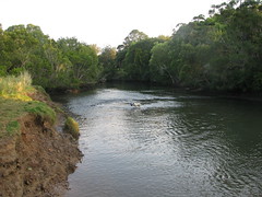
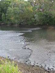
Harrison and I went out exploring today to see if we could find where the photo was taken so we could get a “then” and “now” photo.

North Pine River. Then and Now.North Pine River. Then and Now.North Pine River. Then and Now.

Tom Petrie Memorial

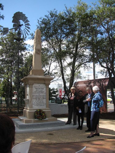
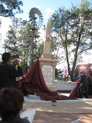
The unveiling of the refurbished Tom Petrie memorial was an amazing experience for many reasons.

I’ve written several articles here previously about Tom Petrie. The man was remarkable for the way he learned the ways and language of the local Turrbal Aboriginal people, and showed them a respect and honor that was more than a century ahead of his time. It was fitting to remember him on the 100th anniversary of his death.

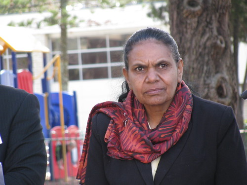
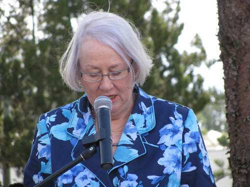
I also had the chance to meet Maroochy Barambah, an elder, Songwoman and Law-Woman of the Turrbal Aboriginal people. This talented and dignified woman is the great grand-daughter of Kulkarawa, a young Aboriginal girl who ran off with a Sri Lankan man named Shake Brown in the 1840’s. Brown was killed in the 1840’s on the banks of what is now called Browns Creek. By some strange co-incidence I actually took some photos of this area and wrote an article about it a few months ago. So I was overwhelmed to meet someone who was actually related to Kulkarawa (Granny Kitty) and Shake Brown (Grandfather Brown).

This event was the first formal occasion that descendants of Tom Petrie and the Turrbal people had met face to face since Petrie’s death. It gives me hope that things like this happen. The mutual history of Aboriginal and non-Aboriginal Australia is something that can unite us, and strengthen our souls. It reminds us how precious is the place in which we live. It gives us continuity and reminds us that each of us is here for such a brief time, while the land is always here.
Tom Petrie Memorial - 26 August 2010Tom Petrie Memorial - 26 August 2010Tom Petrie Memorial - 26 August 2010

Sentinel

Sentinel

Ancient One with your arms held high,
Guarding the bones in this field of tears,
If I bend my ear to your gentle sigh
Will you sing me your song from long-gone years?

……

The dark-skinned keepers of the river of pines
Chant dream-time clap-stick songs and vows
And leave their beloved dead behind
To sleep in my timeless caring boughs.
I see the tears on your dusty face.
Your treasure is safe in my wooden embrace.

The sunburned settler far from home,
Far from the gentler softer lands,
Bows in prayer at the open grave
In the blessed shade of my verdant hands.
Lie peacefully now at my wooden feet.
I’ll shelter your parched bones from the heat.

The soldier’s widow speechless stands,
Farewells the ANZAC she loved the most.
The wind sighs through my leafy hands
As the bugler plays a sad “Last Post”.
Your brave lover’s watch has come to an end.
He can rest. I’ll guard him well, my friend.

……

Sentinel with your arms held high,
Will you watch my bones when I am gone?
Will you shade my children from the scorching sky,
You long-lived ageless timeless one?

The children of earth are a short lived race
Who rush to and fro in haste and greed.
I have not lived such a quickened pace
As I have grown to this height from such a small seed.
But I watch you all and I taste your tears,
And I’ll care for your bones through all my years.


I saw this tree in a cemetery a while ago, and later learned that some local Aborigines believe it was once used as a “burial tree”.  The tree is certainly old enough to predate European settlement and there’s a beautiful resonance in the thought that a tree that may have been a vital part of the burials of the first Australians should still be “keeping an eye” on a modern cemetery.

Some things like trees are almost timeless.

Some things like grief at the loss of a loved on are timeless!

Hoop Pine at John Oxley Reserve

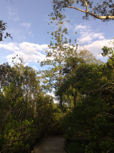
This is the only remaining Hoop Pine (Araucaria Cunninghamii) at John Oxley Reserve, Murrumba Downs, on the north bank of the North Pine River about 2km west of Petrie.

John Oxley came ashore here on 1 December 1823. He was impressed with many “fine cypresses” he saw there referring to the Hoop Pines. This was the first reference to the species, which was later cataloged by English botanist and explorer, Allan Cunningham.

The first settlers loved these huge trees for their long straight trunks which were ideal for ship masts or any buildings which required large quantities of long straight timber.

Today if you drive down Gympie Road, Strathpine, you’ll see the road lined with dozens of Hoop Pines on either side – a fitting tribute to this majestic tree, native to this area.


Irrigation Dam, Joyner’s Hill


William Joyner purchased the “Samsonvale Run” in 1845 from Darling Downs squatters James Sibley and Joseph King.

He died in 1847 in a shipping accident, and his wife, Isabella decided to sail up from Sydney and manage the property.

This irrigation dam is about a kilometer from where the family built “Aust House” in 1865.

This area is rarely visited, and some of the scrub is very thick. It made me wonder what Isabella would have thought of it when she arrived in 1847.

Martin Lavelle Was Here

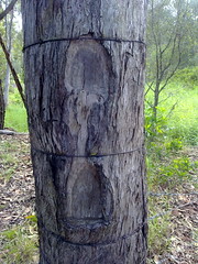
Surveyor Martin Lavelle marked this tree in 1867 while he was surveying the Griffin area on the northern banks of the Pine River.

Surveyors often used natural features as reference points when preparing a plan of an area. When trees or stumps were used, they would cut a mark in the tree to make it easier to find by others.

This stump is known affectionately by locals as “Tom Petrie’s Stump”, probably because it marks the corner of a property that he purchased in 1870.

The surrounding area is being redeveloped from rural land into a housing estate. Happily, the developers have agreed to protect the tree, erect bollards around it, and place an informative marker near it so people can understand its significance.

Next time you see an old tree with a large triangle cut out of it, listen closely and you might hear the whisper of an old story.

Along the Old North Road (Part 2)

Last week Simon and I rode from Wamuran to Moorina along the historic Old North Road.

This week we wanted to complete the southern section of where we think the road went, between Kurwongbah and Moorina.

Along the Old North Road: Dunlop LaneAlong the Old North Road: Mosquito CreekAn old bridge beam?Along the Old North Road: Mosquito CreekAlong the Old North Road: Smiths Road

We started at Dunlop Lane then headed north along Smiths Road where it crosses Mosquito Creek. I looked around here for any traces of an old bridge but could find nothing except an old beam in one of the banks.

Along the Old North Road: Franz RoadSurvey TreeAlong the Old North Road: Franz Road
Merelyn very kindly let us look around her property which is on the southern end of historic Franz Road where it used to meet Alf Dobson Road. She showed us the remnants of the Old Road, with what I think are survey marks clearly chopped out of a dead tree near the road.

Merelyn has records of the road reserve being re-gazetted from it’s historic route past her front door, to a point along one of the boundaries of her farm.

The ground is heavily compacted showing evidence of frequent traffic at some time in the past.

Merelyn has had conversations with several old-timers who tell her cattle used to be driven southwards along the road prior to the early 20th century.

Along the Old North Road: Franz RoadAlong the Old North Road: Franz RoadAlong the Old North Road: Franz Homestead 1891

Cliff, Owen and Cathy very kindly let us ride through their farm trying to find any remnants of the road.

As Franz Road heads north, we tried to retrace the road by referencing an old survey plan by William Fryar in 1868.

These old trees are close to where Fryar’s plan showed trees that he used as reference markers for his pegs. Unfortunately the original trees are long gone.

I would have made a hopeless surveyor, and found it difficult to differentiate between what I thought were remnants of the old road, and more recent farm tracks.

Cathy showed us this old photo of the old Franz homestead near where we passed.

Along the Old North Road: Haywood RoadAlong the Old North Road: Haywood Road
Judy and Ken kindly showed us the remnants of an old road passing through their property.

Judy tells me that the road was used by Cobb & Co in the 19th century.

It winds up a fairly steep hill, and in some places it’s possible to see evidence of past maintenance, including an old log bridge, and frequent large rocks lining the sides of the road.