Eclipse – 2012

Totality

After experiencing the Eclipse of 2002 in Woomera, South Australia with my daughter Laura, I was hooked. I vowed I was definitely going to do my best to see this rare event a second time. So ten years later, Liz and I agreed to take the kids to North Queensland to catch a glimpse of one of nature’s most awe-inspiring spectacles.

There were differences between the two events. Woomera is in the desert of South Australia. So in 2002 we had an almost certain chance of cloud-free skies. The down-side was it was miles from nowhere, we had to camp out in the desert, and that eclipse only lasted 30 seconds.
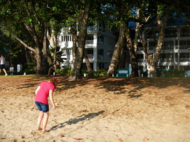
Vila Paradiso - Palm Cove
Roll forward to 2012. Palm Cove is in tropical North Queensland. November is the start of the “Wet Season” where it rains incessantly for 4 months or more. There was a pretty big chance that clouds would foil our attempt of viewing the eclipse. The up-side was that Palm Cove is a beautiful resort town on the beach. We were able to book great accommodation across the road from the beach, with uninterrupted views of the morning sky. And this Eclipse would last over two minutes – four times longer than the previous one.
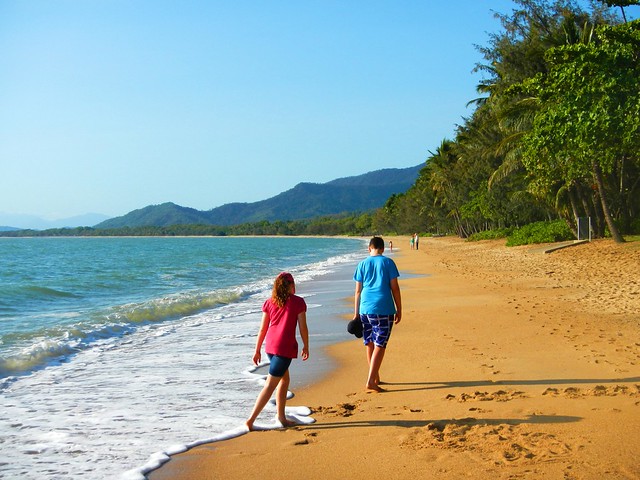
The Beach to Ourselves
We arrived at Palm Cove a few days before the main event. We had the beaches to ourselves. Although you could spot the odd geeky looking tourist in town (do I look geeky), this tropical paradise was serene.
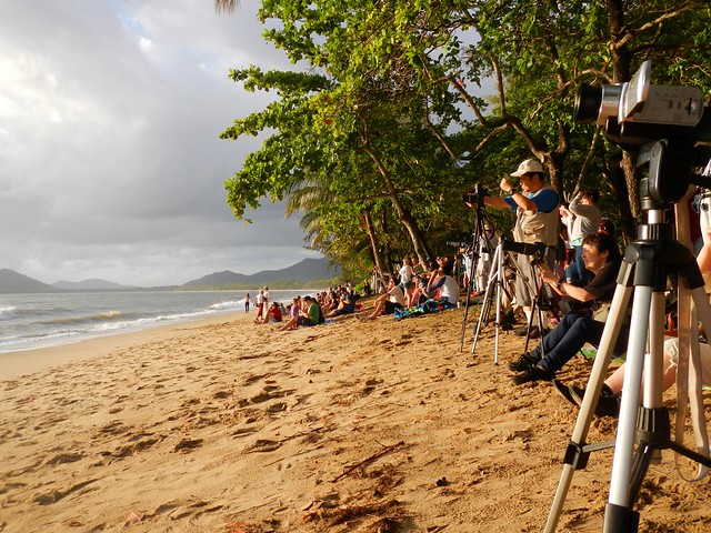
Waiting for Totality
A couple of days later it was packed. Umbraphiles (look it up) as far as the eye could see. There were network TV cameras on the esplanade, high-powered telescopes, satelite dishes, and learned looking people with devices I didn’t have a clue about. We just grabbed a couple of beach towels, walked across the road from the hotel, and plonked ourselves down on the sand to wait for the main event.
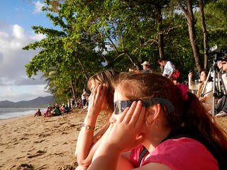
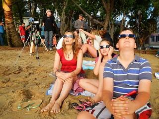
Putting on the Eclipse GlassesWatching the Eclipse
We all had our Eclipse Glasses – I had bought them on eBay over six months ago. I gave them to Liz, because she was less likely to lose them than me 🙂 Nevertheless, before the trip I think I asked her half a dozen times if she had packed the glasses. (I just wanted to make sure).
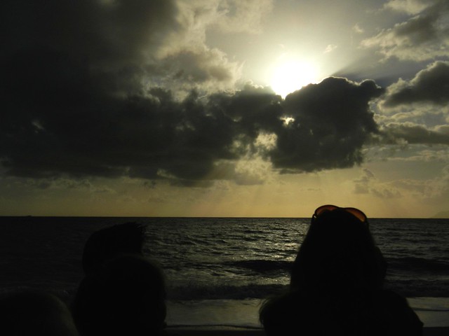
Clouds Before the Eclipse
And then disaster struck. The clouds started massing on the eastern horizon like they do most mornings at this time of year. The sun disappeared and two thousand people sat on the beach crossing their fingers and willing the clouds to part.
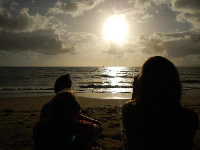
The Clouds Part
And they did! People cheered. I got a bit teary because I finally realized this was going to happen! We were going to see the eclipse. I had my watch synchronized to the second and counted off the minutes, the seconds to totality.

Totality
Totality

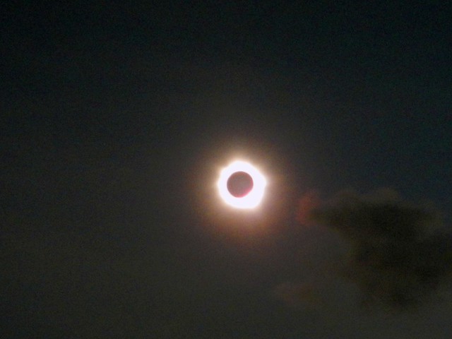
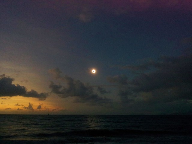
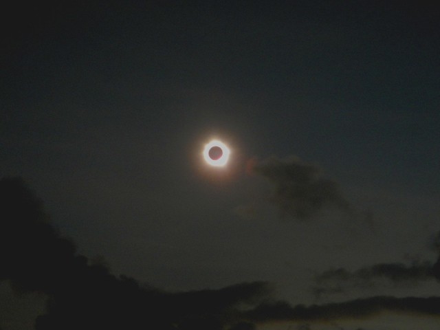
And then “It” happened. Have you ever heard several thousand people gasp in awe? I was ecstatic. “You can take your glasses off now” I said to the kids. “Oh Wow! Look at that!”. The sky went dark, the stars came out. And a fiery black hole appeared in the sky where the sun was a few seconds ago. And I could look straight at it. And, emotional petal that I am, I cried. People cheered, yelled, sighed, and just gazed at something simply beautiful.

And as you can see, I did manage to find a few seconds to take a couple of photos. The professionals got some amazing photos, but the images I came for were those that are now in my head. I’ll never forget what I saw, and how I felt.

And, I think I’m now an eclipse chaser. I’ve spent just over two and a half minutes of the last ten years in “Totality”.

I want more 🙂

Border Ranges and Horseshoe Creek

Border Ranges

A few weeks ago some friends and I had to cut short our ride through the Border Ranges National Park because of our late start and slow progress.

Today Eric, Darb and I gave it another try.

We arrived at the starting point at about 8:30am after a two and a half hour drive from Brisbane, and immediately started the long climb up into the National Park.

Normally, this ride has some amazing views. Rising over 1,100 meters, some of the lookouts are perched atop shear drops, and let you see forever in every direction. The clouds, mist and rain made that impossible today, but it was still a wonderful experience riding through the lush rainforest.

The rain also made it impossible to take photos. My camera is out of action, so all I had was my mobile phone which doesn’t handle moisture too well. Thankfully, Darb was able to capture the high points of the ride on his Contour video camera. Here’s a link to his video of it.

The challenging thing about this route is that apart from three fast descents, we were climbing for almost 35km, which took us about three and a half hours. All the while, it was raining, and the temperature was hovering around 11C. So it was hard work.

Eric and Darb are strong hill climbers. I found it impossible to keep up with them on the long ascents, and was thankful they stopped several times to help me catch up.

The fast descents were exhillarating though. Shooting down a dirt track at about 40 km/h with fogged up mud-covered glasses, and chill breezes cutting through rain-soaked clothes really makes you feel alive – and cold 🙂 I was glad I added a couple of Snickers Bars to my normal stash of food – they helped to warm me up again.
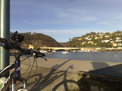
The final descent out of the National Park is awesome. We dropped 1,000 metres of altitude in just over 10km. That’s the longest descent I’ve ever done.

Normally on a run like this my brakes would overheat, and I’d end up losing them. This time my local bike shop had installed an 8″ brake rotor on the front, and a 7″ rotor on the back. They handled the descent with ease. My brakes didn’t fade at all. Thank you, Sam from Strathpine Bicycle Centre!

Once we left the park, we took a detour through some private property. I had been in touch with a local land owner who said he didn’t mind us riding down through his property to Horseshoe Creek. This was another fun descent down a steep boggy 4wd track with a couple of dozen water bars.

Horseshoe Creek
(Picture – Dean Dwyer)

At the bottom of the boggy track, with the bikes covered in mud, we had to cross a flooded Horseshoe Creek. Eric just lifted his bike above his head and waded across in the knee-deep water. I pussy-footed around trying to hop across the rocks and keep my feet dry. In the end, Eric took pity on me, waded back into the water and grabbed my bike, while I finished crossing the creek. My efforts were to no avail – my feet were soaked despite wearing plastic feezer bags over my socks.

The creek was a good spot to wash the mud off the bikes and start the second half of the trip through the much flatter farmland in the valley below the ranges.


(© State of New South Wales through the Department of Education and Training)
In order to fit the ride into one day, we decided to leave out riding into the small town of Kyogle. This saved us about 45 minutes, but it also meant that there wasn’t any place we could stock up on water if we needed it. In the preceding week I got in touch with the teacher at Collins Creek Public School who kindly agreed to let us pop into the school grounds and fill up on water if we needed it. It was a beautiful little school surrounded by farmland, and it in just the right spot for us.

For me, the toughest part of the ride was the final two kilometers. With the end of the day seamingly in sight, and 80 tough kilometers on our legs, the road became suddenly steeper, and we had to grind our way up the hill back to the car.

We did a total of 2,000m of vertical ascent on this ride. It took us seven and a half hours to ride 81.5 km (including an hour in breaks). I burned about 8,000 kcal.

Doing this ride in cold wet weather and having to drive two and a half hours each way to get there definitely rates this one 10 out of 10 on the tough-o-meter.

Total distance: 82.71 km
Total climbing: 1999 m
Average temperature: NAN
Total time: 07:33:35
Download file: activity_184546001.gpx
More data

Border Ranges – Deans Pictures

Dean the Diesel
In my last post I mentioned that my friend Dean successfully completed the 90km Border Ranges Loop, and managed to match our 4wd speed-wise over the last 5 km.

This man is like a diesel engine – he just keeps going. Plus he has a strange ability to get out of bed really early to get to the start point of a ride.

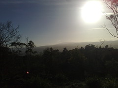
Here’s some of his pictures of his ride on the same day. It overlapped ours for part of the way, but when the weather got wet – he decided to stick to the original plan 🙂
panorama-1
panorama-2
panorama-3
panorama-4
panorama-5
panorama-7
panorama-8
panorama-10
panorama-13
panorama-15
panorama-16
simes-rd

panorama-6

View Larger Map

Border Ranges

Ridgeline
Like its name suggests, the Border Ranges National Park is a mountainous area of rainforest on the border of NSW and Queensland, just south of the border. It rises above 1,100 (3,600ft) in places and is covered with thick lush rainforest, towering trees and fast flowing streams.

The area is the traditional country of the Githabul Aboriginal People. It covers some of Australia’s most scenic country covering a number of natonal parks amd state forests around Kyogle, Woodenbong and Tenterfield, such as Koreelah NP, Mount Clunie NP, Richmond Range NP, Mount Northofagus NP, and Mount Lindesay State Forest.

Our plan was to start an 80km loop at the north-western edge of the park, head south towards Kyogle, then loop back northwards through Lynches Creek. This was quite ambitious considering we had to drive two and a half hours to get there in the first place, and considering the fact that that I find it very difficult to get out of bed early.
Simes Road
We arrived at the starting point, Simes Road, at 9:30am – a little later than we had anticipated and were optimistic we could make good time if we kept the pace up.
Tweed Range Road
The roads were muddy from the overnight rain. Being from the UK, Adi was used to wet tracks, and showed us how the Brits handle mud by popping a wheelstand while riding up one of the steep hills.
Border Ranges National Park
(Photo by Nick Mills)

After about half an hour climbing, farmland gave way to rainforest as we reached the entrance to the National Park.
Resting in the Mist
We didn’t realize that we’d be climbing for well over two hours before we reached the top of mountain. Physically this was ok – we were all used to long climbs. You just sit back, turn the pedals, and enjoy the view 🙂 The problem was that it meant we made much slower progress that we had expected, and we didn’t get to the top of the range till about 12:30.
Brindle Creek
(Photo by Nick Mills)

It started to rain fairly heavily on the way up, so we were all quite wet by the time we got to the top. This, and the mist, meant that we couldn’t see anything from the lookout, but Brindle Creek looked spectactular. There’s something about a bubbling creek in the middle of a misty rainforest that stirs my soul.

Brindle Creek Road
At the eastern edge of the loop through the rainforest the track splits in two where Bridnle Creek Road meets Tweed Range Road. Our intended route was southwards. The other alternative was to take Tweed Range Road westward back to our starting point. This would shorten the ride by more than half. We talked about it for a while. It was getting close to 1pm, our intended route still involved 60km of muddy roads and heavy rain, and we still had a 3 hour drive home after that. So we decided to take the shortcut and head back downhill along Tweed Range Road. At least we’d end up getting home before dark.
Bottom of the Hill
(Photo by Nick Mills)
While it took us over two hours to ride UP the range, it only took us about 20 minutes to ride down. It was incredible fun. Riding downhill at close to 60km/h in a wet jersey makes you very cold, so I decided to put on a jacket to keep the wind out. One consequence of that is that the wind inflated the jacket, so by the time I reached the bottom I looked like the Michelin Tyre man 🙂

Nick
Being a much tougher rider, Nick decided to give the jacket a miss. But he still ended up wearing a fine mask of mud all over his face by the time he got to the bottom of the hill.

Dean
Perhaps the biggest surprise of the day was when we got back to the car, and met our exhausted and mud covered friend Dean grinding his bike up the hill from the other direction. He had actually started the ride two and a half hours before us. Unlike us, he slogged it out the entire way finishing the 80km loop at about the same time we finished our 35km loop.

What was most impressive was that he had parked 5km down the road from us at the top of Simes Road. So he kept pedalling on while we got in the cars to leave. 5km later when we had driven to the top of Simes Road, we looked in the rear view mirror, and there was Dean right behind us on the bike. After an 85km slog through the hills, he was able to go head to head with a 4wd over 5km in about the same time. Good on ya, Dean!

Lookout
On the drive home we stopped at the Railway Loop Lookout. Just before it reaches the Qld / NSW border, the railway line has to climb several hundred metres in a short time. The engineers came up with a novel way of overcoming this obstacle by making the railway loop over itself in a big circle (see the google map below). You can see this unusual bit of railway from the lookout.

View Larger Map

All up, 35km in 3 hours with 1,100m of ascent and 4,000kcal bunred. I can’t rate our intended loop as we didn’t finish it. I’m rating our actual loop 8 out of 10 on the tough-o-meter. I would have rated it lower, but the rain made it more difficult, as well as the logistics of getting to and from the starting point. It’s a great loop for anyone who’d like to see some great views over a short distance. But make sure you do it in dry weather!

Total distance: 36.73 km
Total climbing: 1118 m
Average temperature: NAN
Total time: 04:04:44
Download file: activity_167779924.gpx
More data

Blue Tiers, Tasmania

I plan to ride a mountain bike through the Blue Tiers in Tasmania this Sunday. It’s a picturesque, remote alpine area of north-eastern Tasmania that is supposed to be well worth the effort.

The only problem is that I’ll probably be riding it alone, and I’ve never been there before.

So to be on the safe side, I’m publishing my proposed route here, with some checkpoints along the way, and I’ll update my twitter feed with a photo from those checkpoints so that (if you’re interested) you can keep an eye on where I’m up to. If I fall off the bike, or get abducted by aliens, at least you’ll know how far I got and where I plan to go.

I’ll be leaving the Weldborough Hotel at about 10.30am and aim to be back by about 3pm.

The checkpoints are:

  1. Weldborough Hotel. 0km. 10:30am
  2. Lotta Rd Turnoff. 6.4km. 11:00am
  3. Town of Lotta. 14.2km.  11:45am
  4. Poimena School Site. 17.8km. 12:30pm
  5. Emu Road. 22.4km. 1:30pm
  6. Weldborough Hotel. 30km. 2:30pm

Here’s the map

I’m really looking forward to it, and hope to share some great photos.

Exploring Launceston by Mountain Bike

I’ll be working in Launceston for the next week, so I thought I’d come down a day and a bit earlier and explore the place by mountain bike.

I hired a basic hardtail bike from a local shop, donned my cold weather gear, and took off into the hills on this beautiful cloudless late autumn day.

The first part of the trip was up to Trevallyn Reserve which is perched atop some of the hills to the west of town.

The reserve has some pretty steep and rocky trails which were hard work to negotiate, but worth the effort. The view down the river towards the dam is spectacular.

After a quick break, I then headed to the Kate Reed reserve to the south of town. This has a lot more narrow single track than Trevallyn, and it was here I suffered a pretty nasty “Gumby Stack” where I fell off my bike for no reason other than I couldn’t pull my feet out of my clip-in pedals. Luckily my shoulder survived the fall and I have no broken bones.

I’ve never ridden in such cold weather before. It takes a lot more preparation than I’m used to. And you still get hot, and cold, and wet with perspiration.

But it’s a great way to explore a city. I’ll definitely try this again!
Looking towards the GorgeEarly morning near the SummitDewy trailsReachng for the CloudsThe Hoo Hoo HutLake TrevallynTrevallyn Dam

Fun at Luna Park

Fun at Luna ParkFun at Luna Park

I had a great time in Sydney today at a client’s Christmas Party.

We had lunch at Luna Park, so I took a few minutes out to take a few photos of this fun place.

The smiley clown looking guy had a girl with him. I told her I was really Seven years old and just looked old, and would she take my picture please.

As you can see she obliged!